Everett's Wood

Wood, Forest in Dorset

England

Everett's Wood

Morden, public route From the bridleway to Winterborne Zelston to the main highway, passing West Morden Farmhouse.
Morden, public route Credit: Mike Faherty

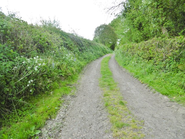
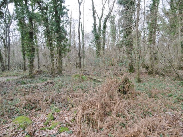
Everett's Wood is a picturesque forest located in the county of Dorset, England. Covering an area of approximately 100 acres, this woodland is known for its natural beauty and rich biodiversity. The forest is situated in close proximity to the village of Everett, hence its name.

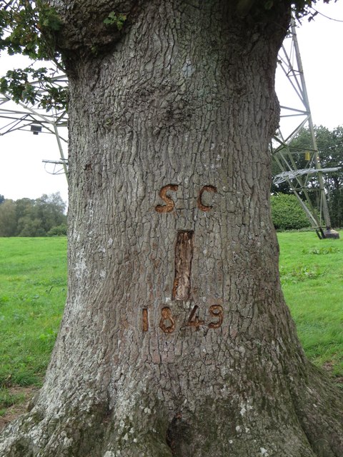
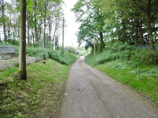
The wood is predominantly composed of deciduous trees, such as oak, beech, and ash, which create a dense canopy that provides shade and shelter for a variety of wildlife. The forest floor is covered in a vibrant carpet of mosses, ferns, and wildflowers, adding to its enchanting atmosphere.

Everett's Wood is a popular destination for nature lovers, walkers, and birdwatchers alike. The diverse ecosystem supports a wide range of wildlife, including deer, foxes, badgers, and a variety of bird species. Birdwatchers may be lucky enough to spot nuthatches, woodpeckers, or even the elusive nightjar.

The forest offers a network of well-maintained footpaths and trails, allowing visitors to explore its beauty at their own pace. There are also picnic areas and benches scattered throughout the wood, providing ideal spots for relaxation and enjoying the serenity of nature.

Everett's Wood is managed by the local authorities in Dorset, who strive to maintain its natural integrity and preserve its ecological balance. The wood is protected under various conservation programs, ensuring its long-term sustainability and the continued enjoyment of its visitors.

In conclusion, Everett's Wood is a captivating forest in Dorset, offering a haven of tranquility and natural beauty. Its diverse flora and fauna, combined with its well-maintained trails, make it an ideal destination for nature enthusiasts and those looking to escape the hustle and bustle of everyday life.

If you have any feedback on the listing, please let us know in the comments section below.

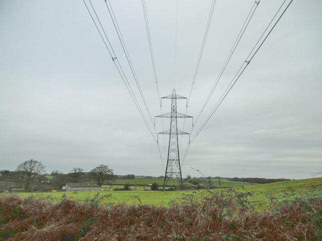
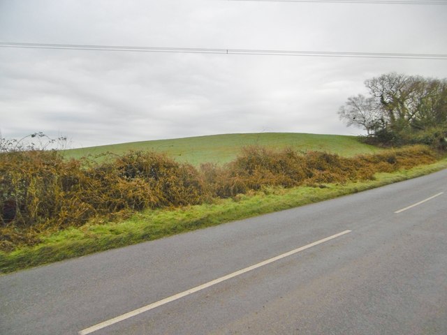
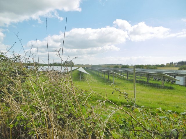
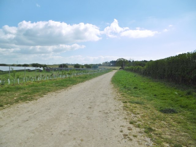
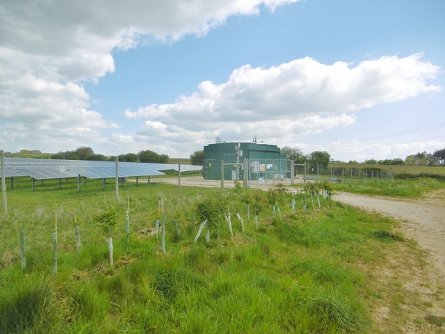
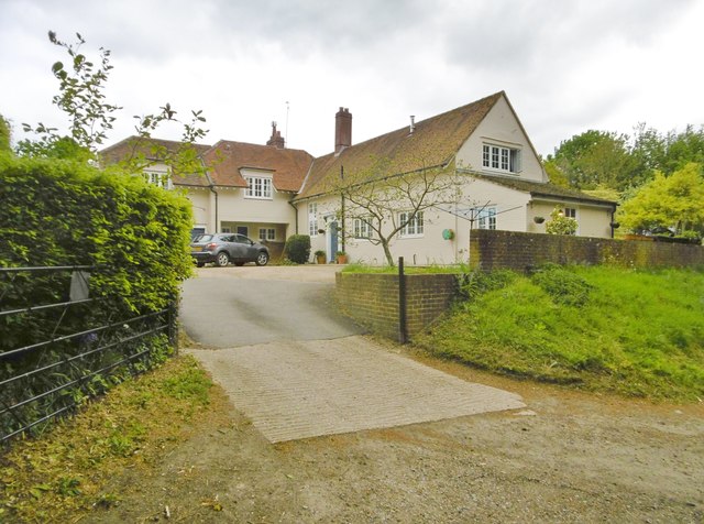
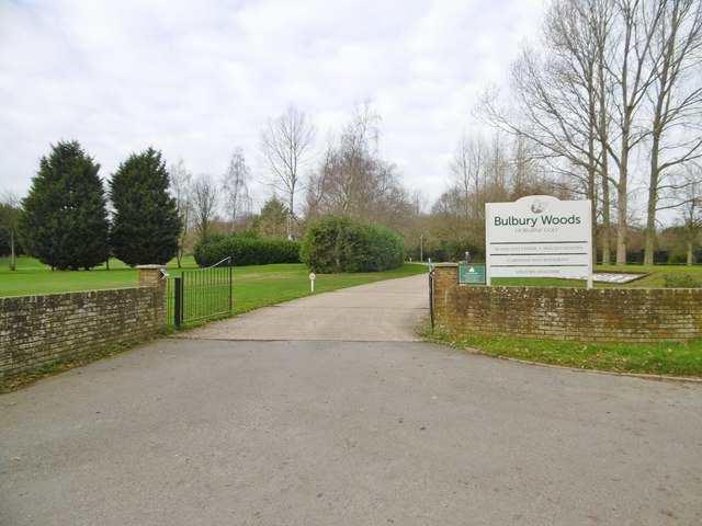
Everett's Wood Images

Images are sourced within 2km of 50.754438/-2.1191262 or Grid Reference SY9194. Thanks to Geograph Open Source API. All images are credited.

Morden, public route From the bridleway to Winterborne Zelston to the main highway, passing West Morden Farmhouse.
Morden, public route
From the bridleway to Winterborne Zelston to the main highway, passing West Morden Farmhouse.
Samuel Crumpler's Oak Tree, Old Park, Lytchett Matravers See also: 
<a href="https://www.geograph.org.uk/photo/5129868">SY9295 : The Giant and the Dwarf</a>

A COUNTRY TRAGEDY
By Beau Parke 
Samuel Crumpler paid the price for being so nice 
and trusting with his bull; 
He walked the field that blistering Summer's day 
whilst checking acreage and gauging chores 
unmindful of his young and powerful charge. 
Then suddenly the animal took pace 
and rushed and roared and snorted t'wards his face, 
whilst Sam stepped back, yet still believed 
the bull was easy to contain: 
But on it went, momentum built 
to such a speed and strength that Sam, alarmed, 
tried frantic'ly to reach for branches of the nearby oak, 
but failed to get the leverage he needed now 
to avoid its frenzied, maddened surge; 
He yelled in terrifying pain as he was pinned against 
the trunk and gored relentlessly by this unreal, unreasoning 
monster that he'd fed and nurtured from a calf; 
The blood was spurting forth as sweat and slime and slaver 
from the bull was intermixed with gore, 
and bones were crushed till Samuel Crumpler's broken frame 
was tossed into the air, now cruelly 
scythed and crunched beyond all comprehension. 

His sorrowing widow and nine sons and daughters 
saw him laid to rest a few days later 
in the Village Churchyard, knowing that local history 
had been made at his expense for trusting that 
young bull and lowering his guard. 
Samuel Crumpler, wheelwright, carpenter and sometime farmer died, 
aged fifty-five, in 1849; a kind and strong and gallant, 
some say foolish, family man.
Samuel Crumpler's Oak Tree, Old Park, Lytchett Matravers
See also: SY9295 : The Giant and the Dwarf A COUNTRY TRAGEDY By Beau Parke Samuel Crumpler paid the price for being so nice and trusting with his bull; He walked the field that blistering Summer's day whilst checking acreage and gauging chores unmindful of his young and powerful charge. Then suddenly the animal took pace and rushed and roared and snorted t'wards his face, whilst Sam stepped back, yet still believed the bull was easy to contain: But on it went, momentum built to such a speed and strength that Sam, alarmed, tried frantic'ly to reach for branches of the nearby oak, but failed to get the leverage he needed now to avoid its frenzied, maddened surge; He yelled in terrifying pain as he was pinned against the trunk and gored relentlessly by this unreal, unreasoning monster that he'd fed and nurtured from a calf; The blood was spurting forth as sweat and slime and slaver from the bull was intermixed with gore, and bones were crushed till Samuel Crumpler's broken frame was tossed into the air, now cruelly scythed and crunched beyond all comprehension. His sorrowing widow and nine sons and daughters saw him laid to rest a few days later in the Village Churchyard, knowing that local history had been made at his expense for trusting that young bull and lowering his guard. Samuel Crumpler, wheelwright, carpenter and sometime farmer died, aged fifty-five, in 1849; a kind and strong and gallant, some say foolish, family man.
The Giant and the Dwarf This veteran Oak tree is dwarfed by its infant neighbour. It soaks up the negative energy emitted by the pylons. For more information about this oak tree, see <a href="https://www.geograph.org.uk/photo/5129861">SY9295 : Samuel Crumpler's Oak Tree, Old Park, Lytchett Matravers</a>.
The Giant and the Dwarf
This veteran Oak tree is dwarfed by its infant neighbour. It soaks up the negative energy emitted by the pylons. For more information about this oak tree, see SY9295 : Samuel Crumpler's Oak Tree, Old Park, Lytchett Matravers.
St Mary's Church, East Morden
Sherford, power lines
Sherford, Chitten Hill
Lytchett Matravers, solar farm Operated by Conergy. <span class="nowrap"><a title="http://www.conergy.com/" rel="nofollow ugc noopener" href="http://www.conergy.com/">Link</a><img style="margin-left:2px;" alt="External link" title="External link - shift click to open in new window" src="https://s1.geograph.org.uk/img/external.png" width="10" height="10"/></span>
Lytchett Matravers, solar farm
Operated by Conergy. LinkExternal link
Slepe, access road Road and bridleway, giving access to the solar farm (left) and Newton Farm; the bridleway continues to Wareham Road.
Slepe, access road
Road and bridleway, giving access to the solar farm (left) and Newton Farm; the bridleway continues to Wareham Road.
Slepe, inverter station Connecting the solar farm's output to the grid. The station is operated by Conergy: <span class="nowrap"><a title="http://www.conergy.com/" rel="nofollow ugc noopener" href="http://www.conergy.com/">Link</a><img style="margin-left:2px;" alt="External link" title="External link - shift click to open in new window" src="https://s1.geograph.org.uk/img/external.png" width="10" height="10"/></span>
Slepe, inverter station
Connecting the solar farm's output to the grid. The station is operated by Conergy: LinkExternal link
Morden, country road From A35 to East Bloxworth.
Morden, country road
From A35 to East Bloxworth.
West Morden Farmhouse
Morden, public route From West Morden Farm to the main highway.
Morden, public route
From West Morden Farm to the main highway.
Old Milestone by the B3075, Chitten Hill, south of Park Corner Carved stone post by the B3075, in parish of MORDEN (PURBECK District), 500m South of junction with A35, 2m back from road almost buried in thick hedge, on East side of road. Erected by the Wareham (North, South & West Branches) turnpike trust in the 19th century. 

Inscription reads:-
: Wareham / 4 : : Blandford / 10 :   

Milestone Society National ID: DO_WABF04.
Old Milestone by the B3075, Chitten Hill, south of Park Corner
Carved stone post by the B3075, in parish of MORDEN (PURBECK District), 500m South of junction with A35, 2m back from road almost buried in thick hedge, on East side of road. Erected by the Wareham (North, South & West Branches) turnpike trust in the 19th century. Inscription reads:- : Wareham / 4 : : Blandford / 10 : Milestone Society National ID: DO_WABF04.
Slepe, golf course The tenth tee at Bulbury Woods Golf Club, off Bulbury Lane: <span class="nowrap"><a title="http://www.bulbury-woods.co.uk/" rel="nofollow ugc noopener" href="http://www.bulbury-woods.co.uk/">Link</a><img style="margin-left:2px;" alt="External link" title="External link - shift click to open in new window" src="https://s1.geograph.org.uk/img/external.png" width="10" height="10"/></span>
Slepe, golf course
The tenth tee at Bulbury Woods Golf Club, off Bulbury Lane: LinkExternal link
Slepe, club entrance On Bulbury Lane, the entrance to Bulbury Woods Golf Club: <span class="nowrap"><a title="http://www.bulbury-woods.co.uk/" rel="nofollow ugc noopener" href="http://www.bulbury-woods.co.uk/">Link</a><img style="margin-left:2px;" alt="External link" title="External link - shift click to open in new window" src="https://s1.geograph.org.uk/img/external.png" width="10" height="10"/></span>
Slepe, club entrance
On Bulbury Lane, the entrance to Bulbury Woods Golf Club: LinkExternal link
Slepe, ditch Seen from Bulbury Lane; probably draining into Sherford River, to the South.
Slepe, ditch
Seen from Bulbury Lane; probably draining into Sherford River, to the South.
Slepe, coppice Bulbury Coppice, at Bulbury Woods Golf Club.
Slepe, coppice
Bulbury Coppice, at Bulbury Woods Golf Club.
Slepe, clubhouse At Bulbury Woods Golf Club: <span class="nowrap"><a title="http://www.bulbury-woods.co.uk/" rel="nofollow ugc noopener" href="http://www.bulbury-woods.co.uk/">Link</a><img style="margin-left:2px;" alt="External link" title="External link - shift click to open in new window" src="https://s1.geograph.org.uk/img/external.png" width="10" height="10"/></span>
Slepe, clubhouse
At Bulbury Woods Golf Club: LinkExternal link
Show me another place!

Everett's Wood is located at Grid Ref: SY9194 (Lat: 50.754438, Lng: -2.1191262)

Unitary Authority: Dorset

Police Authority: Dorset

What 3 Words

///skate.captions.putter. Near Lytchett Matravers, Dorset

Related Wikis

Morden, Dorset

Morden (otherwise Moreden) is a civil parish in the Purbeck district of south Dorset, England. Morden is about 6 miles (10 km) north-west of Poole. At...

Loosebarrow Hundred

Loosebarrow Hundred was a hundred in the county of Dorset, England, containing the following parishes: Almer Morden Spetisbury == See also == List of...

Slepe

Slepe is a hamlet in the county of Dorset, England. It is located on the A35 east of Organford. == References ==

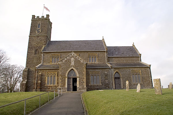
St Mary the Virgin, Lytchett Matravers

St Mary the Virgin is the Church of England parish church of Lytchett Matravers in Dorset. Its parish is part of the Diocese of Salisbury. The building...

Almer

Almer is a village and former civil parish, now in the parish of Sturminster Marshall, in the Dorset district, in the ceremonial county of Dorset, England...

Lytchett Matravers

Lytchett Matravers is a large village and civil parish in Dorset, England. The 2011 census recorded the parish as having 1,439 households and a population...

Charborough House

Charborough House, also known as Charborough Park, is a Grade I listed building, the manor house of the ancient manor of Charborough. The house is between...

Rushmore Hundred

Rushmore Hundred was a hundred in the county of Dorset, England, containing the parish of Winterborne Zelston == See also == List of hundreds in Dorset...

Nearby Amenities

Located within 500m of 50.754438,-2.1191262
East Morden
Place: hamlet
Lat/Long: 50.7578663/-2.1194821
Material: wood
Power: pole
Source: bing
Switch: yes
Lat/Long: 50.7532577/-2.1236105
Material: wood
Power: pole
Source: bing
Lat/Long: 50.7536892/-2.1259704
Morden Village Hall
Manufacturer: ABB Transformers Ltd
Material: wood
Power: pole
Ref: 57304233
Source: survey
Source Ref: survey
Transformer: distribution
Voltage Primary: 11000
Voltage Secondary: 400
Voltage Tertiary: 230
Lat/Long: 50.7537481/-2.1255036
Material: wood
Power: pole
Ref: 6;57304234
Source: survey
Source Ref: survey
Lat/Long: 50.7538159/-2.1249292
Material: wood
Power: pole
Ref: 5;57304235
Source: survey
Source Ref: survey
Lat/Long: 50.7538994/-2.1243688
Morden No2
Material: wood
Note: 3 low voltage fuses, only single phase input.
Poles: bipole
Power: pole
Ref: 57304465
Source: bing
Transformer: distribution
Voltage Primary: 11000
Voltage Secondary: 460
Voltage Tertiary: 230
Lat/Long: 50.7560394/-2.1215176
Material: wood
Power: pole
Ref: 57304462;52
Source: bing
Source Ref: survey
Lat/Long: 50.7572276/-2.1206157
Material: wood
Power: pole
Ref: 57304463;1
Source: bing
Source Ref: survey
Lat/Long: 50.7577599/-2.1212358
Churchland Green
Material: wood
Poles: bipole
Power: pole
Ref: 57304464
Source: bing
Source Ref: survey
Transformer: distribution
Voltage Primary: 11000
Voltage Secondary: 460
Voltage Tertiary: 230
Lat/Long: 50.7582952/-2.1218806
Material: wood
Power: pole
Source: bing
Lat/Long: 50.7583948/-2.1168585
Material: wood
Power: pole
Source: bing
Lat/Long: 50.7584417/-2.1197311
Morden No1
Material: wood
Note: 3 low voltage fuses, only single phase input.
Power: pole
Source: bing
Transformer: distribution
Voltage Primary: 11000
Voltage Secondary: 460
Voltage Tertiary: 230
Lat/Long: 50.758565/-2.118381
Entrance: yes
Lat/Long: 50.7549044/-2.1259057
Barrier: stile
Source: survey
Lat/Long: 50.7583005/-2.1184378
East Morden No1
Material: wood
Power: pole
Ref: 3;57304248;SY9137994978
Transformer: distribution
Lat/Long: 50.7543287/-2.123575
Addr Housename: Harvey Cottage
Source Addr: survey
Lat/Long: 50.7552351/-2.1210663
Barrier: stile
Source: GPS+GLONASS
Lat/Long: 50.7503314/-2.1203644
Material: wood
Power: pole
Source: survey
Transformer: distribution
Lat/Long: 50.7510199/-2.1196465
Barrier: stile
Source: GPS+GLONASS
Lat/Long: 50.7511178/-2.1203447
Material: wood
Power: pole
Source: bing
Lat/Long: 50.7511296/-2.1226897
Barrier: stile
Source: GPS+GLONASS
Lat/Long: 50.7513814/-2.1202485
Public Bookcase
Morden Book & DVD Exchange
Access: yes
Booth: K6
Disused Amenity: telephone
Historic Amenity: telephone
Historic Operator: BT
Man Made: telephone_box
Old Phone: +44 1929 459336
Opening Hours: 24/7
Public Bookcase Type: phone_box
Ref GB Uprn: 10024741054
Lat/Long: 50.7514966/-2.123904
Post Box
Collection Times: Mo-Fr 17:00; Sa 12:00
Post Box Mounting: brick_pillar
Post Box Type: wall
Ref: BH20 102
Ref GB Uprn: 10015311592
Royal Cypher: GVIR
Royal Cypher Wikidata: Q33102169
Source: GPS+GLONASS
Lat/Long: 50.7515028/-2.1238796
Material: wood
Power: pole
Ref: 1;57304246
Source: GPS+GLONASS
Lat/Long: 50.7515206/-2.1200329
Fire Hydrant
Emergency: fire_hydrant
Fire Hydrant Diameter: 90
Fire Hydrant Type: underground
Ref: 10682
Source: survey
Lat/Long: 50.751605/-2.123836
Material: wood
Power: pole
Source: bing
Lat/Long: 50.7516442/-2.1217366
Barrier: stile
Source: GPS+GLONASS
Lat/Long: 50.7520399/-2.11924
Material: wood
Power: pole
Source: bing
Lat/Long: 50.752299/-2.1206601
Material: wood
Power: pole
Ref: 2;57304239
Source: GPS+GLONASS
Lat/Long: 50.7523426/-2.1234731
Material: wood
Power: pole
Source: bing
Lat/Long: 50.752657/-2.1200138
Material: wood
Power: pole
Source: survey
Transformer: distribution
Lat/Long: 50.7527322/-2.1189794
Fire Hydrant
Emergency: fire_hydrant
Fire Hydrant Diameter: 90
Fire Hydrant Type: underground
Ref: 2561
Source: GPS+GLONASS
Lat/Long: 50.752909/-2.123214
Fire Hydrant
Emergency: fire_hydrant
Fire Hydrant Diameter: 75
Fire Hydrant Type: underground
Ref: 4230
Source: GPS+GLONASS
Lat/Long: 50.753706/-2.12271
Material: wood
Note: Vertically stacked
Power: pole
Ref: 4
Source: survey
Source Ref: interpolation
Lat/Long: 50.753959/-2.1237561
Fire Hydrant
Emergency: fire_hydrant
Fire Hydrant Diameter: 100
Fire Hydrant Type: underground
Ref: 6222
Source: GPS+GLONASS
Lat/Long: 50.753934/-2.123947
Barrier: stile
Source: survey
Lat/Long: 50.7542282/-2.1237998
Material: wood
Power: pole
Ref: 817976
Source: GPS+GLONASS
Lat/Long: 50.7547188/-2.1217733
Material: wood
Power: pole
Ref: 2
Ref Switch: 71848
Switch: yes
Lat/Long: 50.7547479/-2.122839
Barrier: stile
Source: survey
Lat/Long: 50.7547793/-2.1228568
Fire Hydrant
Emergency: fire_hydrant
Fire Hydrant Diameter: 100
Fire Hydrant Type: underground
Ref: 6612
Source: GPS+GLONASS
Lat/Long: 50.7549795/-2.1210196
Material: wood
Power: pole
Ref: 1;57304250
Source: GPS+GLONASS
Source Ref: interpolation;survey
Lat/Long: 50.7550062/-2.1224292
Grit Bin
Source: survey
Lat/Long: 50.7556136/-2.1212674
Material: wood
Power: pole
Ref: 817265
Source: GPS+GLONASS
Lat/Long: 50.7556943/-2.1221645
Fire Hydrant
Emergency: fire_hydrant
Fire Hydrant Diameter: 4 inch
Fire Hydrant Type: underground
Ref: 6224
Source: GPS
Lat/Long: 50.7558976/-2.1215886
Material: wood
Power: pole
Source: survey
Lat/Long: 50.7538294/-2.1237318
Material: wood
Power: pole
Ref: 817257
Source: survey
Lat/Long: 50.7557771/-2.1212783
Fire Hydrant
Emergency: fire_hydrant
Fire Hydrant Diameter: 90
Fire Hydrant Type: underground
Ref: 00792
Source: survey
Lat/Long: 50.7588177/-2.1187974
Material: wood
Power: pole
Lat/Long: 50.7568165/-2.1157574
Material: wood
Power: pole
Lat/Long: 50.7571092/-2.1162
Material: wood
Power: pole
Lat/Long: 50.757407/-2.1166266
Material: wood
Power: pole
Lat/Long: 50.7580056/-2.1175267
Bench
Backrest: no
Colour: brown
Material: wood
Source: survey
Lat/Long: 50.7537349/-2.1256441
Waste Basket
Source: survey
Lat/Long: 50.7537234/-2.1258019
Bench
Source: survey
Lat/Long: 50.7538241/-2.1259011
Waste Basket
Waste: rubbish
Lat/Long: 50.7515082/-2.123876
Defibrillator
Access: yes
Defibrillator Location: outside Morden Village Hall - by entrance
Emergency: defibrillator
Indoor: no
Opening Hours: 24/7
Operator: South Western Ambulance Service;Community Heartbeat
Ref: CHT-9425
Source: survey
Wheelchair: yes
Lat/Long: 50.7548947/-2.1259028
Cock and Bottle
Information: guidepost
Ref: 913 094
Tourism: information
Lat/Long: 50.7514132/-2.1237758
Bench
Backrest: yes
Colour: brown
Material: wood
Lat/Long: 50.7514225/-2.1237523
Camera Direction: 245
Camera Mount: ceiling
Camera Type: fixed
Height: 3
Man Made: surveillance
Surveillance: outdoor
Surveillance Type: camera
Lat/Long: 50.7588156/-2.1184155
Camera Direction: 356
Camera Mount: ceiling
Camera Type: fixed
Height: 3
Man Made: surveillance
Surveillance: public
Surveillance Type: camera
Lat/Long: 50.7588213/-2.11841
Power: pole
Source: survey;bing
Lat/Long: 50.7587385/-2.1185468
Power: pole
Source: survey;bing
Lat/Long: 50.7588641/-2.1188271
Man Made: utility_pole
Material: wood
Operator: BT OpenReach
Ref: 6
Source: survey
Utility: telecom
Lat/Long: 50.7588687/-2.1187956
Camera Direction: 68
Camera Mount: wall
Camera Type: fixed
Height: 3
Man Made: surveillance
Surveillance: public
Surveillance Type: camera
Lat/Long: 50.753723/-2.1233395
Camera Direction: 262
Camera Mount: wall
Camera Type: fixed
Height: 6
Man Made: surveillance
Surveillance: public
Surveillance Type: camera
Lat/Long: 50.7540359/-2.1235467
Bench
Backrest: yes
Colour: brown
Inscription: Remembered with Love Dennis Rugg 1927 - 2003
Material: wood
Source: survey
Lat/Long: 50.7548919/-2.1255088
Bench
Backrest: yes
Colour: brown
Inscription: The Lawrence Baker and "Kitch" Burr Memorial Seat
Material: wood
Source: survey
Lat/Long: 50.7548584/-2.125256
Bench
Backrest: yes
Colour: brown
Material: wood
Source: survey
Lat/Long: 50.7540496/-2.1242435
Camera Direction: 122
Camera Mount: wall
Camera Type: fixed
Height: 4
Man Made: surveillance
Surveillance: outdoor
Surveillance Type: camera
Lat/Long: 50.7534944/-2.1257066
Camera Direction: 277
Camera Mount: wall
Camera Type: fixed
Height: 3
Man Made: surveillance
Surveillance: outdoor
Surveillance Type: camera
Lat/Long: 50.7536359/-2.1253179
Power: pole
Ref: 817978
Source: survey
Year: 2005
Lat/Long: 50.7529039/-2.1232367
Man Made: utility_pole
Material: wood
Operator: BT OpenReach
Ref: 4A
Source: survey
Utility: telecom
Lat/Long: 50.7528386/-2.1232742
Power: pole
Source: survey;bing
Transformer: distribution
Lat/Long: 50.7516109/-2.12336
Colour: green
Man Made: street_cabinet
Operator: Wessex Water
Street Cabinet: water
Lat/Long: 50.7516444/-2.123987
The data included in this document is from www.openstreetmap.org. The data is made available under ODbL.

Have you been to Everett's Wood?

Leave your review of Everett's Wood below (or comments, questions and feedback).