Mosshouse Planting

Wood, Forest in Wiltshire

England

Mosshouse Planting

Bend in the road at Semley Common The common is a small strip of land on either side of the road at this point
Bend in the road at Semley Common Credit: David Martin

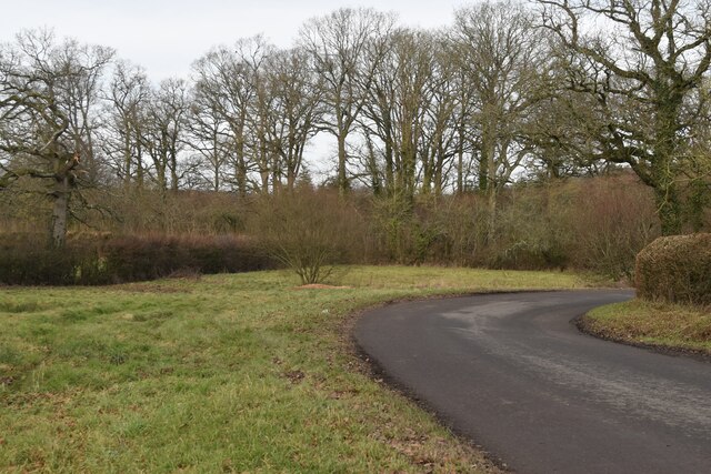
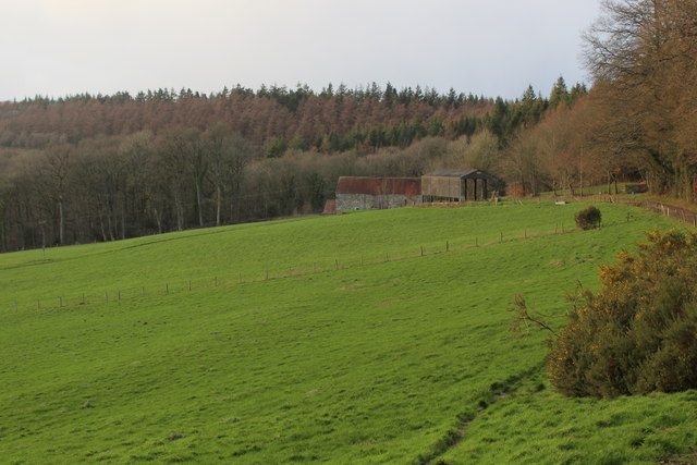
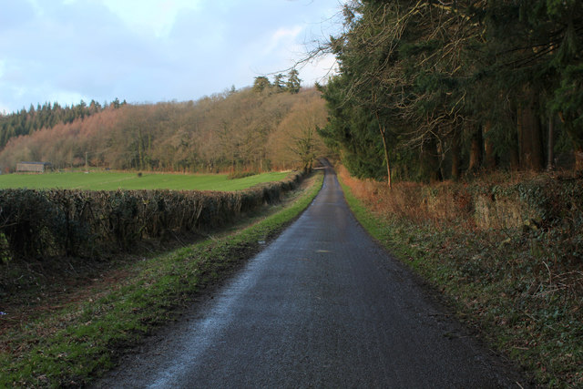
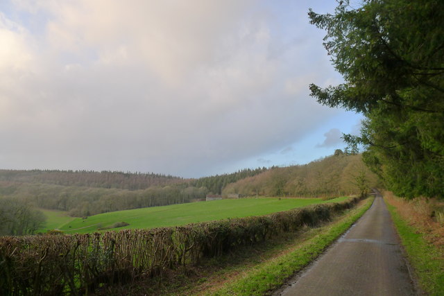
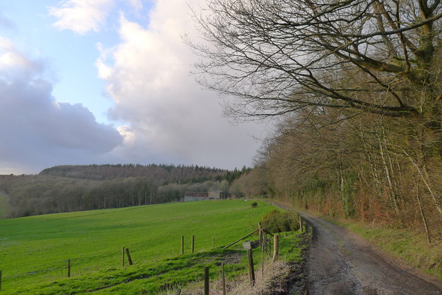
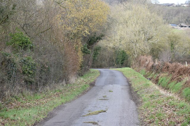
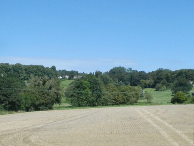
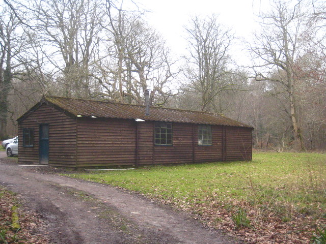
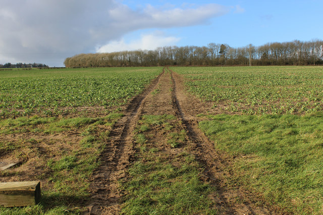
Mosshouse Planting is a woodland area located in the county of Wiltshire, England. This picturesque forest is spread across a vast area and is known for its dense coverage of moss and other plant species, hence its name. The plantation is characterized by its lush greenery and tranquil atmosphere, making it an ideal destination for nature enthusiasts and hikers.

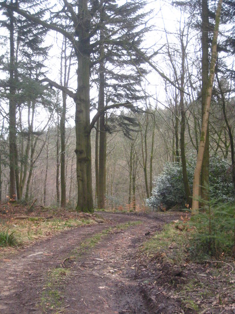
The woodland is home to a diverse range of plant and animal species, contributing to its ecological importance. The moss-covered trees create a unique and enchanting environment, adding to the overall beauty of the area. Visitors can explore the winding paths that meander through the forest, immersing themselves in the serene ambiance and enjoying the sights and sounds of nature.

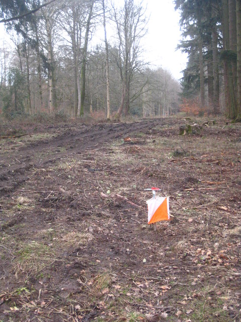
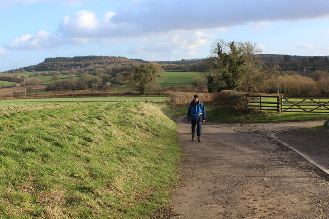
The plantation offers a variety of recreational activities for visitors to enjoy. Walking and hiking trails are abundant, catering to both beginner and experienced hikers. These trails provide an opportunity to witness the beauty of the woods up close and personal, with stunning views and hidden treasures waiting to be discovered.

Wildlife enthusiasts will be delighted by the diverse range of fauna that calls Mosshouse Planting its home. Birdwatchers can spot various species of birds, including woodpeckers and owls, while small mammals like squirrels and rabbits frolic through the undergrowth.

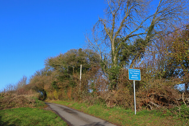
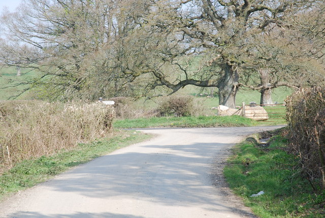
Mosshouse Planting is easily accessible, with nearby parking facilities available for visitors. The area is well-maintained, ensuring a safe and enjoyable experience for all visitors. Whether it's a leisurely stroll, an adventurous hike, or simply a desire to immerse oneself in the beauty of nature, Mosshouse Planting in Wiltshire offers a memorable experience for all who visit.

If you have any feedback on the listing, please let us know in the comments section below.

Mosshouse Planting Images

Images are sourced within 2km of 51.058367/-2.131792 or Grid Reference ST9028. Thanks to Geograph Open Source API. All images are credited.

Bend in the road at Semley Common The common is a small strip of land on either side of the road at this point
Bend in the road at Semley Common
The common is a small strip of land on either side of the road at this point
Ruddlemoor Farm Almost completely surrounded by forest
Ruddlemoor Farm
Almost completely surrounded by forest
Minor Road between Newtown and Hindon For most of its length this quiet lane runs through shady woodland
Minor Road between Newtown and Hindon
For most of its length this quiet lane runs through shady woodland
Heading North towards Hindon Section of the woodland road between Newtown and Hindon
Heading North towards Hindon
Section of the woodland road between Newtown and Hindon
Minor road around the west flank of Beacon Hill Looking towards Ruddlemoor farm in the middle distance.
Minor road around the west flank of Beacon Hill
Looking towards Ruddlemoor farm in the middle distance.
Track to Ruddlemoor Farm
Railway west of Tisbury A view east of the ex London & South Western Railway (LSWR) main Salisbury to Exeter railway line.  This has suffered downgrading in past years, being singled for much of its length, but hopefully it might be upgraded in the future, with rail traffic increasing.
Railway west of Tisbury
A view east of the ex London & South Western Railway (LSWR) main Salisbury to Exeter railway line. This has suffered downgrading in past years, being singled for much of its length, but hopefully it might be upgraded in the future, with rail traffic increasing.
West Hatch Houses at West Hatch.
West Hatch
Houses at West Hatch.
Road Junction Near East Hatch.
Road Junction
Near East Hatch.
Lane north of Broad Oak Farm
Fields near West Hatch
Orienteering control site beside a forest track in Fonthill Abbey Wood During a SARUM orienteering club event.
Orienteering control site beside a forest track in Fonthill Abbey Wood
During a SARUM orienteering club event.
Bend in a forest track in Fonthill Abbey Wood
A timber shed in a clearing in Fonthill Abbey Wood
Newtown: a hidden phone box This telephone box has been rather overcome by the adjacent foliage in the 8 years since it was photographed here: <a href="https://www.geograph.org.uk/photo/1201067">ST9128 : Telephone box, Newtown</a>

The ivy has also made its way into the box from the far corner, not via the door which seems to be jammed half-open.

A notice in the box, saying that BT propose to remove it as it isn't sufficiently used, is dated 2009 although the phone apparatus is still in the box.

A postbox in a pillar can be seen to the far left.
Newtown: a hidden phone box
This telephone box has been rather overcome by the adjacent foliage in the 8 years since it was photographed here: ST9128 : Telephone box, Newtown The ivy has also made its way into the box from the far corner, not via the door which seems to be jammed half-open. A notice in the box, saying that BT propose to remove it as it isn't sufficiently used, is dated 2009 although the phone apparatus is still in the box. A postbox in a pillar can be seen to the far left.
Single Track Railway from Viney's Bridge, West Hatch Section of railway between Gillingham and Tisbury Stations
Single Track Railway from Viney's Bridge, West Hatch
Section of railway between Gillingham and Tisbury Stations
Wessex Ridgeway descending towards West Hatch The long distance footpath outside New Barn
Wessex Ridgeway descending towards West Hatch
The long distance footpath outside New Barn
Wessex Ridgeway heading towards Bottom Copse The long distance footpath on a northward track from New Barn
Wessex Ridgeway heading towards Bottom Copse
The long distance footpath on a northward track from New Barn
Show me another place!

Mosshouse Planting is located at Grid Ref: ST9028 (Lat: 51.058367, Lng: -2.131792)

Unitary Authority: Wiltshire

Police Authority: Wiltshire

What 3 Words

///crib.portable.cured. Near Tisbury, Wiltshire

Related Wikis

Pythouse

Pythouse, sometimes spelled Pyt House and pronounced pit-house, is a country house in southwest Wiltshire, in the west of England. It is about 2+1⁄2 miles...

West Tisbury, Wiltshire

West Tisbury is a civil parish in southwest Wiltshire, England. The parish takes in the southwestern quarter of the village of Tisbury and extends about...
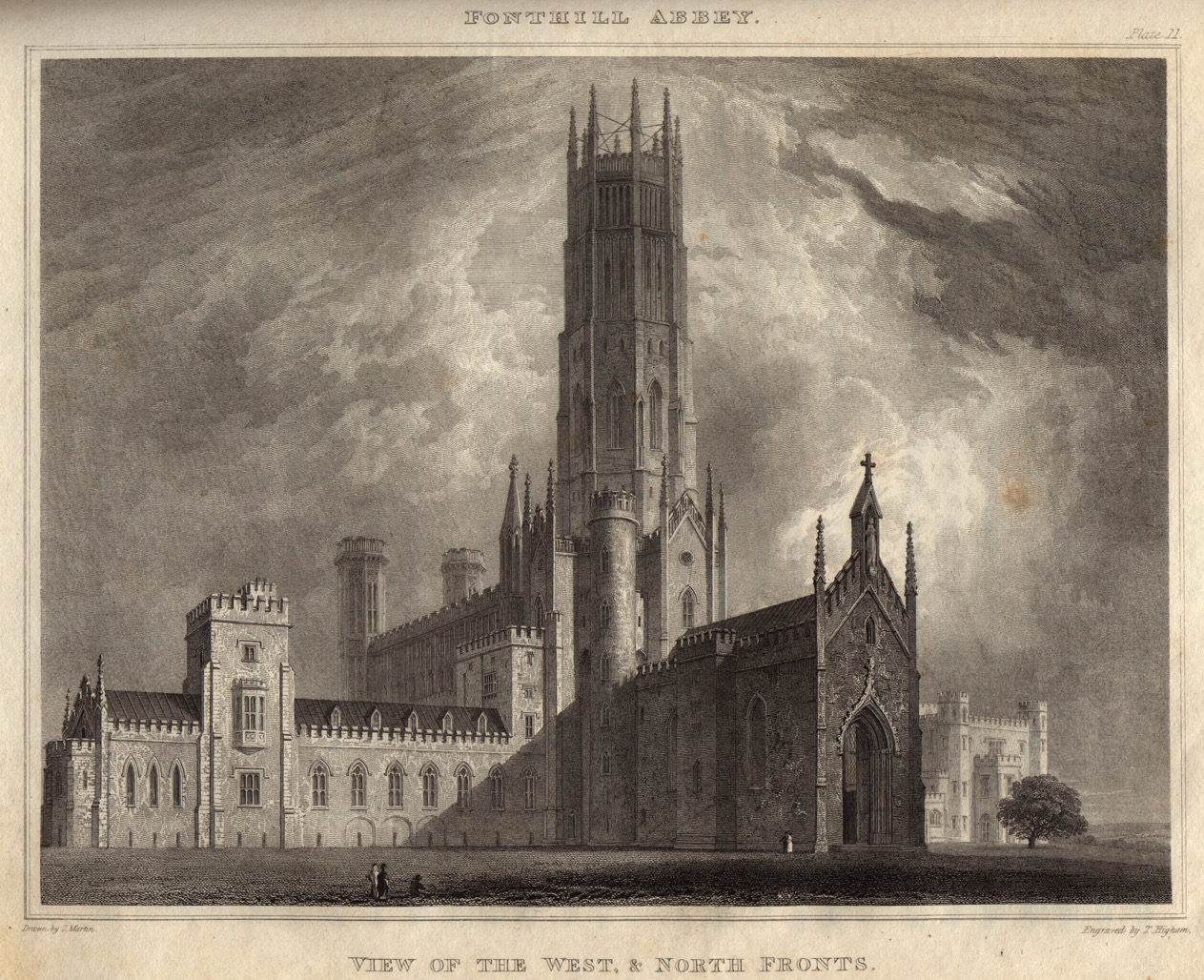
Fonthill Abbey

Fonthill Abbey—also known as Beckford's Folly—was a large Gothic Revival country house built between 1796 and 1813 at Fonthill Gifford in Wiltshire, England...

Wardour, Wiltshire

Wardour is a settlement in the civil parish of Tisbury, in Wiltshire, England, about 13 miles (21 km) west of Salisbury and 4 miles (6 km) south of Hindon...

Semley

Semley is a village and former civil parish, now in the parish of Sedgehill and Semley, in Wiltshire, England, about 3 miles (4.8 km) north-east of Shaftesbury...

Gutch Common

Gutch Common (grid reference ST896259) is a 35.1 hectare biological Site of Special Scientific Interest in Wiltshire, notified in 1951. == Sources == Natural...

East Knoyle War Memorial

The East Knoyle War Memorial is a monument that commemorates the lives of soldiers from East Knoyle, Wiltshire, England, who were killed in war. Unveiled...

East Knoyle

East Knoyle is a village and civil parish in Wiltshire, in the south-west of England, just west of the A350 and about 9 miles (14 km) south of Warminster...

Nearby Amenities

Located within 500m of 51.058367,-2.131792
Cafe
Pythouse Kitchen Garden Farm Shop & Cafe
Lat/Long: 51.0545914/-2.132232
Ele: 215
Natural: peak
Lat/Long: 51.060464/-2.1291583
The data included in this document is from www.openstreetmap.org. The data is made available under ODbL.

Have you been to Mosshouse Planting?

Leave your review of Mosshouse Planting below (or comments, questions and feedback).