Monday's Hill Coppice

Wood, Forest in Worcestershire Wychavon

England

Monday's Hill Coppice

Hay bales near Broughton Hackett Hay bales in a field between Broughton Hackett and Bredicot, Thrift Wood can be seen on the hill in the background.
Hay bales near Broughton Hackett Credit: Philip Halling

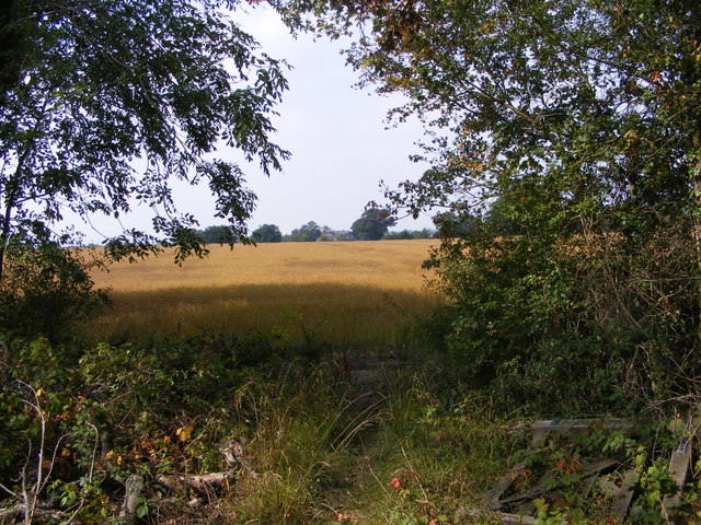
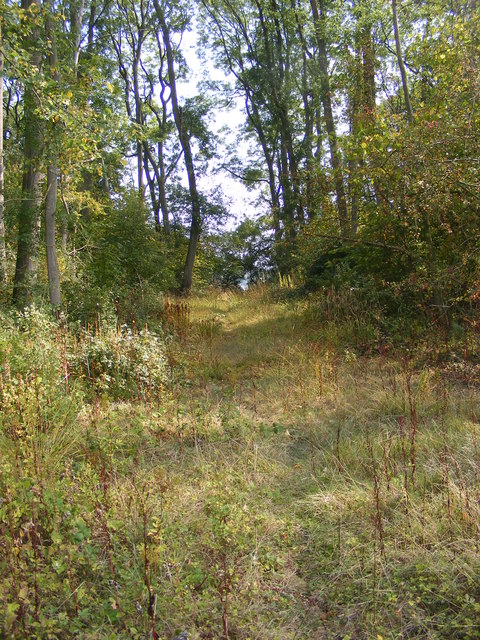
Monday's Hill Coppice is a picturesque woodland located in Worcestershire, England. Covering an area of approximately 50 acres, it is a popular destination for nature enthusiasts and outdoor adventurers alike. The coppice is situated on a gentle hillside, providing visitors with stunning panoramic views of the surrounding countryside.

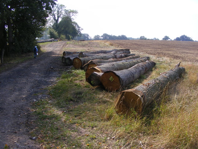
The woodland is predominantly composed of native broadleaf trees, such as oak, ash, and beech, which create a diverse and vibrant ecosystem. These trees are carefully managed through traditional coppicing techniques, which involve periodically cutting them to ground level to encourage new growth. This process not only promotes the health of the woodland but also provides a sustainable source of timber for local industries.

Walking through Monday's Hill Coppice, visitors can explore a network of well-maintained footpaths that wind their way through the trees. These paths offer a chance to observe the rich biodiversity of the area, with sightings of various woodland birds, butterflies, and small mammals being common. Along the way, there are also several clearings and picnic spots where visitors can rest and enjoy the tranquil surroundings.

In addition to its natural beauty, Monday's Hill Coppice holds historical significance. It is believed to have been a part of the ancient Forest of Feckenham, which was once a royal hunting ground. Today, remnants of this history can be seen in the form of old boundary markers and earthworks scattered throughout the woodland.

Overall, Monday's Hill Coppice is a haven for nature lovers, offering a serene and captivating experience amidst the beauty of Worcestershire's countryside.

If you have any feedback on the listing, please let us know in the comments section below.

Monday's Hill Coppice Images

Images are sourced within 2km of 52.184679/-2.1458235 or Grid Reference SO9054. Thanks to Geograph Open Source API. All images are credited.

Hay bales near Broughton Hackett Hay bales in a field between Broughton Hackett and Bredicot, Thrift Wood can be seen on the hill in the background.
Hay bales near Broughton Hackett
Hay bales in a field between Broughton Hackett and Bredicot, Thrift Wood can be seen on the hill in the background.
Under the Rails The footpath passes under the Birmingham to Cheltenham railway line near Bredicot.
Under the Rails
The footpath passes under the Birmingham to Cheltenham railway line near Bredicot.
High Speed Crossing The footpath passes over the track on the Birmingham to Cheltenham line, frequently used by the Virgin trains near Bredicot.
High Speed Crossing
The footpath passes over the track on the Birmingham to Cheltenham line, frequently used by the Virgin trains near Bredicot.
St James Scene The 13th Century church of St James the Less at Bredicot.
St James Scene
The 13th Century church of St James the Less at Bredicot.
The Old Rectory The view next to St James the Less Church at Bredicot.
The Old Rectory
The view next to St James the Less Church at Bredicot.
Felled Trees The view alongside the footpath near Churchill Wood.
Felled Trees
The view alongside the footpath near Churchill Wood.
Out of the Wood The view from the Marshes Wood near Sneachill.
Out of the Wood
The view from the Marshes Wood near Sneachill.
Path to the Rails The footpath view towards the railway line near Bredicot.
Path to the Rails
The footpath view towards the railway line near Bredicot.
Strange Crop The view of the field next to the Marshes Wood near Churchill. The seed crop is Camelina sativa i think.
Strange Crop
The view of the field next to the Marshes Wood near Churchill. The seed crop is Camelina sativa i think.
Strange Crop detail The detail view of the field crop next to the Marshes Wood near Churchill. The seed crop is Camelina sativa i think.
Strange Crop detail
The detail view of the field crop next to the Marshes Wood near Churchill. The seed crop is Camelina sativa i think.
Woodland Path The view of the path through Marshes Wood near Churchill.
Woodland Path
The view of the path through Marshes Wood near Churchill.
High Speed Train at Bredicot A northbound Cross Country Trains HST set, with power car No 43285 nearest to the camera, passes Bredicot.
High Speed Train at Bredicot
A northbound Cross Country Trains HST set, with power car No 43285 nearest to the camera, passes Bredicot.
Footpath Crossing Road Near Bredicot
Road and Fields of Oil Seed Rape near Bredicot
Tree and Oil Seed Rape near Bredicot
Field boundary near Bredicot A distinctive double right-angled bend betraying the removal of other field boundaries, seen from the railway line between Bromsgrove and Tewkesbury just a few metres north of the bridge shown in <a href="https://www.geograph.org.uk/photo/2584226">SO9055 : Under the Rails</a>.
Field boundary near Bredicot
A distinctive double right-angled bend betraying the removal of other field boundaries, seen from the railway line between Bromsgrove and Tewkesbury just a few metres north of the bridge shown in SO9055 : Under the Rails.
Footpath to Bredicote at Cabbage Corner
Pershore Lane at Bredicot Rough A4538 southbound
Pershore Lane at Bredicot Rough
A4538 southbound
Show me another place!

Monday's Hill Coppice is located at Grid Ref: SO9054 (Lat: 52.184679, Lng: -2.1458235)

Administrative County: Worcestershire

District: Wychavon

Police Authority: West Mercia

What 3 Words

///bugs.bigger.faced. Near Worcester, Worcestershire

Related Wikis

Spetchley

Spetchley is a hamlet and civil parish in Worcestershire, England, that lies in the district of Wychavon, half a mile from Worcester, along the A44 road...

Spetchley railway station

Spetchley railway station was an intermediate stop on the Birmingham and Gloucester Railway, opened in 1840. Besides the village of Spetchley, it served...

Spetchley Park

Spetchley Park is a country mansion standing in 4500 acres of gardens and parkland in the hamlet of Spetchley, near Worcester, England. The house and...

A422 road

The A422 is an "A" road for east–west journeys in south central England, connecting the county towns of Bedford and Worcester by way of Milton Keynes,...

All Saints' Church, Spetchley

All Saints' Church, Spetchley, is a redundant Anglican church adjacent to Spetchley Park, Worcestershire, England. It is recorded in the National Heritage...

Bredicot

Bredicot is a small village and civil parish in Worcestershire, England, about 4 miles (6.4 km) east of Worcester. It was formerly (as described in 1868...

Bredicot railway station

Bredicot railway station served the village of Bredicot, Worcestershire, England, from 1845 to 1855 on the Birmingham and Gloucester Railway. == History... ==

Churchill, Wychavon

Churchill or Churchill by Spetchley is a village and civil parish 4 miles (6.4 km) from Worcester, in the Wychavon district, in the county of Worcestershire...

Nearby Amenities

Located within 500m of 52.184679,-2.1458235
Bus Stop
Spetchley Park Gardens
Bus: yes
Naptan AtcoCode: 2000G323378
Naptan Bearing: SE
Naptan CommonName: Spetchley Park Gardens
Naptan Indicator: opp
Naptan NaptanCode: wocdjwmw
Naptan Street: A44
Naptan Verified: no
Public Transport: platform
Source: naptan_import
Lat/Long: 52.1836475/-2.1529426
Spetchley Hall
Power: transformer
Transformer: distribution
Voltage Primary: 11000
Lat/Long: 52.1834436/-2.1525753
Power: pole
Lat/Long: 52.185484/-2.1391328
Power: pole
Lat/Long: 52.1841635/-2.1398208
Spetchley Crossroads
Power: pole
Transformer: distribution
Voltage Primary: 11000
Lat/Long: 52.1827632/-2.1396397
Power: pole
Lat/Long: 52.1832417/-2.139686
Power: pole
Lat/Long: 52.1837499/-2.1397497
Location Transition: yes
Power: pole
Lat/Long: 52.1845006/-2.1512201
Power: pole
Lat/Long: 52.1848443/-2.1500936
Power: pole
Lat/Long: 52.185211/-2.1489
Power: pole
Lat/Long: 52.1854939/-2.1471807
Power: pole
Lat/Long: 52.185743/-2.1456492
Bredicot Rough
Power: pole
Transformer: distribution
Voltage Primary: 11000
Lat/Long: 52.1858491/-2.1450175
Power: pole
Lat/Long: 52.1856287/-2.1443684
Spetchley Station
Power: pole
Transformer: distribution
Voltage Primary: 11000
Lat/Long: 52.1829186/-2.1441203
Power: pole
Lat/Long: 52.1836537/-2.1440305
Power: pole
Lat/Long: 52.1846026/-2.1439098
Power: pole
Lat/Long: 52.1854298/-2.1438092
Power: pole
Lat/Long: 52.1850926/-2.1428061
Power: pole
Lat/Long: 52.1847407/-2.141811
Power: pole
Lat/Long: 52.1844743/-2.141068
Power: pole
Lat/Long: 52.1845853/-2.1398704
Spetchley Bridge
Power: pole
Transformer: distribution
Voltage Primary: 11000
Lat/Long: 52.1849455/-2.1398771
Power: pole
Lat/Long: 52.1852082/-2.1395317
Power: pole
Lat/Long: 52.185757/-2.1387425
The data included in this document is from www.openstreetmap.org. The data is made available under ODbL.

Have you been to Monday's Hill Coppice?

Leave your review of Monday's Hill Coppice below (or comments, questions and feedback).