Wittantree Plantation

Wood, Forest in Gloucestershire Stroud

England

Wittantree Plantation

Lane to Througham Slad One of many such dead-end lanes in the Cotswolds.
Lane to Througham Slad Credit: Jonathan Billinger

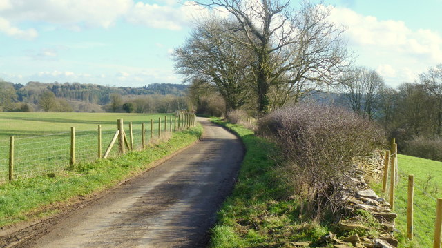
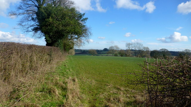
Wittantree Plantation is a picturesque woodland area located in Gloucestershire, England. Covering an expansive area of approximately 500 acres, this enchanting plantation is nestled within the heart of the beautiful Forest of Dean. The plantation is renowned for its diverse range of indigenous tree species, creating a stunning natural landscape that attracts nature enthusiasts and tourists alike.

The woodland is predominantly composed of deciduous trees, including oak, beech, and ash, which provide a rich canopy of foliage throughout the year. This vibrant mix of trees offers a plethora of colors during autumn, making it a popular destination for visitors seeking breathtaking seasonal views. Additionally, the dense woodland provides a haven for a wide range of British wildlife, including deer, badgers, and a variety of bird species.

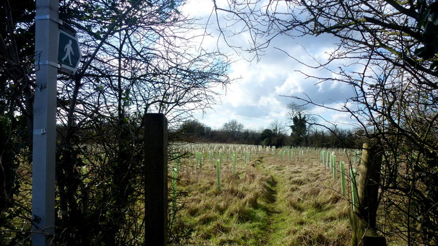
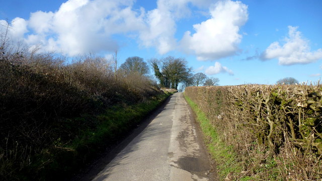
Wittantree Plantation offers several well-maintained walking trails that wind their way through the woodland, allowing visitors to explore its beauty at their own pace. These trails cater to all levels of fitness, from leisurely strolls to more challenging hikes, providing an opportunity for everyone to enjoy the tranquility of the forest.

The plantation is also home to a small visitor center, which offers information about the local flora and fauna, as well as the history of the Forest of Dean. The center provides an educational experience for visitors, with interactive displays and knowledgeable staff on hand to answer questions and offer guidance.

Overall, Wittantree Plantation is a captivating destination, perfect for those seeking an escape into the natural beauty of Gloucestershire's woodlands. Its rich biodiversity, stunning scenery, and peaceful atmosphere make it an ideal location for nature lovers and outdoor enthusiasts to immerse themselves in the wonders of the Forest of Dean.

If you have any feedback on the listing, please let us know in the comments section below.

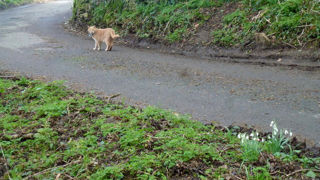
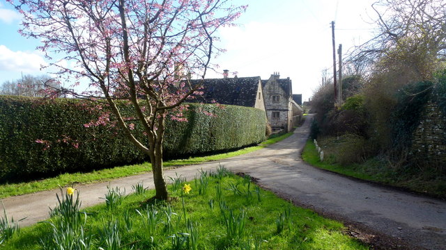
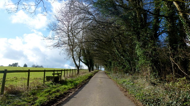
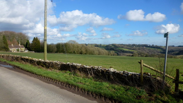
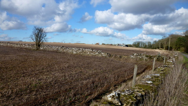
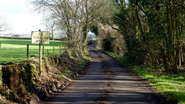
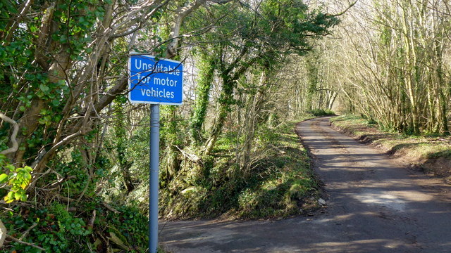
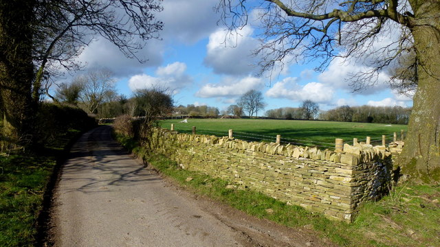
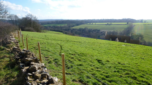
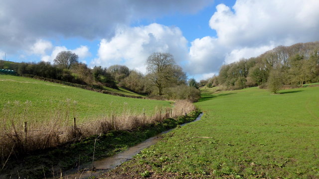
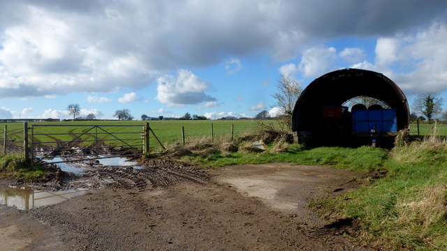
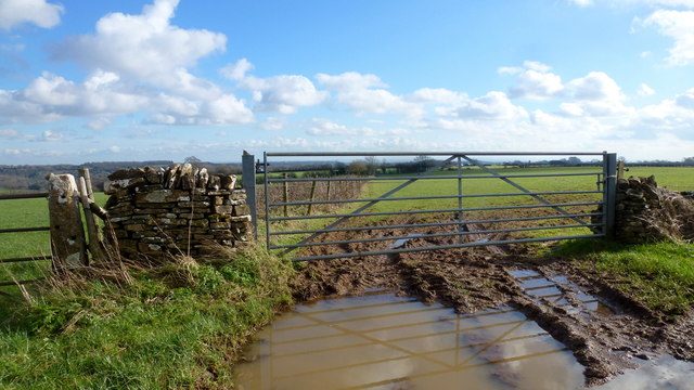
Wittantree Plantation Images

Images are sourced within 2km of 51.76644/-2.1448898 or Grid Reference SO9007. Thanks to Geograph Open Source API. All images are credited.

Lane to Througham Slad One of many such dead-end lanes in the Cotswolds.
Lane to Througham Slad
One of many such dead-end lanes in the Cotswolds.
Footpath east from Througham Lane Follows this field edge towards Honeycombe Farm over typical Cotswolds countryside.
Footpath east from Througham Lane
Follows this field edge towards Honeycombe Farm over typical Cotswolds countryside.
Footpath west from Througham Lane Passes through recently-planted woodland of the future.
Footpath west from Througham Lane
Passes through recently-planted woodland of the future.
Througham Lane Looking north towards The Camp.
Througham Lane
Looking north towards The Camp.
Minding his own business A ginger tom on a mid-afternoon constitutional tour around his estate.
Wild snowdrops in the bottom right of this picture.
Minding his own business
A ginger tom on a mid-afternoon constitutional tour around his estate. Wild snowdrops in the bottom right of this picture.
Througham A Cotswolds hamlet clustered around a fine stone house, Througham Court, seen ahead on the left.
The pink blossom is that of a winter-flowering cherry.
Througham
A Cotswolds hamlet clustered around a fine stone house, Througham Court, seen ahead on the left. The pink blossom is that of a winter-flowering cherry.
Lane and stile Lane west from Througham with a short footpath heading diagonally across the field to the left.
Lane and stile
Lane west from Througham with a short footpath heading diagonally across the field to the left.
Short footpath to Througham The path leads across this field to the stile in <a href="https://www.geograph.org.uk/photo/4888965">SO9107 : Lane and stile</a>.
Short footpath to Througham
The path leads across this field to the stile in SO9107 : Lane and stile.
Cotswolds farmland Typical scene with stone walls to the west of Througham.
Cotswolds farmland
Typical scene with stone walls to the west of Througham.
No Through Road to Througham Slad The lane boasts a pre-Worboys sign.
No Through Road to Througham Slad
The lane boasts a pre-Worboys sign.
Unsuitable? I beg to differ; I was able to use this steep, narrow lane without any trouble.
Unsuitable?
I beg to differ; I was able to use this steep, narrow lane without any trouble.
Lane from Througham Slad Nice bit of new-build drystone walling here.
Lane from Througham Slad
Nice bit of new-build drystone walling here.
View over Jones Slad Farm Cotswolds house with a fine southerly aspect.
View over Jones Slad Farm
Cotswolds house with a fine southerly aspect.
Cotswolds stream by Calfway Farm This winter stream in full flow feeds the Holy Brook and the River Frome to become part of the Greater Stroud drainage basin.
Cotswolds stream by Calfway Farm
This winter stream in full flow feeds the Holy Brook and the River Frome to become part of the Greater Stroud drainage basin.
Small agricultural structure North of Calfway Lane, Bisley.
Small agricultural structure
North of Calfway Lane, Bisley.
Young cereal field near Bisley Typical Cotswold view in late winter.
Young cereal field near Bisley
Typical Cotswold view in late winter.
The Stirrup Cup, Bisley Walker-friendly pub at the north end of the village.
The Stirrup Cup, Bisley
Walker-friendly pub at the north end of the village.
Notice on the Stirrup Cup Not unfriendly to outdoor-types!
Notice on the Stirrup Cup
Not unfriendly to outdoor-types!
Show me another place!

Wittantree Plantation is located at Grid Ref: SO9007 (Lat: 51.76644, Lng: -2.1448898)

Administrative County: Gloucestershire

District: Stroud

Police Authority: Gloucestershire

What 3 Words

///campers.animator.jetliner. Near Painswick, Gloucestershire

Related Wikis

Rough Bank, Miserden

Rough Bank, Miserden (grid reference SO907087) is a 9.2-hectare (23-acre) biological Site of Special Scientific Interest in Gloucestershire, notified in...

Bisley, Gloucestershire

Bisley is a village and former civil parish, now in the parish of Bisley-with-Lypiatt, in the Stroud district, in Gloucestershire, England, about 4 miles...

Lypiatt

Lypiatt is a small village and former civil parish, now in the parish of Miserden, in the Stroud district, in Gloucestershire, England, approximately 4...

Snows Farm Nature Reserve

Snows Farm Nature Reserve (grid reference SO887081) is a 21.3-hectare (53-acre) nature reserve in Gloucestershire. The site is listed in the ‘Stroud District...

Bisley-with-Lypiatt

Bisley-with-Lypiatt is a civil parish in the Stroud district of Gloucestershire, England. It had a population of 2350 in 2019. It includes Bisley, Lypiatt...

The Camp, Gloucestershire

The Camp is a hamlet in the south of Gloucestershire, approximately 10 miles south of Cheltenham and 5 miles north-east of Stroud. It is in the parish...

Lypiatt Park

Lypiatt Park is a medieval and Tudor manor house with notable nineteenth-century additions in the parish of Bisley, near Stroud, in Gloucestershire, England...

Battlescombe

Battlescombe is an area in the village of Bisley in Gloucestershire, England. == References ==

Related Videos

Walking at First Light Through a Beautiful Cotswold Village

So, today we are out and about walking at very first light in the village Of Bisley which is located around 4 miles east of Stroud in ...

The Hidden Gem of Bisley, ENGLAND: Autumn Walk in the COTSWOLDS

Bisley is a picturesque English village located in the Cotswolds, a designated Area of Outstanding Natural Beauty in England.

Albion - Chapter 2 - Part 2 - The Curse of the Cotswolds - Lands End to John O'Groats Walk

lejog #jogle #landsendtojohnogroats Lands End to John O'Groats In this episode I have finished my 2 week recovery at my ...

Nearby Amenities

Located within 500m of 51.76644,-2.1448898
Power: pole
Lat/Long: 51.767327/-2.1417973
Power: pole
Lat/Long: 51.7668906/-2.1458636
Power: pole
Lat/Long: 51.7649583/-2.1487121
Power: pole
Lat/Long: 51.769201/-2.1401022
Power: pole
Lat/Long: 51.7651445/-2.1503481
Power: pole
Lat/Long: 51.7643973/-2.1497367
Power: pole
Lat/Long: 51.7671229/-2.144737
Power: pole
Lat/Long: 51.7683131/-2.1422882
Power: pole
Lat/Long: 51.7678781/-2.1433798
Power: pole
Lat/Long: 51.7648191/-2.1511581
Power: pole
Lat/Long: 51.7655692/-2.1491841
Power: pole
Lat/Long: 51.7655973/-2.1475454
Power: pole
Lat/Long: 51.7660241/-2.1480791
Power: pole
Lat/Long: 51.7672259/-2.1432994
Power: pole
Lat/Long: 51.7673288/-2.1446861
Power: pole
Lat/Long: 51.7674416/-2.1403758
Power: pole
Lat/Long: 51.7663743/-2.1471591
Power: pole
Lat/Long: 51.7675446/-2.1390454
Power: pole
Lat/Long: 51.7687629/-2.1411965
Power: pole
Lat/Long: 51.7660656/-2.1466736
Power: pole
Lat/Long: 51.7665602/-2.1457536
Stancombe Farm Shop
Shop: farm
Lat/Long: 51.7626983/-2.1445189
Fuel
Holbrook Garage
Addr City: Bisley
Addr Postcode: GL6 7BX
Addr Street: Calf Way
Lat/Long: 51.7654525/-2.1384703
The Greenshop Bisley
Addr City: Bisley
Addr Postcode: GL6 7BX
Addr Street: Calf Way
Shop: yes
Lat/Long: 51.7653305/-2.1379718
Power: pole
Lat/Long: 51.7640452/-2.1393111
The data included in this document is from www.openstreetmap.org. The data is made available under ODbL.

Have you been to Wittantree Plantation?

Leave your review of Wittantree Plantation below (or comments, questions and feedback).