Narrow Plantation

Wood, Forest in Yorkshire Craven

England

Narrow Plantation

Old milestone This top section and part of the backing stone of the WRCC milestone that once stood west of Coniston Cold on the A65 was found some years ago by a collector who has a small museum in Kings Meaburn  (NY62402075).  The lost sides would have had SKIPTON/6¾ MILES/KEIGHLEY/16 MILES and SETTLE/8¾ MILES/KENDAL/38 MILES.   it is not known which side of the road it once stood.
Old milestone Credit: Chris Minto

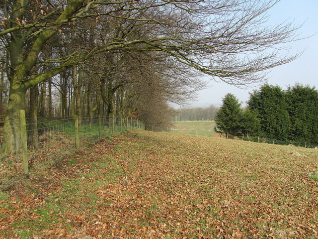
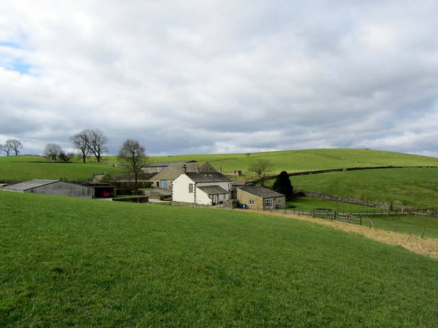
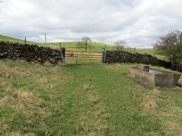
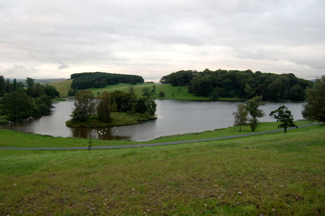
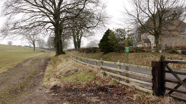
Narrow Plantation is a picturesque woodland located in Yorkshire, England. Situated within the larger Forest of Yorkshire, this plantation is a haven for nature lovers and outdoor enthusiasts alike. Spanning over a vast area, the woodland is characterized by its tall and slender trees, hence the name "Narrow Plantation."

The woodland boasts a diverse range of tree species, including oak, beech, and pine, creating a vibrant and lush environment. The well-maintained footpaths and trails throughout the woodland offer visitors the opportunity to explore its natural beauty at their own pace. As visitors wander along the trails, they can enjoy the tranquility of the woodland, listening to the melodic songs of birds and the gentle rustling of leaves in the breeze.

Narrow Plantation is also home to a variety of wildlife, making it a popular spot for wildlife enthusiasts. Squirrels, rabbits, deer, and a plethora of bird species can often be spotted within the woodland's boundaries. Keen-eyed visitors may even catch a glimpse of a red fox or a badger, adding to the sense of adventure and discovery.

This woodland is not only a natural treasure but also a historical landmark. It has stood for centuries, witnessing the changing landscapes and providing a habitat for countless generations of flora and fauna. Today, Narrow Plantation stands as a testament to the importance of preserving our natural heritage and offers a serene escape from the hustle and bustle of everyday life.

If you have any feedback on the listing, please let us know in the comments section below.

Narrow Plantation Images

Images are sourced within 2km of 53.999151/-2.1535045 or Grid Reference SD9055. Thanks to Geograph Open Source API. All images are credited.
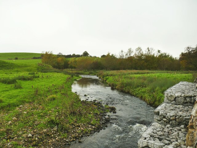
Old milestone This top section and part of the backing stone of the WRCC milestone that once stood west of Coniston Cold on the A65 was found some years ago by a collector who has a small museum in Kings Meaburn  (NY62402075).  The lost sides would have had SKIPTON/6¾ MILES/KEIGHLEY/16 MILES and SETTLE/8¾ MILES/KENDAL/38 MILES.   it is not known which side of the road it once stood.
Old milestone
This top section and part of the backing stone of the WRCC milestone that once stood west of Coniston Cold on the A65 was found some years ago by a collector who has a small museum in Kings Meaburn (NY62402075). The lost sides would have had SKIPTON/6¾ MILES/KEIGHLEY/16 MILES and SETTLE/8¾ MILES/KENDAL/38 MILES. it is not known which side of the road it once stood.
Otterburn Beck, with gabions The gabions are presumably to prevent the beck eroding the adjacent road.
Otterburn Beck, with gabions
The gabions are presumably to prevent the beck eroding the adjacent road.
Marsh by the road to Otterburn The parish boundary between Coniston Cold and Otterburn passes through this marsh (indeed the 1909 map indicates the boundary being 'C[entre of] Marsh') and it may therefore mark a previous course of Otterburn Beck.
Marsh by the road to Otterburn
The parish boundary between Coniston Cold and Otterburn passes through this marsh (indeed the 1909 map indicates the boundary being 'C[entre of] Marsh') and it may therefore mark a previous course of Otterburn Beck.
Four royal trees Four young sycamore trees, well spaced, on the verge of the lane from Otterburn to Bell Busk (the village name sign for the latter can be seen here). From nearest the camera, the dedications are to the late Queen Elizabeth II (2022), the coronation of Charles III (2023), the late Duke of Edinburgh (2021), and the Queen's platinum jubilee (earlier in 2022). A series of royal celebrations and commemorations not likely to be repeated for a long time.
Four royal trees
Four young sycamore trees, well spaced, on the verge of the lane from Otterburn to Bell Busk (the village name sign for the latter can be seen here). From nearest the camera, the dedications are to the late Queen Elizabeth II (2022), the coronation of Charles III (2023), the late Duke of Edinburgh (2021), and the Queen's platinum jubilee (earlier in 2022). A series of royal celebrations and commemorations not likely to be repeated for a long time.
Pits Hill On the summit of the hill next to the plantation
Pits Hill
On the summit of the hill next to the plantation
Coniston Hall Estate shooting ground A mecca for clay pigeon shooting.
Coniston Hall Estate shooting ground
A mecca for clay pigeon shooting.
Pull! Clay pigeons being discharged at Coniston shooting ground.
Pull!
Clay pigeons being discharged at Coniston shooting ground.
Track from the shooting grounds Coniston Hall Estate.
Pot Haw Hill One of several grass covered drumlins that abound in this area
Pot Haw Hill
One of several grass covered drumlins that abound in this area
Kelber Farm Farming operation hidden between a series of grass covered drumlins just south of the A65 road between Hellifield and Coniston Cold.
Kelber Farm
Farming operation hidden between a series of grass covered drumlins just south of the A65 road between Hellifield and Coniston Cold.
Footpath approaching Kelber Little used footpath approaching a rusty gate, just beyond which is Kelber Farm.
Footpath approaching Kelber
Little used footpath approaching a rusty gate, just beyond which is Kelber Farm.
A65 crossing Coniston Moor Footpath track on right
A65 crossing Coniston Moor
Footpath track on right
Entrance to Coniston Hall Hotel from A65
Coniston Lake Lake at the rear of the Coniston Hotel, Coniston Cold, Gargrave
Coniston Lake
Lake at the rear of the Coniston Hotel, Coniston Cold, Gargrave
Moorber Lane passing Pot Haw Farm A minor road leaves the A65 at the small settlement of Coniston Cold. Where it's met by a bridleway from the south (Kay Lane), the public nature of the road changes and it continues as Moorber Lane, a bridleway only; the green notice attached to the post tells as much.
Moorber Lane passing Pot Haw Farm
A minor road leaves the A65 at the small settlement of Coniston Cold. Where it's met by a bridleway from the south (Kay Lane), the public nature of the road changes and it continues as Moorber Lane, a bridleway only; the green notice attached to the post tells as much.
Steeling Hill A view from the flat summit of Steeling Hill towards Winterley Cobba.
Parked in lay-by near entrance to High Ground Farm which we walked round to the right before cutting back to use lane to access trig field. Then down to track to go past farm to bag Steeling Hill with its enclosure ditch and flat summit via gate to field. Then walk back along the busy A65.
Name: Steeling Hill
Hill number: 108477
Height: 218m / 715ft
Area: 36: Lancashire, Cheshire & the Southern Pennines
Class: 2
Grid ref: SD886551 (est)
Drop: 33m
Col: 185m
Steeling Hill
A view from the flat summit of Steeling Hill towards Winterley Cobba. Parked in lay-by near entrance to High Ground Farm which we walked round to the right before cutting back to use lane to access trig field. Then down to track to go past farm to bag Steeling Hill with its enclosure ditch and flat summit via gate to field. Then walk back along the busy A65. Name: Steeling Hill Hill number: 108477 Height: 218m / 715ft Area: 36: Lancashire, Cheshire & the Southern Pennines Class: 2 Grid ref: SD886551 (est) Drop: 33m Col: 185m
Pot Haw Hill Parked in Coniston Cold and walked up to Pot Haw Farm with easy access to the summit through fields with a course set out for horses. Then through similar fields to bag Winterley Cobba. Then joined the bridleway below Stainton Cotes to get back to Coniston Cold. A lovely area to explore even with Martin Richardson. View towards dry stone wall.
Name: Pot Haw Hill
Hill number: 108486
Height: 202m / 663ft
Area: 36: Lancashire, Cheshire & the Southern Pennines
Class: 2
Grid ref: SD893548 (est)
Drop: 31m
Col: 171m
Pot Haw Hill
Parked in Coniston Cold and walked up to Pot Haw Farm with easy access to the summit through fields with a course set out for horses. Then through similar fields to bag Winterley Cobba. Then joined the bridleway below Stainton Cotes to get back to Coniston Cold. A lovely area to explore even with Martin Richardson. View towards dry stone wall. Name: Pot Haw Hill Hill number: 108486 Height: 202m / 663ft Area: 36: Lancashire, Cheshire & the Southern Pennines Class: 2 Grid ref: SD893548 (est) Drop: 31m Col: 171m
Hillside grazing, Reek House Hill
Show me another place!

Narrow Plantation is located at Grid Ref: SD9055 (Lat: 53.999151, Lng: -2.1535045)

Division: West Riding

Administrative County: North Yorkshire

District: Craven

Police Authority: North Yorkshire

What 3 Words

///evolution.wicked.fussy. Near Gargrave, North Yorkshire

Related Wikis

Bell Busk railway station

Bell Busk railway station served the hamlet of Bell Busk in North Yorkshire, England. It was located on the Leeds to Morecambe Line between Gargrave and...

Bell Busk

Bell Busk is a hamlet situated in the Craven district of North Yorkshire, England. The hamlet is located at the southern end of Malhamdale where the nascent...

Aire Gap

Aire Gap is a pass through the Pennines in England formed by geologic faults and carved out by glaciers. The term is used to describe a geological division...
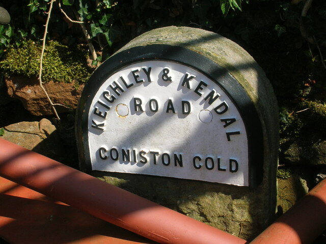
Coniston Cold

Coniston Cold is a village and civil parish in the Craven district of North Yorkshire, England. Historically part of the Staincliffe Wapentake of the West...

A65 road

The A65 is a major road in England. It runs north west from Leeds in West Yorkshire via Kirkstall, Horsforth, Yeadon, Guiseley, Ilkley and Skipton, west...

Newfield Hall

Newfield Hall is a former country house located 1 mile (1.6 km) to the southeast of the village of Airton, North Yorkshire, England. It is now a hotel...

Otterburn, North Yorkshire

Otterburn (historically known as Otterburn-in-Craven) is a village and civil parish in the Craven district of North Yorkshire, England. It is at OS Grid...

Bank Newton

Bank Newton is a small settlement and civil parish in the Craven district of North Yorkshire, England. According to the 2001 census the parish had a population...

Nearby Amenities

Located within 500m of 53.999151,-2.1535045
Windy Hill
Is In Country Code: GB
Natural: peak
Source: OS 1:25k
Lat/Long: 54.0005982/-2.1578262
Heber Hill
Is In Country Code: GB
Natural: peak
Source: OS 1:25k
Lat/Long: 53.9973063/-2.1570537
Information: guidepost
Source: GPS Survey
Tourism: information
Lat/Long: 53.9962202/-2.1508996
Hiking: yes
Information: guidepost
Tourism: information
Lat/Long: 53.9961699/-2.1508716
Power: pole
Source: Bing
Lat/Long: 53.9956821/-2.1511497
Power: pole
Source: Bing
Lat/Long: 53.9949167/-2.1510307
Power: pole
Source: Bing
Lat/Long: 53.9966275/-2.1513457
Defibrillator
Defibrillator Location: Outside wall facing car park
Emergency: defibrillator
Indoor: no
Lat/Long: 53.9989828/-2.1496612
Power: pole
Source: Bing
Lat/Long: 54.0015761/-2.1473206
Power: pole
Source: Bing
Lat/Long: 54.0015838/-2.1482544
Power: pole
Source: Bing
Lat/Long: 54.0006736/-2.1484153
Power: pole
Source: Bing
Lat/Long: 54.0000393/-2.1491805
Power: pole
Source: Bing
Lat/Long: 53.9995118/-2.1498238
Power: pole
Source: Bing
Lat/Long: 53.9988394/-2.1506616
Power: pole
Source: Bing
Lat/Long: 53.9980709/-2.1510714
Power: pole
Source: Bing
Lat/Long: 53.9972674/-2.1514865
The data included in this document is from www.openstreetmap.org. The data is made available under ODbL.

Have you been to Narrow Plantation?

Leave your review of Narrow Plantation below (or comments, questions and feedback).