Pennyhill Wood

Wood, Forest in Gloucestershire Stroud

England

Pennyhill Wood

Chalford from railway line Looking towards High Street at Chalford, with Coppice Hill further up. Chalford Baptist Church is visible at top mid-right of picture.
Chalford from railway line Credit: Clint Mann

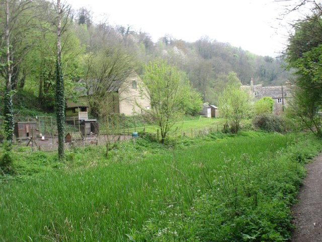
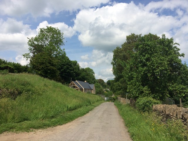
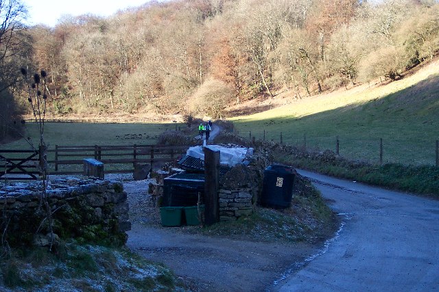
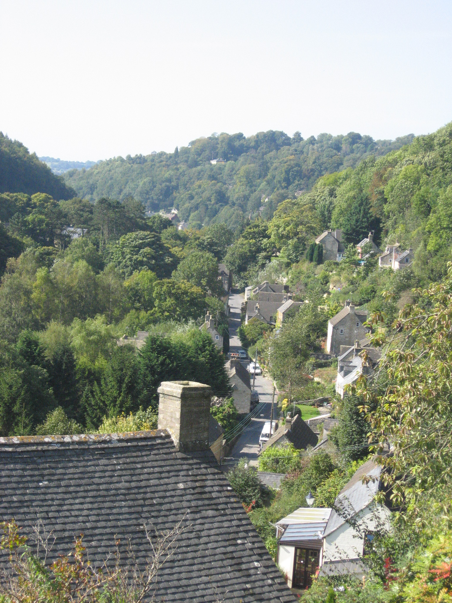
Pennyhill Wood is a tranquil and picturesque woodland located in the county of Gloucestershire, England. Spread across an area of approximately 100 acres, this enchanting forest is a haven for nature lovers and outdoor enthusiasts.

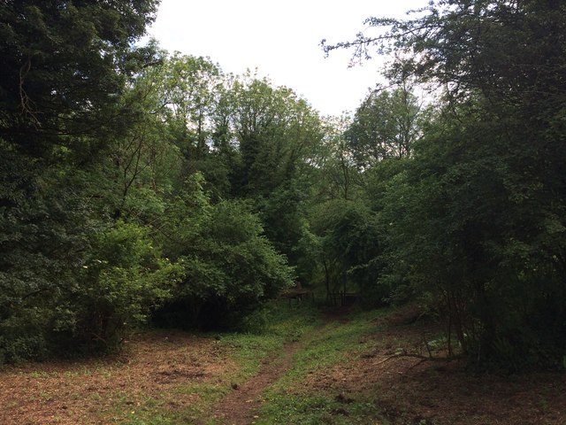
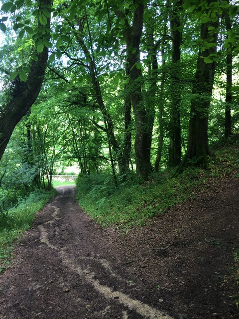
The wood is predominantly composed of broadleaf trees, including majestic oaks, beeches, and birches, which form a dense canopy overhead, providing shade and shelter for a diverse range of flora and fauna. The forest floor is adorned with an array of native wildflowers, such as bluebells, primroses, and wood anemones, creating a vibrant and colorful carpet during the spring months.

Pennyhill Wood offers several well-maintained walking trails, allowing visitors to explore its natural beauty at their own pace. These paths meander through the woodland, leading to hidden clearings, babbling brooks, and peaceful ponds. Birdwatchers will be delighted by the variety of avian species that call this forest home, including great spotted woodpeckers, tawny owls, and chiffchaffs.

The wood is managed by a local conservation organization, which ensures the preservation of its ecological balance and the protection of its wildlife. There are designated picnic areas and benches throughout the forest, providing visitors with the perfect opportunity to relax and immerse themselves in the serenity of their surroundings.

Pennyhill Wood is open to the public year-round and offers a magical escape from the hustle and bustle of everyday life. Whether you are seeking a peaceful stroll, a family picnic, or a chance to connect with nature, this charming woodland is sure to captivate and inspire all who visit.

If you have any feedback on the listing, please let us know in the comments section below.

Pennyhill Wood Images

Images are sourced within 2km of 51.719963/-2.1536726 or Grid Reference SO8902. Thanks to Geograph Open Source API. All images are credited.

Chalford from railway line Looking towards High Street at Chalford, with Coppice Hill further up. Chalford Baptist Church is visible at top mid-right of picture.
Chalford from railway line
Looking towards High Street at Chalford, with Coppice Hill further up. Chalford Baptist Church is visible at top mid-right of picture.
Track and bridleway Towards Upper Hill Farm.
Track and bridleway
Towards Upper Hill Farm.
Cotswolds pasture land To the north-west of France Lench.
Cotswolds pasture land
To the north-west of France Lench.
Across the (disused) Thames & Severn Canal Seen walking west, towards Stroud and the Severn.
Across the (disused) Thames & Severn Canal
Seen walking west, towards Stroud and the Severn.
Lynch Road, France Lynch
Footpath in Dimmel's Dale
Steep Path in Oldhills Wood
Gliders on Aston Down airfield The field between the boundary fence and runways is planted with oilseed rape.
Gliders on Aston Down airfield
The field between the boundary fence and runways is planted with oilseed rape.
Milestone at Chalford Water Works on the towpath of the Thames & Severn canal. Plate is a true copy of the original which is in the Canal centre at Walbridge.

Walbridge 5 / Inglesham 23¾ 

Milestone Society National ID: TSC-05
Milestone at Chalford Water Works
on the towpath of the Thames & Severn canal. Plate is a true copy of the original which is in the Canal centre at Walbridge. Walbridge 5 / Inglesham 23¾ Milestone Society National ID: TSC-05
Aston Down Airfield: aerial 2019 Now home to the Cotswold Gliding Club.
Aston Down Airfield: aerial 2019
Now home to the Cotswold Gliding Club.
Milestone, A419 (old road) By the entrance to Westley Farm, on the verge of the original route of the road. The area is the Junction of the Cirencester Road and the Stroud Road. This particular section of the Cirencester Road was created  during WW2 when Aston Down aerodrome was built, cutting through a road that joined the A419 a mile along.

No record of the inscription. It is 7 miles from Ciren (& Stroud)

Milestone Society National ID: GL_CISD07
Milestone, A419 (old road)
By the entrance to Westley Farm, on the verge of the original route of the road. The area is the Junction of the Cirencester Road and the Stroud Road. This particular section of the Cirencester Road was created during WW2 when Aston Down aerodrome was built, cutting through a road that joined the A419 a mile along. No record of the inscription. It is 7 miles from Ciren (& Stroud) Milestone Society National ID: GL_CISD07
Charley Barnett's house This house at the bottom of Gypsy Lane, Chalford was
completely obscured by Virginia Creeper.
Charley Barnett's house
This house at the bottom of Gypsy Lane, Chalford was completely obscured by Virginia Creeper.
France Lynch (Glos) St John the Baptist's Church
Lane to Chalford The lane in the view goes down the valley to Chalford and the railway, river and canal are nearby but not visible also following the contours. At this junction one lane climbs to Oakridge and the other to Frampton Mansell.
Lane to Chalford
The lane in the view goes down the valley to Chalford and the railway, river and canal are nearby but not visible also following the contours. At this junction one lane climbs to Oakridge and the other to Frampton Mansell.
Bottom of the gardens, Chalford Bottom The gardens on the right back on to the River Frome, and each house has its own bridge giving access to the footpath. The path was originally the towpath of the Thames and Severn Canal, now dry, which runs alongside it to the left. In the distance is an elevated section of the Gloucester-Swindon railway.
Bottom of the gardens, Chalford Bottom
The gardens on the right back on to the River Frome, and each house has its own bridge giving access to the footpath. The path was originally the towpath of the Thames and Severn Canal, now dry, which runs alongside it to the left. In the distance is an elevated section of the Gloucester-Swindon railway.
Aston Down Polo Grounds The Cirencester Park Polo Club, founded 1894. With Chalford visible across the valley.
Aston Down Polo Grounds
The Cirencester Park Polo Club, founded 1894. With Chalford visible across the valley.
Gloucester to Swindon Railway Line A view of the railway as it descends into the valley below Chalford.
Gloucester to Swindon Railway Line
A view of the railway as it descends into the valley below Chalford.
Coppice Hill, Chalford The hill heads south down the valley side to the main road at the bottom.
Coppice Hill, Chalford
The hill heads south down the valley side to the main road at the bottom.
Show me another place!

Pennyhill Wood is located at Grid Ref: SO8902 (Lat: 51.719963, Lng: -2.1536726)

Administrative County: Gloucestershire

District: Stroud

Police Authority: Gloucestershire

What 3 Words

///differ.highly.before. Near Chalford, Gloucestershire

Related Wikis

Chalford railway station

Chalford railway station was situated on the Great Western Railway's Golden Valley Line, between Swindon and Gloucester. It was just east of the bridge...

Chalford

Chalford is a large village in the Frome Valley of the Cotswolds in Gloucestershire, England. It is to the southeast of Stroud about four miles (six kilometres...

St Mary's Crossing Halt railway station

St Mary's Crossing Halt was opened on 12 October 1903 on what is now the Golden Valley Line between Kemble and Stroud. This line was opened in 1845 as...

Bussage

Bussage is a village in Gloucestershire, England in the district of Stroud. == Geography == There is an older part to the village and a newer part. The...

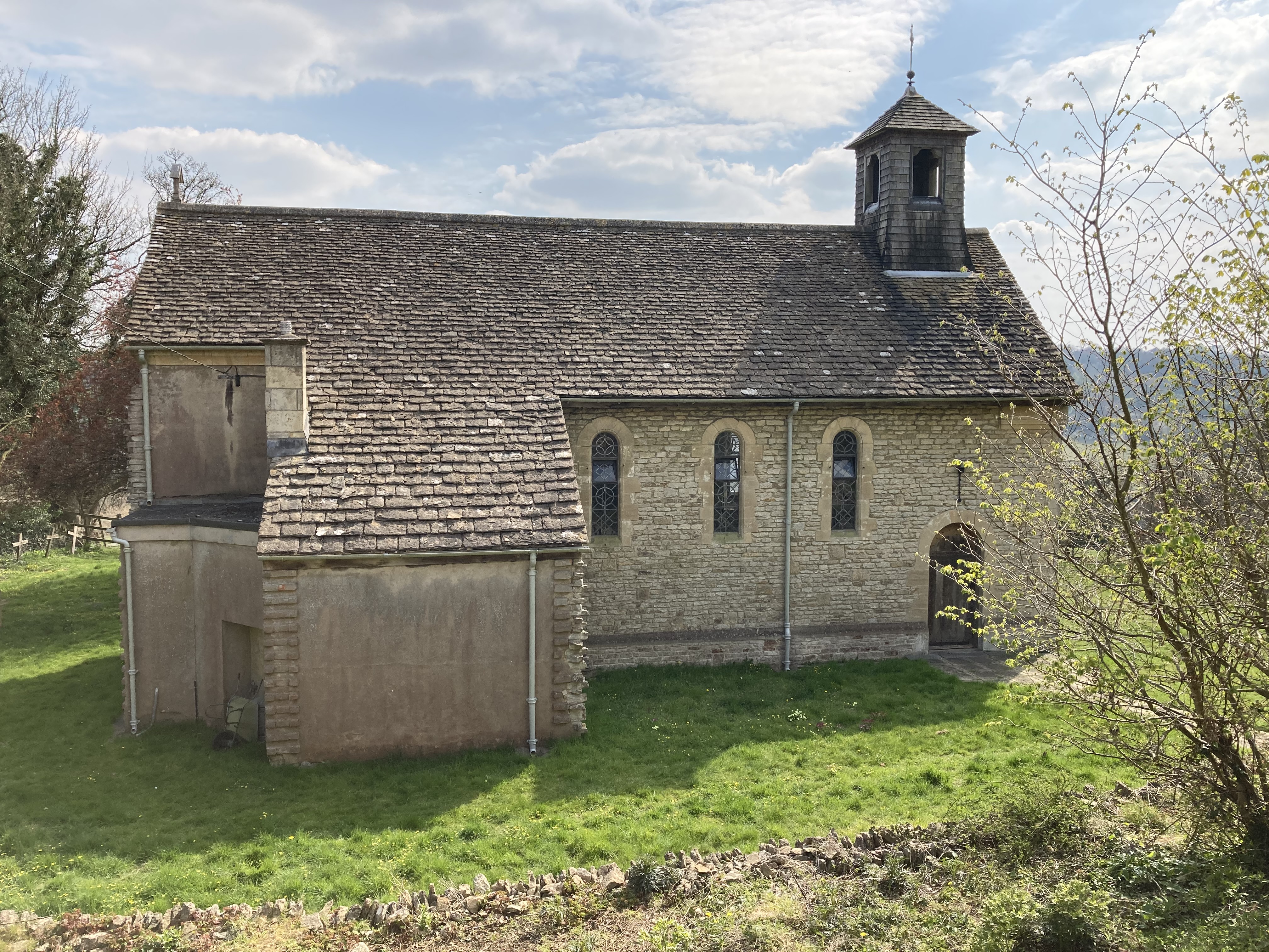
St Mary of the Angels Church, Brownshill

St Mary of the Angels Church is located to the south of the village of Brownshill in the parish of Chalford, Gloucestershire, England. It is a redundant...

Brimscombe railway station

Brimscombe was opened on 1 June 1845 on what is now the Golden Valley Line between Kemble and Stroud in Gloucestershire. This line was opened in 1845 as...

Thomas Keble School

Thomas Keble School is a mixed secondary school located in Eastcombe in the English county of Gloucestershire. The school is named after Thomas Keble,...

Strawberry Banks

Strawberry Banks (grid reference SO910033) is a 5.06-hectare (12.5-acre) biological Site of Special Scientific Interest in Gloucestershire, notified in...

Nearby Amenities

Located within 500m of 51.719963,-2.1536726
Chalford
Is In: Gloucestershire, England, UK
Place: village
Postal Code: GL6
Source: NPE
Lat/Long: 51.7217427/-2.1483712
Bus Stop
Marle Hill
Bench: yes
Bus: yes
Naptan AtcoCode: 1600GL969
Naptan Bearing: SW
Naptan CommonName: Marle Hill
Naptan NaptanCode: glodmjag
Naptan Street: Off London Rd A419
Naptan Verified: no
Public Transport: platform
Shelter: yes
Source: naptan_import
Lat/Long: 51.7214404/-2.1530068
Bus Stop
The Old Silk Mill
Bus: yes
Naptan AtcoCode: 1600GLS790
Naptan Bearing: SW
Naptan CommonName: The Old Silk Mill
Naptan Indicator: Opp
Naptan NaptanCode: glodmatg
Naptan PlusbusZoneRef: STRUD
Naptan Street: London Rd A419
Naptan Verified: no
Public Transport: platform
Source: naptan_import
Lat/Long: 51.7207958/-2.1605244
Bus Stop
Dark Lane
Bench: no
Bin: no
Bus: yes
Lit: no
Naptan AtcoCode: 1600GLS791
Naptan Bearing: NE
Naptan CommonName: Dark Lane
Naptan NaptanCode: glodmgdm
Naptan PlusbusZoneRef: STRUD
Naptan Street: London Rd A419
Naptan Verified: no
Public Transport: platform
Shelter: no
Source: naptan_import
Tactile Paving: no
Lat/Long: 51.721693/-2.1565533
Bus Stop
Dark Lane
Bench: yes
Bin: no
Bus: yes
Lit: no
Naptan AtcoCode: 1600GLS792
Naptan Bearing: SW
Naptan CommonName: Dark Lane
Naptan Indicator: Opp
Naptan NaptanCode: glodmgdj
Naptan PlusbusZoneRef: STRUD
Naptan Street: London Rd A419
Naptan Verified: no
Public Transport: platform
Shelter: yes
Source: naptan_import
Tactile Paving: no
Lat/Long: 51.721549/-2.1566686
Seamark Type: gate
Waterway: lock_gate
Lat/Long: 51.7211455/-2.151022
Seamark Type: gate
Waterway: lock_gate
Lat/Long: 51.7210941/-2.1469803
Seamark Type: gate
Waterway: lock_gate
Lat/Long: 51.7215678/-2.156428
Crossing
Crossing: unmarked
Crossing Markings: no
Kerb: lowered
Tactile Paving: no
Lat/Long: 51.7233243/-2.1520455
Barrier: entrance
Lat/Long: 51.7223202/-2.1526011
Gallery Manouche
Lat/Long: 51.721087/-2.1515074
Site of Chalford Railway Station
Historic: yes
Website: https://en.wikipedia.org/wiki/Chalford_railway_station
Lat/Long: 51.7208103/-2.1476757
Power: pole
Lat/Long: 51.7226853/-2.1591996
Power: pole
Lat/Long: 51.7221916/-2.1592206
Material: wood
Power: pole
Lat/Long: 51.7208931/-2.159156
Power: pole
Lat/Long: 51.7218149/-2.1592409
Seamark Type: gate
Waterway: lock_gate
Lat/Long: 51.7210216/-2.1514897
Historic: memorial
Memorial: war_memorial
Lat/Long: 51.721537/-2.1573211
Cluster Stroud
Office: yes
Lat/Long: 51.7211549/-2.1515479
True Function
Leisure: fitness_centre
Lat/Long: 51.7212727/-2.1516366
Bench
Backrest: yes
Lat/Long: 51.72208/-2.1515788
RMC: The cave
Air Conditioning: yes
Museum: technology
Operator: Retro Collective
Operator Type: private
Tourism: museum
Website: https://www.retrocollective.co.uk/the-cave.php
Lat/Long: 51.7205915/-2.1590646
Seamark Type: gate
Waterway: lock_gate
Lat/Long: 51.7214905/-2.156863
Seamark Type: gate
Waterway: lock_gate
Lat/Long: 51.7207333/-2.1604611
Wring ring
Artist Name: Alex Chinneck
Artwork Type: sculpture
Image: https://pixelfed.de/storage/m/_v2/615797448648714432/bc40e5d2a-3c51e6/sFOb0qfKyRJi/iv4GPf43rmQU3umF7TzlQEDnFyiB6Q6KAQgzgppH.jpg
Material: metal
Source: https://mastodon.online/@AmiW/111497906186520017
Tourism: artwork
Lat/Long: 51.7214424/-2.1560149
Renegade Retro Repairs
Craft: electronics_repair
Lat/Long: 51.7206576/-2.1597037
Bench: yes
Leisure: picnic_table
Lat/Long: 51.7205858/-2.1597069
Bench: yes
Leisure: picnic_table
Lat/Long: 51.7206018/-2.1596425
Arcade Archive
Air Conditioning: yes
Museum: technology
Operator: Retro Collective
Operator Type: private
Tourism: museum
Website: https://www.retrocollective.co.uk/arcade-archive.php
Wikidata: Q124390850
Lat/Long: 51.720534/-2.1593861
The data included in this document is from www.openstreetmap.org. The data is made available under ODbL.

Have you been to Pennyhill Wood?

Leave your review of Pennyhill Wood below (or comments, questions and feedback).