Hyde Wood

Wood, Forest in Gloucestershire Stroud

England

Hyde Wood

Chalford from railway line Looking towards High Street at Chalford, with Coppice Hill further up. Chalford Baptist Church is visible at top mid-right of picture.
Chalford from railway line Credit: Clint Mann

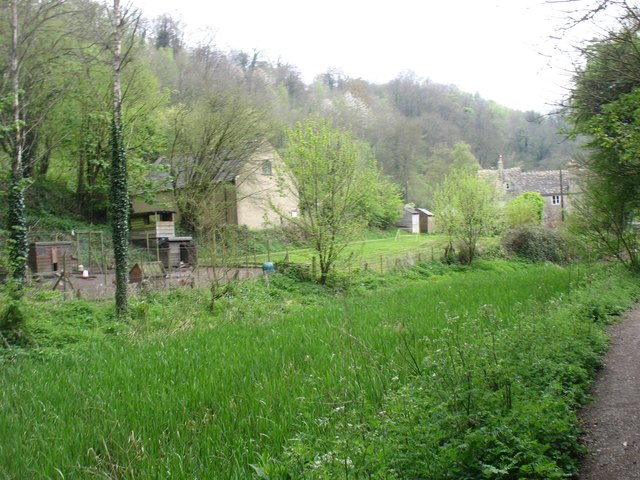
Hyde Wood is a picturesque forest located in the county of Gloucestershire in southwestern England. Covering an area of approximately 150 hectares, it is a popular destination for nature lovers, hikers, and wildlife enthusiasts. The wood is situated near the village of Hyde, which is known for its charming countryside atmosphere.

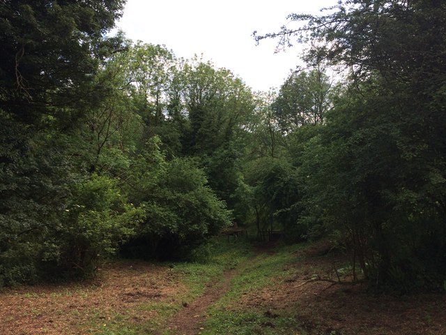
Hyde Wood boasts a diverse ecosystem, characterized by a mix of deciduous and coniferous trees, including oak, beech, and pine. This variety of tree species provides a rich habitat for a wide range of wildlife, such as deer, squirrels, badgers, and numerous bird species. The forest floor is adorned with an array of wildflowers and ferns, creating a beautiful and vibrant landscape.

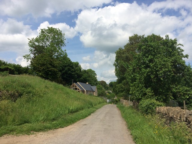
The wood offers several well-marked trails, making it a great place for outdoor activities. Visitors can enjoy leisurely walks, jogging, or even cycling along the designated paths. There are also picnic areas scattered throughout the wood, providing a perfect spot for families and friends to relax and enjoy the serene surroundings.

Hyde Wood is managed by the local forestry commission, ensuring the preservation of its natural beauty and the protection of the local flora and fauna. The wood is open to the public throughout the year, free of charge, allowing everyone to experience the tranquility and wonders of this enchanting forest.

Overall, Hyde Wood in Gloucestershire is a captivating destination for anyone seeking an escape from the hustle and bustle of daily life, offering a peaceful retreat in the heart of nature.

If you have any feedback on the listing, please let us know in the comments section below.
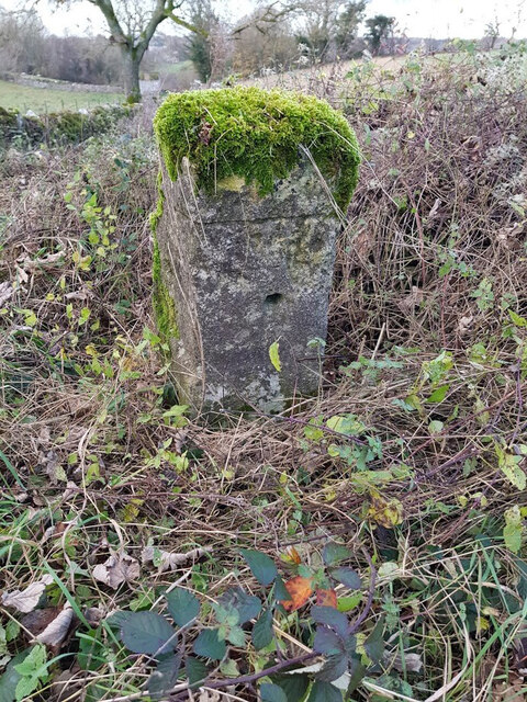
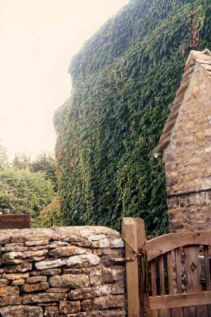
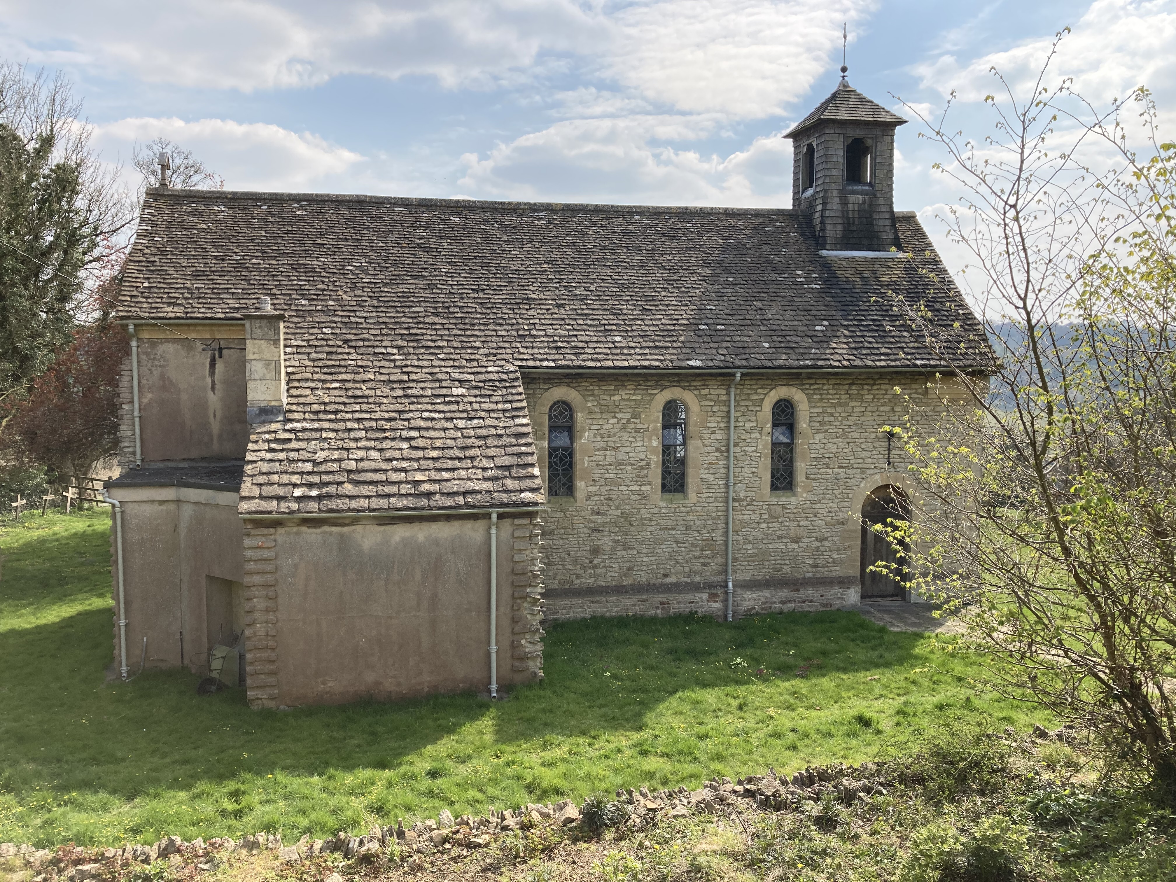
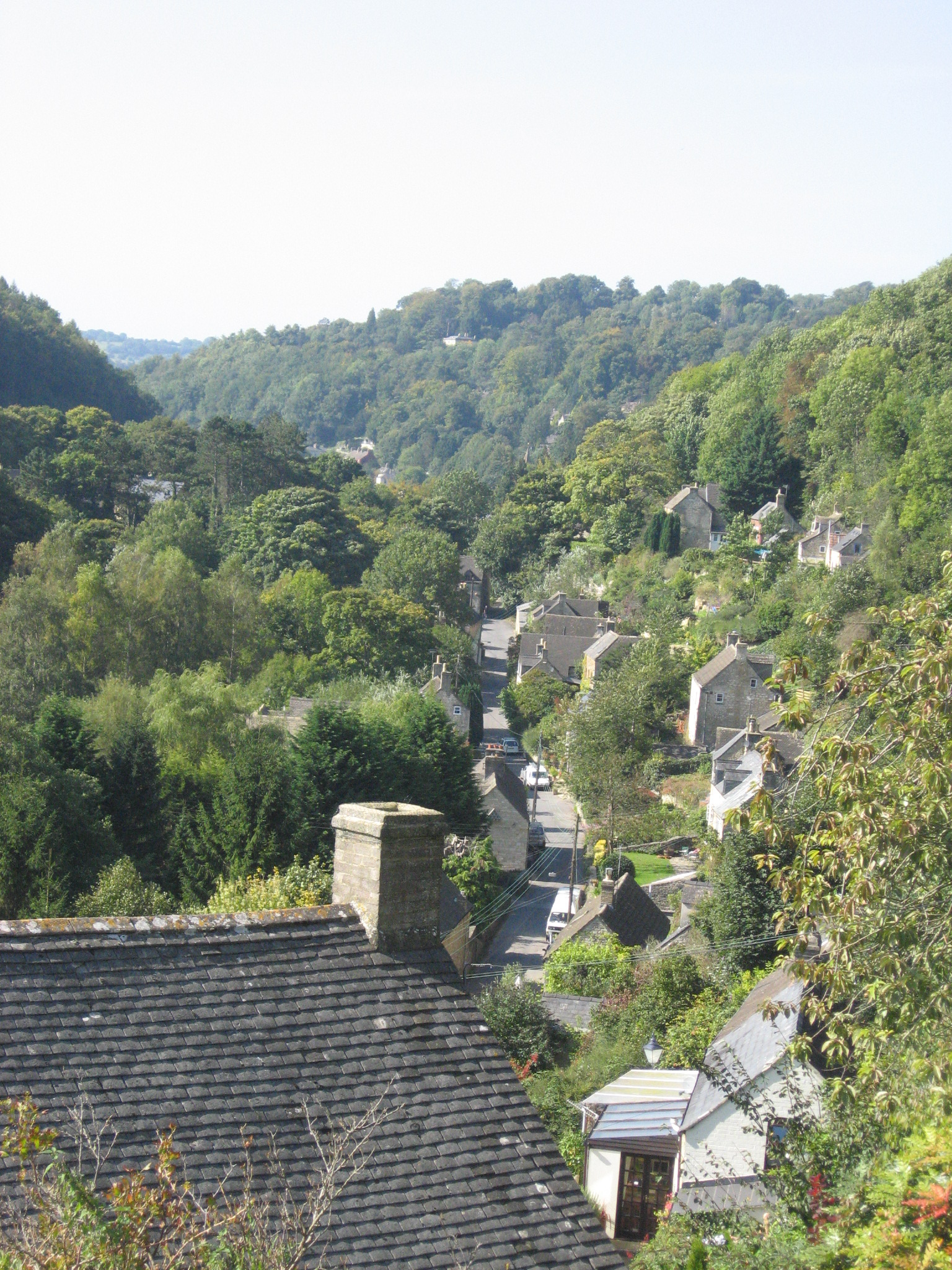
Hyde Wood Images

Images are sourced within 2km of 51.71794/-2.1601651 or Grid Reference SO8902. Thanks to Geograph Open Source API. All images are credited.

Chalford from railway line Looking towards High Street at Chalford, with Coppice Hill further up. Chalford Baptist Church is visible at top mid-right of picture.
Chalford from railway line
Looking towards High Street at Chalford, with Coppice Hill further up. Chalford Baptist Church is visible at top mid-right of picture.
Across the (disused) Thames & Severn Canal Seen walking west, towards Stroud and the Severn.
Across the (disused) Thames & Severn Canal
Seen walking west, towards Stroud and the Severn.
Lynch Road, France Lynch
Footpath in Dimmel's Dale
Milestone at Chalford Water Works on the towpath of the Thames & Severn canal. Plate is a true copy of the original which is in the Canal centre at Walbridge.

Walbridge 5 / Inglesham 23¾ 

Milestone Society National ID: TSC-05
Milestone at Chalford Water Works
on the towpath of the Thames & Severn canal. Plate is a true copy of the original which is in the Canal centre at Walbridge. Walbridge 5 / Inglesham 23¾ Milestone Society National ID: TSC-05
Milestone, A419 (old road) By the entrance to Westley Farm, on the verge of the original route of the road. The area is the Junction of the Cirencester Road and the Stroud Road. This particular section of the Cirencester Road was created  during WW2 when Aston Down aerodrome was built, cutting through a road that joined the A419 a mile along.

No record of the inscription. It is 7 miles from Ciren (& Stroud)

Milestone Society National ID: GL_CISD07
Milestone, A419 (old road)
By the entrance to Westley Farm, on the verge of the original route of the road. The area is the Junction of the Cirencester Road and the Stroud Road. This particular section of the Cirencester Road was created during WW2 when Aston Down aerodrome was built, cutting through a road that joined the A419 a mile along. No record of the inscription. It is 7 miles from Ciren (& Stroud) Milestone Society National ID: GL_CISD07
Charley Barnett's house This house at the bottom of Gypsy Lane, Chalford was
completely obscured by Virginia Creeper.
Charley Barnett's house
This house at the bottom of Gypsy Lane, Chalford was completely obscured by Virginia Creeper.
France Lynch (Glos) St John the Baptist's Church
Bottom of the gardens, Chalford Bottom The gardens on the right back on to the River Frome, and each house has its own bridge giving access to the footpath. The path was originally the towpath of the Thames and Severn Canal, now dry, which runs alongside it to the left. In the distance is an elevated section of the Gloucester-Swindon railway.
Bottom of the gardens, Chalford Bottom
The gardens on the right back on to the River Frome, and each house has its own bridge giving access to the footpath. The path was originally the towpath of the Thames and Severn Canal, now dry, which runs alongside it to the left. In the distance is an elevated section of the Gloucester-Swindon railway.
Aston Down Polo Grounds The Cirencester Park Polo Club, founded 1894. With Chalford visible across the valley.
Aston Down Polo Grounds
The Cirencester Park Polo Club, founded 1894. With Chalford visible across the valley.
Gloucester to Swindon Railway Line A view of the railway as it descends into the valley below Chalford.
Gloucester to Swindon Railway Line
A view of the railway as it descends into the valley below Chalford.
Coppice Hill, Chalford The hill heads south down the valley side to the main road at the bottom.
Coppice Hill, Chalford
The hill heads south down the valley side to the main road at the bottom.
Chalford Hill, Chalford Taken from Coppice Hill, this view shows the start of the open country east of Chalford.
Chalford Hill, Chalford
Taken from Coppice Hill, this view shows the start of the open country east of Chalford.
Church of St John the Baptist, France Lynch, Chalford The church was built in 1857 according to the village website. The derivation of the name 'France Lynch' from the same source is as follows: 

'Lynch from the Anglo-Saxon ‘hline’ means a cultivated terrace following the contours of a hill. ‘France’ is much more difficult to explain. Some say it is derived from Frams-eye (island) or –ea(stream) from the Fram (Frome) river in the valley, thence, perhaps via ‘Francey’ to ‘France’. Others say it is derived from the 17th century Huguenot refugees who settled here to make woollen cloth and silk.'

The land in the foreground is private but has a public footpath through it and this provided the viewpoint.
Church of St John the Baptist, France Lynch, Chalford
The church was built in 1857 according to the village website. The derivation of the name 'France Lynch' from the same source is as follows: 'Lynch from the Anglo-Saxon ‘hline’ means a cultivated terrace following the contours of a hill. ‘France’ is much more difficult to explain. Some say it is derived from Frams-eye (island) or –ea(stream) from the Fram (Frome) river in the valley, thence, perhaps via ‘Francey’ to ‘France’. Others say it is derived from the 17th century Huguenot refugees who settled here to make woollen cloth and silk.' The land in the foreground is private but has a public footpath through it and this provided the viewpoint.
France Lynch, Chalford The viewpoint is the public footpath east of the France Lynch parish church.
France Lynch, Chalford
The viewpoint is the public footpath east of the France Lynch parish church.
View towards Avenis Green, near Chalford Into autumn now and the leaves are falling. This is the day before the last day of British Summer Time. The woodland isn't named on the maps. The viewpoint is a public footpath east of the parish church.
View towards Avenis Green, near Chalford
Into autumn now and the leaves are falling. This is the day before the last day of British Summer Time. The woodland isn't named on the maps. The viewpoint is a public footpath east of the parish church.
Churchyard and graves, Church of St John the Baptist, France Lynch, Chalford The east end of the church is at the right. The church is early Victorian.
Churchyard and graves, Church of St John the Baptist, France Lynch, Chalford
The east end of the church is at the right. The church is early Victorian.
East end, Church of St John the Baptist, France Lynch, Chalford More about the church interior here <span class="nowrap"><a title="http://www.rootsweb.ancestry.com/~engcots/FranceLynchPhotos.html" rel="nofollow ugc noopener" href="http://www.rootsweb.ancestry.com/~engcots/FranceLynchPhotos.html">Link</a><img style="margin-left:2px;" alt="External link" title="External link - shift click to open in new window" src="https://s1.geograph.org.uk/img/external.png" width="10" height="10"/></span>
East end, Church of St John the Baptist, France Lynch, Chalford
More about the church interior here LinkExternal link
Show me another place!

Hyde Wood is located at Grid Ref: SO8902 (Lat: 51.71794, Lng: -2.1601651)

Administrative County: Gloucestershire

District: Stroud

Police Authority: Gloucestershire

What 3 Words

///relies.improving.presuming. Near Chalford, Gloucestershire

Related Wikis

St Mary's Crossing Halt railway station

St Mary's Crossing Halt was opened on 12 October 1903 on what is now the Golden Valley Line between Kemble and Stroud. This line was opened in 1845 as...

Bussage

Bussage is a village in Gloucestershire, England in the district of Stroud. == Geography == There is an older part to the village and a newer part. The...

St Mary of the Angels Church, Brownshill

St Mary of the Angels Church is located to the south of the village of Brownshill in the parish of Chalford, Gloucestershire, England. It is a redundant...

Chalford railway station

Chalford railway station was situated on the Great Western Railway's Golden Valley Line, between Swindon and Gloucester. It was just east of the bridge...

Chalford

Chalford is a large village in the Frome Valley of the Cotswolds in Gloucestershire, England. It is to the southeast of Stroud about four miles (six kilometres...

Brimscombe railway station

Brimscombe was opened on 1 June 1845 on what is now the Golden Valley Line between Kemble and Stroud in Gloucestershire. This line was opened in 1845 as...

Thomas Keble School

Thomas Keble School is a mixed secondary school located in Eastcombe in the English county of Gloucestershire. The school is named after Thomas Keble,...

Cotswold Gliding Club

The Cotswold Gliding Club (CGC) is based at Aston Down airfield, between Cirencester and Stroud in Gloucestershire, South West England. The club maintains...

Related Videos

weaving driving walking

Taking a break from weaving for a bit. Resting and playing with editing video and sound.

Walk with me 21 - Hampton Lane off London Road in Chalford (St Mary's) to the top of Cowcombe Hill

It was a lovely sunny afternoon on 6 November 2020 that I set off from Hampton Lane which is on the south side of London Road ...

Nearby Amenities

Located within 500m of 51.71794,-2.1601651
Bus Stop
Carpenters
Bus: yes
Naptan AtcoCode: 1600GLS787
Naptan Bearing: NE
Naptan CommonName: Carpenters
Naptan NaptanCode: glodmadg
Naptan Street: London Rd A419
Naptan Verified: no
Public Transport: platform
Shelter: no
Source: naptan_import
Lat/Long: 51.7195959/-2.1646528
Bus Stop
Carpenters
Bus: yes
Naptan AtcoCode: 1600GLS788
Naptan Bearing: SW
Naptan CommonName: Carpenters
Naptan Indicator: Opp
Naptan NaptanCode: glodjwtw
Naptan Street: London Rd A419
Naptan Verified: no
Public Transport: platform
Source: naptan_import
Lat/Long: 51.7194338/-2.1648548
The Old Silk Mill
Naptan AtcoCode: 1600GLS789
Naptan Bearing: NE
Naptan BusStopType: CUS
Naptan CommonName: The Old Silk Mill
Naptan NaptanCode: glodmatw
Naptan PlusbusZoneRef: STRUD
Naptan Street: London Rd A419
Naptan Verified: no
Source: naptan_import
Lat/Long: 51.7207163/-2.1617008
Bus Stop
The Old Silk Mill
Bus: yes
Naptan AtcoCode: 1600GLS790
Naptan Bearing: SW
Naptan CommonName: The Old Silk Mill
Naptan Indicator: Opp
Naptan NaptanCode: glodmatg
Naptan PlusbusZoneRef: STRUD
Naptan Street: London Rd A419
Naptan Verified: no
Public Transport: platform
Source: naptan_import
Lat/Long: 51.7207958/-2.1605244
Bus Stop
Dark Lane
Bench: no
Bin: no
Bus: yes
Lit: no
Naptan AtcoCode: 1600GLS791
Naptan Bearing: NE
Naptan CommonName: Dark Lane
Naptan NaptanCode: glodmgdm
Naptan PlusbusZoneRef: STRUD
Naptan Street: London Rd A419
Naptan Verified: no
Public Transport: platform
Shelter: no
Source: naptan_import
Tactile Paving: no
Lat/Long: 51.721693/-2.1565533
Bus Stop
Dark Lane
Bench: yes
Bin: no
Bus: yes
Lit: no
Naptan AtcoCode: 1600GLS792
Naptan Bearing: SW
Naptan CommonName: Dark Lane
Naptan Indicator: Opp
Naptan NaptanCode: glodmgdj
Naptan PlusbusZoneRef: STRUD
Naptan Street: London Rd A419
Naptan Verified: no
Public Transport: platform
Shelter: yes
Source: naptan_import
Tactile Paving: no
Lat/Long: 51.721549/-2.1566686
St Mary's level crossing
Crossing Barrier: no
Railway: level_crossing
Ref Tiploc: STRUMLC
Lat/Long: 51.7188139/-2.1662014
Seamark Type: gate
Waterway: lock_gate
Lat/Long: 51.7215678/-2.156428
Saint Mary's Farm
Landuse: farm
Note Retag: CS #48756035
Source: OS OpenData StreetView
Lat/Long: 51.7169622/-2.1631761
Barrier: kissing_gate
Lat/Long: 51.7190705/-2.1631928
Barrier: kissing_gate
Lat/Long: 51.7189639/-2.1631765
Seamark Type: gate
Waterway: lock_gate
Lat/Long: 51.719876/-2.1629793
Power: pole
Lat/Long: 51.7221916/-2.1592206
Material: wood
Power: pole
Lat/Long: 51.7208931/-2.159156
Power: pole
Lat/Long: 51.7218149/-2.1592409
Seamark Type: gate
Waterway: lock_gate
Lat/Long: 51.720023/-2.1625772
Seamark Type: gate
Waterway: lock_gate
Lat/Long: 51.7186651/-2.1662691
Historic: memorial
Memorial: war_memorial
Lat/Long: 51.721537/-2.1573211
St Mary's level crossing
Crossing Barrier: no
Railway: level_crossing
Ref Tiploc: STRUMLC
Lat/Long: 51.7188546/-2.1661164
Seamark Type: gate
Waterway: lock_gate
Lat/Long: 51.7187657/-2.165879
Power: pole
Lat/Long: 51.7213513/-2.1641647
Crossing Barrier: no
Railway: crossing
Lat/Long: 51.7190485/-2.1631894
Crossing Barrier: no
Railway: crossing
Lat/Long: 51.7190124/-2.1631855
RMC: The cave
Air Conditioning: yes
Museum: technology
Operator: Retro Collective
Operator Type: private
Tourism: museum
Website: https://www.retrocollective.co.uk/the-cave.php
Lat/Long: 51.7205915/-2.1590646
Disused Power: generator
Generator Method: run-of-the-river
Generator Source: hydro
Operator: St Mary's Mill
Start Date: 1844
Lat/Long: 51.7180267/-2.1667655
Man Made: chimney
Lat/Long: 51.7182456/-2.166816
Seamark Type: gate
Waterway: lock_gate
Lat/Long: 51.7214905/-2.156863
Seamark Type: gate
Waterway: lock_gate
Lat/Long: 51.7207333/-2.1604611
Seamark Type: gate
Waterway: lock_gate
Lat/Long: 51.720594/-2.1608891
Wring ring
Artist Name: Alex Chinneck
Artwork Type: sculpture
Image: https://pixelfed.de/storage/m/_v2/615797448648714432/bc40e5d2a-3c51e6/sFOb0qfKyRJi/iv4GPf43rmQU3umF7TzlQEDnFyiB6Q6KAQgzgppH.jpg
Material: metal
Source: https://mastodon.online/@AmiW/111497906186520017
Tourism: artwork
Lat/Long: 51.7214424/-2.1560149
Renegade Retro Repairs
Craft: electronics_repair
Lat/Long: 51.7206576/-2.1597037
Bench: yes
Leisure: picnic_table
Lat/Long: 51.7205858/-2.1597069
Bench: yes
Leisure: picnic_table
Lat/Long: 51.7206018/-2.1596425
Arcade Archive
Air Conditioning: yes
Museum: technology
Operator: Retro Collective
Operator Type: private
Tourism: museum
Website: https://www.retrocollective.co.uk/arcade-archive.php
Wikidata: Q124390850
Lat/Long: 51.720534/-2.1593861
The data included in this document is from www.openstreetmap.org. The data is made available under ODbL.

Have you been to Hyde Wood?

Leave your review of Hyde Wood below (or comments, questions and feedback).