Bailey's Wood

Wood, Forest in Staffordshire Staffordshire Moorlands

England

Bailey's Wood

View over a hedge Looking north towards Whitemoor, over the valley of Biddulph Brook, from the side of the A527.
View over a hedge Credit: Richard Dorrell

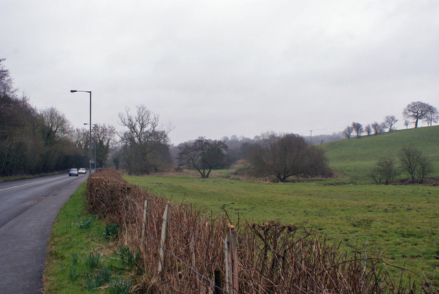
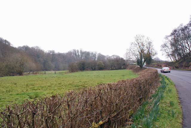
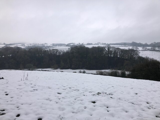
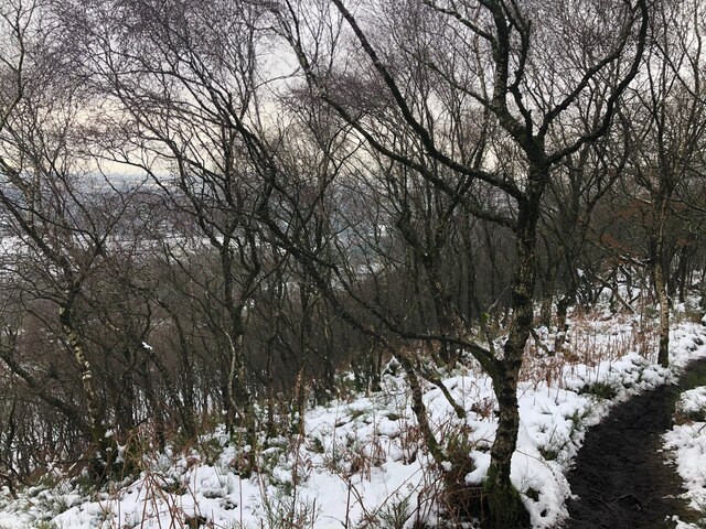
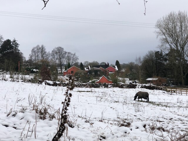
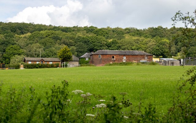
Bailey's Wood is a picturesque woodland located in Staffordshire, England. Spanning approximately 100 acres, this woodland area is a popular recreational spot for locals and tourists alike. It is situated in the southern part of Staffordshire, near the town of Stafford.

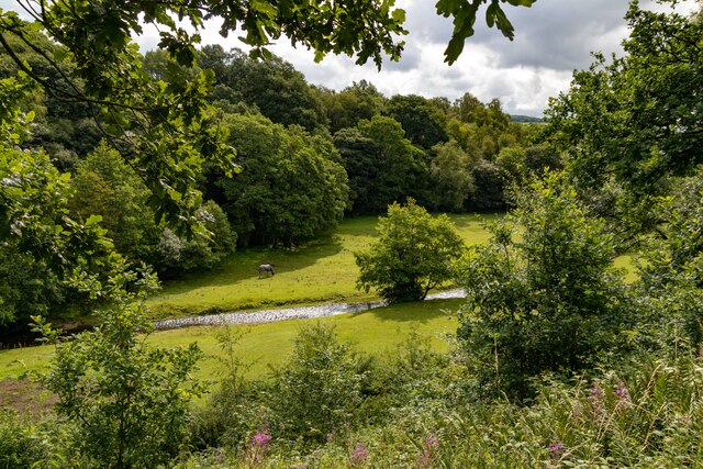
The wood is characterized by its diverse range of tree species, including oak, beech, birch, and pine trees. These tall, majestic trees provide a lush canopy, creating a peaceful and serene atmosphere within the wood. The forest floor is covered with a variety of flora, such as bluebells, ferns, and wildflowers, adding to the natural beauty of the area.

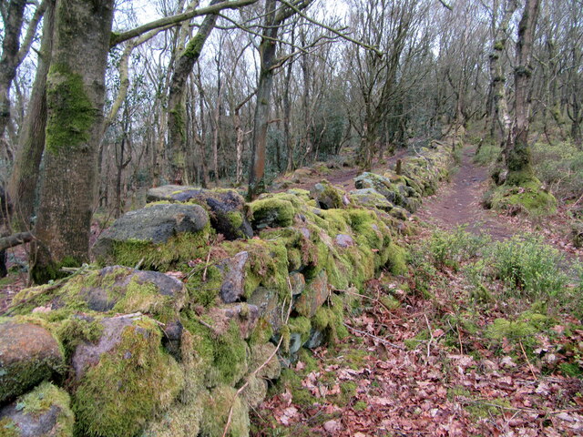
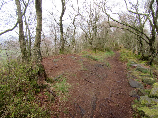
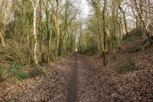
Bailey's Wood offers a network of well-maintained walking trails, providing visitors with the opportunity to explore and appreciate the natural surroundings. The trails meander through the wood, allowing hikers to immerse themselves in the tranquility of nature. Along the way, there are several benches and picnic spots, perfect for those seeking a moment of relaxation or a family outing.

The wood is also home to a diverse range of wildlife, including foxes, badgers, deer, and a variety of bird species. Birdwatchers can enjoy spotting robins, blackbirds, and woodpeckers among the treetops.

Overall, Bailey's Wood in Staffordshire is a haven for nature enthusiasts and those seeking an escape from the hustle and bustle of everyday life. With its beautiful trees, diverse flora, and peaceful ambiance, this woodland offers a serene retreat for all who visit.

If you have any feedback on the listing, please let us know in the comments section below.

Bailey's Wood Images

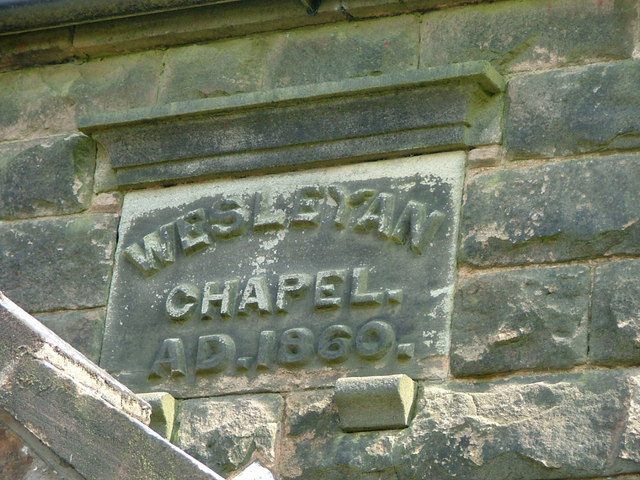
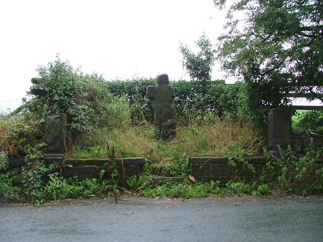
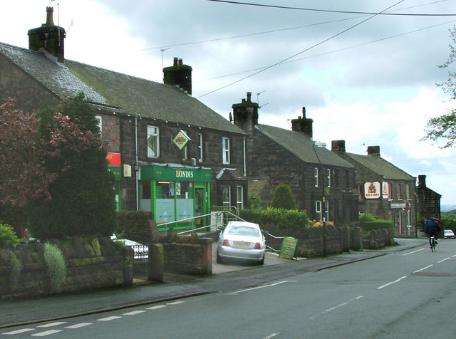
Images are sourced within 2km of 53.133519/-2.1694832 or Grid Reference SJ8859. Thanks to Geograph Open Source API. All images are credited.

View over a hedge Looking north towards Whitemoor, over the valley of Biddulph Brook, from the side of the A527.
View over a hedge
Looking north towards Whitemoor, over the valley of Biddulph Brook, from the side of the A527.
Valley of Biddulph Brook Here, the brook flows through grazing land, approximately parallel to the A527 road.
Valley of Biddulph Brook
Here, the brook flows through grazing land, approximately parallel to the A527 road.
Old Milestone by the A527, Whitemoor, BiddulphParish Carved stone post by the A527, in parish of BIDDULPH (STAFFORDSHIRE MOORLANDS District), Whitemoor near County Boundary, in low wall, on West side of road. Newcastle triangle stone, erected by the New Biddulph turnpike trust in the 19th century. Defaced.

Inscription reads:- : TO / Congleton / 1 Mile : : TO / Newcastle / 11 / Miles :   

Milestone Society National ID: ST_NCCO11.
Old Milestone by the A527, Whitemoor, BiddulphParish
Carved stone post by the A527, in parish of BIDDULPH (STAFFORDSHIRE MOORLANDS District), Whitemoor near County Boundary, in low wall, on West side of road. Newcastle triangle stone, erected by the New Biddulph turnpike trust in the 19th century. Defaced. Inscription reads:- : TO / Congleton / 1 Mile : : TO / Newcastle / 11 / Miles : Milestone Society National ID: ST_NCCO11.
Old Wayside Cross by Overton Road, Biddulph parish Shepherd's Cross, old head and shaft, by the wayside, in parish of Biddulph (Staffordshire Moorlands District), Overton Road, near Biddulph Grange Garden.

Grade II listed.
List Entry Number: 1190201 <span class="nowrap"><a title="https://historicengland.org.uk/listing/the-list/list-entry/1190201" rel="nofollow ugc noopener" href="https://historicengland.org.uk/listing/the-list/list-entry/1190201">Link</a><img style="margin-left:2px;" alt="External link" title="External link - shift click to open in new window" src="https://s1.geograph.org.uk/img/external.png" width="10" height="10"/></span>
Scheduled Monument.
List Entry Number: 1014689 <span class="nowrap"><a title="https://historicengland.org.uk/listing/the-list/list-entry/1014689" rel="nofollow ugc noopener" href="https://historicengland.org.uk/listing/the-list/list-entry/1014689">Link</a><img style="margin-left:2px;" alt="External link" title="External link - shift click to open in new window" src="https://s1.geograph.org.uk/img/external.png" width="10" height="10"/></span>

To be surveyed

Milestone Society National ID: STMO_BID01
Old Wayside Cross by Overton Road, Biddulph parish
Shepherd's Cross, old head and shaft, by the wayside, in parish of Biddulph (Staffordshire Moorlands District), Overton Road, near Biddulph Grange Garden. Grade II listed. List Entry Number: 1190201 LinkExternal link Scheduled Monument. List Entry Number: 1014689 LinkExternal link To be surveyed Milestone Society National ID: STMO_BID01
The Castle Inn By the A527 heading out of Congleton towards Biddulph.
The Castle Inn
By the A527 heading out of Congleton towards Biddulph.
Mossy wall on Congleton Edge
Path on Congleton Edge
View over Whitemoor from Biddulph Valley Way Living up to its name.
View over Whitemoor from Biddulph Valley Way
Living up to its name.
Path through Birch Wood on Congleton Edge
Dreamcatcher Meadows
Biddulph Valley Way Path <span class="nowrap"><a title="https://en.wikipedia.org/wiki/Biddulph_Valley_line" rel="nofollow ugc noopener" href="https://en.wikipedia.org/wiki/Biddulph_Valley_line">Link</a><img style="margin-left:2px;" alt="External link" title="External link - shift click to open in new window" src="https://s1.geograph.org.uk/img/external.png" width="10" height="10"/></span>
Biddulph Valley Way Path
Biddulph Valley Way Farm buildings alongside the Biddulph Valley Way.
Biddulph Valley Way
Farm buildings alongside the Biddulph Valley Way.
Higher Whitemoor Farm
Biddulph Brook Biddulph Brook seen from the Biddulph Valley Way.
Biddulph Brook
Biddulph Brook seen from the Biddulph Valley Way.
Bridge over A527 at Whitemoor Ex-railway bridge carries the Gritstone Way over the main Biddulph - Congleton road. Path onto trail is on left of picture. Sign marking Staffordshire/Cheshire border can be seen through the bridge arch.
Bridge over A527 at Whitemoor
Ex-railway bridge carries the Gritstone Way over the main Biddulph - Congleton road. Path onto trail is on left of picture. Sign marking Staffordshire/Cheshire border can be seen through the bridge arch.
Biddulph Park Methodist Chapel Established in 1860. The left hand part of the building is a private dwelling, not surprisingly called Chapel Cottage.
Biddulph Park Methodist Chapel
Established in 1860. The left hand part of the building is a private dwelling, not surprisingly called Chapel Cottage.
Date stone of Biddulph Park Chapel
Shepherd's Cross Possibly a Christianised standing stone (menhir) or 14th century wayside cross.
Shepherd's Cross
Possibly a Christianised standing stone (menhir) or 14th century wayside cross.
Show me another place!

Bailey's Wood is located at Grid Ref: SJ8859 (Lat: 53.133519, Lng: -2.1694832)

Administrative County: Staffordshire

District: Staffordshire Moorlands

Police Authority: Staffordshire

What 3 Words

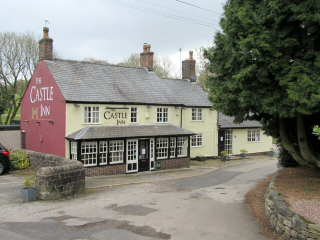
///skinny.basis.burns. Near Biddulph, Staffordshire

Related Wikis

Biddulph Grange

Biddulph Grange is a National Trust landscaped garden, in Biddulph near Stoke-on-Trent, Staffordshire, England. It is separate from Biddulph Grange Country...

Biddulph Grange Country Park

Biddulph Grange Country Park is a country park in Biddulph, UK. It was originally part of Biddulph Grange. == Contents == The 73 acres (0.30 km2) park...

Biddulph

Biddulph is a town in Staffordshire, England, 8.5 miles (14 km) north of Stoke-on-Trent and 4.5 miles (7 km) south-east of Congleton, Cheshire. == Origin... ==

Biddulph railway station

Biddulph railway station was a railway station opened by the North Staffordshire Railway in 1864. Originally named Gillow Heath the station was renamed...

Astbury, Cheshire

Astbury was one of the eight ancient parishes of the Macclesfield Hundred of Cheshire, England. It included two chapelries and ten townships. The chapelry...

Biddulph Moor

Biddulph Moor is a village located on the hill which bears the same name. It is in Biddulph parish and is a part of the Staffordshire Moorlands district...

Braddocks Hay

Braddocks Hay is a village in Staffordshire, England. Population details for the 2011 census can be found under Biddulph

Limekiln Wood Nature Reserve

Limekiln Wood Nature Reserve is a 13.1-hectare (32-acre) nature reserve in Cheshire, England, north of the village of Mow Cop. A Site of Special Scientific...

Nearby Amenities

Located within 500m of 53.133519,-2.1694832
Bus Stop
St James' Court
Bus: yes
Naptan AtcoCode: 3800C801100
Naptan Bearing: SW
Naptan CommonName: St James' Court
Naptan Indicator: Adj
Naptan Landmark: St James' Court
Naptan Street: Grange Rd
Naptan Verified: no
Public Transport: platform
Shelter: no
Source: naptan_import
Lat/Long: 53.1315799/-2.1629594
Bus Stop
Grange Road
Bench: no
Bin: no
Bus: yes
Naptan AtcoCode: 3800C819001
Naptan Bearing: N
Naptan BusStopType: CUS
Naptan CommonName: Grange Road
Naptan Indicator: opp
Naptan Street: Congleton road
Naptan Verified: no
Public Transport: platform
Shelter: no
Source: naptan_import
Tactile Paving: no
Lat/Long: 53.1299935/-2.166092
Bus Stop
Lea Forge Cottages
Bench: no
Bin: no
Bus: yes
Lit: no
Naptan AtcoCode: 3800C820101
Naptan Bearing: N
Naptan CommonName: Lea Forge Cottages
Naptan Indicator: Adj
Naptan Landmark: Lea Forge Cottages
Naptan Street: Congleton Rd
Naptan Verified: no
Public Transport: platform
Shelter: no
Source: naptan_import
Tactile Paving: no
Lat/Long: 53.1344302/-2.1689341
Bus Stop
Lea Forge Cottages
Bench: no
Bin: no
Bus: yes
Lit: yes
Naptan AtcoCode: 3800C820102
Naptan Bearing: S
Naptan CommonName: Lea Forge Cottages
Naptan Indicator: Opp
Naptan Landmark: Lea Forge Cottages
Naptan Street: Congleton Rd
Naptan Verified: no
Public Transport: platform
Shelter: no
Source: naptan_import
Tactile Paving: no
Lat/Long: 53.1342509/-2.1685598
Bus Stop
Bosley Brook
Bench: no
Bin: no
Bus: yes
Lit: no
Naptan AtcoCode: 3800C863201
Naptan Bearing: N
Naptan CommonName: Bosley Brook
Naptan Indicator: Opp
Naptan Landmark: Bosley Brook
Naptan Street: Congleton Rd
Naptan Verified: no
Public Transport: platform
Shelter: no
Source: naptan_import
Tactile Paving: no
Lat/Long: 53.1377362/-2.1703672
Bus Stop
Congleton Road
Bench: no
Bin: no
Bus: yes
Lit: no
Naptan AtcoCode: 3800C863202
Naptan Bearing: S
Naptan CommonName: Congleton Road
Naptan Indicator: o/s 11
Naptan Landmark: Congleton Road
Naptan Street: Congleton Rd
Naptan Verified: no
Public Transport: platform
Shelter: no
Source: naptan_import
Tactile Paving: no
Lat/Long: 53.1367751/-2.1698403
Kerb: no
Lat/Long: 53.133804/-2.1703786
Barrier: cycle_barrier
Cycle Barrier: tilted
Lat/Long: 53.1295317/-2.171544
Kerb: no
Lat/Long: 53.1295645/-2.1715345
Barrier: cycle_barrier
Cycle Barrier: tilted
Lat/Long: 53.1296293/-2.1714858
Material: wood
Power: pole
Lat/Long: 53.1362157/-2.1692367
Material: wood
Power: pole
Lat/Long: 53.136067/-2.1691907
Material: wood
Power: pole
Lat/Long: 53.1362639/-2.1666303
Material: wood
Power: pole
Lat/Long: 53.1362891/-2.165799
Material: wood
Power: pole
Lat/Long: 53.1362457/-2.164377
Material: wood
Power: pole
Lat/Long: 53.1354626/-2.1641949
Material: wood
Power: pole
Lat/Long: 53.1344764/-2.1644587
Material: wood
Power: pole
Lat/Long: 53.1334496/-2.1647273
Line Management: transition
Material: wood
Power: pole
Lat/Long: 53.1328108/-2.1649958
Power: pole
Lat/Long: 53.1368906/-2.1649607
The data included in this document is from www.openstreetmap.org. The data is made available under ODbL.

Have you been to Bailey's Wood?

Leave your review of Bailey's Wood below (or comments, questions and feedback).