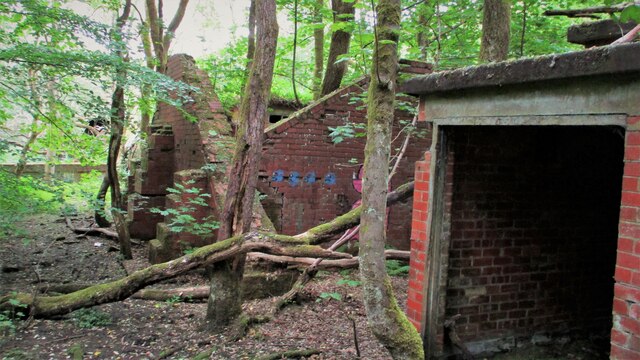
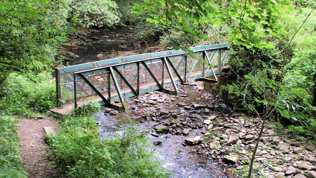
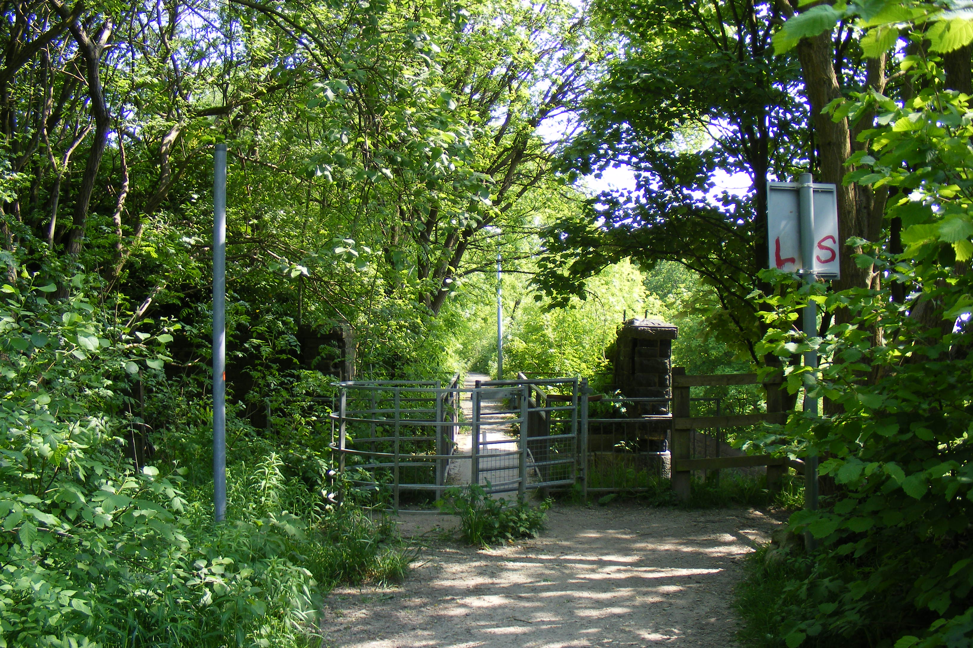
Hollows Wood

Wood, Forest in Lancashire

England

Hollows Wood

Former Rochdale to Bacup Railway Trackbed at Shawclough Start of trail on trackbed with Dell Road retaining wall to the left
Former Rochdale to Bacup Railway Trackbed at Shawclough Credit: Kevin Waterhouse

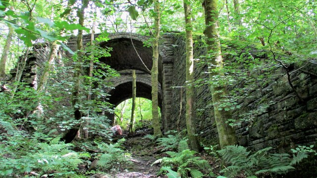
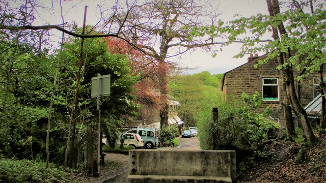
Hollows Wood is a picturesque forest located in the county of Lancashire, England. Spanning across a vast area, this enchanting woodland is renowned for its natural charm and serene ambiance.

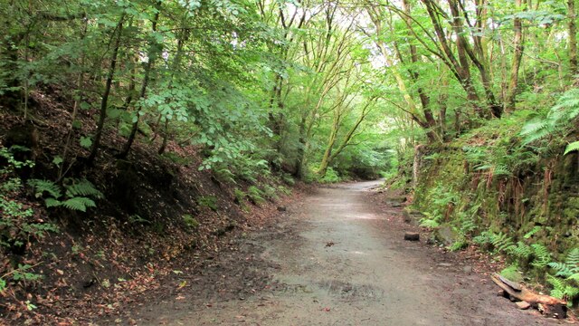
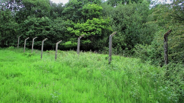
The wood is predominantly home to a diverse range of broadleaf trees, such as oak, beech, and birch, which create a lush canopy overhead. These majestic trees provide shade and shelter to a variety of flora and fauna that thrive within the forest. The forest floor is adorned with a carpet of bluebells during spring, adding a vibrant splash of color to the landscape.

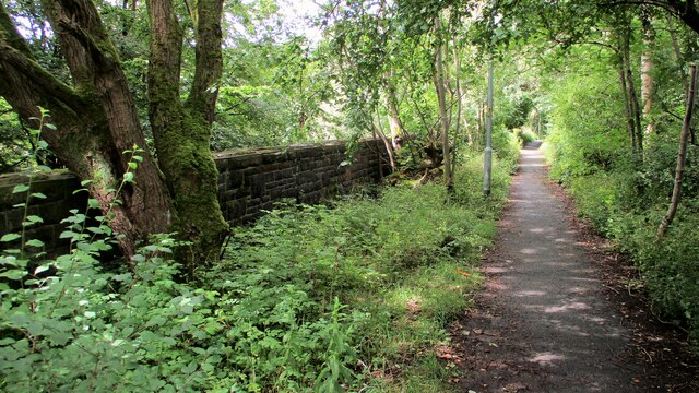
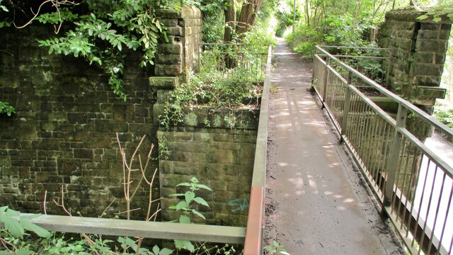
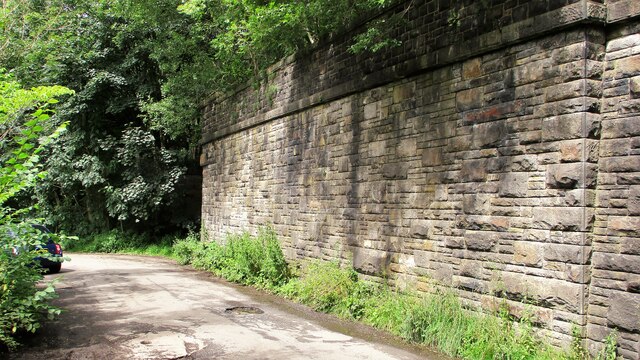
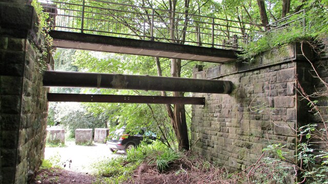
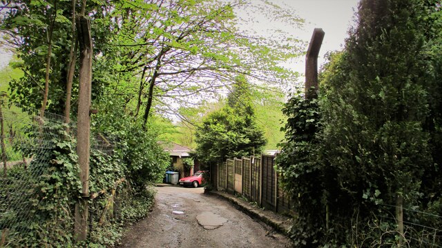
Numerous walking trails weave their way through Hollows Wood, offering visitors the opportunity to explore its hidden treasures. The paths are well-maintained and clearly marked, ensuring ease of navigation for hikers and nature enthusiasts. Along these trails, visitors are likely to encounter various wildlife species, including squirrels, rabbits, and a variety of bird species, making Hollows Wood a haven for wildlife lovers and birdwatchers.

In addition to its natural beauty, Hollows Wood also boasts a tranquil atmosphere, making it an ideal destination for those seeking peace and solitude. The forest is popular among locals and tourists alike, who come here to unwind, reconnect with nature, and enjoy the serene surroundings.

Overall, Hollows Wood in Lancashire is a breathtaking forest that offers a welcome escape from the hustle and bustle of everyday life. With its stunning scenery, diverse wildlife, and peaceful atmosphere, it is a must-visit destination for nature lovers and anyone in search of a tranquil retreat.

If you have any feedback on the listing, please let us know in the comments section below.
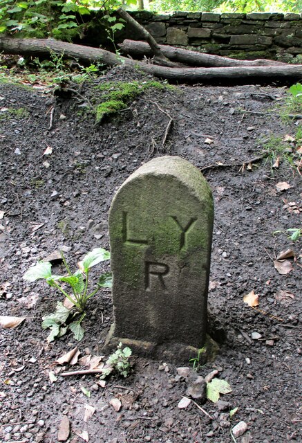
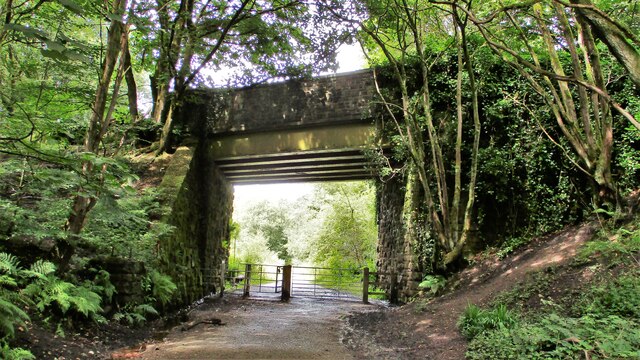
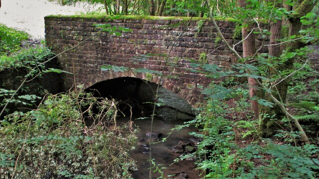
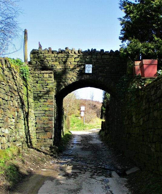
Hollows Wood Images

Images are sourced within 2km of 53.626809/-2.1723031 or Grid Reference SD8814. Thanks to Geograph Open Source API. All images are credited.

Former Rochdale to Bacup Railway Trackbed at Shawclough Start of trail on trackbed with Dell Road retaining wall to the left
Former Rochdale to Bacup Railway Trackbed at Shawclough
Start of trail on trackbed with Dell Road retaining wall to the left
Footbridge replacement for Railway Bridge at Shawclough View towards Rochdale over former Shawclough Station access road
Footbridge replacement for Railway Bridge at Shawclough
View towards Rochdale over former Shawclough Station access road
Retaining Wall for Railway on Dell Road Shawclough Retaining Wall for Rochdale to Bacup Railway, view North
Retaining Wall for Railway on Dell Road Shawclough
Retaining Wall for Rochdale to Bacup Railway, view North
Railway Bridge Abutments at Shawclough Station Access Road Footbridge has replaced original Railway Bridge. Concrete Block barriers stop vehicle entry to Woodland Road from Dell Road
Railway Bridge Abutments at Shawclough Station Access Road
Footbridge has replaced original Railway Bridge. Concrete Block barriers stop vehicle entry to Woodland Road from Dell Road
Former Rochdale to Bacup Railway Trackbed after Shawclough Adverse Gradient after heading North from the former Shawclough Station at Dell Road bridge
Former Rochdale to Bacup Railway Trackbed after Shawclough
Adverse Gradient after heading North from the former Shawclough Station at Dell Road bridge
Siamese Railway Bridges at Healey The original bridge was found to be slipping down the hillside so another was built for the Rochdale to Bacup Railway.
Siamese Railway Bridges at Healey
The original bridge was found to be slipping down the hillside so another was built for the Rochdale to Bacup Railway.
Typical Rochdale/Whitworth Boundary Stone On the former Rochdale to Bacup Railway on the Boundary. The Boundary Stones in this area of Healey Corner had metal plates on the stones all now mainly removed.
This stone is typical but it may not be what it seems.
Typical Rochdale/Whitworth Boundary Stone
On the former Rochdale to Bacup Railway on the Boundary. The Boundary Stones in this area of Healey Corner had metal plates on the stones all now mainly removed. This stone is typical but it may not be what it seems.
Milestone 14 on Rochdale to Bacup Railway Close to Rochdale/Whitworth Boundary on former Railway Trackbed
Milestone 14 on Rochdale to Bacup Railway
Close to Rochdale/Whitworth Boundary on former Railway Trackbed
LYR Boundary Stone This stone is close to the former railway trackbed so may be re-positioned. South of Dell Road access to Healey Dell Viaduct.
LYR Boundary Stone
This stone is close to the former railway trackbed so may be re-positioned. South of Dell Road access to Healey Dell Viaduct.
Station Road Railway Bridge Broadley The Bridge from the South on the former trackbed. On the North side is the site of Broadley Station
Station Road Railway Bridge Broadley
The Bridge from the South on the former trackbed. On the North side is the site of Broadley Station
Bridge over River Spodden near Former Station Yard Substantial Bridge now footpath but gave alternative access perhaps to the Station Yard at Broadley. It is also the site of Broadley Mill.
Bridge over River Spodden near Former Station Yard
Substantial Bridge now footpath but gave alternative access perhaps to the Station Yard at Broadley. It is also the site of Broadley Mill.
Private Footbridge over Ending Rake Footbridge for Mount Ending residence where Ending Rake goes on to the moorland.
Private Footbridge over Ending Rake
Footbridge for Mount Ending residence where Ending Rake goes on to the moorland.
Modern & WWII Pole Barriers Modern concrete block across Dell Road and WWII pole barrier still surviving from when the mill beyond was a munitions filling factory.
Modern & WWII Pole Barriers
Modern concrete block across Dell Road and WWII pole barrier still surviving from when the mill beyond was a munitions filling factory.
Dell Road North entrance to former WWII ROF Site MoD fencing poles mark entrance to former WWII munitions filling factory site in Healey Hall Mill
Dell Road North entrance to former WWII ROF Site
MoD fencing poles mark entrance to former WWII munitions filling factory site in Healey Hall Mill
Former WWII Fencing at ROF Healey Hall Mill WWII fencing remains on boundary of former munitions filling factory on West bank of River Spodden.
Former WWII Fencing at ROF Healey Hall Mill
WWII fencing remains on boundary of former munitions filling factory on West bank of River Spodden.
Former WWII Munitions Filling Site Nissen Hut One of the several huts which are extra long on the Healey Hall mills site
Former WWII Munitions Filling Site Nissen Hut
One of the several huts which are extra long on the Healey Hall mills site
Former WWII Munitions Filling Factory Buildings What appears to be a blast wall is visible in this complex at Healey Hall Mill site
Former WWII Munitions Filling Factory Buildings
What appears to be a blast wall is visible in this complex at Healey Hall Mill site
Footbridge across River Spodden Footpath links Healey Dell with Smallshaw Farm
Footbridge across River Spodden
Footpath links Healey Dell with Smallshaw Farm
Show me another place!

Hollows Wood is located at Grid Ref: SD8814 (Lat: 53.626809, Lng: -2.1723031)

Unitary Authority: Rochdale

Police Authority: Greater Manchester

What 3 Words

///bits.prices.maker. Near Rochdale, Manchester

Related Wikis

Shawclough

Shawclough is a mainly residential area north of Rochdale, Greater Manchester, England. Its boundaries are roughly Whitworth Road, Shawclough Road, and...

Falinge Park High School

Falinge Park High School is an 11–16 mixed comprehensive school in Shawclough area of the Metropolitan Borough of Rochdale in Greater Manchester, United...

Falinge Park

Falinge Park is a Grade II listed public park located in Rochdale, Greater Manchester. Opened to the public in 1906, it lies in the historic grounds of...

Shawclough and Healey railway station

Shawclough & Healey railway station served the townships of Shawclough and Healey in Rochdale, in the Metropolitan Borough of Rochdale in Greater Manchester...

St Edmund's Church, Rochdale

Saint Edmund's Church (or the Church of Saint Edmund) is a redundant church building located on Clement Royds Street in the Falinge area of Rochdale, in...
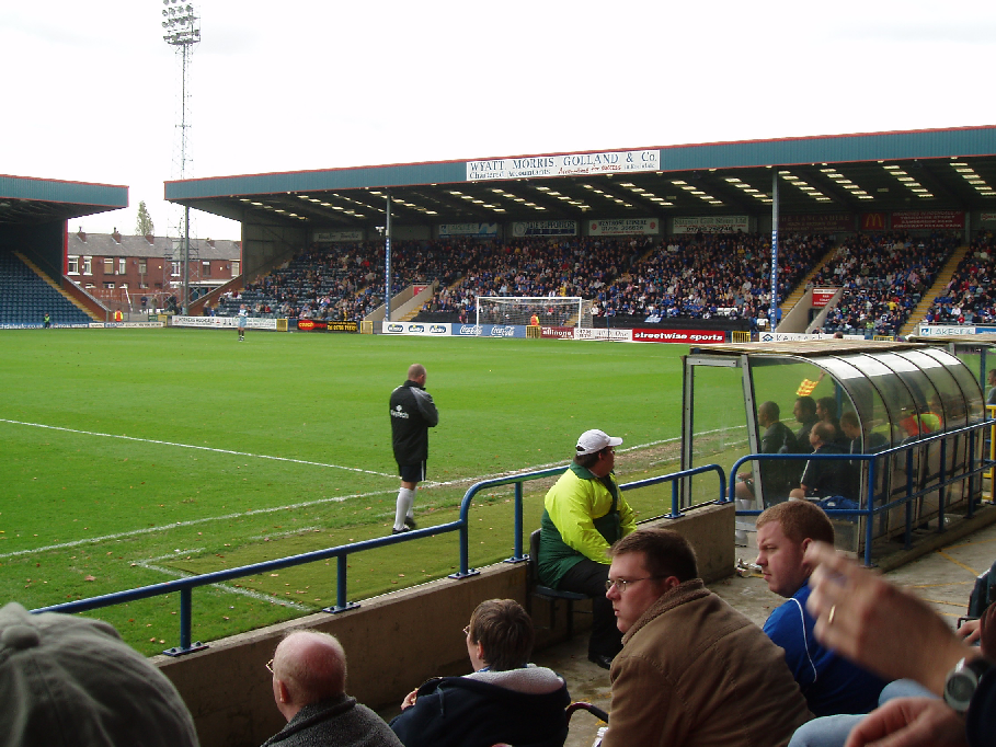
Spotland Stadium

Spotland Stadium, known as the Crown Oil Arena for sponsorship reasons, is a multi-purpose sports stadium in the Spotland area of Rochdale, Greater Manchester...

Rochdale Infirmary

Rochdale Infirmary is an acute general hospital in Rochdale, Greater Manchester, England. It is managed by the Northern Care Alliance NHS Foundation Trust...

Spotland

Spotland ( SPOT-land) is a district of Rochdale in Greater Manchester, England. The Rochdale ward name is Spotland and Falinge. The population of this...

Nearby Amenities

Located within 500m of 53.626809,-2.1723031
Shawclough
Place: suburb
Source: npe
Lat/Long: 53.6277436/-2.170576
Bus Stop
Shawclough Road/Fallowfield Drive
Bus: yes
Naptan AtcoCode: 1800NE16281
Naptan Bearing: SE
Naptan CommonName: Shawclough Road/Fallowfield Drive
Naptan Indicator: Matheson Ltd
Naptan Landmark: SHAW HOUSE
Naptan NaptanCode: mandwtgm
Naptan PlusbusZoneRef: MNCRPIC
Naptan ShortCommonName: Fallowfield Drive
Naptan Street: Shawclough Rad
Naptan Verified: no
Network: TfGM
Public Transport: platform
Source: naptan_import
Lat/Long: 53.6308344/-2.1725134
Bus Stop
Shawclough Road/Fallowfield Drive
Bus: yes
Naptan AtcoCode: 1800NE16291
Naptan Bearing: NW
Naptan CommonName: Shawclough Road/Fallowfield Drive
Naptan Indicator: Op Works
Naptan Landmark: SHAW HOUSE
Naptan NaptanCode: mandwtgp
Naptan PlusbusZoneRef: MNCRPIC
Naptan ShortCommonName: Fallowfield Drive
Naptan Street: SHAWCLOUGH ROAD
Naptan Verified: no
Network: TfGM
Public Transport: platform
Source: naptan_import
Lat/Long: 53.6305022/-2.172255
Bus Stop
Bentley Street/Clarence Street
Bus: yes
Naptan AtcoCode: 1800NE16481
Naptan Bearing: NE
Naptan CommonName: Bentley Street/Clarence Street
Naptan Indicator: Nr House 106
Naptan Landmark: HOUSE 106
Naptan NaptanCode: mandwtjg
Naptan PlusbusZoneRef: MNCRPIC
Naptan ShortCommonName: Clarence Street
Naptan Street: BENTLEY STREET
Naptan Verified: no
Network: TfGM
Public Transport: platform
Source: naptan_import
Lat/Long: 53.630417/-2.1689278
Bus Stop
Bentley Street/Clarence Street
Bus: yes
Naptan AtcoCode: 1800NE01811
Naptan Bearing: SW
Naptan CommonName: Bentley Street/Clarence Street
Naptan Indicator: Nt Culdesac
Naptan Landmark: NT CULDESAC
Naptan NaptanCode: mandwdpa
Naptan PlusbusZoneRef: MNCRPIC
Naptan ShortCommonName: Clarence Street
Naptan Street: BENTLEY STREET
Naptan Verified: no
Network: TfGM
Public Transport: platform
Source: naptan_import
Lat/Long: 53.6302912/-2.1689273
Bus Stop
Rooley Moor Road/Post Office
Bench: yes
Bus: yes
Naptan AtcoCode: 1800NE48781
Naptan Bearing: SE
Naptan CommonName: Rooley Moor Road/Post Office
Naptan Indicator: O/s House 70
Naptan Landmark: HOUSE 70
Naptan NaptanCode: mangdwga
Naptan PlusbusZoneRef: MNCRPIC
Naptan ShortCommonName: Post Office
Naptan Street: Rooley Moor Road
Naptan Verified: no
Network: TfGM
Public Transport: platform
Shelter: yes
Source: naptan_import
Tactile Paving: no
Lat/Long: 53.6235935/-2.1760521
Bus Stop
Rooley Moor Road/Post Office
Bench: no
Bus: yes
Naptan AtcoCode: 1800NE48791
Naptan Bearing: NW
Naptan CommonName: Rooley Moor Road/Post Office
Naptan Indicator: O/s House 83
Naptan Landmark: HOUSE 81
Naptan NaptanCode: mangdwgd
Naptan PlusbusZoneRef: MNCRPIC
Naptan ShortCommonName: Post Office
Naptan Street: Rooley Moor Road
Naptan Verified: no
Network: TfGM
Public Transport: platform
Shelter: yes
Source: naptan_import
Tactile Paving: no
Lat/Long: 53.6237458/-2.1763703
Bus Stop
Rooley Moor Road/Spotland Church
Bus: yes
Naptan AtcoCode: 1800NE48801
Naptan Bearing: NW
Naptan CommonName: Rooley Moor Road/Spotland Church
Naptan Indicator: Church
Naptan Landmark: CHURCH
Naptan NaptanCode: mangdwgj
Naptan PlusbusZoneRef: MNCRPIC
Naptan ShortCommonName: Spotland Church
Naptan Street: Rooley Moor Road
Naptan Verified: no
Network: TfGM
Public Transport: platform
Source: naptan_import
Lat/Long: 53.6248956/-2.1768892
Bus Stop
Rooley Moor Road/Spotland Church
Bus: yes
Naptan AtcoCode: 1800NE48811
Naptan Bearing: SE
Naptan CommonName: Rooley Moor Road/Spotland Church
Naptan Indicator: Nr Church
Naptan Landmark: FLATS 140-144
Naptan NaptanCode: mangdwgm
Naptan PlusbusZoneRef: MNCRPIC
Naptan ShortCommonName: Spotland Church
Naptan Street: Rooley Moor Road
Naptan Verified: no
Network: TfGM
Public Transport: platform
Source: naptan_import
Lat/Long: 53.6252551/-2.1768907
Bus Stop
Rooley Moor Road/Churchill Street
Bus: yes
Naptan AtcoCode: 1800NE48831
Naptan Bearing: W
Naptan CommonName: Rooley Moor Road/Churchill Street
Naptan Indicator: Op Openland
Naptan Landmark: PROPERTY 223
Naptan NaptanCode: mangdwgt
Naptan PlusbusZoneRef: MNCRPIC
Naptan ShortCommonName: Churchill Street
Naptan Street: Rooley Moor Road
Naptan Verified: no
Network: TfGM
Public Transport: platform
Source: naptan_import
Lat/Long: 53.6262041/-2.1794349
Bus Stop
Shawclough Road/Bentley Street
Bus: yes
Naptan AtcoCode: 1800NE12411
Naptan Bearing: SE
Naptan CommonName: Shawclough Road/Bentley Street
Naptan Indicator: Nr Open Land
Naptan Landmark: NR OPEN LAND
Naptan NaptanCode: mandwpwa
Naptan PlusbusZoneRef: MNCRPIC
Naptan ShortCommonName: Bentley Street
Naptan Street: SHAWCLOUGH ROAD
Naptan Verified: no
Network: TfGM
Public Transport: platform
Source: naptan_import
Lat/Long: 53.6294547/-2.1693172
Bus Stop
Shawclough Road/Bentley Street
Bus: yes
Naptan AtcoCode: 1800NE12421
Naptan Bearing: NW
Naptan CommonName: Shawclough Road/Bentley Street
Naptan Indicator: Nr Open Land
Naptan Landmark: NR OPEN LAND
Naptan NaptanCode: mandwpwd
Naptan PlusbusZoneRef: MNCRPIC
Naptan ShortCommonName: Bentley Street
Naptan Street: SHAWCLOUGH ROAD
Naptan Verified: no
Network: TfGM
Public Transport: platform
Source: naptan_import
Lat/Long: 53.6294542/-2.1696498
Bus Stop
Falinge Road/The Talbot Head
Bus: yes
Naptan AtcoCode: 1800NE12431
Naptan Bearing: N
Naptan CommonName: Falinge Road/The Talbot Head
Naptan Indicator: Opp House 18
Naptan Landmark: House 18
Naptan NaptanCode: mandwpwg
Naptan PlusbusZoneRef: MNCRPIC
Naptan ShortCommonName: The Talbot Head
Naptan Street: Shawclough Road
Naptan Verified: no
Network: TfGM
Public Transport: platform
Source: naptan_import
Lat/Long: 53.6283867/-2.1681637
Bus Stop
Falinge Road/The Talbot Head
Bus: yes
Naptan AtcoCode: 1800NE12441
Naptan Bearing: S
Naptan CommonName: Falinge Road/The Talbot Head
Naptan Indicator: Nr Open Land
Naptan Landmark: House 14
Naptan NaptanCode: mandwpwj
Naptan PlusbusZoneRef: MNCRPIC
Naptan ShortCommonName: The Talbot Head
Naptan Street: Shawclough Road
Naptan Verified: no
Network: TfGM
Public Transport: platform
Source: naptan_import
Lat/Long: 53.628126/-2.1681475
Bus Stop
Falinge Road/Falinge High School
Bus: yes
Naptan AtcoCode: 1800NE12451
Naptan Bearing: NW
Naptan CommonName: Falinge Road/Falinge High School
Naptan Indicator: Sch Turning Cir
Naptan Landmark: SCH TURNING CIR
Naptan NaptanCode: mandwpwm
Naptan PlusbusZoneRef: MNCRPIC
Naptan ShortCommonName: Falinge HS
Naptan Street: School Layby
Naptan Verified: no
Network: TfGM
Public Transport: platform
Source: naptan_import
Lat/Long: 53.6255818/-2.1684852
Bus Stop
Falinge Road/Falinge High School
Bus: yes
Naptan AtcoCode: 1800NE12461
Naptan Bearing: S
Naptan CommonName: Falinge Road/Falinge High School
Naptan Indicator: School Opp
Naptan Landmark: Manor Mews
Naptan NaptanCode: mandwpwp
Naptan PlusbusZoneRef: MNCRPIC
Naptan ShortCommonName: Falinge HS
Naptan Street: FALINGE ROAD
Naptan Verified: no
Network: TfGM
Public Transport: platform
Source: naptan_import
Lat/Long: 53.6254384/-2.1682275
Post Office
Source: OS OpenData StreetView
Lat/Long: 53.6291499/-2.1682175
Barrier: bollard
Lat/Long: 53.6258778/-2.1654682
Turning Circle
Source: Bing
Lat/Long: 53.6284678/-2.165613
Waterway: weir
Lat/Long: 53.6255737/-2.1741346
Turning Circle
Source: bing
Lat/Long: 53.6240949/-2.1753762
Barrier: block
Bicycle: yes
Foot: yes
Motor Vehicle: no
Lat/Long: 53.6263139/-2.1793869
Generator Method: photovoltaic
Generator Output Electricity: yes
Generator Source: solar
Generator Type: solar_photovoltaic_panel
Location: roof
Power: generator
Lat/Long: 53.6246841/-2.1778045
Generator Method: photovoltaic
Generator Output Electricity: yes
Generator Source: solar
Generator Type: solar_photovoltaic_panel
Location: roof
Power: generator
Lat/Long: 53.6247557/-2.1776462
Generator Method: photovoltaic
Generator Output Electricity: yes
Generator Source: solar
Generator Type: solar_photovoltaic_panel
Location: roof
Power: generator
Lat/Long: 53.6245982/-2.177209
Generator Method: photovoltaic
Generator Output Electricity: yes
Generator Source: solar
Generator Type: solar_photovoltaic_panel
Location: roof
Power: generator
Lat/Long: 53.6245139/-2.1778259
Generator Method: photovoltaic
Generator Output Electricity: yes
Generator Source: solar
Generator Type: solar_photovoltaic_panel
Location: roof
Power: generator
Lat/Long: 53.6244693/-2.1777696
Generator Method: photovoltaic
Generator Output Electricity: yes
Generator Source: solar
Generator Type: solar_photovoltaic_panel
Location: roof
Power: generator
Lat/Long: 53.6243962/-2.1777187
Generator Method: photovoltaic
Generator Output Electricity: yes
Generator Source: solar
Generator Type: solar_photovoltaic_panel
Location: roof
Power: generator
Lat/Long: 53.6247283/-2.1774416
Generator Method: photovoltaic
Generator Output Electricity: yes
Generator Source: solar
Generator Type: solar_photovoltaic_panel
Location: roof
Power: generator
Lat/Long: 53.6247053/-2.1777742
Generator Method: photovoltaic
Generator Output Electricity: yes
Generator Source: solar
Generator Type: solar_photovoltaic_panel
Location: roof
Power: generator
Lat/Long: 53.6288633/-2.1751082
Generator Method: photovoltaic
Generator Output Electricity: yes
Generator Source: solar
Generator Type: solar_photovoltaic_panel
Location: roof
Power: generator
Lat/Long: 53.6291961/-2.1725346
Generator Method: photovoltaic
Generator Output Electricity: yes
Generator Source: solar
Generator Type: solar_photovoltaic_panel
Location: roof
Power: generator
Lat/Long: 53.6284692/-2.1721014
Generator Method: photovoltaic
Generator Output Electricity: yes
Generator Source: solar
Generator Type: solar_photovoltaic_panel
Location: roof
Power: generator
Lat/Long: 53.6281797/-2.1728431
The data included in this document is from www.openstreetmap.org. The data is made available under ODbL.

Have you been to Hollows Wood?

Leave your review of Hollows Wood below (or comments, questions and feedback).