Pigeon Plantation

Wood, Forest in Yorkshire Craven

England

Pigeon Plantation

Lightning Tree on the Road to Otterburn Situated on the road from Airton to Otterburn.
Lightning Tree on the Road to Otterburn Credit: Andy Beecroft

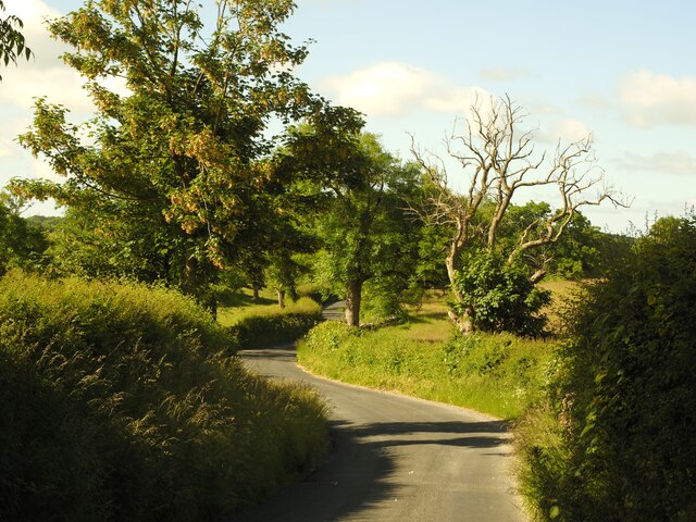
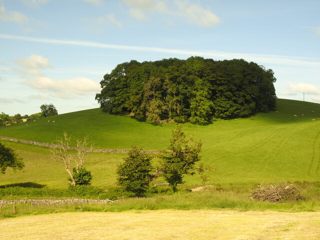
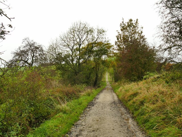
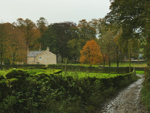
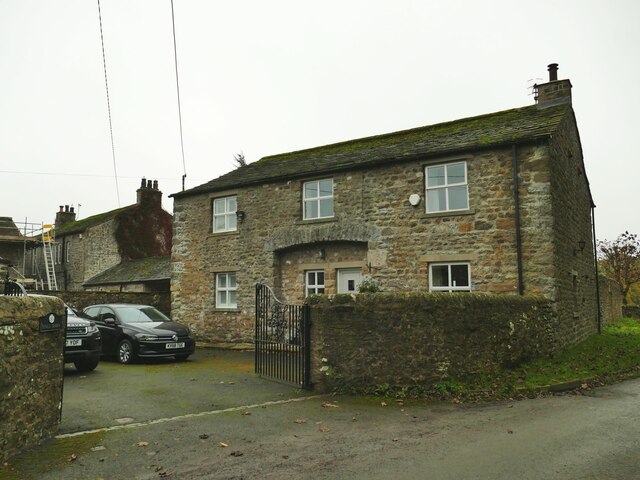
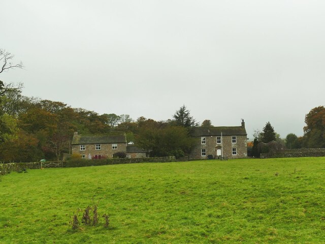
Pigeon Plantation, located in Yorkshire, is a picturesque woodland area known for its abundant pigeon population and scenic beauty. Situated in the heart of the county, this woodland offers a peaceful retreat for nature enthusiasts and birdwatchers alike.

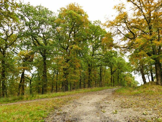
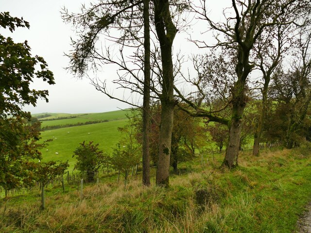
Covering an area of approximately 500 acres, Pigeon Plantation is known for its diverse range of trees, including oak, beech, and birch. These towering trees create a dense canopy that provides a habitat for a variety of wildlife, making it a haven for bird species, especially pigeons. The woodland's name itself is derived from the significant number of pigeons that call this place home.

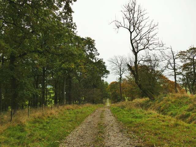
The plantation features well-maintained walking trails that wind through the forest, allowing visitors to explore and immerse themselves in the tranquility of nature. These paths are suitable for all levels of hikers and are often accompanied by informative signposts highlighting the local flora and fauna.

In addition to its natural beauty, Pigeon Plantation offers recreational activities such as birdwatching, picnicking, and photography. Birdwatchers can spot a wide range of avian species, including wood pigeons, collared doves, and various songbirds. The plantation's peaceful atmosphere and stunning scenery make it an ideal spot for capturing memorable photographs or simply enjoying a leisurely picnic amidst nature's serenity.

Overall, Pigeon Plantation in Yorkshire is a cherished natural gem, providing a sanctuary for pigeons and a tranquil escape for visitors seeking to reconnect with the beauty of the woodlands.

If you have any feedback on the listing, please let us know in the comments section below.

Pigeon Plantation Images

Images are sourced within 2km of 54.004038/-2.1811523 or Grid Reference SD8856. Thanks to Geograph Open Source API. All images are credited.
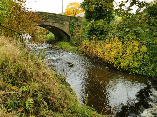
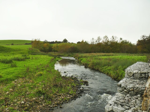
Lightning Tree on the Road to Otterburn Situated on the road from Airton to Otterburn.
Lightning Tree on the Road to Otterburn
Situated on the road from Airton to Otterburn.
Hillside Copse near Otterburn
Path junction on Dacre Lane Dacre Lane, bending right here towards Otterburn village, is a public footpath. To the left is a private road into Crook Beck Plantation.
Path junction on Dacre Lane
Dacre Lane, bending right here towards Otterburn village, is a public footpath. To the left is a private road into Crook Beck Plantation.
Looking down Dacre Lane The track is dead straight for 650 metres from this point.
Looking down Dacre Lane
The track is dead straight for 650 metres from this point.
View towards Crossber from Dacre Lane The post-glacial drumlins in this area are sheep pasture country.
View towards Crossber from Dacre Lane
The post-glacial drumlins in this area are sheep pasture country.
Dacre Lane, looking north-west Part of a long route linking Otterburn to Settle.
Dacre Lane, looking north-west
Part of a long route linking Otterburn to Settle.
Young oaks alongside Dacre Lane New oaks have been planted in among mature trees.
Young oaks alongside Dacre Lane
New oaks have been planted in among mature trees.
Dacre Lane, approaching Otterburn The end of a long route from Settle.
Dacre Lane, approaching Otterburn
The end of a long route from Settle.
House on a bend in Hellifield Road  My eye was caught by the small, blocked, arched opening between ground and first floor window levels. I wonder what that was for?
House on a bend in Hellifield Road
My eye was caught by the small, blocked, arched opening between ground and first floor window levels. I wonder what that was for?
Otterburn Bridge  The grade II listed bridge is dated to the late 18th or early 19th century. List entry 1132058.
Otterburn Bridge
The grade II listed bridge is dated to the late 18th or early 19th century. List entry 1132058.
View north along Otterburn Beck from the bridge The furthest of the three buildings in the photo is the Grade II listed Grove Farm.
View north along Otterburn Beck from the bridge
The furthest of the three buildings in the photo is the Grade II listed Grove Farm.
Hellifield Road out of Otterburn Note three pieces of street furniture: the road sign for a width restriction, the postbox in a wall, and the county marker (possibly relocated from the nearby bridge?) <a href="https://www.geograph.org.uk/photo/4669588">SD8857 : West Riding marker beside building at cross roads</a>. The building itself looks like an agricultural one converted to residential.
Hellifield Road out of Otterburn
Note three pieces of street furniture: the road sign for a width restriction, the postbox in a wall, and the county marker (possibly relocated from the nearby bridge?) SD8857 : West Riding marker beside building at cross roads. The building itself looks like an agricultural one converted to residential.
Cattle farm at Otterburn Hall A local website says 'Otterburn Hall Farm is a 170 hectare permanent grassland farm in Otterburn Village, bordering Otterburn Beck, with 850 breeding sheep and 40 beef cattle'. Some of the cattle could be heard in the shed here.
Cattle farm at Otterburn Hall
A local website says 'Otterburn Hall Farm is a 170 hectare permanent grassland farm in Otterburn Village, bordering Otterburn Beck, with 850 breeding sheep and 40 beef cattle'. Some of the cattle could be heard in the shed here.
Hall Barn, Otterburn A barn conversion at Otterburn Hall Farm.
Hall Barn, Otterburn
A barn conversion at Otterburn Hall Farm.
Otterburn Hall A cattle and sheep farm on the outskirts of the village. To the right is the grade II listed farmhouse (list entry 1316881) and to the left is a converted barn <a href="https://www.geograph.org.uk/photo/7640188">SD8857 : Hall Barn, Otterburn</a>.
Otterburn Hall
A cattle and sheep farm on the outskirts of the village. To the right is the grade II listed farmhouse (list entry 1316881) and to the left is a converted barn SD8857 : Hall Barn, Otterburn.
Cyclists on the road from Otterburn to Bell Busk One of three groups I saw within a few minutes - possibly all part of the same club ride.
Cyclists on the road from Otterburn to Bell Busk
One of three groups I saw within a few minutes - possibly all part of the same club ride.
Otterburn Beck, with gabions The gabions are presumably to prevent the beck eroding the adjacent road.
Otterburn Beck, with gabions
The gabions are presumably to prevent the beck eroding the adjacent road.
Marsh by the road to Otterburn The parish boundary between Coniston Cold and Otterburn passes through this marsh (indeed the 1909 map indicates the boundary being 'C[entre of] Marsh') and it may therefore mark a previous course of Otterburn Beck.
Marsh by the road to Otterburn
The parish boundary between Coniston Cold and Otterburn passes through this marsh (indeed the 1909 map indicates the boundary being 'C[entre of] Marsh') and it may therefore mark a previous course of Otterburn Beck.
Show me another place!

Pigeon Plantation is located at Grid Ref: SD8856 (Lat: 54.004038, Lng: -2.1811523)

Division: West Riding

Administrative County: North Yorkshire

District: Craven

Police Authority: North Yorkshire

What 3 Words

///attending.slant.removers. Near Hellifield, North Yorkshire

Related Wikis

Aire Gap

Aire Gap is a pass through the Pennines in England formed by geologic faults and carved out by glaciers. The term is used to describe a geological division...

Otterburn, North Yorkshire

Otterburn (historically known as Otterburn-in-Craven) is a village and civil parish in the Craven district of North Yorkshire, England. It is at OS Grid...

A65 road

The A65 is a major road in England. It runs north west from Leeds in West Yorkshire via Kirkstall, Horsforth, Yeadon, Guiseley, Ilkley and Skipton, west...

Bell Busk railway station

Bell Busk railway station served the hamlet of Bell Busk in North Yorkshire, England. It was located on the Leeds to Morecambe Line between Gargrave and...

Bell Busk

Bell Busk is a hamlet situated in the Craven district of North Yorkshire, England. The hamlet is located at the southern end of Malhamdale where the nascent...

Coniston Cold

Coniston Cold is a village and civil parish in the Craven district of North Yorkshire, England. Historically part of the Staincliffe Wapentake of the West...

Hellifield

Hellifield is a village and civil parish in the Craven district of North Yorkshire, England (grid reference SD855565). Historically part of the West Riding...

Swinden

Swinden is a village in the civil parish of Hellifield, in North Yorkshire, England. It is near Halton West and Nappa and about 7 miles north of Barnoldswick...

Related Videos

Walking from Airton to Bell Busk, Otterburn and back in the Yorkshire Dales

Photos from a walk on 28 March 2018 in the Yorkshire Dales.

Khan on holiday

Skipton Coniston hotel.

Yorkshire Tandem Rides - Hellifield (or Gargrave) to Settle Viewpoint - easy 20 miles

This is an easy ride on fairly good roads (Hellifield is a mess!) with a nice short climb at the furthest point. There is a mixture of ...

Nearby Amenities

Located within 500m of 54.004038,-2.1811523
Crane Field Hill
Is In Country Code: GB
Natural: peak
Source: OS 1:25k
Lat/Long: 54.0076857/-2.1855066
Pits Hill
Is In Country Code: GB
Natural: peak
Source: OS 1:25k
Lat/Long: 54.0010901/-2.1845839
The data included in this document is from www.openstreetmap.org. The data is made available under ODbL.

Have you been to Pigeon Plantation?

Leave your review of Pigeon Plantation below (or comments, questions and feedback).