Beech Drive

Wood, Forest in Worcestershire Malvern Hills

England

Beech Drive

Croome House The National Trust Property at Croome Park, once home to the Earls of Coventry, the grounds of which were designed by Capability Brown.
Croome House Credit: Bill Johnson

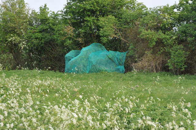
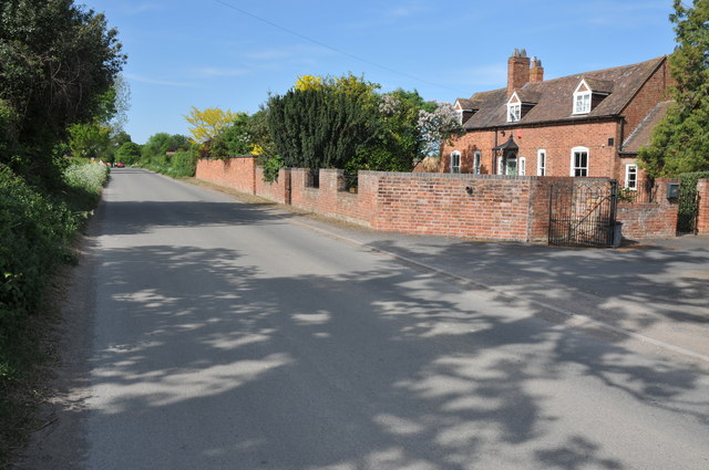
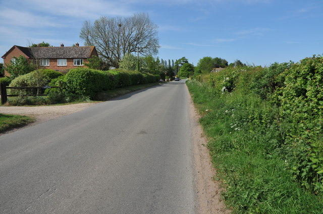
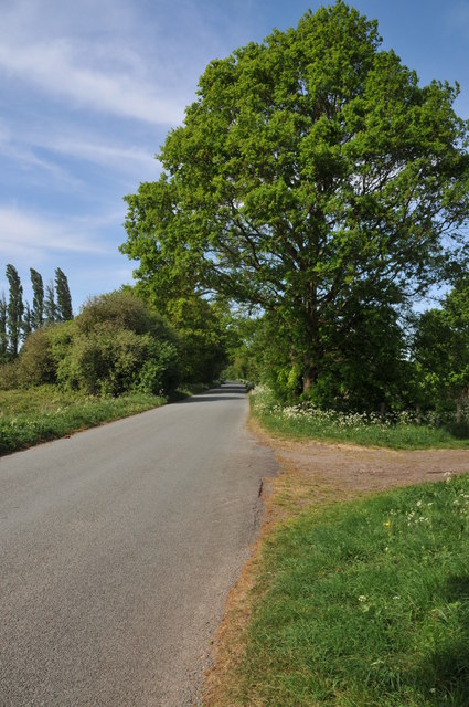
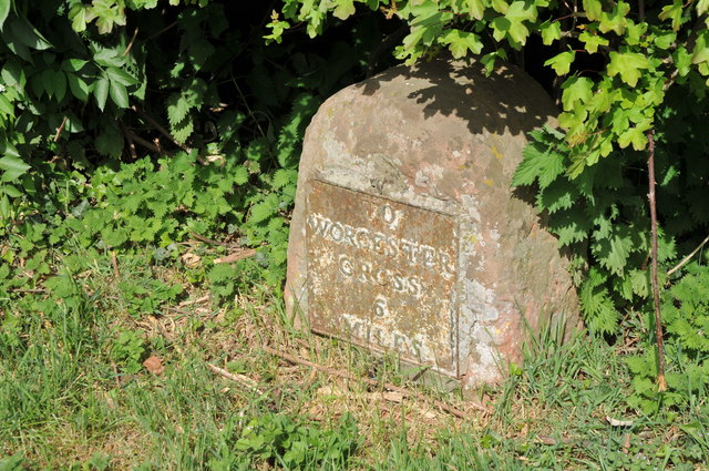
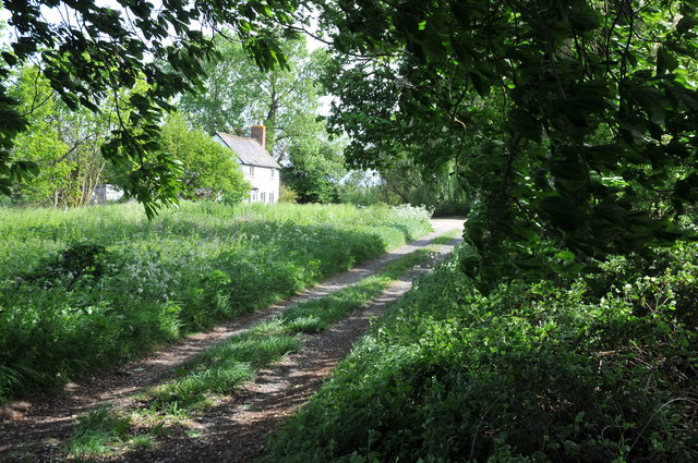
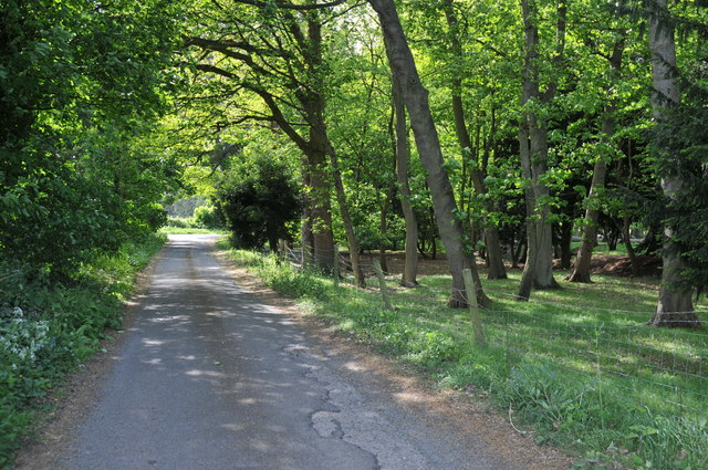
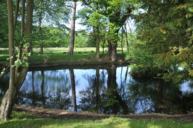
Beech Drive is an enchanting road located in the picturesque county of Worcestershire in England. Nestled within a lush woodland area, the drive is aptly named after the magnificent beech trees that line its path, creating a serene and captivating atmosphere. The road is situated within a vast forest, known for its rich biodiversity and natural beauty.

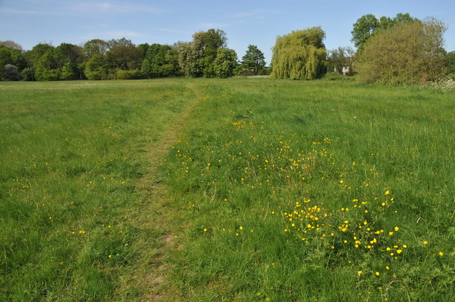
The dense canopy formed by the beech trees provides a cool and refreshing shade during the summer months, making it an ideal spot for leisurely walks or cycling. The foliage transforms into a breathtaking display of vibrant colors during the autumn season, attracting visitors from far and wide to witness nature's spectacle. The peaceful surroundings and the soothing sound of rustling leaves make Beech Drive a haven for nature lovers and outdoor enthusiasts.

The drive offers a glimpse into the diverse wildlife that inhabits the area. Keen observers may spot various species of birds, including woodpeckers and owls, as well as small mammals like squirrels and rabbits. The forest is also home to a variety of plant life, with bluebells carpeting the woodland floor in the springtime.

Beech Drive is not only a natural haven but also provides access to well-maintained walking trails and picnic areas, allowing visitors to fully immerse themselves in the beauty of Worcestershire's countryside. Whether one seeks solitude or a family outing, Beech Drive offers a tranquil escape where one can reconnect with nature in all its glory.

If you have any feedback on the listing, please let us know in the comments section below.

Beech Drive Images

Images are sourced within 2km of 52.111727/-2.1865011 or Grid Reference SO8745. Thanks to Geograph Open Source API. All images are credited.

Croome House The National Trust Property at Croome Park, once home to the Earls of Coventry, the grounds of which were designed by Capability Brown.
Croome House
The National Trust Property at Croome Park, once home to the Earls of Coventry, the grounds of which were designed by Capability Brown.
The Lake at Croome Park This lake was created by Capability Brown and formed part of the Pleasure Park at Croome Park.
The Lake at Croome Park
This lake was created by Capability Brown and formed part of the Pleasure Park at Croome Park.
The Lake at Croome Park This lake was created by Capability Brown and formed part of the Pleasure Park at Croome Park.

The island in the middle of the lake stands out in this pnotograph.
The Lake at Croome Park
This lake was created by Capability Brown and formed part of the Pleasure Park at Croome Park. The island in the middle of the lake stands out in this pnotograph.
The Church at Croome Park Croome Park as it exists today is all the work of Capability Brown and the Earls of Coventry.

Formerly a collection of houses were to be found in the land to the west of the church.  These were removed to produce the current layout.
The Church at Croome Park
Croome Park as it exists today is all the work of Capability Brown and the Earls of Coventry. Formerly a collection of houses were to be found in the land to the west of the church. These were removed to produce the current layout.
Netting over a hedge at Kerswell Green This curious netting appeared over this hedge about a month ago, an internet search has revealed this is likely to stop birds nesting before the hedge is grubbed out to make an entrance.  

Soon after work began on building a sewage treatment works. <a href="https://www.geograph.org.uk/photo/4093553">SO8646 : Kerswell Green sewage treatment works</a>
Netting over a hedge at Kerswell Green
This curious netting appeared over this hedge about a month ago, an internet search has revealed this is likely to stop birds nesting before the hedge is grubbed out to make an entrance. Soon after work began on building a sewage treatment works. SO8646 : Kerswell Green sewage treatment works
Netting over a hedge at Kerswell Green This curious netting appeared over this hedge about a month ago, an internet search has revealed this is likely to stop birds nesting before the hedge is grubbed out to make an entrance.
Netting over a hedge at Kerswell Green
This curious netting appeared over this hedge about a month ago, an internet search has revealed this is likely to stop birds nesting before the hedge is grubbed out to make an entrance.
Cottages at Kerswell Green Unfortunately the proximity and noise of the nearby traffic on the M5 motorway detracts from the rural scene.
Cottages at Kerswell Green
Unfortunately the proximity and noise of the nearby traffic on the M5 motorway detracts from the rural scene.
Road through Kerswell Green Cottage beside the road through Kerswell Green.
Road through Kerswell Green
Cottage beside the road through Kerswell Green.
Road through Kerswell Green
Road out of Kerswell Green Country road leaving the north end of the small hamlet of Kerswell Green near Kempsey.
Road out of Kerswell Green
Country road leaving the north end of the small hamlet of Kerswell Green near Kempsey.
Milestone in Kerswell Green Milestone on the roadside in Kerswell Green indicating it is 6 miles to Worcester Cross.
Milestone in Kerswell Green
Milestone on the roadside in Kerswell Green indicating it is 6 miles to Worcester Cross.
Normoor Common, Kerswell Green Normoor Common small piece of common land at Kerswell Green.
Normoor Common, Kerswell Green
Normoor Common small piece of common land at Kerswell Green.
Cottage on Normoor Common Cottage overlooking Normoor Common near Kerswell Green.
Cottage on Normoor Common
Cottage overlooking Normoor Common near Kerswell Green.
Road to Park Farm This is a no through road giving access to Park Farm which is on the other side of the M5 motorway.
Road to Park Farm
This is a no through road giving access to Park Farm which is on the other side of the M5 motorway.
Pond at Kerswell Green This small pond is beside a sharp bend in the road to the north of Kerswell Green.
Pond at Kerswell Green
This small pond is beside a sharp bend in the road to the north of Kerswell Green.
Traffic on the M5 motorway Traffic travelling north on the M5 motorway to the south of Worcester viewed from the footpath adjacent to the road.
Traffic on the M5 motorway
Traffic travelling north on the M5 motorway to the south of Worcester viewed from the footpath adjacent to the road.
Tree in a ploughed field This lime tree is in the middle of a field which has been seeded with grass seed to grow lawn turf.
Tree in a ploughed field
This lime tree is in the middle of a field which has been seeded with grass seed to grow lawn turf.
Dry dusty fields These fields at Kerswell Green have been prepared for growing lawn turf but the dry spring is causing the soil to dry out and blow in the wind.
Dry dusty fields
These fields at Kerswell Green have been prepared for growing lawn turf but the dry spring is causing the soil to dry out and blow in the wind.
Show me another place!

Beech Drive is located at Grid Ref: SO8745 (Lat: 52.111727, Lng: -2.1865011)

Administrative County: Worcestershire

District: Malvern Hills

Police Authority: West Mercia

What 3 Words

///prawn.slicer.impulsive. Near Kempsey, Worcestershire

Related Wikis

High Green, Worcestershire

High Green is a village in Worcestershire, England.

Kerswell Green

Kerswell Green is a village in Worcestershire, England.

Croome D'Abitot

Croome D'Abitot is a village and civil parish, which shares a joint parish council with Severn Stoke, in the Malvern Hills District in the county of Worcestershire...

Pirton, Worcestershire

Pirton is a small village in the English county of Worcestershire. The village has been occupied since at least 1086, when Domesday listed the village...

St Mary Magdalene's Church, Croome D'Abitot

St Mary Magdalene's Church is a former Anglican church in the grounds of Croome Court, at Croome D'Abitot, Worcestershire, England. It is recorded in...

Croome Court

Croome Court is a mid-18th-century Neo-Palladian mansion surrounded by extensive landscaped parkland at Croome D'Abitot, near Upton-upon-Severn in south...

Horewell Forest

Horewell Forest was a royal forest, i. e. a royal game preserve. In the west, it bordered the river Severn, and Strensham in the south and extended to...

Severn Stoke

Severn Stoke is an English village and civil parish in the Malvern Hills District, in the south of the county of Worcestershire, alongside the A38 trunk...

Nearby Amenities

Located within 500m of 52.111727,-2.1865011
Man Made: tower
Note: Approximate location
Source: survey
Tower Type: communication
Lat/Long: 52.1091763/-2.1924245
BT Mast Gallops Bridge
Power: pole
Transformer: distribution
Voltage Primary: 11000
Lat/Long: 52.1093864/-2.192156
Power: pole
Lat/Long: 52.1102422/-2.1915874
Power: pole
Lat/Long: 52.1137746/-2.1891412
Power: pole
Lat/Long: 52.1128406/-2.1897689
Power: pole
Lat/Long: 52.1119825/-2.1903563
Power: pole
Lat/Long: 52.1111177/-2.1909544
Power: pole
Lat/Long: 52.1161563/-2.1859574
Power: pole
Lat/Long: 52.1148254/-2.1886879
Power: pole
Lat/Long: 52.1155156/-2.1884036
Power: pole
Lat/Long: 52.1162024/-2.1870223
Power: pole
Lat/Long: 52.1144878/-2.181344
Power: pole
Lat/Long: 52.1123679/-2.1816659
Power: pole
Lat/Long: 52.1137499/-2.1814969
Power: pole
Lat/Long: 52.1130449/-2.1816364
Power: pole
Lat/Long: 52.1115278/-2.1816793
Power: pole
Lat/Long: 52.1107405/-2.1815828
Power: pole
Lat/Long: 52.1097999/-2.1818054
Power: pole
Lat/Long: 52.1088955/-2.1820226
Power: pole
Lat/Long: 52.1098073/-2.1804663
The data included in this document is from www.openstreetmap.org. The data is made available under ODbL.

Have you been to Beech Drive?

Leave your review of Beech Drive below (or comments, questions and feedback).