Dick Clough Wood

Wood, Forest in Lancashire Burnley

England

Dick Clough Wood

Old Wayside Cross in Tiwneley Park, Burnley Foldys' Cross, an old market cross base in a new cross. Moved to the intersection of footpaths leading towards Todmorden road in Towneley Park, 300 metres southwest of Towneley Hall in Burnley. Grade II Listed <span class="nowrap"><a title="https://historicengland.org.uk/listing/the-list/list-entry/1247301" rel="nofollow ugc noopener" href="https://historicengland.org.uk/listing/the-list/list-entry/1247301">Link</a><img style="margin-left:2px;" alt="External link" title="External link - shift click to open in new window" src="https://s1.geograph.org.uk/img/external.png" width="10" height="10"/></span>. See also <a title="https://www.geograph.org.uk/photo/3569776" href="https://www.geograph.org.uk/photo/3569776">Link</a> and <a title="https://www.geograph.org.uk/photo/1133733" href="https://www.geograph.org.uk/photo/1133733">Link</a>.

Milestone Society National ID: LABU_BUR03
Old Wayside Cross in Tiwneley Park, Burnley Credit: Lee Rob

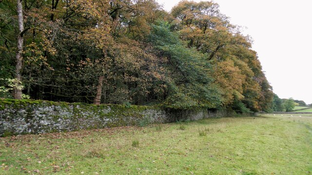
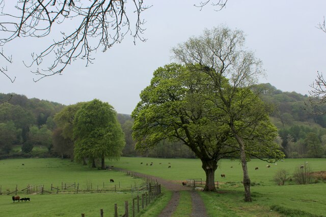
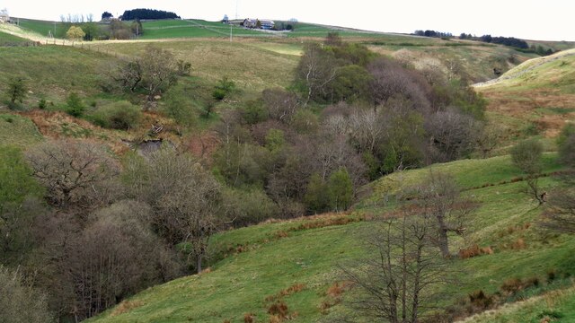
Dick Clough Wood is a picturesque forest located in the county of Lancashire, England. Spread over an area of approximately 100 acres, this woodland is a haven for nature enthusiasts and those seeking to escape the hustle and bustle of city life.

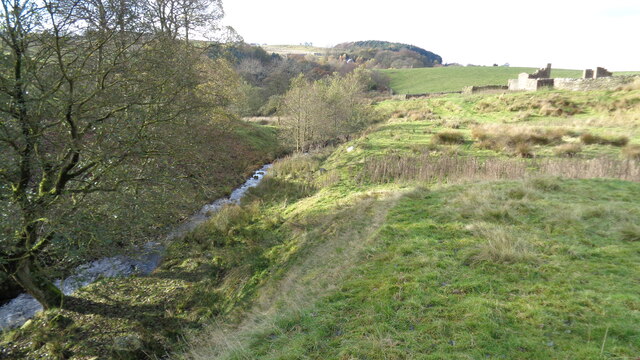
The wood is characterized by its dense canopy of oak, birch, and beech trees, which provide a serene and tranquil atmosphere. The forest floor is covered in a lush carpet of moss and ferns, creating a visually stunning and vibrant setting. This verdant woodland is home to a diverse array of flora and fauna, including squirrels, rabbits, and a variety of bird species.

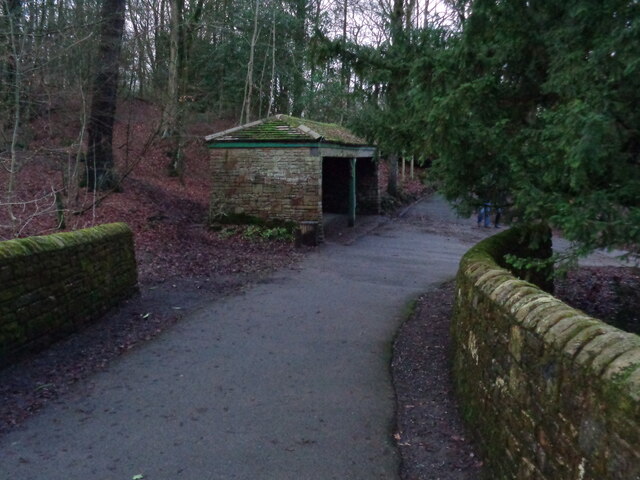
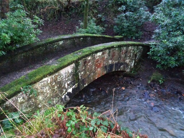
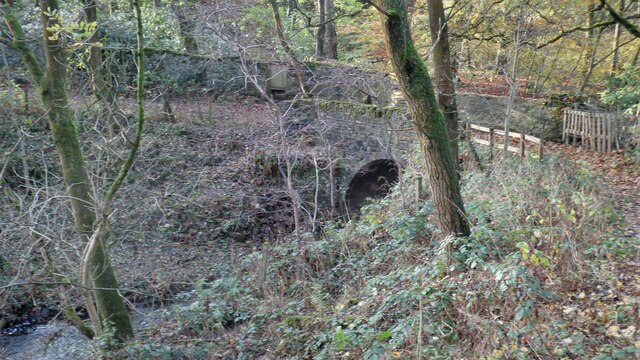
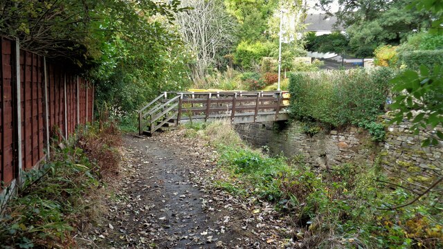
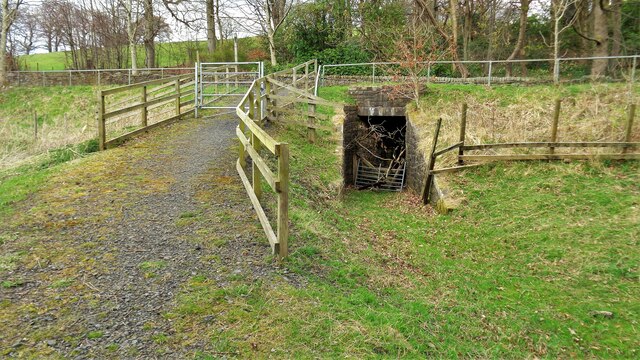
The wood offers numerous walking trails, allowing visitors to explore its natural beauty at their own pace. These pathways wind through the forest, taking visitors past babbling brooks, small waterfalls, and charming wooden bridges. Along the trails, there are strategically placed benches where visitors can rest and take in the serene surroundings.

Dick Clough Wood is not only a haven for wildlife but also a popular destination for outdoor activities such as picnicking, birdwatching, and photography. The forest is well-maintained, with clear signposts and information boards providing valuable insights into the local flora and fauna.

Conveniently located near the town of Lancaster, Dick Clough Wood is easily accessible and provides a welcome respite for both locals and tourists alike. Whether one seeks solitude, a leisurely stroll, or an opportunity to connect with nature, this enchanting woodland offers a truly immersive experience in the heart of Lancashire.

If you have any feedback on the listing, please let us know in the comments section below.

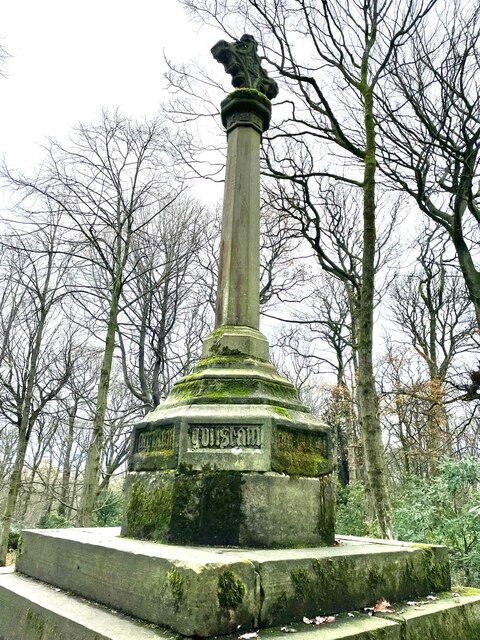
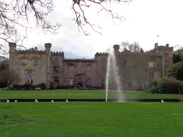
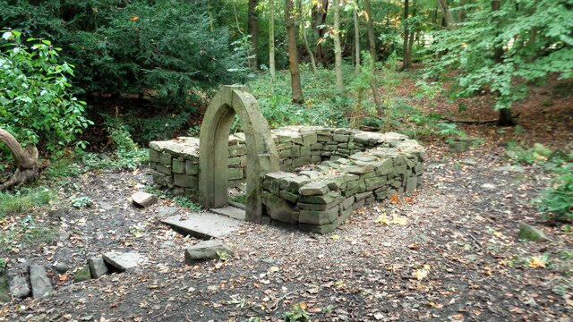
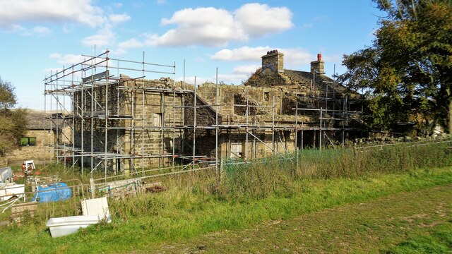
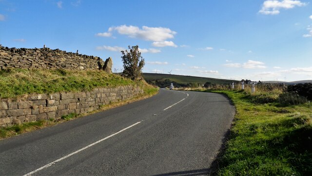
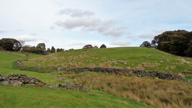
Dick Clough Wood Images

Images are sourced within 2km of 53.76817/-2.198324 or Grid Reference SD8730. Thanks to Geograph Open Source API. All images are credited.

Old Wayside Cross in Tiwneley Park, Burnley Foldys' Cross, an old market cross base in a new cross. Moved to the intersection of footpaths leading towards Todmorden road in Towneley Park, 300 metres southwest of Towneley Hall in Burnley. Grade II Listed <span class="nowrap"><a title="https://historicengland.org.uk/listing/the-list/list-entry/1247301" rel="nofollow ugc noopener" href="https://historicengland.org.uk/listing/the-list/list-entry/1247301">Link</a><img style="margin-left:2px;" alt="External link" title="External link - shift click to open in new window" src="https://s1.geograph.org.uk/img/external.png" width="10" height="10"/></span>. See also <a title="https://www.geograph.org.uk/photo/3569776" href="https://www.geograph.org.uk/photo/3569776">Link</a> and <a title="https://www.geograph.org.uk/photo/1133733" href="https://www.geograph.org.uk/photo/1133733">Link</a>.

Milestone Society National ID: LABU_BUR03
Old Wayside Cross in Tiwneley Park, Burnley
Foldys' Cross, an old market cross base in a new cross. Moved to the intersection of footpaths leading towards Todmorden road in Towneley Park, 300 metres southwest of Towneley Hall in Burnley. Grade II Listed LinkExternal link. See also Link and Link. Milestone Society National ID: LABU_BUR03
Towneley Hall The north east frontage
Towneley Hall
The north east frontage
Park Shelters At Boggart Bridge in Towneley Park Wilderness
Park Shelters
At Boggart Bridge in Towneley Park Wilderness
Ornamental Footbridge In the Wilderness of Towneley Park over Copy Clough
Ornamental Footbridge
In the Wilderness of Towneley Park over Copy Clough
Cant Clough With the remains of Hey Laithe on the right in this view
Cant Clough
With the remains of Hey Laithe on the right in this view
Foxstones Bridge Over the infant River Brun
Foxstones Bridge
Over the infant River Brun
Burnley Way Footbridge Crosses the River Calder to give access to Park Road
Burnley Way Footbridge
Crosses the River Calder to give access to Park Road
Rustic Pavilion For the football fields in Towneley Park
Rustic Pavilion
For the football fields in Towneley Park
Monk's Well In Thanet Lee Wood on the Towneley Estate. Whilst it contains a stone trough, the construction around it is believed to be a re-created Gothick folly.
Monk's Well
In Thanet Lee Wood on the Towneley Estate. Whilst it contains a stone trough, the construction around it is believed to be a re-created Gothick folly.
Work at Middle Pasture Farm Is it renovation work?
Work at Middle Pasture Farm
Is it renovation work?
The Long Causeway at Stump Cross The way marking stone known as Stump Cross is at the top of the roadside embankment on the bend. This stone has not been dressed unlike the Mount Cross which is further along this ancient route
The Long Causeway at Stump Cross
The way marking stone known as Stump Cross is at the top of the roadside embankment on the bend. This stone has not been dressed unlike the Mount Cross which is further along this ancient route
Round Hill There are earthworks marked on the OS map for the hill. There are surface stones visible in that area. More remarkable are the large monoliths built into the field walls around this area and perhaps they had been in the earthworks in times past.
Round Hill
There are earthworks marked on the OS map for the hill. There are surface stones visible in that area. More remarkable are the large monoliths built into the field walls around this area and perhaps they had been in the earthworks in times past.
Estate Walling to Ormerod House The substantial walling encloses the River Brun within the private estate, so this path along the valley has no view of the river.
Estate Walling to Ormerod House
The substantial walling encloses the River Brun within the private estate, so this path along the valley has no view of the river.
New Housing (The Calders) Off Red Lees Road and causing the diversion of public footpaths
New Housing (The Calders)
Off Red Lees Road and causing the diversion of public footpaths
Disused Rock Quarry By Rock Water
Disused Rock Quarry
By Rock Water
Track heading towards Buckley Wood Public footpath from A646 south of Holme Chapel leading to Buckley Wood over the River Calder
Track heading towards Buckley Wood
Public footpath from A646 south of Holme Chapel leading to Buckley Wood over the River Calder
Private Subway This subway under the now A646 allowed the owners of The Holme to walk to the railway station in private. A public footpath now comes through the gate in the view to join and go forward to a gated subway under the railway
Private Subway
This subway under the now A646 allowed the owners of The Holme to walk to the railway station in private. A public footpath now comes through the gate in the view to join and go forward to a gated subway under the railway
The wooded Green Clough
Show me another place!

Dick Clough Wood is located at Grid Ref: SD8730 (Lat: 53.76817, Lng: -2.198324)

Administrative County: Lancashire

District: Burnley

Police Authority: Lancashire

What 3 Words

///clear.ridge.bend. Near Burnley, Lancashire

Related Wikis

Cliviger

Cliviger is a civil parish in the Borough of Burnley, in Lancashire, England. It is situated to the southeast of Burnley, and northwest of Todmorden....

Fother Royd Wood

Fother Royd Wood is a woodland in Lancashire, England, near Worsthorne. It covers a total area of 1.03 hectares (2.55 acres). It is owned and managed by...

Hurstwood

Hurstwood is a rural hamlet on the eastern outskirts of Burnley in Lancashire, England. It is in the civil parish of Worsthorne-with-Hurstwood and the...

Towneley Park

Towneley Park is owned and managed by Burnley Borough Council and is the largest and most popular park in Burnley, Lancashire, England. The main entrance...

Worsthorne-with-Hurstwood

Worsthorne-with-Hurstwood is a civil parish in the Borough of Burnley, in Lancashire, England. Situated on the eastern outskirts of Burnley, in 2011 it...

Church of St John the Divine, Holme Chapel

The Church of St John the Divine is in Burnley Road, Holme Chapel, a village in the civil parish of Cliviger, near Burnley, Lancashire, England. It is...

Holme railway station (Lancashire)

Holme railway station served Holme Chapel on the Copy Pit line. The station closed in July 1930 and the line now serves as a non-stop route between Hebden...

Holme Hall, Cliviger

Holme Hall (or The Holme) is a Grade II* listed manor house in Cliviger near Burnley, in Lancashire, England. The house dates back to at least the 15th...

Nearby Amenities

Located within 500m of 53.76817,-2.198324
Bus Stop
Bus: yes
Public Transport: platform
Lat/Long: 53.766185/-2.1970053
Barrier: stile
Lat/Long: 53.7718167/-2.1954479
Barrier: stile
Lat/Long: 53.771365/-2.1975115
Barrier: stile
Lat/Long: 53.7710705/-2.2004404
Overtown
Place: hamlet
Lat/Long: 53.7658345/-2.19557
Mereclough
Place: hamlet
Lat/Long: 53.7707997/-2.1928663
Barrier: stile
Lat/Long: 53.7716036/-2.1961545
Barrier: yes
Lat/Long: 53.7648179/-2.1966891
The data included in this document is from www.openstreetmap.org. The data is made available under ODbL.

Have you been to Dick Clough Wood?

Leave your review of Dick Clough Wood below (or comments, questions and feedback).