Camps Plantation

Wood, Forest in Northumberland

England

Camps Plantation

On Carrawburgh Roman Fort Carrawburgh is one of 16 large forts along Hadrian's Wall. Built for a garrison of 500 soldiers around AD 130, it remained in use until the end of the 4th century.

Wikipedia Carrawburgh <span class="nowrap"><a title="https://en.wikipedia.org/wiki/Carrawburgh" rel="nofollow ugc noopener" href="https://en.wikipedia.org/wiki/Carrawburgh">Link</a><img style="margin-left:2px;" alt="External link" title="External link - shift click to open in new window" src="https://s1.geograph.org.uk/img/external.png" width="10" height="10"/></span>
On Carrawburgh Roman Fort Credit: Jeff Buck

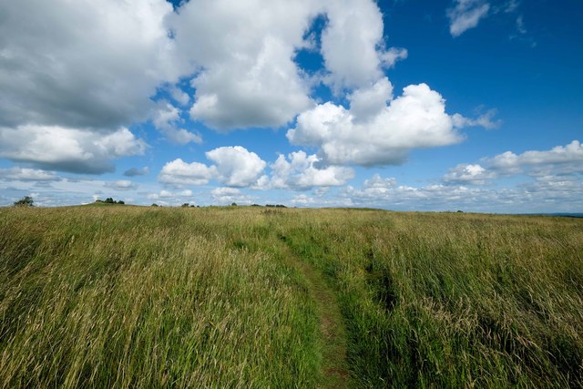
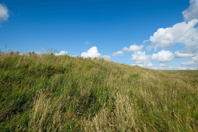
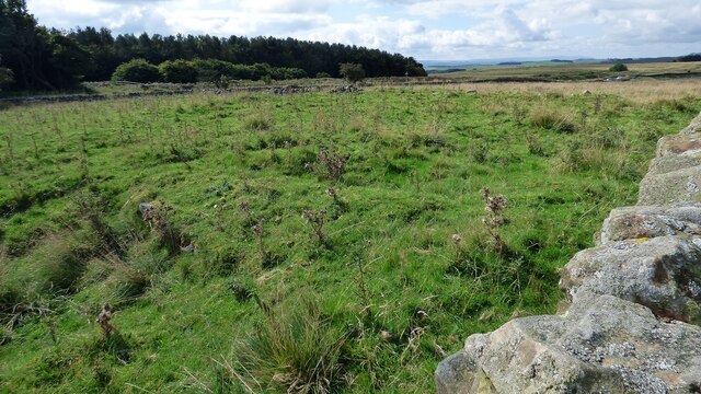
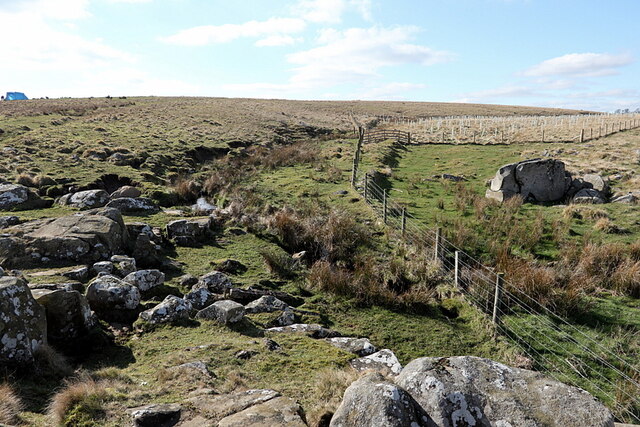
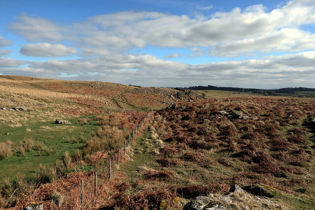
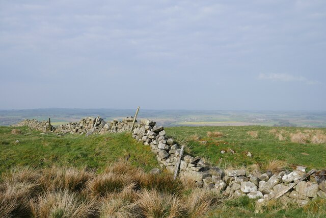
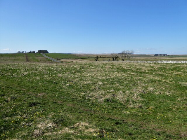
Camps Plantation is a picturesque woodland located in Northumberland, England. Situated in the heart of the county, this enchanting forest covers an area of approximately 100 acres. It is known for its diverse range of native trees and vibrant vegetation, making it a popular destination for nature lovers, hikers, and photographers.

The woodland is predominantly composed of deciduous trees, including oak, birch, and beech, which create a stunning tapestry of colors during the autumn season. In addition to the magnificent trees, Camps Plantation is home to a variety of wildflowers, ferns, and mosses, adding to the overall beauty and biodiversity of the area.

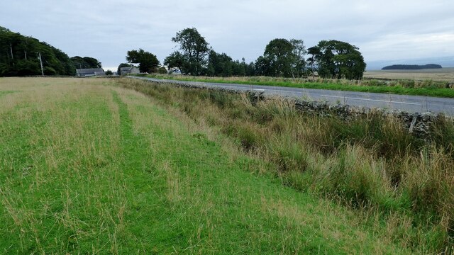
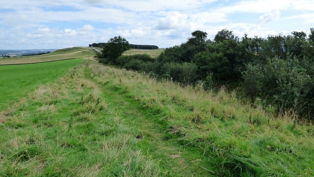
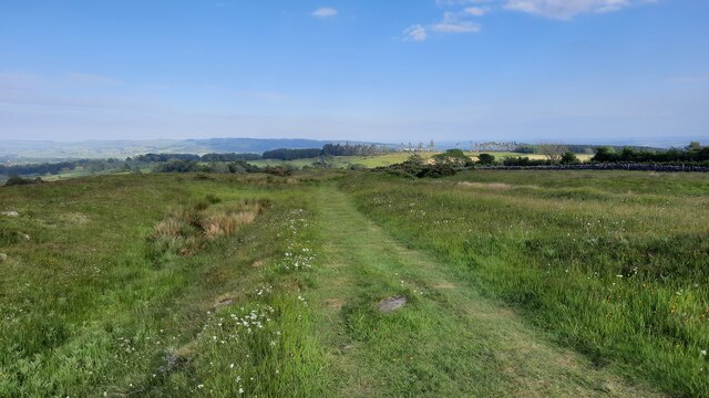
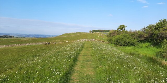
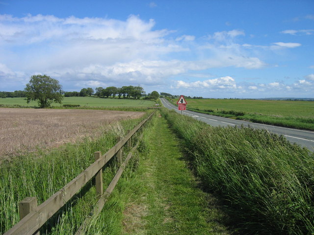
The forest is crisscrossed by well-maintained walking trails that offer visitors the opportunity to explore the woodland at their leisure. These paths wind through the trees, leading to hidden clearings, babbling brooks, and secluded picnic spots. The tranquil atmosphere and the abundance of wildlife make it an ideal location for birdwatchers and animal enthusiasts, with sightings of deer, foxes, and various bird species being common occurrences.

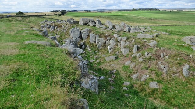
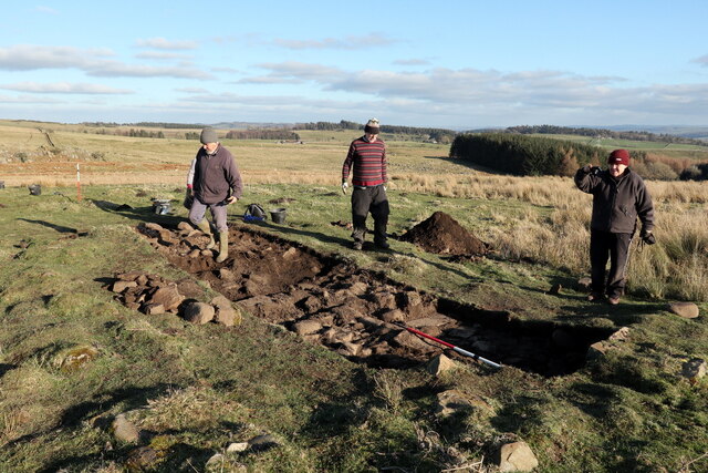
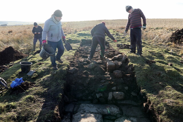
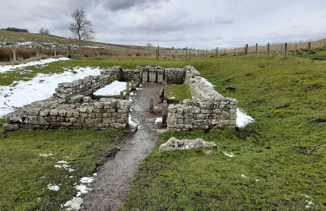
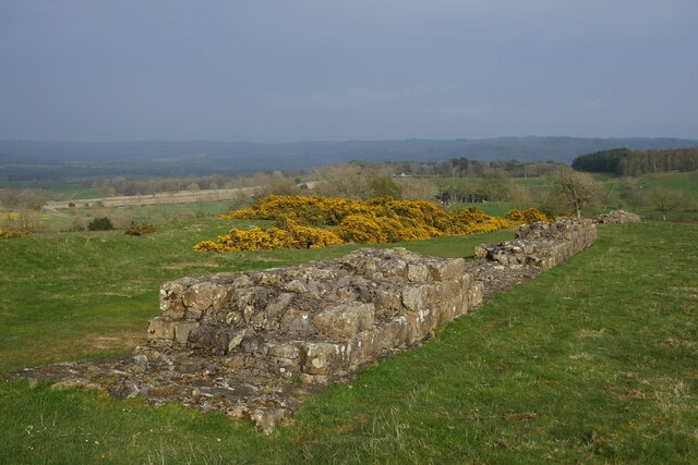
Camps Plantation is not only a haven for nature enthusiasts but also a place of historical significance. The forest has remnants of an old Roman road that once connected the nearby settlements, adding an element of intrigue to the woodland and its surroundings.

Overall, Camps Plantation is a captivating woodland that offers visitors a chance to immerse themselves in the beauty of nature, explore walking trails, and experience the rich history of Northumberland.

If you have any feedback on the listing, please let us know in the comments section below.

Camps Plantation Images

Images are sourced within 2km of 55.031677/-2.2155833 or Grid Reference NY8670. Thanks to Geograph Open Source API. All images are credited.

On Carrawburgh Roman Fort Carrawburgh is one of 16 large forts along Hadrian's Wall. Built for a garrison of 500 soldiers around AD 130, it remained in use until the end of the 4th century.

Wikipedia Carrawburgh <span class="nowrap"><a title="https://en.wikipedia.org/wiki/Carrawburgh" rel="nofollow ugc noopener" href="https://en.wikipedia.org/wiki/Carrawburgh">Link</a><img style="margin-left:2px;" alt="External link" title="External link - shift click to open in new window" src="https://s1.geograph.org.uk/img/external.png" width="10" height="10"/></span>
On Carrawburgh Roman Fort
Carrawburgh is one of 16 large forts along Hadrian's Wall. Built for a garrison of 500 soldiers around AD 130, it remained in use until the end of the 4th century. Wikipedia Carrawburgh LinkExternal link
Carrawburgh, rampart and ditch Carrawburgh is one of 16 large forts along Hadrian's Wall. Built for a garrison of 500 soldiers around AD 130, it remained in use until the end of the 4th century.

Wikipedia Carrawburgh <span class="nowrap"><a title="https://en.wikipedia.org/wiki/Carrawburgh" rel="nofollow ugc noopener" href="https://en.wikipedia.org/wiki/Carrawburgh">Link</a><img style="margin-left:2px;" alt="External link" title="External link - shift click to open in new window" src="https://s1.geograph.org.uk/img/external.png" width="10" height="10"/></span>
Carrawburgh, rampart and ditch
Carrawburgh is one of 16 large forts along Hadrian's Wall. Built for a garrison of 500 soldiers around AD 130, it remained in use until the end of the 4th century. Wikipedia Carrawburgh LinkExternal link
Roman ditch on Hadrian's Wall Along this length, the wall itself is under the public highway.
Roman ditch on Hadrian's Wall
Along this length, the wall itself is under the public highway.
Hadrian's Wall ditch The wall itself lies under the road on the other side of the hedge.
Hadrian's Wall ditch
The wall itself lies under the road on the other side of the hedge.
Hadrian's Wall rock cut ditch The northern defensive ditch was cut through hard dolerite at this point.
Hadrian's Wall rock cut ditch
The northern defensive ditch was cut through hard dolerite at this point.
Milecastle 30 on Hadrian's Wall Hadrian's wall or 'Vallum Aelium' is the remains of a large Roman fortification. The wall extended west from Segedunum at Wallsend on the River Tyne to the shore of the Solway Firth, ending a short but unknown distance west of the village of Bowness-on-Solway. Construction probably started sometime in AD 122 and was largely completed within six years.

The remains were made a UNESCO World Heritage Site in 1987.
Milecastle 30 on Hadrian's Wall
Hadrian's wall or 'Vallum Aelium' is the remains of a large Roman fortification. The wall extended west from Segedunum at Wallsend on the River Tyne to the shore of the Solway Firth, ending a short but unknown distance west of the village of Bowness-on-Solway. Construction probably started sometime in AD 122 and was largely completed within six years. The remains were made a UNESCO World Heritage Site in 1987.
Archaeological excavation of Greyside farmstead 3D model of excavation trench on Sketchfab: <span class="nowrap"><a title="https://skfb.ly/ottxH" rel="nofollow ugc noopener" href="https://skfb.ly/ottxH">Link</a><img style="margin-left:2px;" alt="External link" title="External link - shift click to open in new window" src="https://s1.geograph.org.uk/img/external.png" width="10" height="10"/></span>
Archaeological excavation of Greyside farmstead
3D model of excavation trench on Sketchfab: LinkExternal link
Archaeological excavation of Greyside farmstead
Valley of Meggie's Dene Burn
Hadrian's Wall Path just east of Limestone Corner
Hadrian's Wall Path between Milecastles 30 and 31
The Temple of Mithras The site was excavated in 1949 and statues, altars and wooden posts were cast in concrete, the originals removed to Newcastle Museum of Antiquities.
The Temple of Mithras
The site was excavated in 1949 and statues, altars and wooden posts were cast in concrete, the originals removed to Newcastle Museum of Antiquities.
Someone else's wall, viewed from Hadrian's Wall A drystone wall viewed from the route of Hadrian's Wall, and crossing the northern defensive ditch.
Someone else's wall, viewed from Hadrian's Wall
A drystone wall viewed from the route of Hadrian's Wall, and crossing the northern defensive ditch.
Hadrian's Wall near Limestone Bank Captured in the early evening with a haar setting in over the surrounding countryside.  Gorse provides a vibrant splash of yellow from thickets growing in the defensive ditch.
Hadrian's Wall near Limestone Bank
Captured in the early evening with a haar setting in over the surrounding countryside. Gorse provides a vibrant splash of yellow from thickets growing in the defensive ditch.
Stanley Dalton memorial coping stone The inscription reads: “S.D. – September 11, 1926.” 

The remarkable story of the murder of Stanley Dalton can be found at <span class="nowrap"><a title="https://woolshed1.blogspot.com/2009/06/murder-of-stanley-dalton.html?fbclid=IwAR2n0QHGOoq-tcJppQNU0uN7UtqMxyhN4cUjRwDUcGyiIttgM00-RYZ4FZw" rel="nofollow ugc noopener" href="https://woolshed1.blogspot.com/2009/06/murder-of-stanley-dalton.html?fbclid=IwAR2n0QHGOoq-tcJppQNU0uN7UtqMxyhN4cUjRwDUcGyiIttgM00-RYZ4FZw">Link</a><img style="margin-left:2px;" alt="External link" title="External link - shift click to open in new window" src="https://s1.geograph.org.uk/img/external.png" width="10" height="10"/></span>

The stone is in a sloping drystone wall on the south side of the B6381 at Limestone Bank.
Stanley Dalton memorial coping stone
The inscription reads: “S.D. – September 11, 1926.” The remarkable story of the murder of Stanley Dalton can be found at LinkExternal link The stone is in a sloping drystone wall on the south side of the B6381 at Limestone Bank.
Brocolitia Roman Fort Site Once on top of the hump within the fence, a disappointing view of a flat site
Brocolitia Roman Fort Site
Once on top of the hump within the fence, a disappointing view of a flat site
The line of Hadrians Wall along the B6318 road View from the entrance to Brocolitia car park
The line of Hadrians Wall along the B6318 road
View from the entrance to Brocolitia car park
Show me another place!

Camps Plantation is located at Grid Ref: NY8670 (Lat: 55.031677, Lng: -2.2155833)

Unitary Authority: Northumberland

Police Authority: Northumbria

What 3 Words

///scavenger.universes.infinite. Near Birtley, Northumberland

Nearby Locations

The Bog Camps Plantation

Related Wikis

Carrawburgh

Carrawburgh is a settlement in Northumberland. In Roman times, it was the site of a 3+1⁄2-acre (1.5 ha) auxiliary fort on Hadrian's Wall called Brocolitia...

Milecastle 31

Milecastle 31 (Carrawburgh) was a milecastle of the Roman Hadrian's Wall. Its remains exist as a turf covered platform beside (and partially covered by...

Milecastle 30

Milecastle 30 (Limestone Corner) was a milecastle of the Roman Hadrian's Wall. Its remains exist as an outward-facing scarp with a maximum height of 0...

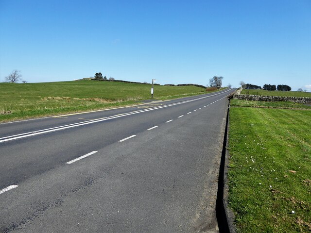
Military Road (Northumberland)

The Military Road is a name given locally to part of the B6318 road in Northumberland, England, which runs from Heddon-on-the-Wall (54.9974°N 1.7929°W...

Related Videos

#Temple of Mithras #Travel #British #HadriansWall

Welcome to my channel. I am a 4 year old vlogger. Please like/follow my facebook page: https://www.facebook.com/BritFil.

Brocolitia Roman fort on #HadriansWall #archaeology

A quick walking tour of the Roman fort and temple of Mithras.

BROCOLITIA Roman Temple of Mithras. Candi yang Ada di #england #uk #travelblogger #fyp #travel

CARRAWBURGH ROMAN FORT & BROCOLITIA Carrawburgh is 1 of 16 Large Roman Forts oh Handrians Wall.

Hadrian's Wall - Black Carts Turret #marathon #views #theconquerorchallenges #beauty

Black Carts Turret, also known as Turret 29A, is part of the defences on Hadrian's Wall. Hadrian's Wall was built by the Romans ...

Nearby Amenities

Located within 500m of 55.031677,-2.2155833
Barrier: kissing_gate
Source: survey;gps
Lat/Long: 55.0338033/-2.2223628
The data included in this document is from www.openstreetmap.org. The data is made available under ODbL.

Have you been to Camps Plantation?

Leave your review of Camps Plantation below (or comments, questions and feedback).