Rockcliffe Wood

Wood, Forest in Lancashire Rossendale

England

Rockcliffe Wood

OS Benchmark locator Newchurch Old Rd Benchmark locator on a stone now used as a step down onto Newchurch Old Road, Bacup.
I assume this would have been located in the wall of the old road originally.
OS Benchmark locator Newchurch Old Rd Credit: Phill

Rockcliffe Wood is a stunning forest located in Lancashire, England. Covering an area of approximately 50 hectares, it is a true natural gem. The wood is situated near the village of Silverdale and is part of the Arnside and Silverdale Area of Outstanding Natural Beauty.

Rockcliffe Wood is characterized by its diverse and rich ecosystem. It is dominated by ancient broadleaf trees, such as oak, ash, and beech, which create a dense canopy that provides shelter for a wide variety of flora and fauna. The forest floor is covered with a lush carpet of bluebells, wild garlic, and ferns, creating a picturesque scene in springtime.

Visitors to Rockcliffe Wood can enjoy a network of well-maintained footpaths that lead them through the forest, allowing for peaceful walks and exploration of its natural wonders. The wood is also home to several species of birds, including pied flycatchers, woodpeckers, and nuthatches, making it a haven for birdwatchers.

The wood's location near the coast adds to its allure, as it offers breathtaking views of Morecambe Bay and the surrounding countryside. The tranquil atmosphere and serene surroundings make Rockcliffe Wood a popular destination for nature enthusiasts, photographers, and those seeking a peaceful escape from the hustle and bustle of everyday life.

Overall, Rockcliffe Wood in Lancashire is a true haven of natural beauty, where visitors can immerse themselves in the wonders of a diverse woodland ecosystem while enjoying stunning views of the surrounding landscapes.

If you have any feedback on the listing, please let us know in the comments section below.

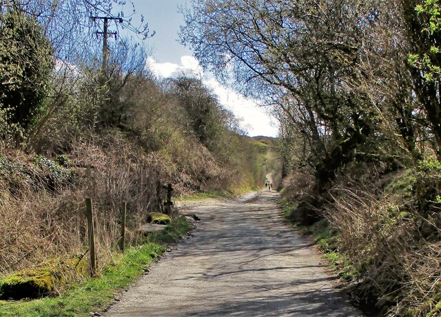
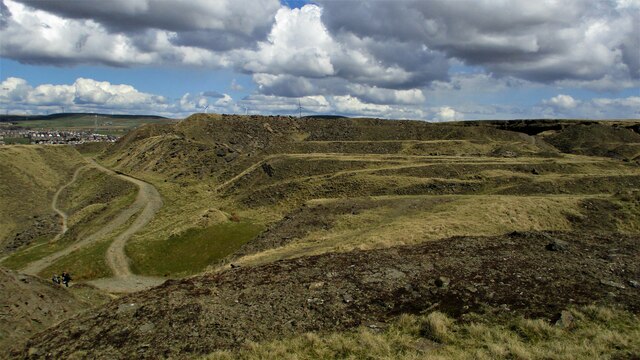
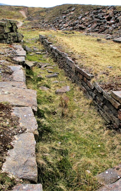
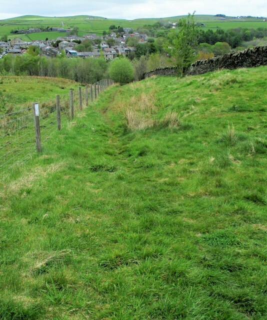
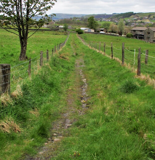
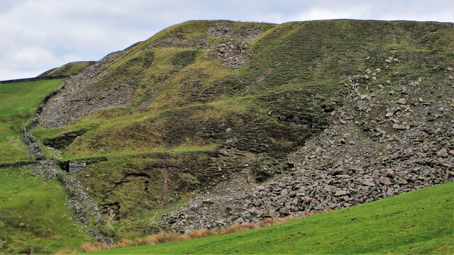
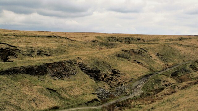
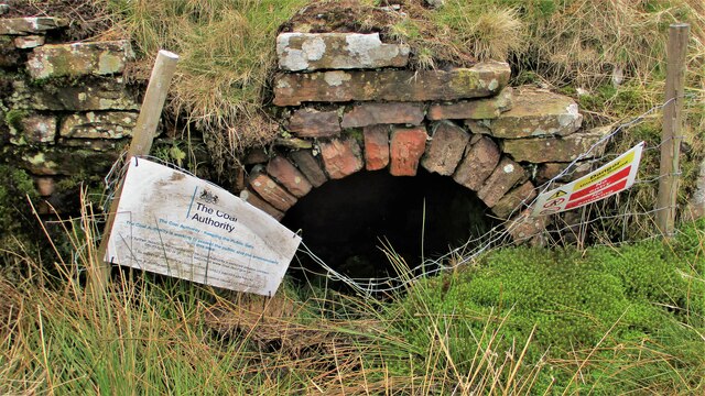
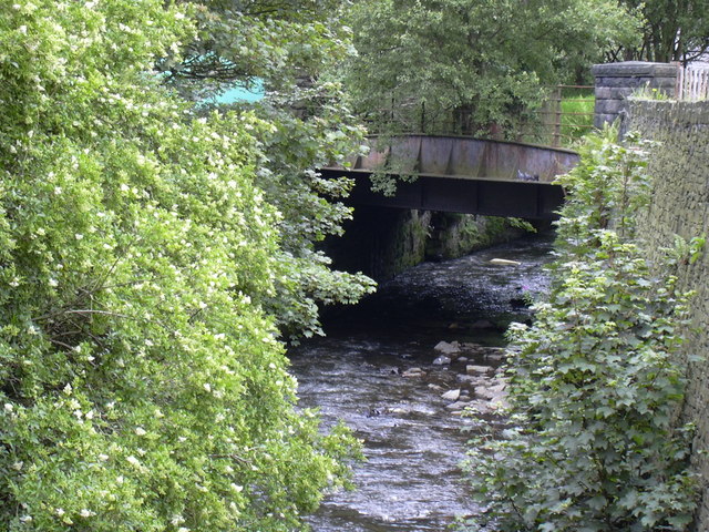
Rockcliffe Wood Images

Images are sourced within 2km of 53.694675/-2.2137284 or Grid Reference SD8522. Thanks to Geograph Open Source API. All images are credited.

OS Benchmark locator Newchurch Old Rd Benchmark locator on a stone now used as a step down onto Newchurch Old Road, Bacup.
I assume this would have been located in the wall of the old road originally.
OS Benchmark locator Newchurch Old Rd
Benchmark locator on a stone now used as a step down onto Newchurch Old Road, Bacup. I assume this would have been located in the wall of the old road originally.
Former Trackbed of Rochdale to Bacup Railway View East from Lee Moor Colliery Incline Bridge along the now cycleway.
Former Trackbed of Rochdale to Bacup Railway
View East from Lee Moor Colliery Incline Bridge along the now cycleway.
Former Trackbed of Rochdale to Bacup Railway View West from Deansgreave Road railway bridge along the former trackbed now a cycleway.
Former Trackbed of Rochdale to Bacup Railway
View West from Deansgreave Road railway bridge along the former trackbed now a cycleway.
Britannia Quarry  - Stripping the Coal Seam Western most workings on Holden Moor where about 20 feet of overlay is removed to reveal a coal seam which appears to run horizontal at this point.
Britannia Quarry - Stripping the Coal Seam
Western most workings on Holden Moor where about 20 feet of overlay is removed to reveal a coal seam which appears to run horizontal at this point.
Former Trackbed of Lee Quarry Tramway Incline View up the incline of about half mile towards Lee Quarry
Former Trackbed of Lee Quarry Tramway Incline
View up the incline of about half mile towards Lee Quarry
Trackbed of former railway heading East out of Lee Quarry A railway following the contour allowed Lee Quarry to link with the Britannia Incline.
Trackbed of former railway heading East out of Lee Quarry
A railway following the contour allowed Lee Quarry to link with the Britannia Incline.
Lee Quarry Eastern Workings The stonework suggests loading platforms for the quarry tramway system
Lee Quarry Eastern Workings
The stonework suggests loading platforms for the quarry tramway system
Former Trackbed of Quarry Railway Incline Land reclamation has obscured the actual trackbed that went steeply down to Siddalls Sidings just East of Stacksteads Station.
Former Trackbed of Quarry Railway Incline
Land reclamation has obscured the actual trackbed that went steeply down to Siddalls Sidings just East of Stacksteads Station.
Former Trackbed of Quarry Railway This section of Siddalls quarry railways ran from Law Head to Greens. Law Head is in the distance in this view.
Former Trackbed of Quarry Railway
This section of Siddalls quarry railways ran from Law Head to Greens. Law Head is in the distance in this view.
Former Railway Routes serving Greens Moor Quarry View across Greens Clough which is filled with quarry spoil but two former trackbeds with stone embankments are apparent.
Former Railway Routes serving Greens Moor Quarry
View across Greens Clough which is filled with quarry spoil but two former trackbeds with stone embankments are apparent.
Former Trackbed of Quarry Railway in Greens Clough Route of Siddalls Quarry railway heading South to Hall Cowm and Back Cowm Quarries plus various mines.
Former Trackbed of Quarry Railway in Greens Clough
Route of Siddalls Quarry railway heading South to Hall Cowm and Back Cowm Quarries plus various mines.
Helm Clough Colliery Remains Coal Authority notices keeping you safe at an entrance
Helm Clough Colliery Remains
Coal Authority notices keeping you safe at an entrance
Former Trackbed of Quarry Railway Route of Siddalls Quarry railway out of Greens Clough and on South to Jacksons Moor
Former Trackbed of Quarry Railway
Route of Siddalls Quarry railway out of Greens Clough and on South to Jacksons Moor
Cyclepath through Newchurch No.2 Tunnel View West on newly laid cyclepath with the blocked Thrutch Tunnel to the left
Cyclepath through Newchurch No.2 Tunnel
View West on newly laid cyclepath with the blocked Thrutch Tunnel to the left
Cyclepath East of Thrutch Tunnel Cyclepath view East along former railway towards Bacup. It is contoured in the hillside above the River Irwell at this point
Cyclepath East of Thrutch Tunnel
Cyclepath view East along former railway towards Bacup. It is contoured in the hillside above the River Irwell at this point
Steps in Railway Cutting near Waterbarn Mill The railway presumably had hillside water drainage problems and needed to climb out of the cutting. Old OS maps have a tank marked about here.
Steps in Railway Cutting near Waterbarn Mill
The railway presumably had hillside water drainage problems and needed to climb out of the cutting. Old OS maps have a tank marked about here.
Vertical Culvert in Railway Cutting This appears to be a drain from the hillside which has required substantial masonry. Near Waterbarn Mills
Vertical Culvert in Railway Cutting
This appears to be a drain from the hillside which has required substantial masonry. Near Waterbarn Mills
Metal Bridge Parapet on Rakehead Lane The railway bridge for Rakehead Lane has been infilled so the cyclepath has to cross the lane on the level
Metal Bridge Parapet on Rakehead Lane
The railway bridge for Rakehead Lane has been infilled so the cyclepath has to cross the lane on the level
Show me another place!

Rockcliffe Wood is located at Grid Ref: SD8522 (Lat: 53.694675, Lng: -2.2137284)

Administrative County: Lancashire

District: Rossendale

Police Authority: Lancashire

What 3 Words

///universal.seagulls.blessing. Near Bacup, Lancashire

Related Wikis

Stacksteads

Stacksteads is a village between the towns of Bacup and Waterfoot within the Rossendale borough of Lancashire, England. The population of this Rossendale...

Bacup railway station

Bacup railway station served the town of Bacup, Rossendale, Lancashire, England, from 1852 until closure in 1966 and was the terminus of two lines; one...

Stacksteads railway station

Stacksteads railway station served Stacksteads near Bacup, Rossendale, Lancashire, England from 1852 until the line closed in 1966. The station was just...

Lee Quarry

Lee Quarry is a mountain bike trail located near Bacup and Stacksteads in Rossendale Valley, Lancashire. Originally a working quarry, the quarry alongside...

Nearby Amenities

Located within 500m of 53.694675,-2.2137284
Mini Roundabout
Direction: clockwise
Lat/Long: 53.69284/-2.2205967
Crossing
Crossing: zebra
Crossing Island: no
Tactile Paving: yes
Lat/Long: 53.692881/-2.2202211
Crossing
Crossing: zebra
Crossing Island: no
Kerb: lowered
Tactile Paving: yes
Lat/Long: 53.6927333/-2.2164613
Barrier: bollard
Bicycle: yes
Foot: yes
Horse: yes
Motor Vehicle: no
Lat/Long: 53.6931136/-2.2159685
Barrier: bollard
Bicycle: yes
Foot: yes
Horse: yes
Motor Vehicle: no
Lat/Long: 53.6938001/-2.2145602
Bicycle Parking
Lat/Long: 53.6933876/-2.2070935
NT Autocare
Shop: car_repair
Lat/Long: 53.6922477/-2.2195116
The data included in this document is from www.openstreetmap.org. The data is made available under ODbL.

Have you been to Rockcliffe Wood?

Leave your review of Rockcliffe Wood below (or comments, questions and feedback).