Caroline's Clump

Wood, Forest in Gloucestershire Stroud

England

Caroline's Clump

Farmland This lane runs between the A46 and Chavenage house. The hay has been harvested and is lying ready to be collected. This part of the Cotswolds is exposed and this road is one of the windiest. Historic maps show a windmill nearby.
Farmland Credit: Peter Kwan

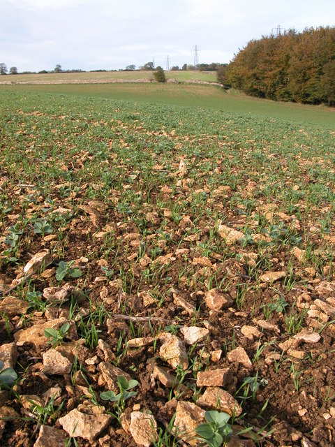
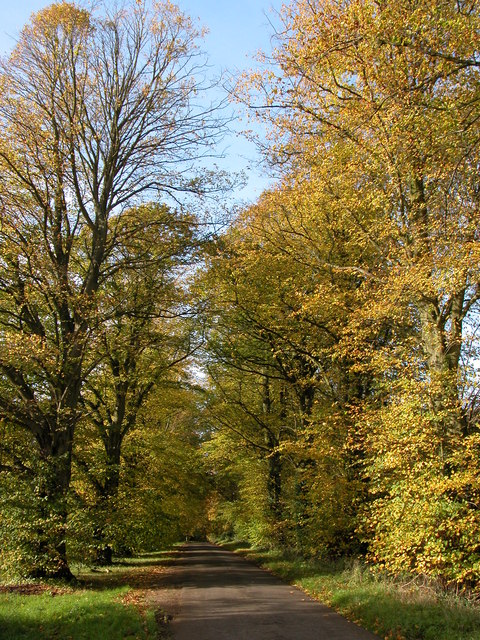
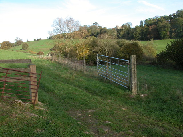
Caroline's Clump is a picturesque woodland located in Gloucestershire, England. Nestled within the heart of the Forest of Dean, this enchanting area covers approximately 10 acres and is a haven for nature lovers and outdoor enthusiasts alike.

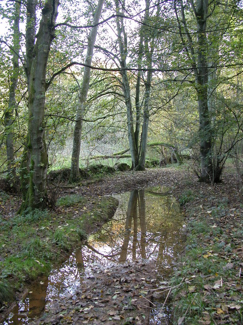
The woodland is named after Caroline, a former local resident who had a deep affection for the forest and its natural beauty. Caroline's Clump is predominantly made up of ancient oak and beech trees, creating a dense and captivating canopy that provides shelter and habitat for a variety of wildlife.

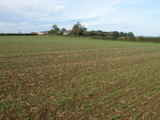
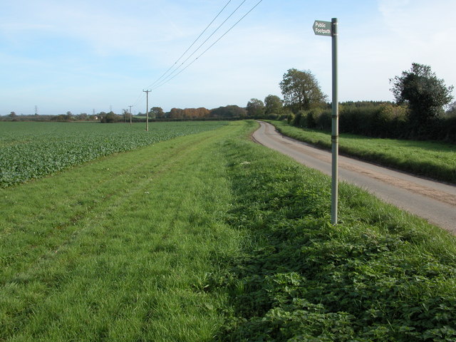
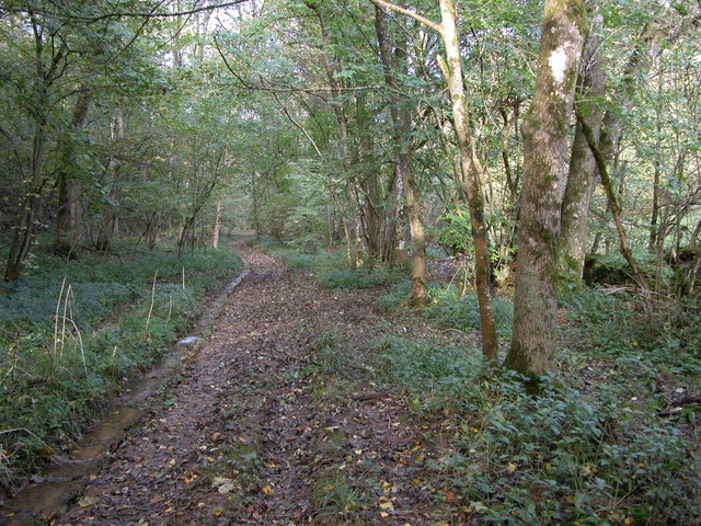
Visitors to Caroline's Clump can expect to find a well-maintained network of walking trails that wind through the woodland, allowing for peaceful strolls and opportunities to immerse oneself in the serene surroundings. The paths are suitable for all levels of fitness and are often adorned with wildflowers during the spring and summer months.

Birdwatchers will find themselves in paradise, as the clump is home to an array of species, including woodpeckers, nuthatches, and tawny owls. With a bit of luck and patience, visitors may even catch a glimpse of elusive creatures such as deer or foxes that call the woodland home.

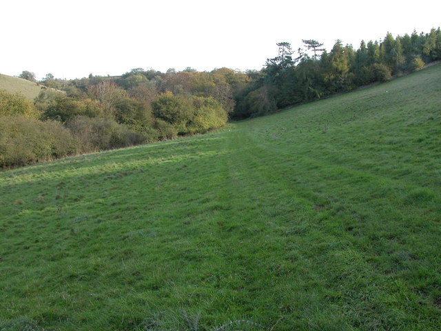
Caroline's Clump offers a tranquil escape from the hustle and bustle of everyday life. It is a place to connect with nature, breathe in the fresh forest air, and appreciate the beauty of Gloucestershire's woodlands. Whether visiting for a leisurely walk, wildlife spotting, or simply to find solace in nature, Caroline's Clump is a must-visit destination for anyone seeking a peaceful retreat in the heart of the Forest of Dean.

If you have any feedback on the listing, please let us know in the comments section below.

Caroline's Clump Images

Images are sourced within 2km of 51.667554/-2.20617 or Grid Reference ST8596. Thanks to Geograph Open Source API. All images are credited.

Farmland This lane runs between the A46 and Chavenage house. The hay has been harvested and is lying ready to be collected. This part of the Cotswolds is exposed and this road is one of the windiest. Historic maps show a windmill nearby.
Farmland
This lane runs between the A46 and Chavenage house. The hay has been harvested and is lying ready to be collected. This part of the Cotswolds is exposed and this road is one of the windiest. Historic maps show a windmill nearby.
Cranmore Covert Neatly ploughed and harrowed fields occupy most of the square between the A46 and Cranmore Covert - the stand of trees seen to the right of the picture.
Cranmore Covert
Neatly ploughed and harrowed fields occupy most of the square between the A46 and Cranmore Covert - the stand of trees seen to the right of the picture.
Tipputs Inn, Tiltups End Tipputs Inn is situated on the A46.
Tipputs Inn, Tiltups End
Tipputs Inn is situated on the A46.
Cattle grazing near Upper Barton End Farmland to the east of Upper Barton End.
Cattle grazing near Upper Barton End
Farmland to the east of Upper Barton End.
Dry stone wall and bridleway to Tiltups End The bridleway to Tiltups End follows to the right of this wall.
Dry stone wall and bridleway to Tiltups End
The bridleway to Tiltups End follows to the right of this wall.
Stony ground near Cranmore Covert Ploughed fields on the Cotswolds can be extremely stony as can be seen here, pieces of oolitic limestone limit the crop. This is a winter cereal crop with broad bean from the previous crop germinating among the cereal.
Stony ground near Cranmore Covert
Ploughed fields on the Cotswolds can be extremely stony as can be seen here, pieces of oolitic limestone limit the crop. This is a winter cereal crop with broad bean from the previous crop germinating among the cereal.
Cranmore Cottages and Cranmore Dairy Cranmore Cottages and to the left Cranmore Dairy viewed from the footpath as is crosses the field to the south-east.
Cranmore Cottages and Cranmore Dairy
Cranmore Cottages and to the left Cranmore Dairy viewed from the footpath as is crosses the field to the south-east.
Road to Chavenage Green Viewed from near Cranmore Cottages.
Road to Chavenage Green
Viewed from near Cranmore Cottages.
Chavenage House Chavenage House is a privately owned Cotswold manor house which is open to the public through the summer months. See: <span class="nowrap"><a title="http://www.hha.org.uk/Property/373/Chavenage-House#opening" rel="nofollow ugc noopener" href="http://www.hha.org.uk/Property/373/Chavenage-House#opening">Link</a><img style="margin-left:2px;" alt="External link" title="External link - shift click to open in new window" src="https://s1.geograph.org.uk/img/external.png" width="10" height="10"/></span>

The house has been used for a number of film and TV productions including the 2015 BBC remake of 'Poldark' when it was the setting for Trenwith.  It was also featured in Nick Crane's 'Great British Journeys'.  Additional text added March 2015.
Chavenage House
Chavenage House is a privately owned Cotswold manor house which is open to the public through the summer months. See: LinkExternal link The house has been used for a number of film and TV productions including the 2015 BBC remake of 'Poldark' when it was the setting for Trenwith. It was also featured in Nick Crane's 'Great British Journeys'. Additional text added March 2015.
Autumn colours at Chavenage Green Avenue of trees (Lime I think) on the road through Chavenage Green.
Autumn colours at Chavenage Green
Avenue of trees (Lime I think) on the road through Chavenage Green.
Longtree Bottom Track through the wooded valley of Longtree Bottom.
Longtree Bottom
Track through the wooded valley of Longtree Bottom.
Ledgemore Bottom A footpath crossing a field in a Cotswold valley near Ledgemore Pond.
Ledgemore Bottom
A footpath crossing a field in a Cotswold valley near Ledgemore Pond.
Vale Farm, Avening Afternoon autumn sun lights Vale Farm which is located in a valley to the west of the village of Avening.
Vale Farm, Avening
Afternoon autumn sun lights Vale Farm which is located in a valley to the west of the village of Avening.
Larch Covert viewed from Ledgemore Bottom Larch Covert can be seen beyond the field on the opposite side of the valley. Viewed here from the footpath passing along Ledgemore Bottom.
Larch Covert viewed from Ledgemore Bottom
Larch Covert can be seen beyond the field on the opposite side of the valley. Viewed here from the footpath passing along Ledgemore Bottom.
Cattle feeder beside Broad Newell Covert The 1940s OS map indicates the footpath passing through here follows the route of a Roman road, though this is not shown on the current map.
Cattle feeder beside Broad Newell Covert
The 1940s OS map indicates the footpath passing through here follows the route of a Roman road, though this is not shown on the current map.
Sheep grazing in a field by Shiptons Grave Lane A footpath crosses diagonally across this field to Shiptons Grave Lane. A salt lick for the sheep can be seen to the right of the electric fence post in the foreground.
Sheep grazing in a field by Shiptons Grave Lane
A footpath crosses diagonally across this field to Shiptons Grave Lane. A salt lick for the sheep can be seen to the right of the electric fence post in the foreground.
Upper Barton End Cotswold stone built houses at Barton End.
Upper Barton End
Cotswold stone built houses at Barton End.
Longtree Bottom After rain this wooded valley can be very wet.
Longtree Bottom
After rain this wooded valley can be very wet.
Show me another place!

Caroline's Clump is located at Grid Ref: ST8596 (Lat: 51.667554, Lng: -2.20617)

Administrative County: Gloucestershire

District: Stroud

Police Authority: Gloucestershire

What 3 Words

///universal.simulations.cares. Near Avening, Gloucestershire

Related Wikis

Barton End

Barton End is a village just south of Nailsworth, Gloucestershire, England.

Chavenage House

Chavenage House, Beverston, Gloucestershire is a country house dating from the late 16th century. The house was built in 1576 and is constructed of Cotswold...

Calcot Manor

Calcot Manor is a historic building in Calcot, three and a half miles west of Tetbury on A 4135 in Gloucestershire, England, near the junction of roads...

Horsley, Gloucestershire

Horsley is a village and civil parish about one and a half miles south-west of the small Cotswold market town of Nailsworth. The origins of the name Horsley...

Horsley Priory

Horsley Priory was a medieval, monastic house in Gloucestershire, England. Goda owned an estate at Horsley, in 1066. It was granted to Troarn Abbey by...

St Mary's Church, Beverston

The Church of Saint Mary the Virgin is the parish church of Beverston, Gloucestershire, England, and a Grade II* listed building. The church is of Norman...

Church of the Holy Cross, Avening

The Anglican Church of the Holy Cross at Avening in the Cotswold District of Gloucestershire, England was built in late 11th century. It is a grade I listed...

Beverston Castle

Beverston Castle, also known as Beverstone Castle or Tetbury Castle, was constructed as a medieval stone fortress in the village of Beverston, Gloucestershire...

Nearby Amenities

Located within 500m of 51.667554,-2.20617
Power: pole
Lat/Long: 51.6673451/-2.2127607
Power: pole
Lat/Long: 51.6665449/-2.2094589
Power: pole
Lat/Long: 51.6661673/-2.2077423
Power: pole
Lat/Long: 51.6658246/-2.2064012
Power: pole
Lat/Long: 51.6654686/-2.2048616
Power: pole
Lat/Long: 51.6650926/-2.2032899
Power: pole
Lat/Long: 51.6647432/-2.2018683
The data included in this document is from www.openstreetmap.org. The data is made available under ODbL.

Have you been to Caroline's Clump?

Leave your review of Caroline's Clump below (or comments, questions and feedback).