Cranmore Covert

Wood, Forest in Gloucestershire Stroud

England

Cranmore Covert

Lane to Hazlecote Farm Lanes without fences are unusual around here. You can see a red car heading down the A46 which runs across the back of these fields. There is a fine display of wild poppies along the edge of the crops.
Lane to Hazlecote Farm Credit: Peter Kwan

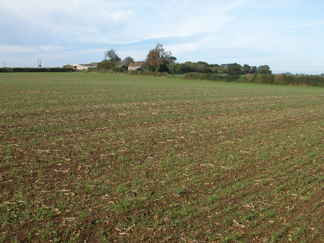
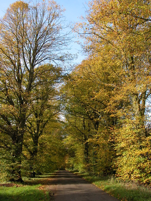
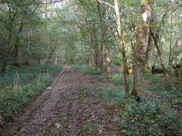
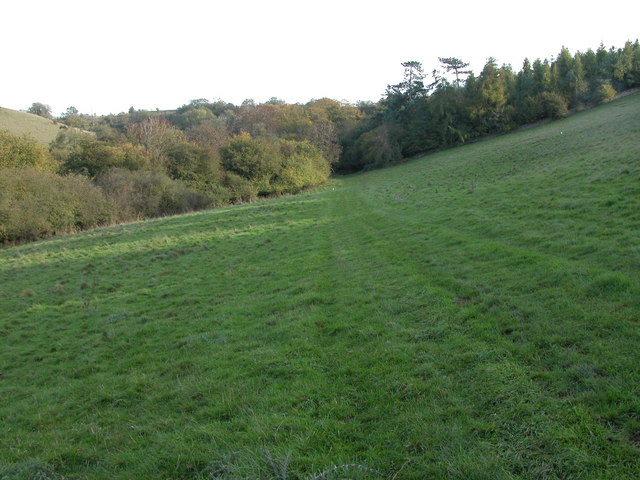
Cranmore Covert is a picturesque woodland area located in Gloucestershire, England. Situated in the heart of the Forest of Dean, this enchanting woodland covers an area of approximately 200 acres. It is a haven for nature lovers and outdoor enthusiasts, offering a tranquil escape from the hustle and bustle of city life.

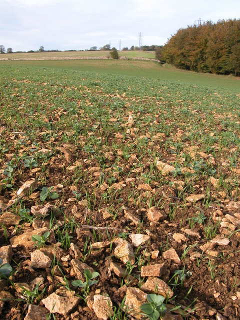
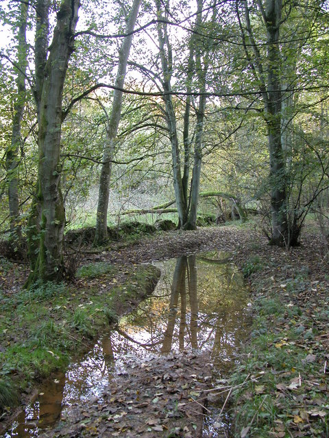
The woodland is predominantly made up of ancient oak trees, which provide a stunning backdrop throughout the year. The forest floor is adorned with an array of wildflowers, creating a vibrant and colorful landscape during the spring and summer months.

Cranmore Covert is home to a diverse range of wildlife, including deer, badgers, and a variety of bird species. Nature enthusiasts will also be delighted to find rare plants and fungi thriving within the woodland, making it a popular spot for botanists and mycologists.

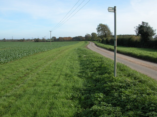
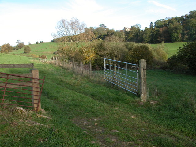
Visitors can explore the woodland through a network of well-maintained footpaths and trails, allowing them to fully immerse themselves in the natural beauty of the area. There are also several picnic areas scattered throughout the woodland, providing the perfect spot for a leisurely lunch or a peaceful break.

Cranmore Covert is a popular destination for outdoor activities such as hiking, cycling, and wildlife spotting. The tranquil atmosphere and stunning scenery make it an ideal location for those seeking a peaceful escape in the heart of nature.

If you have any feedback on the listing, please let us know in the comments section below.

Cranmore Covert Images

Images are sourced within 2km of 51.665225/-2.2159623 or Grid Reference ST8596. Thanks to Geograph Open Source API. All images are credited.

Lane to Hazlecote Farm Lanes without fences are unusual around here. You can see a red car heading down the A46 which runs across the back of these fields. There is a fine display of wild poppies along the edge of the crops.
Lane to Hazlecote Farm
Lanes without fences are unusual around here. You can see a red car heading down the A46 which runs across the back of these fields. There is a fine display of wild poppies along the edge of the crops.
Farmland This lane runs between the A46 and Chavenage house. The hay has been harvested and is lying ready to be collected. This part of the Cotswolds is exposed and this road is one of the windiest. Historic maps show a windmill nearby.
Farmland
This lane runs between the A46 and Chavenage house. The hay has been harvested and is lying ready to be collected. This part of the Cotswolds is exposed and this road is one of the windiest. Historic maps show a windmill nearby.
Cranmore Covert Neatly ploughed and harrowed fields occupy most of the square between the A46 and Cranmore Covert - the stand of trees seen to the right of the picture.
Cranmore Covert
Neatly ploughed and harrowed fields occupy most of the square between the A46 and Cranmore Covert - the stand of trees seen to the right of the picture.
Hartley Bridge A view looking down on the wooded valley where Hartley bridge crosses a small spring fed stream, and many beautiful houses lay hidden amongst the trees. Horsley wood is behind.
Hartley Bridge
A view looking down on the wooded valley where Hartley bridge crosses a small spring fed stream, and many beautiful houses lay hidden amongst the trees. Horsley wood is behind.
Tipputs Inn, Tiltups End Tipputs Inn is situated on the A46.
Tipputs Inn, Tiltups End
Tipputs Inn is situated on the A46.
Cattle grazing near Upper Barton End Farmland to the east of Upper Barton End.
Cattle grazing near Upper Barton End
Farmland to the east of Upper Barton End.
Dry stone wall and bridleway to Tiltups End The bridleway to Tiltups End follows to the right of this wall.
Dry stone wall and bridleway to Tiltups End
The bridleway to Tiltups End follows to the right of this wall.
Stony ground near Cranmore Covert Ploughed fields on the Cotswolds can be extremely stony as can be seen here, pieces of oolitic limestone limit the crop. This is a winter cereal crop with broad bean from the previous crop germinating among the cereal.
Stony ground near Cranmore Covert
Ploughed fields on the Cotswolds can be extremely stony as can be seen here, pieces of oolitic limestone limit the crop. This is a winter cereal crop with broad bean from the previous crop germinating among the cereal.
Cranmore Cottages and Cranmore Dairy Cranmore Cottages and to the left Cranmore Dairy viewed from the footpath as is crosses the field to the south-east.
Cranmore Cottages and Cranmore Dairy
Cranmore Cottages and to the left Cranmore Dairy viewed from the footpath as is crosses the field to the south-east.
Road to Chavenage Green Viewed from near Cranmore Cottages.
Road to Chavenage Green
Viewed from near Cranmore Cottages.
Autumn colours at Chavenage Green Avenue of trees (Lime I think) on the road through Chavenage Green.
Autumn colours at Chavenage Green
Avenue of trees (Lime I think) on the road through Chavenage Green.
Longtree Bottom Track through the wooded valley of Longtree Bottom.
Longtree Bottom
Track through the wooded valley of Longtree Bottom.
Ledgemore Bottom A footpath crossing a field in a Cotswold valley near Ledgemore Pond.
Ledgemore Bottom
A footpath crossing a field in a Cotswold valley near Ledgemore Pond.
Larch Covert viewed from Ledgemore Bottom Larch Covert can be seen beyond the field on the opposite side of the valley. Viewed here from the footpath passing along Ledgemore Bottom.
Larch Covert viewed from Ledgemore Bottom
Larch Covert can be seen beyond the field on the opposite side of the valley. Viewed here from the footpath passing along Ledgemore Bottom.
Cattle feeder beside Broad Newell Covert The 1940s OS map indicates the footpath passing through here follows the route of a Roman road, though this is not shown on the current map.
Cattle feeder beside Broad Newell Covert
The 1940s OS map indicates the footpath passing through here follows the route of a Roman road, though this is not shown on the current map.
Sheep grazing in a field by Shiptons Grave Lane A footpath crosses diagonally across this field to Shiptons Grave Lane. A salt lick for the sheep can be seen to the right of the electric fence post in the foreground.
Sheep grazing in a field by Shiptons Grave Lane
A footpath crosses diagonally across this field to Shiptons Grave Lane. A salt lick for the sheep can be seen to the right of the electric fence post in the foreground.
Upper Barton End Cotswold stone built houses at Barton End.
Upper Barton End
Cotswold stone built houses at Barton End.
Longtree Bottom After rain this wooded valley can be very wet.
Longtree Bottom
After rain this wooded valley can be very wet.
Show me another place!

Cranmore Covert is located at Grid Ref: ST8596 (Lat: 51.665225, Lng: -2.2159623)

Administrative County: Gloucestershire

District: Stroud

Police Authority: Gloucestershire

What 3 Words

///flick.signal.royally. Near Nailsworth, Gloucestershire

Related Wikis

Barton End

Barton End is a village just south of Nailsworth, Gloucestershire, England.

Calcot Manor

Calcot Manor is a historic building in Calcot, three and a half miles west of Tetbury on A 4135 in Gloucestershire, England, near the junction of roads...

RAF Babdown Farm

Royal Air Force Babdown Farm or more simply RAF Babdown Farm is a former Royal Air Force relief landing ground located 2.9 miles (4.7 km) west of Tetbury...

Kingscote and Horsley Woods

Kingscote and Horsley Woods (grid reference ST831971) is a 43.79-hectare (108.2-acre) biological Site of Special Scientific Interest in Gloucestershire...

Horsley Priory

Horsley Priory was a medieval, monastic house in Gloucestershire, England. Goda owned an estate at Horsley, in 1066. It was granted to Troarn Abbey by...

Horsley, Gloucestershire

Horsley is a village and civil parish about one and a half miles south-west of the small Cotswold market town of Nailsworth. The origins of the name Horsley...

Chavenage House

Chavenage House, Beverston, Gloucestershire is a country house dating from the late 16th century. The house was built in 1576 and is constructed of Cotswold...

St Mary's Church, Beverston

The Church of Saint Mary the Virgin is the parish church of Beverston, Gloucestershire, England, and a Grade II* listed building. The church is of Norman...

Nearby Amenities

Located within 500m of 51.665225,-2.2159623
Power: pole
Lat/Long: 51.6692/-2.2184846
Power: pole
Lat/Long: 51.6686693/-2.2169584
Power: pole
Lat/Long: 51.6677643/-2.2145203
Power: pole
Lat/Long: 51.6673451/-2.2127607
Power: pole
Lat/Long: 51.6665449/-2.2094589
The data included in this document is from www.openstreetmap.org. The data is made available under ODbL.

Have you been to Cranmore Covert?

Leave your review of Cranmore Covert below (or comments, questions and feedback).