The Million

Wood, Forest in Staffordshire South Staffordshire

England

The Million

Enville windmill The tower mill on the edge of Enville Common built in 1800-1801 remained in use until 1870. The mill had four sails, boat cap and fantail. Little remains inside the shell except for sections of the turning ring for the boat cap. 

See <span class="nowrap"><a title="http://www.search.staffspasttrack.org.uk/engine/resource/default.asp?resource=11298" rel="nofollow ugc noopener" href="http://www.search.staffspasttrack.org.uk/engine/resource/default.asp?resource=11298">Link</a><img style="margin-left:2px;" alt="External link" title="External link - shift click to open in new window" src="https://s1.geograph.org.uk/img/external.png" width="10" height="10"/></span>
Enville windmill Credit: John M

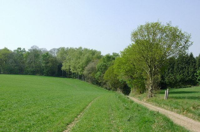
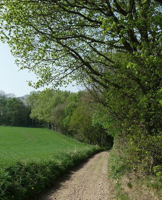
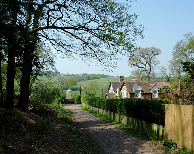
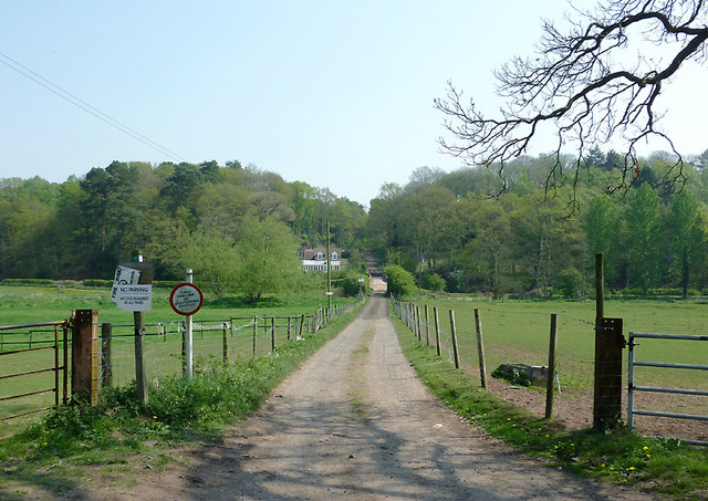
The Million, Staffordshire, also known as the Staffordshire Wood or Forest, is a picturesque woodland located in the county of Staffordshire, England. Spanning an area of approximately 1 million square meters, the forest is a popular destination for nature enthusiasts, hikers, and wildlife enthusiasts.

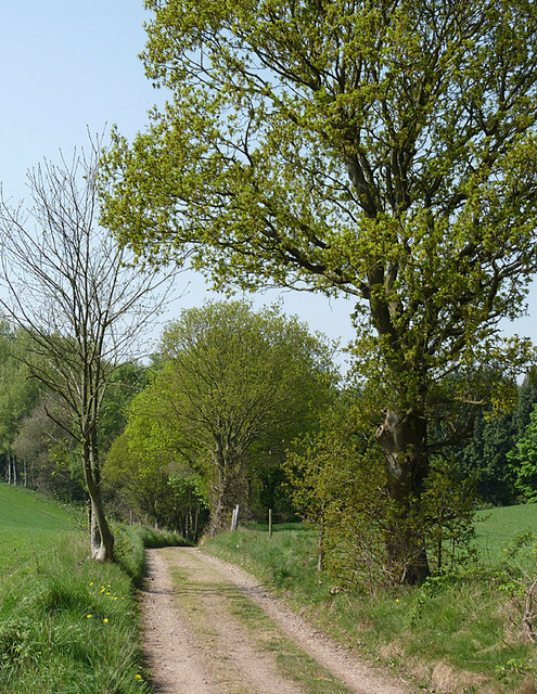
The Million is characterized by its dense, lush vegetation, consisting of a variety of tree species such as oak, beech, and birch. The forest floor is carpeted with a rich assortment of ferns, mosses, and wildflowers, adding to its natural beauty. The diverse ecosystem supports a wide range of wildlife, including deer, foxes, badgers, and numerous bird species.

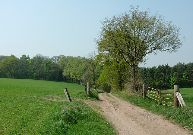
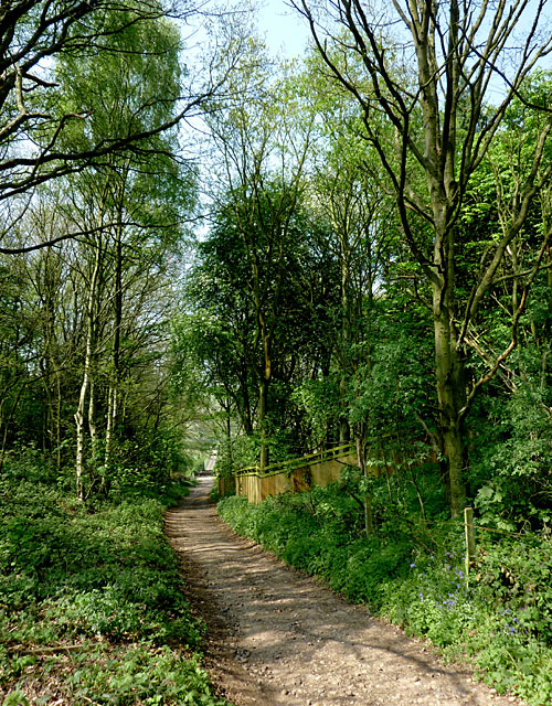
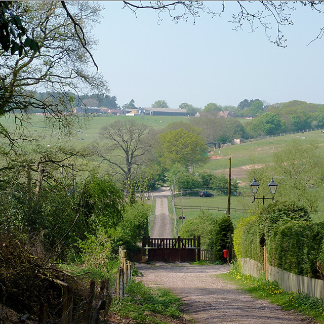
The woodland offers a network of well-maintained footpaths and trails, allowing visitors to explore the area at their own pace. These paths lead to scenic viewpoints, tranquil ponds, and hidden clearings, providing ample opportunities for relaxation and contemplation amidst nature.

The Million holds historical significance as well, with remnants of ancient settlements and burial mounds dating back to the Bronze Age. Visitors can immerse themselves in the rich cultural heritage of the area and learn about the ancient civilizations that once inhabited the forest.

Whether it's a leisurely stroll, a bird-watching expedition, or a peaceful picnic, The Million, Staffordshire promises a tranquil and enchanting experience for all who venture into its verdant depths. With its natural beauty and historical importance, it attracts visitors from near and far, providing a haven for those seeking solace in the embrace of nature.

If you have any feedback on the listing, please let us know in the comments section below.
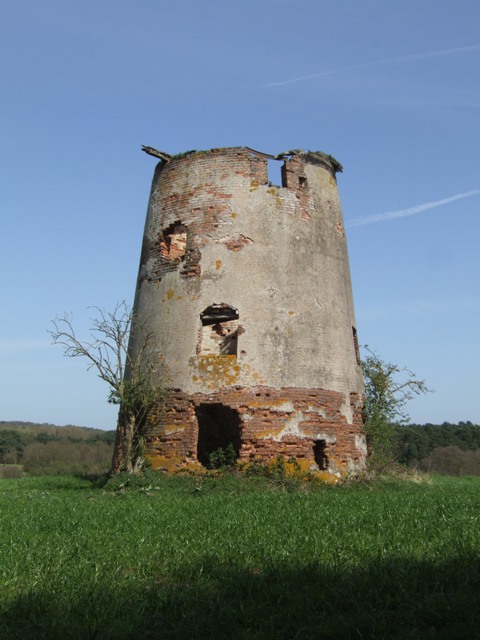
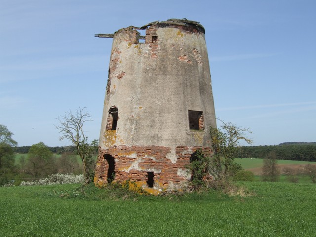
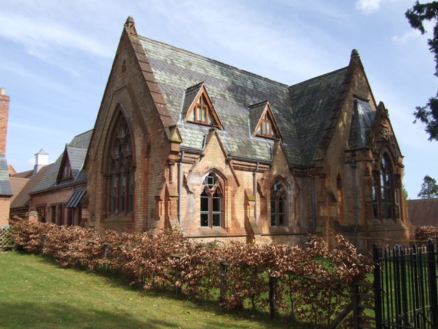
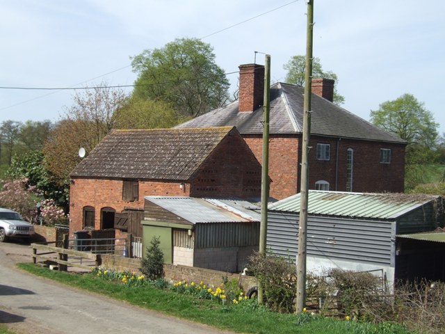
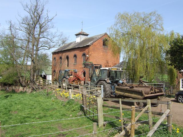
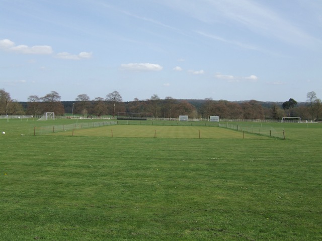
The Million Images

Images are sourced within 2km of 52.480941/-2.230791 or Grid Reference SO8487. Thanks to Geograph Open Source API. All images are credited.

Enville windmill The tower mill on the edge of Enville Common built in 1800-1801 remained in use until 1870. The mill had four sails, boat cap and fantail. Little remains inside the shell except for sections of the turning ring for the boat cap. 

See <span class="nowrap"><a title="http://www.search.staffspasttrack.org.uk/engine/resource/default.asp?resource=11298" rel="nofollow ugc noopener" href="http://www.search.staffspasttrack.org.uk/engine/resource/default.asp?resource=11298">Link</a><img style="margin-left:2px;" alt="External link" title="External link - shift click to open in new window" src="https://s1.geograph.org.uk/img/external.png" width="10" height="10"/></span>
Enville windmill
The tower mill on the edge of Enville Common built in 1800-1801 remained in use until 1870. The mill had four sails, boat cap and fantail. Little remains inside the shell except for sections of the turning ring for the boat cap. See LinkExternal link
Enville windmill The tower mill on the edge of Enville Common built in 1800-1801 remained in use until 1870. The mill had four sails, boat cap and fantail. Little remains inside the shell except for sections of the turning ring for the boat cap. 

<span class="nowrap"><a title="http://www.search.staffspasttrack.org.uk/engine/resource/default.asp?resource=11298" rel="nofollow ugc noopener" href="http://www.search.staffspasttrack.org.uk/engine/resource/default.asp?resource=11298">Link</a><img style="margin-left:2px;" alt="External link" title="External link - shift click to open in new window" src="https://s1.geograph.org.uk/img/external.png" width="10" height="10"/></span>
Enville windmill
The tower mill on the edge of Enville Common built in 1800-1801 remained in use until 1870. The mill had four sails, boat cap and fantail. Little remains inside the shell except for sections of the turning ring for the boat cap. LinkExternal link
Former Enville School School in the estate village erected by the Countess of Stamford and Warrington in the 1860s.
Former Enville School
School in the estate village erected by the Countess of Stamford and Warrington in the 1860s.
Mill farm Estate farm in Mill Lane.
Mill farm
Estate farm in Mill Lane.
Spittlebrook Mill Estate property on the Enville Estate.
Spittlebrook Mill
Estate property on the Enville Estate.
Enville Cricket Club In the grounds of Enville Hall.
Enville Cricket Club
In the grounds of Enville Hall.
Staffordshire and Worcestershire Canal near Prestwood, Staffordshire Seen from the bridleway crossing Prestwood Bridge (No 34). The canal was opened in 1772, engineered by James Brindley. It joins the River Severn at Stourport to the Trent and Mersey Canal at Great Haywood Junction in Staffordshire. There are 43 locks (45 if you don't fancy the deep wide locks at Stourport) and the canal is 46 miles in length.
Staffordshire and Worcestershire Canal near Prestwood, Staffordshire
Seen from the bridleway crossing Prestwood Bridge (No 34). The canal was opened in 1772, engineered by James Brindley. It joins the River Severn at Stourport to the Trent and Mersey Canal at Great Haywood Junction in Staffordshire. There are 43 locks (45 if you don't fancy the deep wide locks at Stourport) and the canal is 46 miles in length.
Bridleway north of Stourton, Staffordshire The bridleway links Wolverhampton Road (A449) at Prestwood with Greensforge Lane and Gothersley Farm, then on to The Million plantation and Enville. The woodland ahead is on the slope down to the Smestow River, east of the canal. To the right of the bridleway there is Gothersley Rough, and to the left, Colbourn's Rough.
Bridleway north of Stourton, Staffordshire
The bridleway links Wolverhampton Road (A449) at Prestwood with Greensforge Lane and Gothersley Farm, then on to The Million plantation and Enville. The woodland ahead is on the slope down to the Smestow River, east of the canal. To the right of the bridleway there is Gothersley Rough, and to the left, Colbourn's Rough.
Bridleway north of Stourton, Staffordshire The bridleway links Wolverhampton Road (A449) at Prestwood with Greensforge Lane, Gothersley Farm and The Million. The woodland ahead is on the slope down to the canal and the Smestow River. To the right of the bridleway there is Gothersley Rough, and to the left, Colbourn's Rough.
Bridleway north of Stourton, Staffordshire
The bridleway links Wolverhampton Road (A449) at Prestwood with Greensforge Lane, Gothersley Farm and The Million. The woodland ahead is on the slope down to the canal and the Smestow River. To the right of the bridleway there is Gothersley Rough, and to the left, Colbourn's Rough.
Arable land north of Stourton, Staffordshire A bridleway crosses these fields, linking Wolverhampton Road (A449) at Prestwood with Greensforge Lane, Gothersley Farm and The Million. The woodland ahead is on the slope down to the Smestow River. To the right of the bridleway there is Gothersley Rough, and to the left, Colbourn's Rough.
Arable land north of Stourton, Staffordshire
A bridleway crosses these fields, linking Wolverhampton Road (A449) at Prestwood with Greensforge Lane, Gothersley Farm and The Million. The woodland ahead is on the slope down to the Smestow River. To the right of the bridleway there is Gothersley Rough, and to the left, Colbourn's Rough.
Bridleway to Gothersley, Staffordshire The bridleway crosses farmland, linking Wolverhampton Road (A449) at Prestwood with Greensforge Lane, Gothersley Farm and The Million. The woodland ahead is on the slope down to the Staffordshire and Worcestershire Canal and Smestow River. To the right of the bridleway there is Gothersley Rough, and to the left, Colbourn's Rough.
Bridleway to Gothersley, Staffordshire
The bridleway crosses farmland, linking Wolverhampton Road (A449) at Prestwood with Greensforge Lane, Gothersley Farm and The Million. The woodland ahead is on the slope down to the Staffordshire and Worcestershire Canal and Smestow River. To the right of the bridleway there is Gothersley Rough, and to the left, Colbourn's Rough.
Bridleway to Gothersley, Staffordshire The bridleway crosses farmland, linking Wolverhampton Road (A449) at Prestwood with Greensforge Lane, Gothersley Farm and The Million. Here it is descending the slope towards the Smestow River, just beyond the canal bridge.
Bridleway to Gothersley, Staffordshire
The bridleway crosses farmland, linking Wolverhampton Road (A449) at Prestwood with Greensforge Lane, Gothersley Farm and The Million. Here it is descending the slope towards the Smestow River, just beyond the canal bridge.
Bridleway to Gothersley Farm, Staffordshire The bridleway has crossed farmland, linking Wolverhampton Road (A449) at Prestwood with Greensforge Lane (middle of the image). Here it is descending the slope towards the Smestow River, just beyond the canal bridge (concealed by the gate). It then continues up the slope to the farm and The Million plantation.
Bridleway to Gothersley Farm, Staffordshire
The bridleway has crossed farmland, linking Wolverhampton Road (A449) at Prestwood with Greensforge Lane (middle of the image). Here it is descending the slope towards the Smestow River, just beyond the canal bridge (concealed by the gate). It then continues up the slope to the farm and The Million plantation.
Bridleway to Gothersley Farm, Staffordshire The bridleway has crossed farmland, linking Wolverhampton Road (A449) at Prestwood with Greensforge Lane (middle of the image). Here it is descending the slope towards the Smestow River, just beyond the canal bridge (concealed by the gate). It then continues up the slope to the farm and The Million plantation...

Edit: ... and on towards Enville. Victorian maps refer to Cook's Road, and a coach road crossing The Million.
Bridleway to Gothersley Farm, Staffordshire
The bridleway has crossed farmland, linking Wolverhampton Road (A449) at Prestwood with Greensforge Lane (middle of the image). Here it is descending the slope towards the Smestow River, just beyond the canal bridge (concealed by the gate). It then continues up the slope to the farm and The Million plantation... Edit: ... and on towards Enville. Victorian maps refer to Cook's Road, and a coach road crossing The Million.
Bridleway to Prestwood, Staffordshire Seen from Greensforge Lane.
The bridleway links The Million plantation and Greensforge Lane with the Wolverhampton Road (A449) at Prestwood. On the skyline is woodland; to the left of the track is Gotherseley Rough, while to the right is Colbourn's Rough. At the bottom of the shallow wide valley the Smestow River flows from left to right. At the base of the woods is the Staffordshire and Worcestershire Canal.
Bridleway to Prestwood, Staffordshire
Seen from Greensforge Lane. The bridleway links The Million plantation and Greensforge Lane with the Wolverhampton Road (A449) at Prestwood. On the skyline is woodland; to the left of the track is Gotherseley Rough, while to the right is Colbourn's Rough. At the bottom of the shallow wide valley the Smestow River flows from left to right. At the base of the woods is the Staffordshire and Worcestershire Canal.
Smestow River north of Stourton, Staffordshire Denmore Cottage is in the trees.
Smestow River north of Stourton, Staffordshire
Denmore Cottage is in the trees.
Paddocks by the Smestow River, Staffordshire Seen from the bridleway crossing Greensforge Lane, much of the land in this area is devoted to catering for the horse riding community. The darker green grass near the trees (by the river) shows land prone to flooding after heavy rain.
Paddocks by the Smestow River, Staffordshire
Seen from the bridleway crossing Greensforge Lane, much of the land in this area is devoted to catering for the horse riding community. The darker green grass near the trees (by the river) shows land prone to flooding after heavy rain.
Show me another place!

The Million is located at Grid Ref: SO8487 (Lat: 52.480941, Lng: -2.230791)

Administrative County: Staffordshire

District: South Staffordshire

Police Authority: Staffordshire

What 3 Words

///into.freshen.gazes. Near Kinvere, Staffordshire

Nearby Locations

The Million Hanging Covert

Related Wikis

West Midlands (region)

The West Midlands is one of nine official regions of England at the first level of International Territorial Level for statistical purposes. It covers...

Enville, Staffordshire

Enville is a village and civil parish in rural Staffordshire, England, on the A458 road between Stourbridge and Bridgnorth. Enville is in the South Staffordshire...

Enville Hall

Enville Hall is an English Tudor country house in the village of Enville, Staffordshire. It is a Grade II listed building.The house has a 16th and 17th...

Great Fountain, Enville

The Great Fountain, Enville, was a fountain created in the mid-19th century by the Earl of Stamford in the middle of a lake on his Enville Hall estate...

Ashwood, Staffordshire

Ashwood is a small area of Staffordshire, England. It is situated in the South Staffordshire district, approximately two miles west of the West Midlands...

Prestwood (Kinver)

Prestwood is a hamlet now in the parish of Kinver, but in the Kingswinford until the creation of Brierley Hill Urban District in the 1930s. == History... ==

Smestow Brook

The Smestow Brook, sometimes called the River Smestow, is a small river that plays an important part in the drainage of Wolverhampton, South Staffordshire...

Greensforge

Greensforge is a scattered hamlet on the boundary of Kinver and Swindon parishes, in South Staffordshire, England. It is noted for its Roman associations...

Have you been to The Million?

Leave your review of The Million below (or comments, questions and feedback).