Kings Lodge Plantation

Wood, Forest in Staffordshire South Staffordshire

England

Kings Lodge Plantation

Enville Cricket Club In the grounds of Enville Hall.
Enville Cricket Club Credit: John M

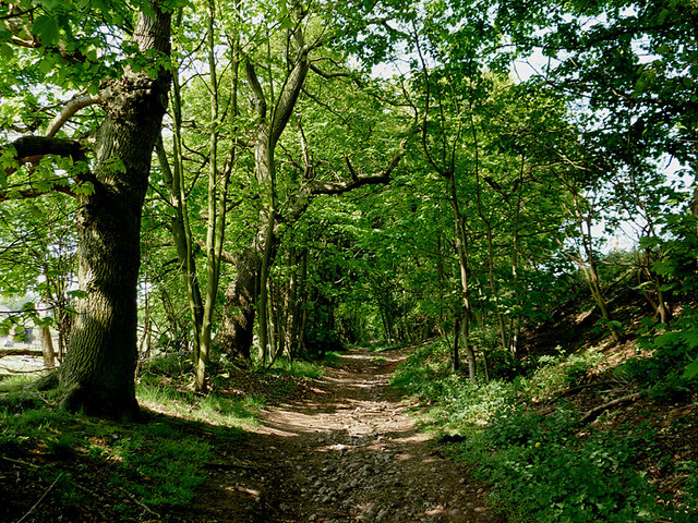
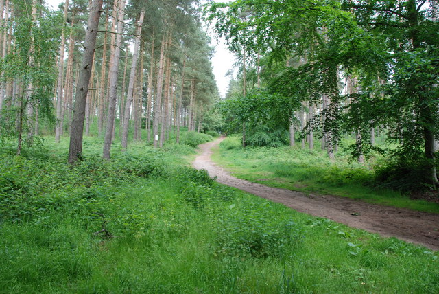
Kings Lodge Plantation is a picturesque woodland located in Staffordshire, England. Covering an expansive area, the plantation is a popular destination for nature enthusiasts and outdoor enthusiasts alike. This serene woodland is situated within close proximity to the village of Kingsley, adding to its accessibility and appeal.

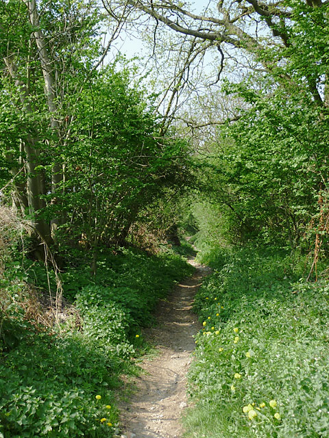
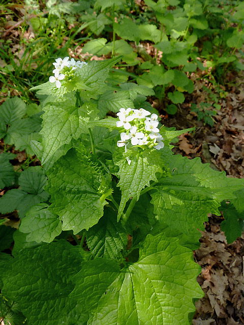
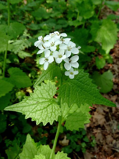
The plantation boasts a diverse range of tree species, including oak, beech, and birch, creating a rich and vibrant forest ecosystem. These towering trees provide a habitat for an array of wildlife, such as birds, squirrels, and deer, making it a haven for nature lovers and wildlife photographers.

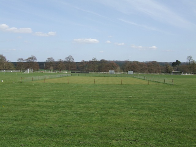
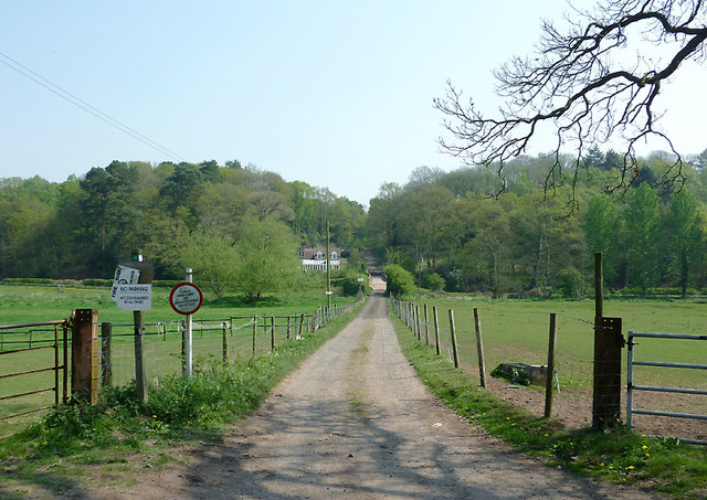
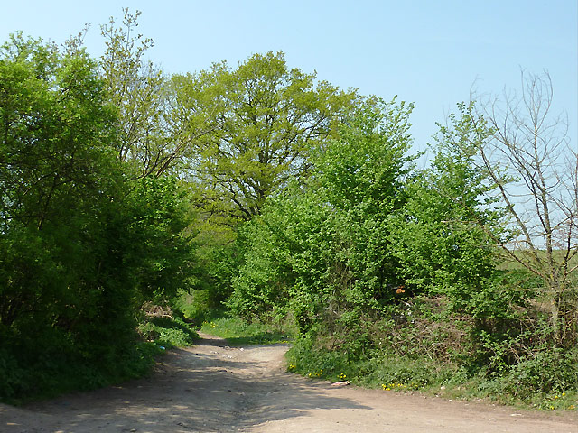
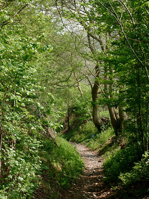
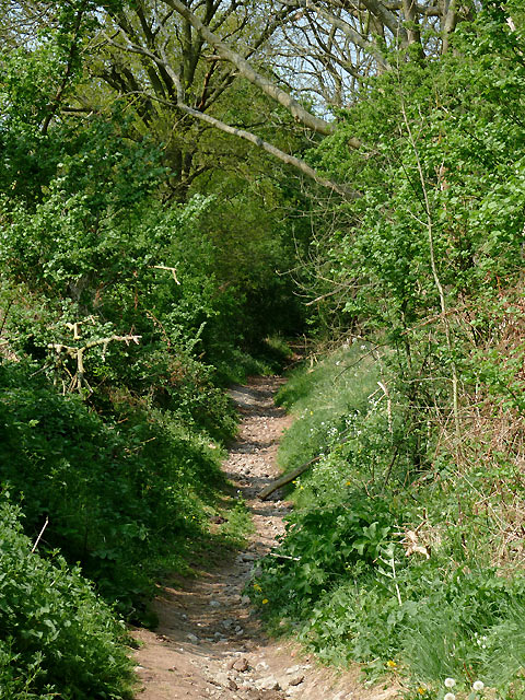
Visitors to Kings Lodge Plantation can explore the numerous walking trails that meander through the woodland. These paths offer stunning views of the surrounding countryside and provide an opportunity to immerse oneself in the tranquility of nature. The plantation also features a picnic area, allowing visitors to enjoy a leisurely lunch amidst the beauty of their surroundings.

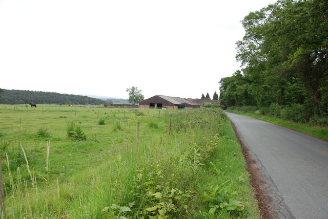
Furthermore, Kings Lodge Plantation is not only a recreational destination but also serves as a practical resource. The woodland is sustainably managed, with periodic tree felling and replanting initiatives. This ensures the continued health and growth of the forest, supporting its long-term sustainability.

In summary, Kings Lodge Plantation in Staffordshire is a captivating woodland that offers a serene escape from the hustle and bustle of everyday life. With its diverse range of tree species, abundant wildlife, and well-maintained walking trails, it provides a haven for nature enthusiasts and outdoor adventurers alike.

If you have any feedback on the listing, please let us know in the comments section below.

Kings Lodge Plantation Images

Images are sourced within 2km of 52.46608/-2.2312431 or Grid Reference SO8485. Thanks to Geograph Open Source API. All images are credited.

Enville Cricket Club In the grounds of Enville Hall.
Enville Cricket Club
In the grounds of Enville Hall.
Bridleway to Prestwood, Staffordshire Seen from Greensforge Lane.
The bridleway links The Million plantation and Greensforge Lane with the Wolverhampton Road (A449) at Prestwood. On the skyline is woodland; to the left of the track is Gotherseley Rough, while to the right is Colbourn's Rough. At the bottom of the shallow wide valley the Smestow River flows from left to right. At the base of the woods is the Staffordshire and Worcestershire Canal.
Bridleway to Prestwood, Staffordshire
Seen from Greensforge Lane. The bridleway links The Million plantation and Greensforge Lane with the Wolverhampton Road (A449) at Prestwood. On the skyline is woodland; to the left of the track is Gotherseley Rough, while to the right is Colbourn's Rough. At the bottom of the shallow wide valley the Smestow River flows from left to right. At the base of the woods is the Staffordshire and Worcestershire Canal.
Bridleway to The Million, Staffordshire This bridleway is a continuation of the wider track from Prestwood, but here it becomes little more than a footpath as it climbs towards Gothersley Farm. It passes through The Million plantation and continues to Enville.
Bridleway to The Million, Staffordshire
This bridleway is a continuation of the wider track from Prestwood, but here it becomes little more than a footpath as it climbs towards Gothersley Farm. It passes through The Million plantation and continues to Enville.
Bridleway to The Million, Staffordshire This bridleway is a continuation of the wider track from Prestwood, but here it becomes little more than a footpath as it climbs towards Gothersley Farm. It then passes through The Million plantation and continues to Enville.
Bridleway to The Million, Staffordshire
This bridleway is a continuation of the wider track from Prestwood, but here it becomes little more than a footpath as it climbs towards Gothersley Farm. It then passes through The Million plantation and continues to Enville.
Bridleway to Prestwood, Staffordshire The bridleway, having come from Enville, links The Million plantation and Greensforge Lane with the Wolverhampton Road (A449) at Prestwood.
Bridleway to Prestwood, Staffordshire
The bridleway, having come from Enville, links The Million plantation and Greensforge Lane with the Wolverhampton Road (A449) at Prestwood.
Bridleway to The Million, Staffordshire This bridleway is a continuation of the wider track from Prestwood, but here it becomes little more than a footpath as it climbs towards Gothersley Farm. It then passes through The Million plantation and continues to Enville.
Bridleway to The Million, Staffordshire
This bridleway is a continuation of the wider track from Prestwood, but here it becomes little more than a footpath as it climbs towards Gothersley Farm. It then passes through The Million plantation and continues to Enville.
Garlic mustard near Gothersley, Staffordshire Garlic Mustard (Alliaria petiolata), sometimes known as Jack-by-the-Hedge, is a common perennial. It is often found in hedgerows and likes damp woodland, flowering from April to June. The plant is common here by the sides of the bridleway between Prestwood and The Million.

The leaves, flowers and fruit are edible, and are best when young. They have a mild flavour of both garlic and mustard, and can be used in salads and pesto. They were also used in cooking to flavour fish and meat. The plant is also used in herbal medicine to treat gangrene, ulcers and sore throats.
Garlic mustard near Gothersley, Staffordshire
Garlic Mustard (Alliaria petiolata), sometimes known as Jack-by-the-Hedge, is a common perennial. It is often found in hedgerows and likes damp woodland, flowering from April to June. The plant is common here by the sides of the bridleway between Prestwood and The Million. The leaves, flowers and fruit are edible, and are best when young. They have a mild flavour of both garlic and mustard, and can be used in salads and pesto. They were also used in cooking to flavour fish and meat. The plant is also used in herbal medicine to treat gangrene, ulcers and sore throats.
Garlic mustard flowers near Gothersley, Staffordshire Garlic Mustard (Alliaria petiolata), sometimes known as Jack-by-the-Hedge, is a common perennial. It is often found in hedgerows and likes damp woodland, flowering from April to June. The plant is common here by the sides of the bridleway between Gothersley and The Million.

The leaves, flowers and fruit are edible, and are best when young. They have a mild flavour of both garlic and mustard, and can be used in salads and pesto. They were also used in cooking to flavour fish and meat. The plant is also used in herbal medicine to treat gangrene, ulcers and sore throats.
Garlic mustard flowers near Gothersley, Staffordshire
Garlic Mustard (Alliaria petiolata), sometimes known as Jack-by-the-Hedge, is a common perennial. It is often found in hedgerows and likes damp woodland, flowering from April to June. The plant is common here by the sides of the bridleway between Gothersley and The Million. The leaves, flowers and fruit are edible, and are best when young. They have a mild flavour of both garlic and mustard, and can be used in salads and pesto. They were also used in cooking to flavour fish and meat. The plant is also used in herbal medicine to treat gangrene, ulcers and sore throats.
Bridleway to The Million, Staffordshire This bridleway is a continuation of the wider track from Prestwood, but here it becomes little more than a footpath as it climbs towards Gothersley Farm. It then passes through The Million plantation and continues to Enville.
Bridleway to The Million, Staffordshire
This bridleway is a continuation of the wider track from Prestwood, but here it becomes little more than a footpath as it climbs towards Gothersley Farm. It then passes through The Million plantation and continues to Enville.
Paddocks near Gothersley, Staffordshire Many of the grass fields in the area are divided into paddocks for use by the horse riding community. The bridleway to Prestwood is behind the trees on the right. The view is across the Smestow Valley.
Paddocks near Gothersley, Staffordshire
Many of the grass fields in the area are divided into paddocks for use by the horse riding community. The bridleway to Prestwood is behind the trees on the right. The view is across the Smestow Valley.
Devil's Den stretch of the Staffs Worcs Canal at Prestwood Curious name and curious, spooky boat house cut into the cliff face.
Devil's Den stretch of the Staffs Worcs Canal at Prestwood
Curious name and curious, spooky boat house cut into the cliff face.
Gamekeepers Cottages. These Cottages are on the Enville Road, Compton Road crossroads. Just outside Kinver.
Gamekeepers Cottages.
These Cottages are on the Enville Road, Compton Road crossroads. Just outside Kinver.
House On The Outskirts Of Kinver. This house replaced an old Cottage, around 1990
House On The Outskirts Of Kinver.
This house replaced an old Cottage, around 1990
Holy Austin Rock, Kinver. One of the Rock houses has been restored, and is open to the public at certain times.The others have been closed off, as is evident from the Photo, for Health & Safety reasons.
Holy Austin Rock, Kinver.
One of the Rock houses has been restored, and is open to the public at certain times.The others have been closed off, as is evident from the Photo, for Health & Safety reasons.
Entrance To Huntsmans Drive, Kinver
A Track Into The Million.
Falcon Farm, Enville. Falcon Farm is part of the Enville Estate.
Falcon Farm, Enville.
Falcon Farm is part of the Enville Estate.
Heading south along Greensforge Lane
Show me another place!

Kings Lodge Plantation is located at Grid Ref: SO8485 (Lat: 52.46608, Lng: -2.2312431)

Administrative County: Staffordshire

District: South Staffordshire

Police Authority: Staffordshire

What 3 Words

///willpower.cakewalk.trump. Near Kinvere, Staffordshire

Related Wikis

Kinver High School

Kinver High School (formerly Edgecliff High School) is a mixed secondary school and sixth form located in Kinver in the English county of Staffordshire...

Dunsley, Staffordshire

Dunsley is a hamlet in Kinver, Staffordshire, England. The settled part of the hamlet is the part of the village of Kinver, lying east of the River Stour...

Kinver

Kinver is a large village in the District of South Staffordshire in Staffordshire, England. It is in the far south-west of the county, at the end of the...

Smestow Brook

The Smestow Brook, sometimes called the River Smestow, is a small river that plays an important part in the drainage of Wolverhampton, South Staffordshire...
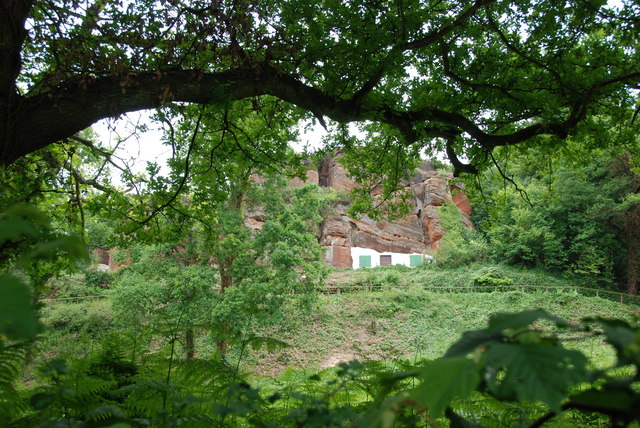
Kinver Edge

Kinver Edge is a high heath and woodland escarpment just west of Kinver, about four miles west of Stourbridge, and four miles north of Kidderminster, and...

Enville Hall

Enville Hall is an English Tudor country house in the village of Enville, Staffordshire. It is a Grade II listed building.The house has a 16th and 17th...

Stourton, Staffordshire

Stourton is a hamlet in Staffordshire, England a few miles to the northwest of Stourbridge. There is a fair amount of dispute over the pronunciation, being...

Great Fountain, Enville

The Great Fountain, Enville, was a fountain created in the mid-19th century by the Earl of Stamford in the middle of a lake on his Enville Hall estate...
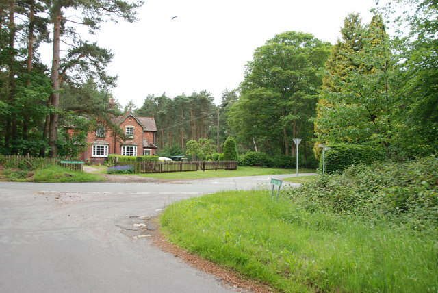
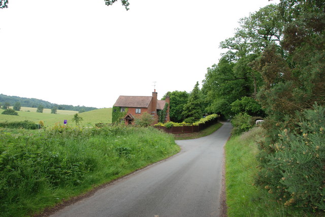
Nearby Amenities

Located within 500m of 52.46608,-2.2312431
Bus Stop
Fox Inn PH
Bus: yes
Naptan AtcoCode: 3800C606100
Naptan Bearing: W
Naptan CommonName: Fox Inn PH
Naptan Indicator: Opp
Naptan Landmark: Fox Inn PH
Naptan Street: Clanbrook Rd
Naptan Verified: no
Public Transport: platform
Source: naptan_import
Lat/Long: 52.4650971/-2.2336582
Littlewood's Common
Place: locality
Source: OS_OpenData_StreetView
Lat/Long: 52.4624094/-2.2345908
Power: pole
Lat/Long: 52.4624145/-2.2312145
Power: pole
Lat/Long: 52.4644164/-2.2351305
Power: pole
Lat/Long: 52.4634898/-2.2367211
Power: pole
Lat/Long: 52.4648804/-2.2382875
Power: pole
Lat/Long: 52.4626612/-2.235329
Power: pole
Lat/Long: 52.4640111/-2.237574
Power: pole
Lat/Long: 52.462975/-2.2358762
Power: pole
Lat/Long: 52.4631531/-2.2333147
Power: pole
Lat/Long: 52.4635731/-2.2345324
Power: pole
Lat/Long: 52.4627282/-2.2321265
Power: pole
Lat/Long: 52.4639717/-2.235841
Power: pole
Lat/Long: 52.4644245/-2.2369625
Power: pole
Lat/Long: 52.4639392/-2.2355811
Power: pole
Lat/Long: 52.461849/-2.2296105
Power: pole
Lat/Long: 52.4622805/-2.234747
The data included in this document is from www.openstreetmap.org. The data is made available under ODbL.

Have you been to Kings Lodge Plantation?

Leave your review of Kings Lodge Plantation below (or comments, questions and feedback).