Foster Plantation

Wood, Forest in Yorkshire Ribble Valley

England

Foster Plantation

Ordnance Survey Cut Mark This mark can be found on the wall of St Mary's Church, Gisburn
The benchmark has a recorded height of 138.3304 metres above sea level.
For more detail see : <span class="nowrap"><a title="https://www.bench-marks.org.uk/bm36317" rel="nofollow ugc noopener" href="https://www.bench-marks.org.uk/bm36317">Link</a><img style="margin-left:2px;" alt="External link" title="External link - shift click to open in new window" src="https://s1.geograph.org.uk/img/external.png" width="10" height="10"/></span>
Ordnance Survey Cut Mark Credit: Peter Wood

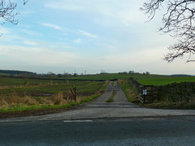
Foster Plantation is a picturesque woodland located in the beautiful county of Yorkshire, England. Situated in the heart of the region, this plantation is a haven for nature enthusiasts and outdoor enthusiasts alike. Covering an expansive area, the plantation is known for its dense forest and sprawling woodlands.

The plantation is home to a variety of tree species, including oak, beech, and pine, creating a diverse and vibrant ecosystem. The dense vegetation provides ample shelter for a wide range of wildlife, making it a popular spot for birdwatching and nature photography.

Visitors to Foster Plantation can explore the numerous walking trails that wind their way through the woodland. These trails offer stunning views of the surrounding countryside and provide an opportunity to immerse oneself in the tranquility of nature. The plantation is also a popular destination for cycling enthusiasts, with designated cycling routes that cater to all skill levels.

In addition to its natural beauty, Foster Plantation holds historical significance. The plantation has been owned by the Foster family for generations, and remnants of their ancestral home, known as Foster House, can still be seen within the grounds. This adds a touch of charm and nostalgia to the overall experience of visiting the plantation.

Overall, Foster Plantation is a must-visit destination for those seeking a peaceful retreat in the heart of Yorkshire. With its lush woodlands, diverse wildlife, and historical significance, it offers a unique and enriching experience for all who venture into its serene embrace.

If you have any feedback on the listing, please let us know in the comments section below.

Foster Plantation Images

Images are sourced within 2km of 53.932049/-2.24991 or Grid Reference SD8348. Thanks to Geograph Open Source API. All images are credited.

Ordnance Survey Cut Mark This mark can be found on the wall of St Mary's Church, Gisburn
The benchmark has a recorded height of 138.3304 metres above sea level.
For more detail see : <span class="nowrap"><a title="https://www.bench-marks.org.uk/bm36317" rel="nofollow ugc noopener" href="https://www.bench-marks.org.uk/bm36317">Link</a><img style="margin-left:2px;" alt="External link" title="External link - shift click to open in new window" src="https://s1.geograph.org.uk/img/external.png" width="10" height="10"/></span>
Ordnance Survey Cut Mark
This mark can be found on the wall of St Mary's Church, Gisburn The benchmark has a recorded height of 138.3304 metres above sea level. For more detail see : LinkExternal link
Delicious Deli and Café - Gisburn
Gutteridge Farm
Gutteridge Farm
Fields East of Gisburn
West Portal Gisburne Park  Railway Tunnel A cut and cover short tunnel required by the landowner and decorated appropriately. The turrets of the east portal can be seen as well across this part of Gisburne Park
West Portal Gisburne Park Railway Tunnel
A cut and cover short tunnel required by the landowner and decorated appropriately. The turrets of the east portal can be seen as well across this part of Gisburne Park
Gisburne Park Railway Tunnel Turrets A curious view of mock castle turrets in parkland, disguising a railway line
Gisburne Park Railway Tunnel Turrets
A curious view of mock castle turrets in parkland, disguising a railway line
Old Guide Stone by A682, Rimington Lane junction with Hardacre Lane (East face) The Guide Stone is located in angle of minor roads, next to grey metal junction box on the West side of the road.  Parish of Rimington (Ribble Valley District). Carved stone post, erected in the 18th Century, old edge chips. An earlier photograph can be found here: <a title="https://www.geograph.org.uk/photo/6076649" href="https://www.geograph.org.uk/photo/6076649">Link</a> 

Inscription reads:- 
TO / {hand to left}  / BurnLey /(1) 2 m : : TO / {hand to right} / (?) /5 ms / TO E {hand to left} / Gisbern / 1m 

Grade II listed. 
List Entry Number: 1165264 <span class="nowrap"><a title="https://historicengland.org.uk/listing/the-list/list-entry/1165264" rel="nofollow ugc noopener" href="https://historicengland.org.uk/listing/the-list/list-entry/1165264">Link</a><img style="margin-left:2px;" alt="External link" title="External link - shift click to open in new window" src="https://s1.geograph.org.uk/img/external.png" width="10" height="10"/></span> 

Milestone Society National ID: YW_XGIS
Old Guide Stone by A682, Rimington Lane junction with Hardacre Lane (East face)
The Guide Stone is located in angle of minor roads, next to grey metal junction box on the West side of the road.  Parish of Rimington (Ribble Valley District). Carved stone post, erected in the 18th Century, old edge chips. An earlier photograph can be found here: Link  Inscription reads:- TO / {hand to left} / BurnLey /(1) 2 m : : TO / {hand to right} / (?) /5 ms / TO E {hand to left} / Gisbern / 1m Grade II listed. List Entry Number: 1165264 LinkExternal link Milestone Society National ID: YW_XGIS
Old Guide Stone by A682, Rimington Lane junction with Hardacre Lane (West Face) The Guide Stone is located in angle of minor roads, next to grey metal junction box on the West side of the road.  Parish of Rimington (Ribble Valley District). Carved stone post, erected in the 18th Century, old edge chips. East face photograph can be found here: <a title="https://www.geograph.org.uk/photo/7383066" href="https://www.geograph.org.uk/photo/7383066">Link</a> 

Inscription reads:- 
TO / {hand to left}  / BurnLey /(1) 2 m : : TO / {hand to right} / (?) / 5 ms / TO E {hand to left} / Gisbern / 1m 

Grade II listed. 
List Entry Number: 1165264 <span class="nowrap"><a title="https://historicengland.org.uk/listing/the-list/list-entry/1165264" rel="nofollow ugc noopener" href="https://historicengland.org.uk/listing/the-list/list-entry/1165264">Link</a><img style="margin-left:2px;" alt="External link" title="External link - shift click to open in new window" src="https://s1.geograph.org.uk/img/external.png" width="10" height="10"/></span> 

Milestone Society National ID: YW_XGIS
Old Guide Stone by A682, Rimington Lane junction with Hardacre Lane (West Face)
The Guide Stone is located in angle of minor roads, next to grey metal junction box on the West side of the road.  Parish of Rimington (Ribble Valley District). Carved stone post, erected in the 18th Century, old edge chips. East face photograph can be found here: Link Inscription reads:- TO / {hand to left} / BurnLey /(1) 2 m : : TO / {hand to right} / (?) / 5 ms / TO E {hand to left} / Gisbern / 1m Grade II listed. List Entry Number: 1165264 LinkExternal link Milestone Society National ID: YW_XGIS
Old milestone This milestone which would have stood at the southeast corner of the A59/B6265 Bracewll Lane is now built into steps at the back of the White Bull PH in Gisburn.  This face is engraved with a hand pointing left/To/SKipton/9 Miles/hand pointing right/Gisbor(n)/2 Ms.  The other visible face is engraved with a hand pointing left To/Settle 11 ms/hand to right/Colne 7 ms.
Old milestone
This milestone which would have stood at the southeast corner of the A59/B6265 Bracewll Lane is now built into steps at the back of the White Bull PH in Gisburn. This face is engraved with a hand pointing left/To/SKipton/9 Miles/hand pointing right/Gisbor(n)/2 Ms. The other visible face is engraved with a hand pointing left To/Settle 11 ms/hand to right/Colne 7 ms.
Gisburne Park Entrance Lodges At the south entrance at the end of Park Road from the centre of Gisburn
Gisburne Park Entrance Lodges
At the south entrance at the end of Park Road from the centre of Gisburn
Road to Middle Breaks
Short muddy track into arable field At the top of the hill in amongst the trees is a Tumulus
Short muddy track into arable field
At the top of the hill in amongst the trees is a Tumulus
A682 near Middle Breaks
Painley Farm near Horton
Middle Breaks Hill Hill about a mile north of Gisburn with Farm bearing the same name at its base to the right
Middle Breaks Hill
Hill about a mile north of Gisburn with Farm bearing the same name at its base to the right
Culvert or Bridge You have a choice as to what you call this, but you will still keep your feet dry when you use it to cross the stream
Culvert or Bridge
You have a choice as to what you call this, but you will still keep your feet dry when you use it to cross the stream
Pasture west of Painley Farm
Grazing and woodland, Middle Breaks Hill
Show me another place!

Foster Plantation is located at Grid Ref: SD8348 (Lat: 53.932049, Lng: -2.24991)

Division: West Riding

Administrative County: Lancashire

District: Ribble Valley

Police Authority: Lancashire

What 3 Words

///lamps.themes.pheasants. Near Barnoldswick, Lancashire

Related Wikis

Gisburn Tunnel

Gisburn Tunnel is a short railway tunnel on the Ribble Valley line in Lancashire, England. The tunnel is 157 yards (144 m) long, just to the east of Gisburn...

Gisburn

Gisburn (formerly Gisburne) is a village and civil parish within the Ribble Valley borough of Lancashire, England. Historically within the West Riding...

Gisburn railway station

Gisburn railway station served the small village of Gisburn, which is now in Lancashire, England, but was in the West Riding of Yorkshire at the time....

Gisburne Park

Gisburne Park is an 18th-century country house and associated park in Gisburn, Lancashire, England, in the Ribble Valley some 6 miles (10 km) north-east...

Stock Beck

Stock Beck is a minor river in the West Craven area of Pendle, Lancashire (formerly in Yorkshire). It is 8.25 miles (13.27 km) long and has a catchment...

A59 road

The A59 is a major road in England which is around 109 miles (175 km) long and runs from Wallasey, Merseyside to York, North Yorkshire. The alignment formed...

Bracewell and Brogden

Bracewell and Brogden is a civil parish in the West Craven area of the Borough of Pendle in Lancashire, England. According to the 2001 census it had a...

St Michael's Church, Bracewell

St Michael's Church is in Bracewell Lane, Bracewell, Lancashire, England. It is an active Anglican parish church in the deanery of Skipton, the archdeaconry...

Nearby Amenities

Located within 500m of 53.932049,-2.24991
Moor Laithe
Building: yes
Source: NPE
Lat/Long: 53.9320948/-2.2544082
Bomber
Building: yes
Source: NPE
Lat/Long: 53.9317411/-2.2473261
Bomber Hill
Natural: peak
Source: OS 1:25k
Lat/Long: 53.930541/-2.2459099
Little Pasture Hill
Natural: peak
Source: OS 1:25k
Lat/Long: 53.9322338/-2.2439358
Power: pole
Lat/Long: 53.9283027/-2.2457197
Power: pole
Lat/Long: 53.9292897/-2.2460657
Power: pole
Lat/Long: 53.9301914/-2.2463822
Power: pole
Lat/Long: 53.9308152/-2.2465995
Power: pole
Lat/Long: 53.9316632/-2.246857
Power: pole
Lat/Long: 53.9325791/-2.2472003
Power: pole
Lat/Long: 53.9334018/-2.2474873
Power: pole
Lat/Long: 53.9342198/-2.2477797
Power: pole
Lat/Long: 53.9350109/-2.2480774
Power: pole
Lat/Long: 53.9358178/-2.2483885
The data included in this document is from www.openstreetmap.org. The data is made available under ODbL.

Have you been to Foster Plantation?

Leave your review of Foster Plantation below (or comments, questions and feedback).