Bomber Hill

Hill, Mountain in Yorkshire Ribble Valley

England

Bomber Hill

Ordnance Survey Cut Mark This mark can be found on the wall of St Mary's Church, Gisburn
The benchmark has a recorded height of 138.3304 metres above sea level.
For more detail see : <span class="nowrap"><a title="https://www.bench-marks.org.uk/bm36317" rel="nofollow ugc noopener" href="https://www.bench-marks.org.uk/bm36317">Link</a><img style="margin-left:2px;" alt="External link" title="External link - shift click to open in new window" src="https://s1.geograph.org.uk/img/external.png" width="10" height="10"/></span>
Ordnance Survey Cut Mark Credit: Peter Wood

Bomber Hill, located in Yorkshire, England, is a prominent hill that has gained historical significance due to its connection with the Royal Air Force (RAF) during World War II. The hill, also known as Bomber County, is situated near the village of Catterick, in the Richmondshire district of North Yorkshire.

Bomber Hill's name originates from its strategic use as a training ground for RAF bomber crews during the war. It provided a realistic terrain for pilots to practice low-level flying and precision bombing techniques. The hill's elevated position and varied topography allowed trainees to simulate different target scenarios, such as attacking enemy installations or evading anti-aircraft fire.

Today, Bomber Hill serves as a memorial to the brave men and women who served in the RAF. A stone plaque at the summit commemorates their sacrifices, and visitors can pay their respects at this poignant site. The hill also offers breathtaking panoramic views of the surrounding countryside, including the Yorkshire Dales and the North York Moors.

Due to its historical significance and natural beauty, Bomber Hill attracts both history enthusiasts and outdoor enthusiasts alike. The area is a popular destination for hikers and walkers, who can explore the hill's trails and enjoy the tranquil surroundings. Additionally, Bomber Hill's proximity to the village of Catterick means visitors can easily access amenities such as cafes, pubs, and accommodations.

In conclusion, Bomber Hill in Yorkshire is a notable landmark and memorial that pays tribute to the RAF's wartime efforts. Its historical significance, coupled with its stunning views and recreational opportunities, make it a compelling destination for those seeking to learn about history or enjoy the natural beauty of the Yorkshire countryside.

If you have any feedback on the listing, please let us know in the comments section below.

Bomber Hill Images

Images are sourced within 2km of 53.930538/-2.2458955 or Grid Reference SD8348. Thanks to Geograph Open Source API. All images are credited.

Ordnance Survey Cut Mark This mark can be found on the wall of St Mary's Church, Gisburn
The benchmark has a recorded height of 138.3304 metres above sea level.
For more detail see : <span class="nowrap"><a title="https://www.bench-marks.org.uk/bm36317" rel="nofollow ugc noopener" href="https://www.bench-marks.org.uk/bm36317">Link</a><img style="margin-left:2px;" alt="External link" title="External link - shift click to open in new window" src="https://s1.geograph.org.uk/img/external.png" width="10" height="10"/></span>
Ordnance Survey Cut Mark
This mark can be found on the wall of St Mary's Church, Gisburn The benchmark has a recorded height of 138.3304 metres above sea level. For more detail see : LinkExternal link
Delicious Deli and Café - Gisburn
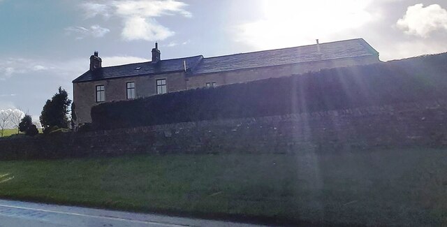
Gutteridge Farm
Gutteridge Farm
Fields East of Gisburn
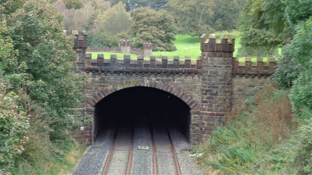
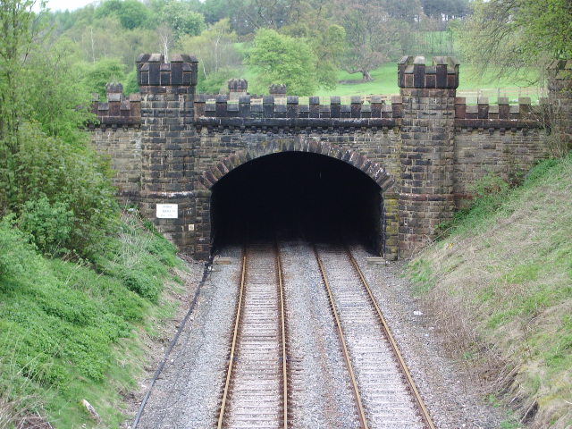
West Portal Gisburne Park  Railway Tunnel A cut and cover short tunnel required by the landowner and decorated appropriately. The turrets of the east portal can be seen as well across this part of Gisburne Park
West Portal Gisburne Park Railway Tunnel
A cut and cover short tunnel required by the landowner and decorated appropriately. The turrets of the east portal can be seen as well across this part of Gisburne Park
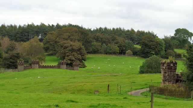
Gisburne Park Railway Tunnel Turrets A curious view of mock castle turrets in parkland, disguising a railway line
Gisburne Park Railway Tunnel Turrets
A curious view of mock castle turrets in parkland, disguising a railway line
Old Guide Stone by A682, Rimington Lane junction with Hardacre Lane (East face) The Guide Stone is located in angle of minor roads, next to grey metal junction box on the West side of the road.  Parish of Rimington (Ribble Valley District). Carved stone post, erected in the 18th Century, old edge chips. An earlier photograph can be found here: <a title="https://www.geograph.org.uk/photo/6076649" href="https://www.geograph.org.uk/photo/6076649">Link</a> 

Inscription reads:- 
TO / {hand to left}  / BurnLey /(1) 2 m : : TO / {hand to right} / (?) /5 ms / TO E {hand to left} / Gisbern / 1m 

Grade II listed. 
List Entry Number: 1165264 <span class="nowrap"><a title="https://historicengland.org.uk/listing/the-list/list-entry/1165264" rel="nofollow ugc noopener" href="https://historicengland.org.uk/listing/the-list/list-entry/1165264">Link</a><img style="margin-left:2px;" alt="External link" title="External link - shift click to open in new window" src="https://s1.geograph.org.uk/img/external.png" width="10" height="10"/></span> 

Milestone Society National ID: YW_XGIS
Old Guide Stone by A682, Rimington Lane junction with Hardacre Lane (East face)
The Guide Stone is located in angle of minor roads, next to grey metal junction box on the West side of the road.  Parish of Rimington (Ribble Valley District). Carved stone post, erected in the 18th Century, old edge chips. An earlier photograph can be found here: Link  Inscription reads:- TO / {hand to left} / BurnLey /(1) 2 m : : TO / {hand to right} / (?) /5 ms / TO E {hand to left} / Gisbern / 1m Grade II listed. List Entry Number: 1165264 LinkExternal link Milestone Society National ID: YW_XGIS
Old Guide Stone by A682, Rimington Lane junction with Hardacre Lane (West Face) The Guide Stone is located in angle of minor roads, next to grey metal junction box on the West side of the road.  Parish of Rimington (Ribble Valley District). Carved stone post, erected in the 18th Century, old edge chips. East face photograph can be found here: <a title="https://www.geograph.org.uk/photo/7383066" href="https://www.geograph.org.uk/photo/7383066">Link</a> 

Inscription reads:- 
TO / {hand to left}  / BurnLey /(1) 2 m : : TO / {hand to right} / (?) / 5 ms / TO E {hand to left} / Gisbern / 1m 

Grade II listed. 
List Entry Number: 1165264 <span class="nowrap"><a title="https://historicengland.org.uk/listing/the-list/list-entry/1165264" rel="nofollow ugc noopener" href="https://historicengland.org.uk/listing/the-list/list-entry/1165264">Link</a><img style="margin-left:2px;" alt="External link" title="External link - shift click to open in new window" src="https://s1.geograph.org.uk/img/external.png" width="10" height="10"/></span> 

Milestone Society National ID: YW_XGIS
Old Guide Stone by A682, Rimington Lane junction with Hardacre Lane (West Face)
The Guide Stone is located in angle of minor roads, next to grey metal junction box on the West side of the road.  Parish of Rimington (Ribble Valley District). Carved stone post, erected in the 18th Century, old edge chips. East face photograph can be found here: Link Inscription reads:- TO / {hand to left} / BurnLey /(1) 2 m : : TO / {hand to right} / (?) / 5 ms / TO E {hand to left} / Gisbern / 1m Grade II listed. List Entry Number: 1165264 LinkExternal link Milestone Society National ID: YW_XGIS
Old milestone This milestone which would have stood at the southeast corner of the A59/B6265 Bracewll Lane is now built into steps at the back of the White Bull PH in Gisburn.  This face is engraved with a hand pointing left/To/SKipton/9 Miles/hand pointing right/Gisbor(n)/2 Ms.  The other visible face is engraved with a hand pointing left To/Settle 11 ms/hand to right/Colne 7 ms.
Old milestone
This milestone which would have stood at the southeast corner of the A59/B6265 Bracewll Lane is now built into steps at the back of the White Bull PH in Gisburn. This face is engraved with a hand pointing left/To/SKipton/9 Miles/hand pointing right/Gisbor(n)/2 Ms. The other visible face is engraved with a hand pointing left To/Settle 11 ms/hand to right/Colne 7 ms.
Gisburne Park Entrance Lodges At the south entrance at the end of Park Road from the centre of Gisburn
Gisburne Park Entrance Lodges
At the south entrance at the end of Park Road from the centre of Gisburn
Painley Farm near Horton
Pasture west of Painley Farm
The Pennine Bridleway by the A682
St Mary The Virgin, Gisburn
Bentlea Road, Gisburn
The Parish Church of St Mary the Virgin, Gisburn It is assumed (<span class="nowrap"><a title="http://www.gisburn.org.uk/gisburnvillage/church_history.htm" rel="nofollow ugc noopener" href="http://www.gisburn.org.uk/gisburnvillage/church_history.htm">Link</a><img style="margin-left:2px;" alt="External link" title="External link - shift click to open in new window" src="https://s1.geograph.org.uk/img/external.png" width="10" height="10"/></span> ) that the foundations of the present church could have been about 1135 although it is possible that there was a church on this site before this There is evidence ’the Rector of Gisburne Church was present at the laying of the foundation stone at Salley (Sawley) Abbey in 1147’. Large cylindrical pillars at the front of the church have been dated as being of 12th century origin

.

The Church has been restored on more than one occasion. The upper part of the tower is 14th century, the porch is 15th century and leads to the south doorway which is 13th century. It is thought that a major restoration was carried out in the late 16th century, Part of the archways originated from the Sawley Abbey after the Dissolution. A further restoration took place in 1872.

<span class="nowrap"><a title="http://www.gisburn.org.uk/gisburnvillage/church_history.htm" rel="nofollow ugc noopener" href="http://www.gisburn.org.uk/gisburnvillage/church_history.htm">Link</a><img style="margin-left:2px;" alt="External link" title="External link - shift click to open in new window" src="https://s1.geograph.org.uk/img/external.png" width="10" height="10"/></span>  Gisburn Village web site
The Parish Church of St Mary the Virgin, Gisburn
It is assumed (LinkExternal link ) that the foundations of the present church could have been about 1135 although it is possible that there was a church on this site before this There is evidence ’the Rector of Gisburne Church was present at the laying of the foundation stone at Salley (Sawley) Abbey in 1147’. Large cylindrical pillars at the front of the church have been dated as being of 12th century origin . The Church has been restored on more than one occasion. The upper part of the tower is 14th century, the porch is 15th century and leads to the south doorway which is 13th century. It is thought that a major restoration was carried out in the late 16th century, Part of the archways originated from the Sawley Abbey after the Dissolution. A further restoration took place in 1872. LinkExternal link Gisburn Village web site
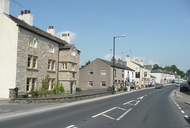
Gisburn Main Street, The White Bull
Gisburn War Memorial and garden In the centre of the village.
Gisburn War Memorial and garden
In the centre of the village.
Show me another place!

Bomber Hill is located at Grid Ref: SD8348 (Lat: 53.930538, Lng: -2.2458955)

Division: West Riding

Administrative County: Lancashire

District: Ribble Valley

Police Authority: Lancashire

What 3 Words

///hillsides.relocated.daunting. Near Barnoldswick, Lancashire

Related Wikis

Gisburn

Gisburn (formerly Gisburne) is a village and civil parish within the Ribble Valley borough of Lancashire, England. Historically within the West Riding...

Gisburn Tunnel

Gisburn Tunnel is a short railway tunnel on the Ribble Valley line in Lancashire, England. The tunnel is 157 yards (144 m) long, just to the east of Gisburn...

Gisburn railway station

Gisburn railway station served the small village of Gisburn, which is now in Lancashire, England, but was in the West Riding of Yorkshire at the time....

Gisburne Park

Gisburne Park is an 18th-century country house and associated park in Gisburn, Lancashire, England, in the Ribble Valley some 6 miles (10 km) north-east...

Stock Beck

Stock Beck is a minor river in the West Craven area of Pendle, Lancashire (formerly in Yorkshire). It is 8.25 miles (13.27 km) long and has a catchment...

A59 road

The A59 is a major road in England which is around 109 miles (175 km) long and runs from Wallasey, Merseyside to York, North Yorkshire. The alignment formed...

Bracewell and Brogden

Bracewell and Brogden is a civil parish in the West Craven area of the Borough of Pendle in Lancashire, England. According to the 2001 census it had a...

St Michael's Church, Bracewell

St Michael's Church is in Bracewell Lane, Bracewell, Lancashire, England. It is an active Anglican parish church in the deanery of Skipton, the archdeaconry...

Nearby Amenities

Located within 500m of 53.930538,-2.2458955
Bomber
Building: yes
Source: NPE
Lat/Long: 53.9317411/-2.2473261
Wedacre
Building: yes
Source: NPE
Lat/Long: 53.9303009/-2.2396882
Bomber Hill
Natural: peak
Source: OS 1:25k
Lat/Long: 53.930541/-2.2459099
Little Pasture Hill
Natural: peak
Source: OS 1:25k
Lat/Long: 53.9322338/-2.2439358
Power: pole
Lat/Long: 53.9270076/-2.2452664
Power: pole
Lat/Long: 53.9276204/-2.2454515
Power: pole
Lat/Long: 53.9283027/-2.2457197
Power: pole
Lat/Long: 53.9292897/-2.2460657
Power: pole
Lat/Long: 53.9301914/-2.2463822
Power: pole
Lat/Long: 53.9308152/-2.2465995
Power: pole
Lat/Long: 53.9316632/-2.246857
Power: pole
Lat/Long: 53.9325791/-2.2472003
Power: pole
Lat/Long: 53.9334018/-2.2474873
Power: pole
Lat/Long: 53.9342198/-2.2477797
The data included in this document is from www.openstreetmap.org. The data is made available under ODbL.

Have you been to Bomber Hill?

Leave your review of Bomber Hill below (or comments, questions and feedback).