Dick Varley Plantation

Wood, Forest in Yorkshire Ribble Valley

England

Dick Varley Plantation

Delicious Deli and Café - Gisburn
Delicious Deli and Café - Gisburn Credit: Anthony Parkes

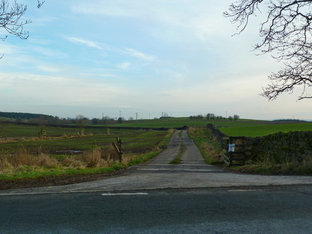
Dick Varley Plantation is a sprawling woodland area located in the picturesque county of Yorkshire, England. Situated in the heart of a rural landscape, the plantation covers a vast expanse of around 500 acres, making it one of the largest woodland areas in the region.

The plantation is primarily composed of a mix of deciduous and coniferous trees, creating a diverse and visually stunning environment. The towering oak, beech, and ash trees dominate the landscape, while the evergreen spruces and firs provide a lush green backdrop throughout the year. This rich variety of trees attracts a wide range of wildlife, including birds, small mammals, and insects, making it a haven for nature enthusiasts and photographers.

Traversing through the plantation, visitors can explore a network of well-maintained footpaths and trails that wind their way through the dense forest. These paths offer a chance to immerse oneself in the tranquility of nature and provide opportunities for hiking, jogging, or simply enjoying a leisurely stroll.

The plantation is not only a natural gem but also serves an important ecological purpose. It acts as a carbon sink, absorbing and storing carbon dioxide from the atmosphere, contributing to the fight against climate change. It also plays a vital role in water regulation, preventing flooding by absorbing excess rainfall and releasing it slowly into the surrounding area.

Dick Varley Plantation is a true testament to the beauty and importance of woodlands, offering visitors a peaceful retreat and a chance to connect with nature. Whether it be for leisure, education, or conservation, this stunning plantation has something to offer for everyone.

If you have any feedback on the listing, please let us know in the comments section below.

Dick Varley Plantation Images

Images are sourced within 2km of 53.93418/-2.249085 or Grid Reference SD8348. Thanks to Geograph Open Source API. All images are credited.

Delicious Deli and Café - Gisburn
Gutteridge Farm
Gutteridge Farm
Fields East of Gisburn
West Portal Gisburne Park  Railway Tunnel A cut and cover short tunnel required by the landowner and decorated appropriately. The turrets of the east portal can be seen as well across this part of Gisburne Park
West Portal Gisburne Park Railway Tunnel
A cut and cover short tunnel required by the landowner and decorated appropriately. The turrets of the east portal can be seen as well across this part of Gisburne Park
Gisburne Park Railway Tunnel Turrets A curious view of mock castle turrets in parkland, disguising a railway line
Gisburne Park Railway Tunnel Turrets
A curious view of mock castle turrets in parkland, disguising a railway line
Old Guide Stone by A682, Rimington Lane junction with Hardacre Lane (East face) The Guide Stone is located in angle of minor roads, next to grey metal junction box on the West side of the road.  Parish of Rimington (Ribble Valley District). Carved stone post, erected in the 18th Century, old edge chips. An earlier photograph can be found here: <a title="https://www.geograph.org.uk/photo/6076649" href="https://www.geograph.org.uk/photo/6076649">Link</a> 

Inscription reads:- 
TO / {hand to left}  / BurnLey /(1) 2 m : : TO / {hand to right} / (?) /5 ms / TO E {hand to left} / Gisbern / 1m 

Grade II listed. 
List Entry Number: 1165264 <span class="nowrap"><a title="https://historicengland.org.uk/listing/the-list/list-entry/1165264" rel="nofollow ugc noopener" href="https://historicengland.org.uk/listing/the-list/list-entry/1165264">Link</a><img style="margin-left:2px;" alt="External link" title="External link - shift click to open in new window" src="https://s1.geograph.org.uk/img/external.png" width="10" height="10"/></span> 

Milestone Society National ID: YW_XGIS
Old Guide Stone by A682, Rimington Lane junction with Hardacre Lane (East face)
The Guide Stone is located in angle of minor roads, next to grey metal junction box on the West side of the road.  Parish of Rimington (Ribble Valley District). Carved stone post, erected in the 18th Century, old edge chips. An earlier photograph can be found here: Link  Inscription reads:- TO / {hand to left} / BurnLey /(1) 2 m : : TO / {hand to right} / (?) /5 ms / TO E {hand to left} / Gisbern / 1m Grade II listed. List Entry Number: 1165264 LinkExternal link Milestone Society National ID: YW_XGIS
Old Guide Stone by A682, Rimington Lane junction with Hardacre Lane (West Face) The Guide Stone is located in angle of minor roads, next to grey metal junction box on the West side of the road.  Parish of Rimington (Ribble Valley District). Carved stone post, erected in the 18th Century, old edge chips. East face photograph can be found here: <a title="https://www.geograph.org.uk/photo/7383066" href="https://www.geograph.org.uk/photo/7383066">Link</a> 

Inscription reads:- 
TO / {hand to left}  / BurnLey /(1) 2 m : : TO / {hand to right} / (?) / 5 ms / TO E {hand to left} / Gisbern / 1m 

Grade II listed. 
List Entry Number: 1165264 <span class="nowrap"><a title="https://historicengland.org.uk/listing/the-list/list-entry/1165264" rel="nofollow ugc noopener" href="https://historicengland.org.uk/listing/the-list/list-entry/1165264">Link</a><img style="margin-left:2px;" alt="External link" title="External link - shift click to open in new window" src="https://s1.geograph.org.uk/img/external.png" width="10" height="10"/></span> 

Milestone Society National ID: YW_XGIS
Old Guide Stone by A682, Rimington Lane junction with Hardacre Lane (West Face)
The Guide Stone is located in angle of minor roads, next to grey metal junction box on the West side of the road.  Parish of Rimington (Ribble Valley District). Carved stone post, erected in the 18th Century, old edge chips. East face photograph can be found here: Link Inscription reads:- TO / {hand to left} / BurnLey /(1) 2 m : : TO / {hand to right} / (?) / 5 ms / TO E {hand to left} / Gisbern / 1m Grade II listed. List Entry Number: 1165264 LinkExternal link Milestone Society National ID: YW_XGIS
Old milestone This milestone which would have stood at the southeast corner of the A59/B6265 Bracewll Lane is now built into steps at the back of the White Bull PH in Gisburn.  This face is engraved with a hand pointing left/To/SKipton/9 Miles/hand pointing right/Gisbor(n)/2 Ms.  The other visible face is engraved with a hand pointing left To/Settle 11 ms/hand to right/Colne 7 ms.
Old milestone
This milestone which would have stood at the southeast corner of the A59/B6265 Bracewll Lane is now built into steps at the back of the White Bull PH in Gisburn. This face is engraved with a hand pointing left/To/SKipton/9 Miles/hand pointing right/Gisbor(n)/2 Ms. The other visible face is engraved with a hand pointing left To/Settle 11 ms/hand to right/Colne 7 ms.
Gisburne Park Entrance Lodges At the south entrance at the end of Park Road from the centre of Gisburn
Gisburne Park Entrance Lodges
At the south entrance at the end of Park Road from the centre of Gisburn
Rivet benchmark on a milestone north of Gisburn Settle 10 miles on the south face, Gisburn 1 mile on the north.   The Ordnance Survey arrow is on the east face
Rivet benchmark on a milestone north of Gisburn
Settle 10 miles on the south face, Gisburn 1 mile on the north. The Ordnance Survey arrow is on the east face
Track off Wing Lane
Track off Wing Lane
Road to Middle Breaks
Short muddy track into arable field At the top of the hill in amongst the trees is a Tumulus
Short muddy track into arable field
At the top of the hill in amongst the trees is a Tumulus
A682 near Middle Breaks
Painley Farm near Horton
Middle Breaks Hill Hill about a mile north of Gisburn with Farm bearing the same name at its base to the right
Middle Breaks Hill
Hill about a mile north of Gisburn with Farm bearing the same name at its base to the right
Culvert or Bridge You have a choice as to what you call this, but you will still keep your feet dry when you use it to cross the stream
Culvert or Bridge
You have a choice as to what you call this, but you will still keep your feet dry when you use it to cross the stream
Show me another place!

Dick Varley Plantation is located at Grid Ref: SD8348 (Lat: 53.93418, Lng: -2.249085)

Division: West Riding

Administrative County: Lancashire

District: Ribble Valley

Police Authority: Lancashire

What 3 Words

///sprayed.stowing.harmony. Near Barnoldswick, Lancashire

Related Wikis

Gisburn Tunnel

Gisburn Tunnel is a short railway tunnel on the Ribble Valley line in Lancashire, England. The tunnel is 157 yards (144 m) long, just to the east of Gisburn...

Gisburn

Gisburn (formerly Gisburne) is a village and civil parish within the Ribble Valley borough of Lancashire, England. Historically within the West Riding...

Gisburn railway station

Gisburn railway station served the small village of Gisburn, which is now in Lancashire, England, but was in the West Riding of Yorkshire at the time....

Gisburne Park

Gisburne Park is an 18th-century country house and associated park in Gisburn, Lancashire, England, in the Ribble Valley some 6 miles (10 km) north-east...

Nearby Amenities

Located within 500m of 53.93418,-2.249085
Moor Laithe
Building: yes
Source: NPE
Lat/Long: 53.9320948/-2.2544082
Bomber
Building: yes
Source: NPE
Lat/Long: 53.9317411/-2.2473261
Bomber Hill
Natural: peak
Source: OS 1:25k
Lat/Long: 53.930541/-2.2459099
Little Pasture Hill
Natural: peak
Source: OS 1:25k
Lat/Long: 53.9322338/-2.2439358
Walter Hill
Natural: peak
Source: OS 1:25k
Lat/Long: 53.9358214/-2.2450301
Power: pole
Lat/Long: 53.9301914/-2.2463822
Power: pole
Lat/Long: 53.9308152/-2.2465995
Power: pole
Lat/Long: 53.9316632/-2.246857
Power: pole
Lat/Long: 53.9325791/-2.2472003
Power: pole
Lat/Long: 53.9334018/-2.2474873
Power: pole
Lat/Long: 53.9342198/-2.2477797
Power: pole
Lat/Long: 53.9350109/-2.2480774
Power: pole
Lat/Long: 53.9358178/-2.2483885
Power: pole
Lat/Long: 53.9366767/-2.2485709
Power: pole
Lat/Long: 53.938393/-2.2489759
The data included in this document is from www.openstreetmap.org. The data is made available under ODbL.

Have you been to Dick Varley Plantation?

Leave your review of Dick Varley Plantation below (or comments, questions and feedback).