Gill Plantation

Wood, Forest in Yorkshire Craven

England

Gill Plantation

Settle, Victoria Street This is number 7 Victoria Street, and the wall faces north-east. There is a benchmark cut into the corner stone of the 2nd course, just above the airbrick.
Settle, Victoria Street Credit: Mel Towler

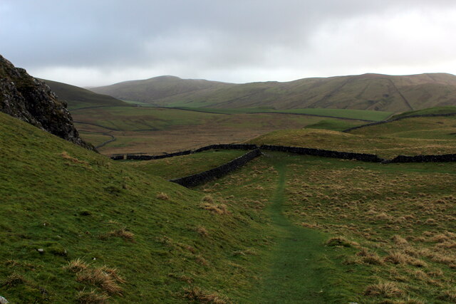
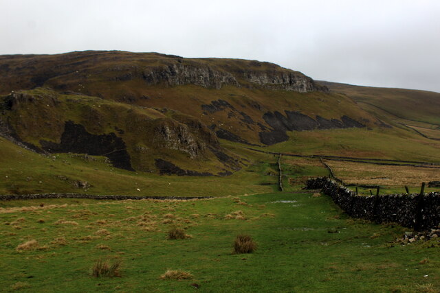
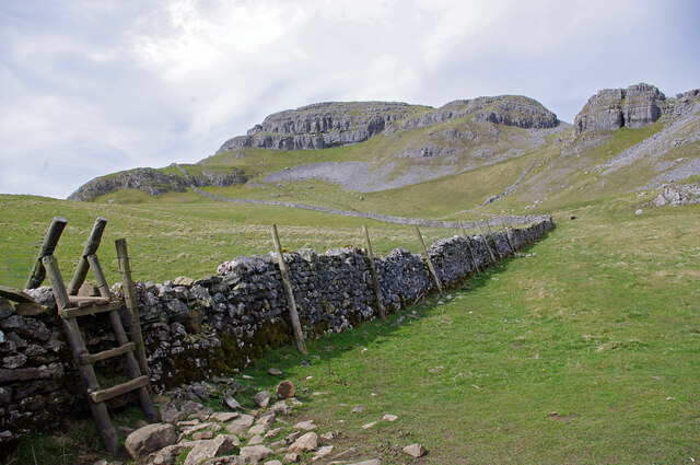
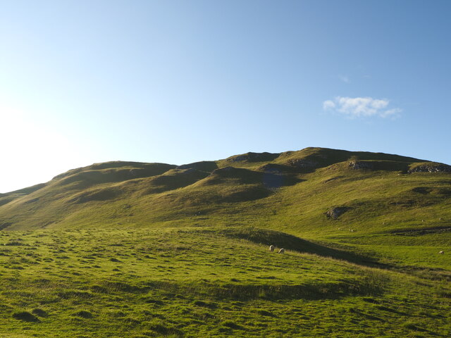
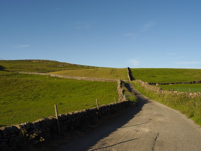
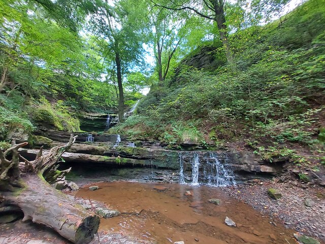
Gill Plantation, located in Yorkshire, England, is a picturesque woodland area known for its enchanting beauty and diverse ecosystem. Situated in the heart of the county, this vast forest covers an extensive area of land and is a popular destination for nature enthusiasts and hikers alike.

The plantation is characterized by its lush greenery, towering trees, and serene atmosphere. Visitors can explore the myriad of well-maintained walking trails that wind through the woodland, offering breathtaking views of the surrounding countryside. The trails are suitable for all levels of fitness, from leisurely strolls to more challenging hikes.

Gill Plantation boasts a rich diversity of flora and fauna, providing a haven for various species of plants and animals. The vibrant colors of wildflowers, such as bluebells and primroses, carpet the forest floor during spring, creating a stunning natural spectacle. Birdwatchers will delight in spotting a wide array of species, including owls, woodpeckers, and songbirds.

Aside from its natural beauty, Gill Plantation also holds historical significance. The area was once part of a medieval hunting ground and remnants of ancient deer parks can still be seen in some parts of the forest. These historical elements add a touch of intrigue and create a unique atmosphere for visitors to immerse themselves in.

Overall, Gill Plantation in Yorkshire is a captivating destination that offers a peaceful retreat from the hustle and bustle of everyday life. Its awe-inspiring landscapes, abundant wildlife, and historical charm make it a must-visit location for those seeking to reconnect with nature.

If you have any feedback on the listing, please let us know in the comments section below.

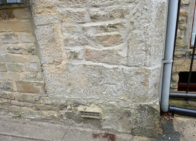
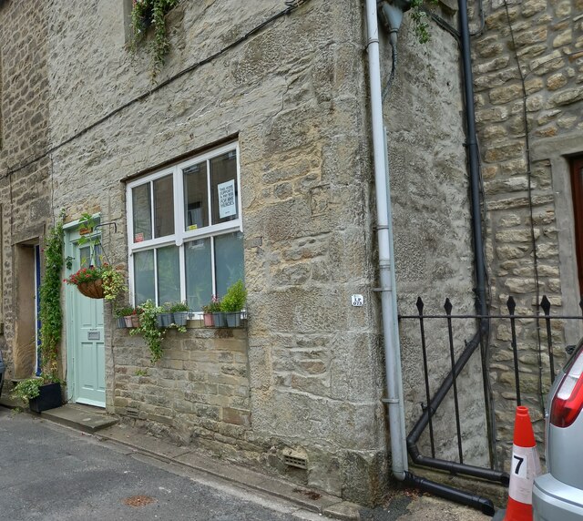
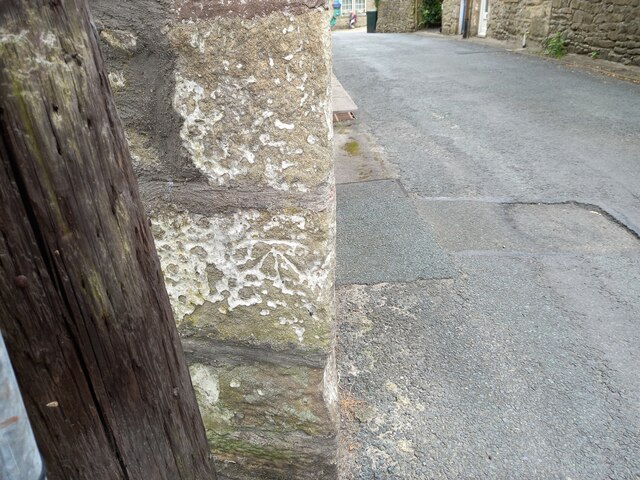
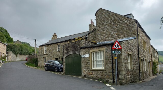
Gill Plantation Images

Images are sourced within 2km of 54.054928/-2.2541304 or Grid Reference SD8362. Thanks to Geograph Open Source API. All images are credited.

Settle, Victoria Street This is number 7 Victoria Street, and the wall faces north-east. There is a benchmark cut into the corner stone of the 2nd course, just above the airbrick.
Settle, Victoria Street
This is number 7 Victoria Street, and the wall faces north-east. There is a benchmark cut into the corner stone of the 2nd course, just above the airbrick.
Settle, Victoria Street A wider angle showing the front facia of number 7 Victoria Street. This wall faces north-east, and there is a benchmark cut into the corner stone of the 2nd course, just above the airbrick.
Settle, Victoria Street
A wider angle showing the front facia of number 7 Victoria Street. This wall faces north-east, and there is a benchmark cut into the corner stone of the 2nd course, just above the airbrick.
Settle, Albert Hill This is a north -east facing wall of a property on Albert Hill. There is an indistinct benchmark cut into a right-hand cornerstone. It looks as if the front facia may have been painted white previously, and the paint still remains in the cut depressions on the stonework.
Settle, Albert Hill
This is a north -east facing wall of a property on Albert Hill. There is an indistinct benchmark cut into a right-hand cornerstone. It looks as if the front facia may have been painted white previously, and the paint still remains in the cut depressions on the stonework.
Settle, Albert Hill A wider angle showing the north -east facing wall of a property on Albert Hill. There is an indistinct benchmark cut into a right-hand cornerstone, to the right of the road sign. It looks as if the front facia may have been painted white previously, and the paint still remains in the cut depressions on the stonework.
Settle, Albert Hill
A wider angle showing the north -east facing wall of a property on Albert Hill. There is an indistinct benchmark cut into a right-hand cornerstone, to the right of the road sign. It looks as if the front facia may have been painted white previously, and the paint still remains in the cut depressions on the stonework.
Greenfoot car park, Settle
OS Bench Mark OS rivet bench mark from the 20th century levelling, on boulder on SE side of Stockdale Lane. 319.69 m above datum. This BM is of later date than the others along Stockdale Lane, but it doesn't look recent, or it got missed off the maps for some reason. It was completely covered by moss.
OS Bench Mark
OS rivet bench mark from the 20th century levelling, on boulder on SE side of Stockdale Lane. 319.69 m above datum. This BM is of later date than the others along Stockdale Lane, but it doesn't look recent, or it got missed off the maps for some reason. It was completely covered by moss.
Path heading for Attermire
Footpath below Warrendale Knotts Heading down towards some impressive limestone scenery
Footpath below Warrendale Knotts
Heading down towards some impressive limestone scenery
Wall below Warrendale Knotts
Lumpy Hills near Settle Taken in the low evening sun.
Lumpy Hills near Settle
Taken in the low evening sun.
Stockdale Lane in the Evening
Settle - Flowerpot Festival 2022 Potty parrots by Greenfoot Car Park.
<span class="nowrap"><a title="www.settleflowerpotfestival.co.uk" rel="nofollow ugc noopener" href="http://www.settleflowerpotfestival.co.uk">Link</a><img style="margin-left:2px;" alt="External link" title="External link - shift click to open in new window" src="https://s1.geograph.org.uk/img/external.png" width="10" height="10"/></span>
Settle - Flowerpot Festival 2022
Potty parrots by Greenfoot Car Park. LinkExternal link
Settle - Flowerpot Festival 2022 Potty primates by Greenfoot Car Park - orangutans swinging from a rugby crossbar.
<span class="nowrap"><a title="www.settleflowerpotfestival.co.uk" rel="nofollow ugc noopener" href="http://www.settleflowerpotfestival.co.uk">Link</a><img style="margin-left:2px;" alt="External link" title="External link - shift click to open in new window" src="https://s1.geograph.org.uk/img/external.png" width="10" height="10"/></span>
Settle - Flowerpot Festival 2022
Potty primates by Greenfoot Car Park - orangutans swinging from a rugby crossbar. LinkExternal link
Settle - Flowerpot Festival 2022 Potty Miss Muffet on her tuffet by Greenfoot Car Park.
<span class="nowrap"><a title="www.settleflowerpotfestival.co.uk" rel="nofollow ugc noopener" href="http://www.settleflowerpotfestival.co.uk">Link</a><img style="margin-left:2px;" alt="External link" title="External link - shift click to open in new window" src="https://s1.geograph.org.uk/img/external.png" width="10" height="10"/></span>
Settle - Flowerpot Festival 2022
Potty Miss Muffet on her tuffet by Greenfoot Car Park. LinkExternal link
Settle - The Folly This historic stone building dates from 1679 and today is home to the Museum of North Craven Life.
<span class="nowrap"><a title="www.thefolly.org.uk" rel="nofollow ugc noopener" href="http://www.thefolly.org.uk">Link</a><img style="margin-left:2px;" alt="External link" title="External link - shift click to open in new window" src="https://s1.geograph.org.uk/img/external.png" width="10" height="10"/></span>
Settle - The Folly
This historic stone building dates from 1679 and today is home to the Museum of North Craven Life. LinkExternal link
The Museum of North Craven Life, School Hill, Settle
Scaleber Force Waterfall
Old Milestone, School Hill, Settle Carved stone post by the UC road, in parish of Settle (Craven District), School Hill, junction with Castlebergh Lane, set in wall, on West side of road. Erected by an unknown authority in the 18th century. Listed Grid Ref is inaccurate. An earlier photograph can be found here <a title="https://www.geograph.org.uk/photo/5632566" href="https://www.geograph.org.uk/photo/5632566">Link</a>.

Inscription reads:-
TO
LONDON 236 MILES
Kirkby Lonsdale 17
HAWES 26
SKIPTON 16
LANCASTER 26 

Grade II listed. List Entry Number:1166728 <span class="nowrap"><a title="https://historicengland.org.uk/listing/the-list/list-entry/1166728" rel="nofollow ugc noopener" href="https://historicengland.org.uk/listing/the-list/list-entry/1166728">Link</a><img style="margin-left:2px;" alt="External link" title="External link - shift click to open in new window" src="https://s1.geograph.org.uk/img/external.png" width="10" height="10"/></span>

Milestone Society National ID: YN_SELN236.
Old Milestone, School Hill, Settle
Carved stone post by the UC road, in parish of Settle (Craven District), School Hill, junction with Castlebergh Lane, set in wall, on West side of road. Erected by an unknown authority in the 18th century. Listed Grid Ref is inaccurate. An earlier photograph can be found here Link. Inscription reads:- TO LONDON 236 MILES Kirkby Lonsdale 17 HAWES 26 SKIPTON 16 LANCASTER 26 Grade II listed. List Entry Number:1166728 LinkExternal link Milestone Society National ID: YN_SELN236.
Show me another place!

Gill Plantation is located at Grid Ref: SD8362 (Lat: 54.054928, Lng: -2.2541304)

Division: West Riding

Administrative County: North Yorkshire

District: Craven

Police Authority: North Yorkshire

What 3 Words

///mascot.landscape.including. Near Settle, North Yorkshire

Related Wikis

Scaleber Force

Scaleber Force (also known as Scaleber Foss and Scaleber Waterfall), is a 40-foot (12 m) high waterfall on Stockdale Beck, later the Long Preston Beck...

Settle Town Hall

Settle Town Hall is a municipal building in Cheapside in Settle, North Yorkshire, England. The structure, which was the meeting place of Settle Rural District...

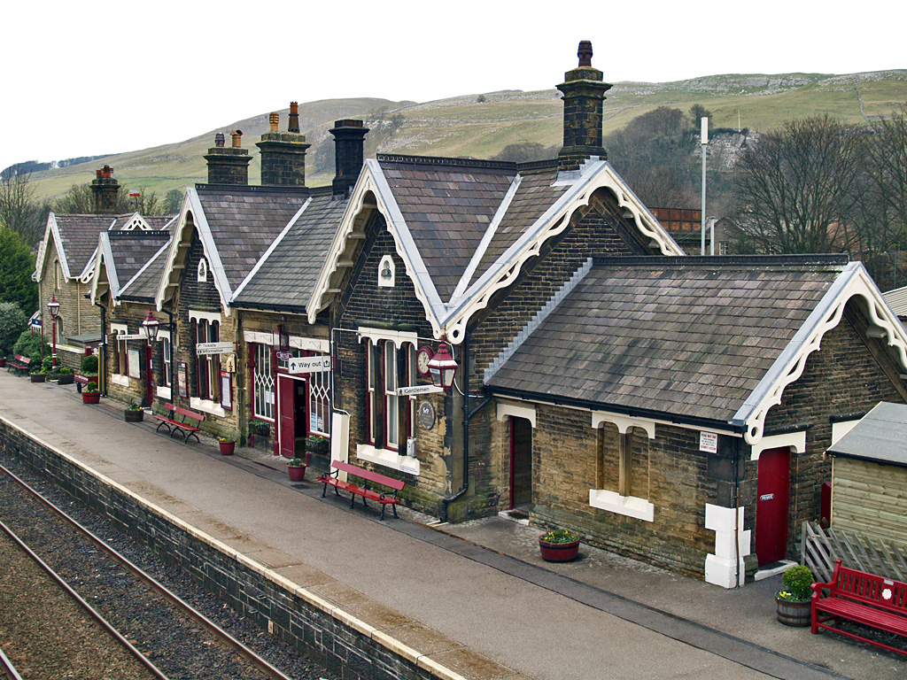
Settle railway station

Settle is a railway station on the Settle and Carlisle Line, which runs between Carlisle and Leeds via Settle. The station, situated 41 miles 37 chains...

Settle, North Yorkshire

Settle is a market town and civil parish in the Craven district of North Yorkshire, England. Historically in the West Riding of Yorkshire, the town had...

Settle Victoria Hall

Settle Victoria Hall is a Grade II listed concert hall in Kirkgate, Settle, North Yorkshire, England. It is the UK's oldest surviving music hall.Built...

Settle Junction railway station

Settle Junction railway station was located near the town of Settle, North Yorkshire, England, immediately to south of the junction between the Midland...

Settle rail crash

The Settle rail crash was a railway accident that occurred at Langcliffe near Settle, England, on the night of 21 January 1960 in which two trains collided...

Settle Hydro

Settle Hydro is a micro hydroelectric scheme, owned by the community, in Settle, North Yorkshire, England. It is located on the River Ribble, at Settle...

Nearby Amenities

Located within 500m of 54.054928,-2.2541304
The data included in this document is from www.openstreetmap.org. The data is made available under ODbL.

Have you been to Gill Plantation?

Leave your review of Gill Plantation below (or comments, questions and feedback).