Ardleigh Heath

Settlement in Essex Tendring

England

Ardleigh Heath

Field north of Birchwood Road
Field north of Birchwood Road Credit: Robin Webster

Ardleigh Heath is a small village located in the county of Essex, England. Situated approximately 8 miles northeast of Colchester, it is nestled in the picturesque countryside of the Tendring District. The village is primarily known for its peaceful and rural atmosphere, making it an ideal destination for those seeking a quiet retreat away from the hustle and bustle of city life.

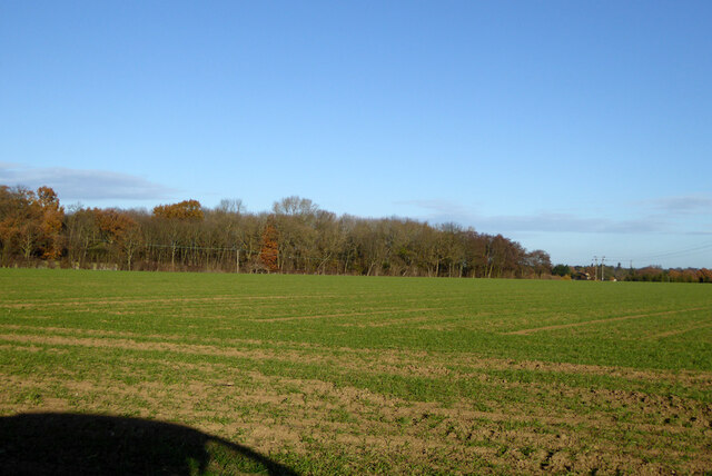
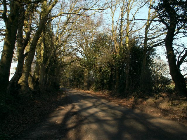
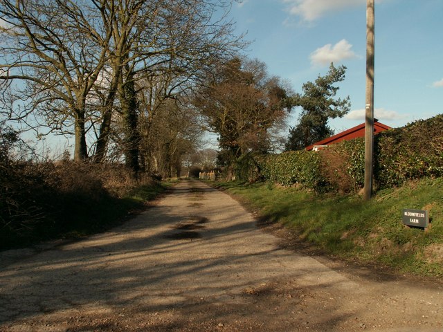
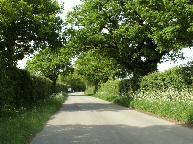
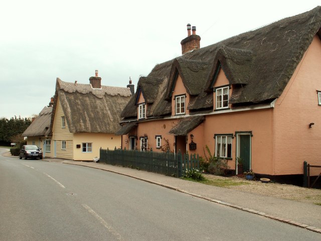
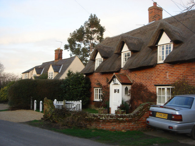
Characterized by its charming thatched cottages and traditional architecture, Ardleigh Heath offers a quintessential English countryside experience. The village is surrounded by beautiful farmlands, rolling green hills, and meandering country lanes, providing ample opportunities for scenic walks and outdoor activities.

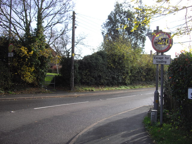
Despite its small size, Ardleigh Heath offers a range of amenities to its residents and visitors. The village is home to a local pub, which serves as a popular gathering spot for locals and visitors alike. Additionally, there is a village hall that hosts various community events and activities throughout the year.

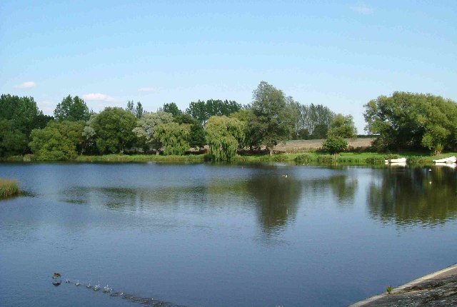
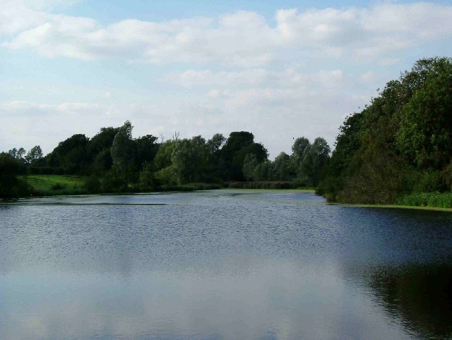
For those seeking a taste of history, Ardleigh Heath is in close proximity to several notable landmarks. The nearby Ardleigh Reservoir offers a tranquil setting for fishing and birdwatching, while the Grade II listed St. Mary's Church provides a glimpse into the village's rich historical past.

Overall, Ardleigh Heath offers a serene and idyllic setting, making it a desirable location for those in search of a peaceful countryside retreat.

If you have any feedback on the listing, please let us know in the comments section below.

Ardleigh Heath Images

Images are sourced within 2km of 51.933488/0.974963 or Grid Reference TM0430. Thanks to Geograph Open Source API. All images are credited.

Field north of Birchwood Road
Ardleigh Reservoir from Wick Lane This is a shot of Ardleigh Reservoir north of Colchester taken from near Fountain Farm. The Reservoir was created in the 1970’s when Colchester’s traditional water source at Lexden Springs became inadequate for the expanding town. The picture was taken from a causeway on Wick Lane looking north east(ish).
Ardleigh Reservoir from Wick Lane
This is a shot of Ardleigh Reservoir north of Colchester taken from near Fountain Farm. The Reservoir was created in the 1970’s when Colchester’s traditional water source at Lexden Springs became inadequate for the expanding town. The picture was taken from a causeway on Wick Lane looking north east(ish).
Ardleigh Reservoir near Hillhouse Farm This is a shot of Ardleigh Reservoir north of Colchester taken from near Hillhouse Farm on Lodge Lane this picture is looking north west. See also <a href="https://www.geograph.org.uk/gridref/TM0429">TM0429</a>
Ardleigh Reservoir near Hillhouse Farm
This is a shot of Ardleigh Reservoir north of Colchester taken from near Hillhouse Farm on Lodge Lane this picture is looking north west. See also TM0429
The Ancient House Brasserie, Ardleigh, Essex This beautiful 16th century timber-framed building stands on the south side of the Colchester Road, not far from the crossroads in Ardleigh.
The Ancient House Brasserie, Ardleigh, Essex
This beautiful 16th century timber-framed building stands on the south side of the Colchester Road, not far from the crossroads in Ardleigh.
Elm Park This building is used by a company called, Partnerships In Care Ltd. That is an organisation that cares for mental health issues.
Elm Park
This building is used by a company called, Partnerships In Care Ltd. That is an organisation that cares for mental health issues.
Milepost Milepost outside Lodge Farm near Ardleigh
Milepost
Milepost outside Lodge Farm near Ardleigh
The Morning After This is the A137 Colchester Rd Ardleigh at the Wooden Fender on New Years Morning looking towards the village.
The Morning After
This is the A137 Colchester Rd Ardleigh at the Wooden Fender on New Years Morning looking towards the village.
Lodge Lane, close to Hillhouse Farm
The road to Bloomfield's Farm
Part of Ardleigh village The road is known as The Street. The parish church of St. Mary can be seen and its beautiful tower is dated c.1500
Part of Ardleigh village
The road is known as The Street. The parish church of St. Mary can be seen and its beautiful tower is dated c.1500
Looking north along Dead Lane
Lodge Lane, Ardleigh View at the A137 entrance to Lodge Lane, heading West towards the reservoir.
Lodge Lane, Ardleigh
View at the A137 entrance to Lodge Lane, heading West towards the reservoir.
A137, Colchester Road, Ardleigh Looking towards Colchester from Lodge Lane on the A137.
A137, Colchester Road, Ardleigh
Looking towards Colchester from Lodge Lane on the A137.
Milepost by the A137, Colchester Road, Ardleigh The A137 looking north towards the village.
Milepost by the A137, Colchester Road, Ardleigh
The A137 looking north towards the village.
The Lion under new management Located in the Street Ardleigh
The Lion under new management
Located in the Street Ardleigh
Row of Gravestones at  St Mary The Virgin Ardleigh
Row of Gravestones at St Mary The Virgin Ardleigh
Bench in Harwich Road Ardleigh The bench is on an area of land that was laid out in 2002 for the Queen's golden jubilee
Bench in Harwich Road Ardleigh
The bench is on an area of land that was laid out in 2002 for the Queen's golden jubilee
Station Road Ardleigh
Show me another place!

Ardleigh Heath is located at Grid Ref: TM0430 (Lat: 51.933488, Lng: 0.974963)

Administrative County: Essex

District: Tendring

Police Authority: Essex

What 3 Words

///intervene.benched.vipers. Near Dedham, Essex

Related Wikis

Nearby Amenities

Located within 500m of 51.933488,0.974963
Power: pole
Lat/Long: 51.9368406/0.97781
Power: pole
Lat/Long: 51.9355705/0.9807711
Power: pole
Lat/Long: 51.9372341/0.9759968
Power: pole
Lat/Long: 51.9364539/0.9795849
Power: pole
Lat/Long: 51.9346908/0.9819406
Power: pole
Lat/Long: 51.9376244/0.9741246
Post Box
Ref: CO7 265
Lat/Long: 51.9350871/0.9790494
Power: pole
Lat/Long: 51.9366662/0.9793579
Power: pole
Transformer: distribution
Lat/Long: 51.9360655/0.9791671
The data included in this document is from www.openstreetmap.org. The data is made available under ODbL.

Have you been to Ardleigh Heath?

Leave your review of Ardleigh Heath below (or comments, questions and feedback).