Fiddle Clump

Wood, Forest in Wiltshire

England

Fiddle Clump

Gates to St. James' Church, North Wraxall The gateway to the church of St. James in North Wraxall.
Gates to St. James' Church, North Wraxall Credit: Kevin Pearson

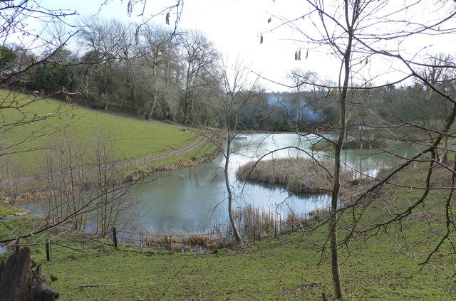
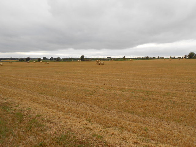
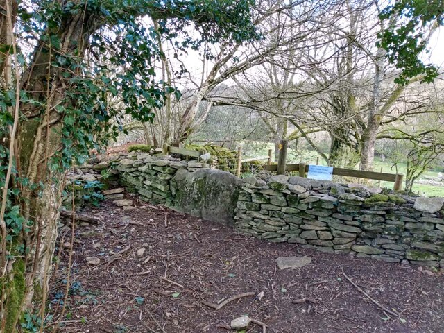
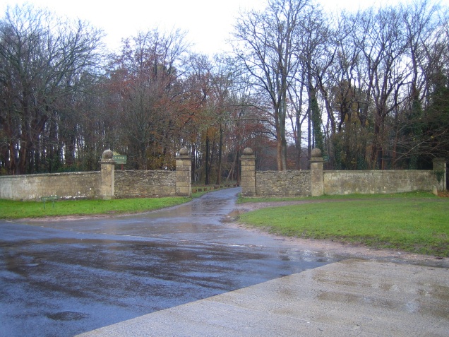
Fiddle Clump is a charming woodland located in the county of Wiltshire, England. Nestled in the heart of the countryside, this enchanting forest covers an area of approximately 100 acres. It is renowned for its picturesque beauty, offering visitors a tranquil escape from the hustle and bustle of everyday life.

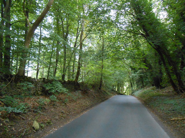
The woodland is predominantly composed of native broadleaf trees, such as oak, beech, and birch, which provide a lush and vibrant canopy throughout the year. Fiddle Clump is particularly famous for its stunning displays of bluebells, creating a sea of purple and providing a breathtaking sight during the spring months.

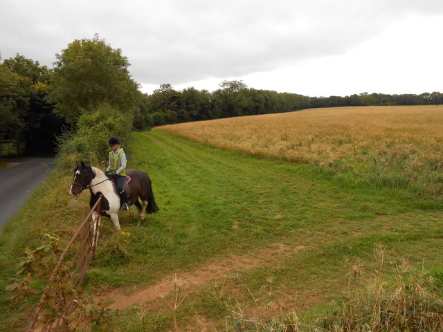
The forest is a haven for wildlife, with a diverse range of species calling it home. Visitors may spot deer gracefully roaming the woodland, squirrels darting through the trees, and a variety of bird species chirping melodiously. Fiddle Clump is a popular destination for birdwatchers, as it attracts a plethora of feathered creatures, including woodpeckers, thrushes, and many others.

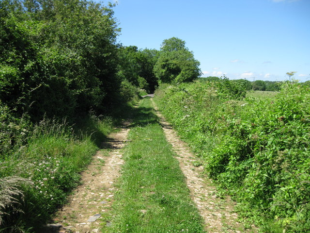
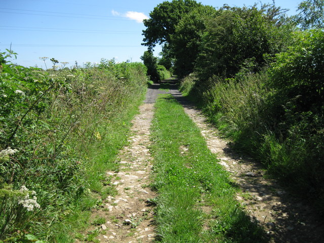
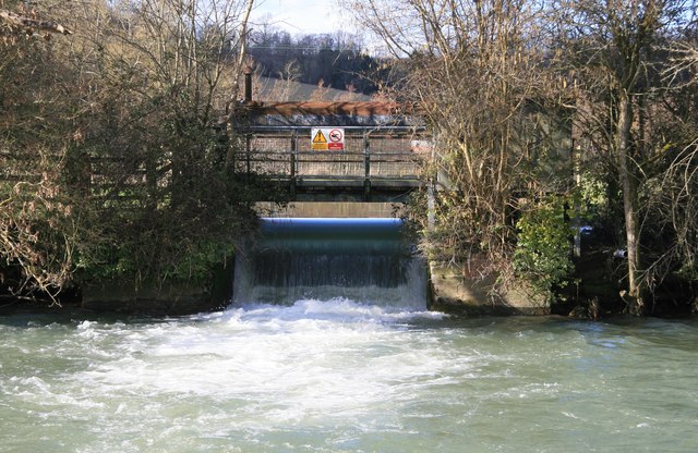
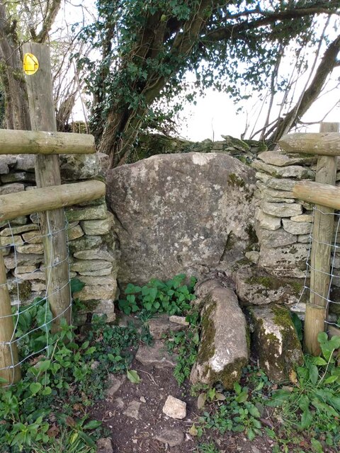
Several well-marked trails wind their way through Fiddle Clump, allowing visitors to explore the woodland at their own pace. These pathways provide an opportunity to discover the forest's hidden gems, such as a babbling brook, hidden clearings, and ancient trees with gnarled and twisted branches.

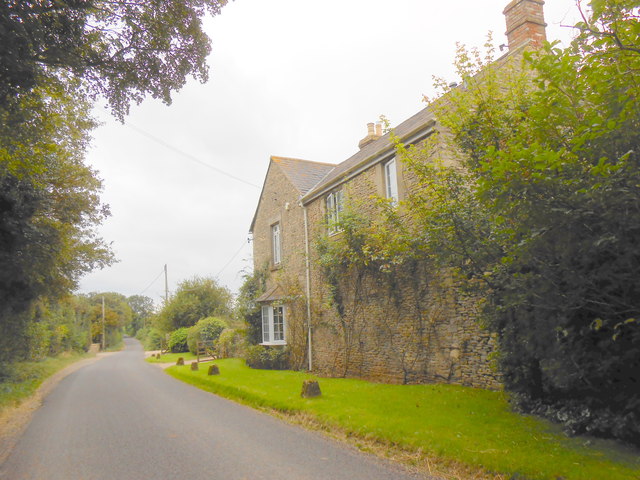
Fiddle Clump offers a peaceful retreat for nature lovers, hikers, and families alike. Whether it's a leisurely stroll, a picnic amidst nature, or simply taking in the serene surroundings, this woodland is a true gem in the Wiltshire countryside.

If you have any feedback on the listing, please let us know in the comments section below.
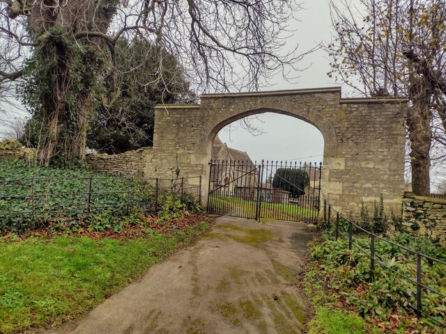
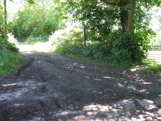
Fiddle Clump Images

Images are sourced within 2km of 51.457321/-2.2629495 or Grid Reference ST8173. Thanks to Geograph Open Source API. All images are credited.

Gates to St. James' Church, North Wraxall The gateway to the church of St. James in North Wraxall.
Gates to St. James' Church, North Wraxall
The gateway to the church of St. James in North Wraxall.
St James, North Wraxall: January 2024
The Old Coach Road The Old Coach Road is now a byway.  It leaves the tarmac lane between North Wraxall and the A420 at this point and continues roughly eastwards for a little over 2km to Ford village on the A420.
The Old Coach Road
The Old Coach Road is now a byway. It leaves the tarmac lane between North Wraxall and the A420 at this point and continues roughly eastwards for a little over 2km to Ford village on the A420.
Looking west along The Old Coach Road The byway has a good stone surface at this point.
Looking west along The Old Coach Road
The byway has a good stone surface at this point.
Looking east along The Old Coach Road
Euridge Manor Lake Seen on a walk from Colerne.
Euridge Manor Lake
Seen on a walk from Colerne.
Old Hangars At Colerne Airfield This airfield used to house an active RAF base but now it is mainly used by flying schools and Air Training Corps groups. The entrance is just off the old Fosse Way.
Old Hangars At Colerne Airfield
This airfield used to house an active RAF base but now it is mainly used by flying schools and Air Training Corps groups. The entrance is just off the old Fosse Way.
Fosse Way This shows the line of the old Roman road as it heads north and starts to descend into the valley of the Doncombe Brook. The road also make its first significant deviation from a straight line after arriving on the high ground at Bannerdown above Batheaston 4km to the south.
Fosse Way
This shows the line of the old Roman road as it heads north and starts to descend into the valley of the Doncombe Brook. The road also make its first significant deviation from a straight line after arriving on the high ground at Bannerdown above Batheaston 4km to the south.
Horse Rider arriving at the Fosse Way A footpath goes off across the field in the right foreground. The horse rider was arriving at the gate after having ridden round the field in the background. The modern road following the line of the Fosse Way can be seen on the left. There was a gap next to the gate so it was unnecessary for the rider to open the gate.
Horse Rider arriving at the Fosse Way
A footpath goes off across the field in the right foreground. The horse rider was arriving at the gate after having ridden round the field in the background. The modern road following the line of the Fosse Way can be seen on the left. There was a gap next to the gate so it was unnecessary for the rider to open the gate.
Fields at Upper Wraxall All that was left in this large wheat field after harvesting was a few round bales of straw and some stubble.It is just off the Fosse Way
Fields at Upper Wraxall
All that was left in this large wheat field after harvesting was a few round bales of straw and some stubble.It is just off the Fosse Way
Halls Barn Farm Situated right on the Fosse Way just west of North Wraxall this is a large working farm with a considerable number of buildings on both sides of the old Roman road.
Halls Barn Farm
Situated right on the Fosse Way just west of North Wraxall this is a large working farm with a considerable number of buildings on both sides of the old Roman road.
By Brook - Slaughterford Gate A sluice operated by the Environment Agency on the By Brook near Slaughterford.
By Brook - Slaughterford Gate
A sluice operated by the Environment Agency on the By Brook near Slaughterford.
Stone Stile, Colerne GS5701 On Gloucestershire footpath LMA/38 NW of the airfield looking West. The view looking East is <a href="https://www.geograph.org.uk/photo/7249155">ST7973 : Stone Stile, Colerne GS5701</a>.
Stone Stile, Colerne GS5701
On Gloucestershire footpath LMA/38 NW of the airfield looking West. The view looking East is ST7973 : Stone Stile, Colerne GS5701.
Stone Stile, Colerne GS5701 On Gloucestershire footpath LMA/38 NW of the airfield looking East. The view looking West is <a href="https://www.geograph.org.uk/photo/7249153">ST7973 : Stone Stile, Colerne GS5701</a>.
Stone Stile, Colerne GS5701
On Gloucestershire footpath LMA/38 NW of the airfield looking East. The view looking West is ST7973 : Stone Stile, Colerne GS5701.
Bridge over Doncombe Brook A view of the bridge over Doncombe Brook on the minor road from the A420 at The Shoe to Batheaston via Banner Down. The junction on the left is Doncombe Lane which goes to Colerne via the eastern perimetr of RAF Colerne. At right is the junction of Star Lane.
Bridge over Doncombe Brook
A view of the bridge over Doncombe Brook on the minor road from the A420 at The Shoe to Batheaston via Banner Down. The junction on the left is Doncombe Lane which goes to Colerne via the eastern perimetr of RAF Colerne. At right is the junction of Star Lane.
Road to Colerne past the Camp Steep hill, gets very icy in winter
Road to Colerne past the Camp
Steep hill, gets very icy in winter
The Shoe at The Shoe This used to be The Shoe pub until the early 2000s (IIRC)
The Shoe at The Shoe
This used to be The Shoe pub until the early 2000s (IIRC)
Lucknam Park Entrance to the Lucknam Park Hotel estate
Lucknam Park
Entrance to the Lucknam Park Hotel estate
Show me another place!

Fiddle Clump is located at Grid Ref: ST8173 (Lat: 51.457321, Lng: -2.2629495)

Unitary Authority: Wiltshire

Police Authority: Wiltshire

What 3 Words

///ownership.uptake.unicorns. Near North Wraxall, Wiltshire

Related Wikis

Lucknam Park

Lucknam Park is a luxury hotel, spa and restaurant in west Wiltshire, England, about 3 miles (5 km) north-west of Corsham and 7 miles (11 km) north-east...

Bury Camp

Bury Camp is the site of an Iron Age multivallate hillfort in north-west Wiltshire, England. It occupies a triangular promontory of Colerne Down, in the...

The Shoe

The Shoe is a hamlet in the parish of North Wraxall, in the north-west of Wiltshire in England. It lies at the junction of the Fosse Way (the old Roman...

North Wraxall

North Wraxall is a village and civil parish in Wiltshire, England. The village is about 6 miles (10 km) west of Chippenham, just north of the A420 road...

Frank's Wood

Frank's Wood is a woodland in Wiltshire, England, on the north-east edge of Colerne village. It covers an area of 1.96 hectares (4.84 acres). It is owned...

Colerne

Colerne is a village and civil parish in north Wiltshire, England. The village is about 3.5 miles (6 km) west of the town of Corsham and 7 miles (11 km...

Colerne Park and Monk's Wood

Colerne Park and Monk's Wood (grid reference ST838725) is a 53.7 hectare biological Site of Special Scientific Interest in Wiltshire, England, notified...

RAF Colerne

Royal Air Force Colerne or more simply RAF Colerne is a former Royal Air Force station which was on the outskirts of the village of Colerne in Wiltshire...

Nearby Amenities

Located within 500m of 51.457321,-2.2629495
Barrier: bollard
Lat/Long: 51.4564127/-2.2655202
Lucknam Park Hotel helipad
Aeroway: helipad
Surface: grass
Lat/Long: 51.4541003/-2.2614028
The data included in this document is from www.openstreetmap.org. The data is made available under ODbL.

Have you been to Fiddle Clump?

Leave your review of Fiddle Clump below (or comments, questions and feedback).