Birch Wood

Wood, Forest in Staffordshire Newcastle-under-Lyme

England

Birch Wood

View from the M6 Northbound  Yet another standstill on the M6
View from the M6 Northbound Credit: jeff collins

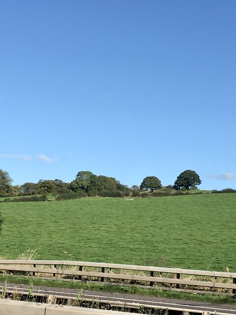
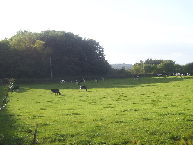
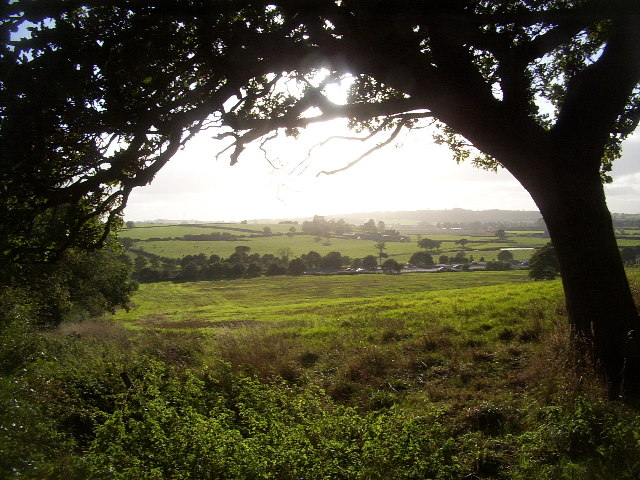
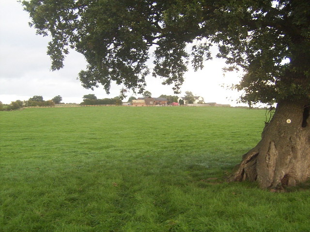
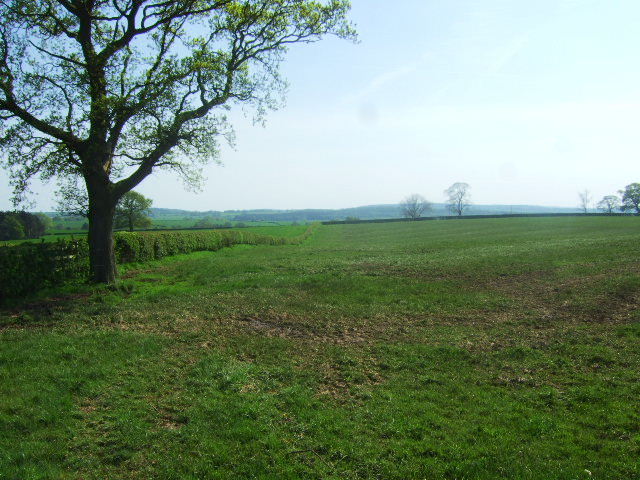
Birch Wood, Staffordshire is a picturesque woodland located in the county of Staffordshire, England. Covering an area of approximately 100 acres, this forest is known for its abundant birch trees, which give it its name. Situated in the heart of the Staffordshire countryside, Birch Wood offers a tranquil and serene environment for visitors to enjoy.

The woodland is home to a diverse range of flora and fauna, making it a haven for nature enthusiasts. The birch trees, with their distinctive silver bark and delicate leaves, create a stunning visual display throughout the year. In spring, the forest floor is carpeted with bluebells, while in autumn, the vibrant hues of changing leaves provide a breathtaking spectacle.

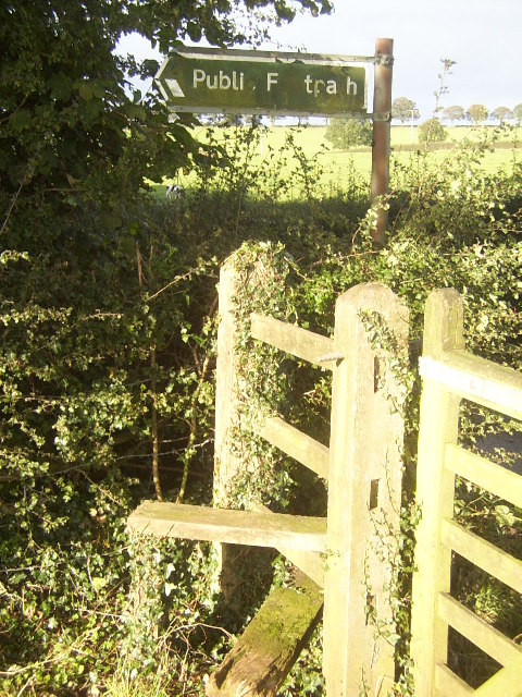
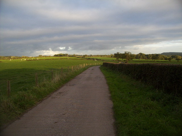
Birch Wood is also a popular destination for outdoor activities such as walking, hiking, and birdwatching. There are several well-maintained trails that crisscross the forest, leading visitors through its enchanting beauty. As visitors explore the woodland, they may be lucky enough to spot a variety of wildlife, including deer, squirrels, and a wide array of bird species.

For those seeking a peaceful retreat, Birch Wood offers several picnic areas and benches where visitors can relax and take in the natural surroundings. The forest is well-maintained, with clear pathways, ensuring visitors of all ages can enjoy its beauty.

In conclusion, Birch Wood in Staffordshire is a stunning forest that showcases the beauty of nature. With its abundance of birch trees, diverse wildlife, and well-maintained trails, it offers a wonderful opportunity for visitors to immerse themselves in the tranquility of the countryside.

If you have any feedback on the listing, please let us know in the comments section below.

Birch Wood Images

Images are sourced within 2km of 52.995199/-2.2885029 or Grid Reference SJ8044. Thanks to Geograph Open Source API. All images are credited.

View from the M6 Northbound  Yet another standstill on the M6
View from the M6 Northbound
Yet another standstill on the M6
Trees at Keele Christmas Tree Farm
Keele Christmas Tree Farm
Merrily Munching Cows A lot of the region around this area is devoted to cattle, mostly dairy cattle. Here is a herd of calves, apparently all male (I didn't check!), presumably being fattened up to make beefburgers. Curiously enough, the map charts a railway not far behind the woodland at the rear of the image, which continues down into <a href="https://www.geograph.org.uk/gridref/SJ7944">SJ7944</a>, yet no evidence of it is visible, save some abandoned cuttings.
Merrily Munching Cows
A lot of the region around this area is devoted to cattle, mostly dairy cattle. Here is a herd of calves, apparently all male (I didn't check!), presumably being fattened up to make beefburgers. Curiously enough, the map charts a railway not far behind the woodland at the rear of the image, which continues down into SJ7944, yet no evidence of it is visible, save some abandoned cuttings.
Stile near Highway Farm Any more iconic and this would be on a shortbread tin... at least up in Scotland! This square also contains the North Staffordshire Railway, which, despite being closed down as part of the Beeching plan, is still shown as being very much alive on maps today.
Stile near Highway Farm
Any more iconic and this would be on a shortbread tin... at least up in Scotland! This square also contains the North Staffordshire Railway, which, despite being closed down as part of the Beeching plan, is still shown as being very much alive on maps today.
Motorway and Fields Rural Staffordshire. Quiet, peaceful, idyllic. And cut in two by the roaring inferno of the M6. Oh well, I guess folks have got to travel.
Motorway and Fields
Rural Staffordshire. Quiet, peaceful, idyllic. And cut in two by the roaring inferno of the M6. Oh well, I guess folks have got to travel.
Lower Stoneylow Farm Taken from the footpath that approaches the farm buildings, this shows one of the typical pastures that are present for miles around, along with a rather gnarled old oak tree.
Lower Stoneylow Farm
Taken from the footpath that approaches the farm buildings, this shows one of the typical pastures that are present for miles around, along with a rather gnarled old oak tree.
Track near Stoney Low A pleasant walk on an autumn afternoon, this track forms part of a path that leads from the village of Madeley to Keele Service Station on the M6.
Track near Stoney Low
A pleasant walk on an autumn afternoon, this track forms part of a path that leads from the village of Madeley to Keele Service Station on the M6.
Fields near Highway Farm The farmland near Highway farm.
Fields near Highway Farm
The farmland near Highway farm.
Field and fertiliser The field has recently been spread with manure,and chain harrowed.
Field and fertiliser
The field has recently been spread with manure,and chain harrowed.
Railway Bridge, A525, Keele The line is no longer in use
Railway Bridge, A525, Keele
The line is no longer in use
M6 motorway - Silverdale branch railway bridge
M6 motorway near Stoney Low
M6 motorway - footbridge near Hungerford House Farm
Disused railway bridge crosses M6 North
Footpath to Honeywall Farm The footpath bears off Highway Lane
Footpath to Honeywall Farm
The footpath bears off Highway Lane
Hedge Near Highway Farm Pasture land south-west of Keele
Hedge Near Highway Farm
Pasture land south-west of Keele
Hungerford House Farm Bridge, M6 The M6 motorway runs from junction 19 of the M1 at the Catthorpe Interchange, near Rugby to the Gretna junction (J45). Here it becomes the A74(M) and M74 which continues to Glasgow.

The M6 is the longest motorway in the United Kingdom (232 miles) and one of the busiest. It incorporates the first length of motorway opened in the UK (the Preston bypass in 1958) and forms part of a motorway "Backbone of Britain", running north-south between London and Glasgow via the industrial north of England. It is also part of the east-west route between the Midlands and the east coast ports.
Hungerford House Farm Bridge, M6
The M6 motorway runs from junction 19 of the M1 at the Catthorpe Interchange, near Rugby to the Gretna junction (J45). Here it becomes the A74(M) and M74 which continues to Glasgow. The M6 is the longest motorway in the United Kingdom (232 miles) and one of the busiest. It incorporates the first length of motorway opened in the UK (the Preston bypass in 1958) and forms part of a motorway "Backbone of Britain", running north-south between London and Glasgow via the industrial north of England. It is also part of the east-west route between the Midlands and the east coast ports.
Show me another place!

Birch Wood is located at Grid Ref: SJ8044 (Lat: 52.995199, Lng: -2.2885029)

Administrative County: Staffordshire

District: Newcastle-under-Lyme

Police Authority: Staffordshire

What 3 Words

///lock.shuts.cans. Near Keele, Staffordshire

Related Wikis

Keele services

Keele services is a motorway service station, between junctions 15 and 16 of the M6 motorway near Keele in England. Operated by Welcome Break, it was built...

Keele (ward)

Keele Ward is a local council ward in the borough of Newcastle-under-Lyme. It covers the village of Keele and the neighbouring University of Keele's campus...

Hollywood Music Festival

The Hollywood Music Festival was held at Leycett in an area called Hollywood on the grounds of Ted Askey's Lower (pig) Farm at Finney Green, between Silverdale...

Keele

Keele is a village and civil parish in the Borough of Newcastle-under-Lyme in Staffordshire, England. It is approximately 3 miles (4.8 km) west of Newcastle...

Loggerheads and Whitmore (ward)

Loggerheads and Whitmore ward was a ward in the Borough of Newcastle-under-Lyme, in the county of Staffordshire, England. It covered, amongst others, the...

Keele Hall

Keele Hall is a 19th-century mansion house at Keele, Staffordshire, England, now standing on the campus of Keele University and serving as the university...

Keele University Science & Business Park

Keele University Science and Innovation Park is a science and business development facility located on the campus of Keele University in North Staffordshire...

Keele University

Keele University, officially known as the University of Keele, is a public research university in Keele, approximately three miles (five kilometres) from...

Nearby Amenities

Located within 500m of 52.995199,-2.2885029
Motorway Junction
Keele Services
Lat/Long: 52.9929572/-2.2830227
Bus Stop
Keele Services
Naptan AtcoCode: 3800C501102
Naptan Bearing: NW
Naptan BusStopType: CUS
Naptan CommonName: Keele Services
Naptan Indicator: Adj
Naptan Landmark: Keele Services Northbound
Naptan Street: M6
Naptan Verified: no
Source: naptan_import
Lat/Long: 52.9930843/-2.2890447
Police
Lat/Long: 52.9927396/-2.2908741
Access: no
Barrier: lift_gate
Bicycle: no
Foot: no
Horse: no
Locked: yes
Motor Vehicle: no
Opening Hours: 24/7
Source: Bing;local knowledge
Lat/Long: 52.9949403/-2.2923002
Access: no
Barrier: lift_gate
Bicycle: no
Foot: no
Horse: no
Locked: yes
Motor Vehicle: no
Opening Hours: 24/7
Source: local knowledge
Lat/Long: 52.9927092/-2.2913549
Give Way
Lat/Long: 52.9927844/-2.290234
Crossing
Crossing: zebra
Lat/Long: 52.9931307/-2.2894709
Stop
Lat/Long: 52.9927975/-2.2899349
Post Box
Brand: Royal Mail
Brand Wikidata: Q638098
Collection Times: Mo-Fr 16:00; Sa 10:00
Operator: Royal Mail
Operator Wikidata: Q638098
Post Box Design: type_k
Post Box Type: pillar
Ref: ST5 528
Royal Cypher: EIIR
Royal Cypher Wikidata: Q33102113
Source: survey
Lat/Long: 52.9941506/-2.2902732
Stop
Lat/Long: 52.9943588/-2.2892947
Toilets
Check Date: 2023-07-12
Fee: no
Wheelchair: yes
Lat/Long: 52.9939088/-2.2901783
Cafe
Starbucks
Brand: Starbucks
Brand Wikidata: Q37158
Cuisine: coffee_shop
Website: https://www.starbucks.com/store-locator/store/19050/keele-s-welcome-break-m-6-motorway-southbound-junction-15-16-three-mile-
Lat/Long: 52.9931191/-2.2901115
WHSmith
Addr Postcode: ST5 5HG
Addr Street: Three Mile Lane
Brand: WHSmith
Brand Wikidata: Q1548712
Brand Wikipedia: en:WHSmith
Fhrs Id: 40936
Shop: newsagent
Source Addr: FHRS Open Data
Lat/Long: 52.9931611/-2.2902509
Waitrose
Addr Postcode: ST5 5HG
Addr Street: Three Mile Lane
Brand: Waitrose & Partners
Brand Wikidata: Q771734
Brand Wikipedia: en:Waitrose & Partners
Fhrs Id: 132021
Operator: Waitrose & Partners
Shop: convenience
Source Addr: FHRS Open Data
Lat/Long: 52.9932951/-2.2902348
Toilets
Lat/Long: 52.9933096/-2.2899317
Fast Food
Burger King
Addr Postcode: ST5 5HG
Addr Street: Three Mile Lane
Brand: Burger King
Brand Wikidata: Q177054
Brand Wikipedia: en:Burger King
Contact Website: https://locations.burgerking.co.uk/keele/junction-15-16-m6-motorway-keele
Cuisine: burger
Drive Through: no
Fhrs Id: 88357
Source Addr: FHRS Open Data
Takeaway: yes
Lat/Long: 52.9936745/-2.290141
Fast Food
KFC
Addr Country: GB
Addr Postcode: ST5 5HG
Addr Street: Three Mile Lane
Alt Name: Kentucky Fried Chicken
Brand: KFC
Brand Wikidata: Q524757
Brand Wikipedia: en:KFC
Contact Website: https://www.kfc.co.uk/kfc-near-me/keele-m6-services
Cuisine: chicken
Drive Through: no
Fhrs Id: 40861
Source Addr: FHRS Open Data
Takeaway: yes
Lat/Long: 52.9937564/-2.2901397
Fast Food
Papa John's
Brand Wikidata: Q2759586
Cuisine: pizza
Lat/Long: 52.9938376/-2.2904736
Cafe
Starbucks
Addr Postcode: ST5 5HG
Addr Street: Three Mile Lane
Brand: Starbucks
Brand Wikidata: Q37158
Brand Wikipedia: en:Starbucks
Check Date: 2023-07-12
Cuisine: coffee_shop
Fhrs Id: 131895
Official Name: Starbucks Coffee
Source Addr: FHRS Open Data
Takeaway: yes
Website: https://www.starbucks.com/store-locator/store/19049/keele-n-welcome-break-m-6-motorway-northbound-junction-15-16-staffordshi
Lat/Long: 52.9940087/-2.2902509
WHSmith
Addr Postcode: ST5 5HG
Addr Street: Three Mile Lane
Brand: WHSmith
Brand Wikidata: Q1548712
Brand Wikipedia: en:WHSmith
Check Date: 2023-07-12
Fhrs Id: 41029
Shop: newsagent
Source Addr: FHRS Open Data
Lat/Long: 52.9939845/-2.2904199
Charging Station
Keele Southbound Supercharger
Access: customers
Addr City: Stoke-on-Trent
Addr Country: GB
Addr Postcode: ST5 5HG
Bicycle: no
Brand: Tesla Supercharger
Brand Wikidata: Q17089620
Capacity: 4
Fee: yes
Motorcar: yes
Opening Hours: 24/7
Operator: Tesla, Inc.
Socket Tesla Supercharger: 4
Socket Tesla Supercharger Output: 150 kW
Socket Tesla Supercharger Ccs: 4
Socket Tesla Supercharger Ccs Output: 150 kW
Website: https://www.tesla.com/findus/location/supercharger/keelesouthsupercharger
Lat/Long: 52.9940936/-2.2905796
Charging Station
Keele Southbound Supercharger
Access: customers
Addr City: Stoke-on-Trent
Addr Country: GB
Addr Postcode: ST5 5HG
Brand: Tesla Supercharger
Brand Wikidata: Q17089620
Capacity: 4
Fee: yes
Opening Hours: 24/7
Operator: Tesla, Inc.
Socket Tesla Supercharger: 4
Socket Tesla Supercharger Output: 150 kW
Socket Tesla Supercharger Ccs: 4
Socket Tesla Supercharger Ccs Output: 150 kW
Website: https://www.tesla.com/findus/location/supercharger/keelesouthsupercharger
Lat/Long: 52.9940512/-2.2907807
Atm
Lat/Long: 52.9941171/-2.2902283
Cafe
Starbucks
Addr Postcode: ST5 5HG
Addr Street: Three Mile Lane
Brand: Starbucks
Brand Wikidata: Q37158
Brand Wikipedia: en:Starbucks
Cuisine: coffee_shop
Drive Through: yes
Fhrs Id: 830891
Official Name: Starbucks Coffee
Source Addr: FHRS Open Data
Takeaway: only
Website: https://www.starbucks.com/store-locator/store/1013272/keele-north-dt-welcome-break-m-6-motorway-northbound-newcastle-eng-st-5-5-hg-gb
Lat/Long: 52.9942951/-2.289459
Atm
Lat/Long: 52.9937856/-2.2874132
Contact Website: https://electrichighway.gridserve.com/keele-southbound-services
Man Made: charging_station
Operator: Gridserve
Operator Wikidata: Q89575318
Lat/Long: 52.9942884/-2.2902132
Capacity: 2
Contact Website: https://electrichighway.gridserve.com/keele-southbound-services
Man Made: charging_station
Operator: Gridserve
Operator Wikidata: Q89575318
Lat/Long: 52.9942931/-2.2902831
Stop
Lat/Long: 52.9935738/-2.2867884
Crossing
Crossing: zebra
Lat/Long: 52.9943668/-2.2901544
Crossing
Crossing: zebra
Lat/Long: 52.9931173/-2.2892094
Crossing
Crossing: zebra
Lat/Long: 52.9931034/-2.2889458
Crossing
Crossing: zebra
Lat/Long: 52.993088/-2.2886519
Crossing
Crossing: zebra
Lat/Long: 52.993075/-2.288405
Crossing
Crossing: zebra
Lat/Long: 52.9930622/-2.2881614
Crossing
Crossing: zebra
Lat/Long: 52.9930526/-2.2879789
Crossing
Crossing: zebra
Lat/Long: 52.9930404/-2.2877455
Stop
Lat/Long: 52.9928075/-2.2896673
Crossing
Crossing: zebra
Lat/Long: 52.9929643/-2.2898553
Crossing
Crossing: zebra
Lat/Long: 52.9942124/-2.2901827
Stop
Lat/Long: 52.9943059/-2.2897247
Stop
Lat/Long: 52.9943223/-2.2894283
Give Way
Lat/Long: 52.9942157/-2.2892217
Crossing
Crossing: marked
Lat/Long: 52.9930731/-2.2895131
Charging Station
Keele Northbound Supercharger
Access: customers
Addr City: Newcastle-Under-Lyme
Addr Country: GB
Addr Postcode: ST5 5HG
Brand: Tesla Supercharger
Brand Wikidata: Q17089620
Capacity: 8
Fee: yes
Opening Hours: 24/7
Operator: Tesla, Inc.
Socket Tesla Supercharger: 8
Socket Tesla Supercharger Output: 150 kW
Socket Tesla Supercharger Ccs: 8
Socket Tesla Supercharger Ccs Output: 150 kW
Website: https://www.tesla.com/findus/location/supercharger/keelenorthsupercharger
Lat/Long: 52.9929435/-2.2902873
Charging Station
Contact Website: https://electrichighway.gridserve.com/keele-southbound-services
Operator: Gridserve
Operator Wikidata: Q89575318
Lat/Long: 52.9942956/-2.2902471
The data included in this document is from www.openstreetmap.org. The data is made available under ODbL.

Have you been to Birch Wood?

Leave your review of Birch Wood below (or comments, questions and feedback).