Bear's Rough

Wood, Forest in Staffordshire Newcastle-under-Lyme

England

Bear's Rough

Trees at Keele Christmas Tree Farm
Trees at Keele Christmas Tree Farm Credit: Jonathan Hutchins

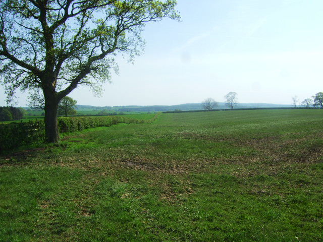
Bear's Rough is a picturesque woodland area located in Staffordshire, England. Covering a vast expanse, it is a part of the larger Cannock Chase Forest, which is known for its natural beauty and diverse wildlife. The forest is situated approximately 30 miles north of Birmingham and is easily accessible by road.

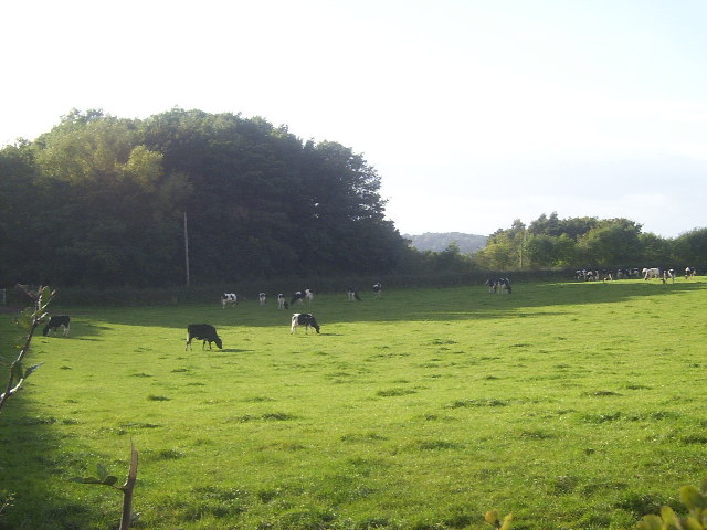
Bear's Rough is characterized by its dense and ancient woodlands, consisting primarily of oak and birch trees. The area is home to a variety of flora and fauna, including deer, foxes, and a wide range of bird species. The forest floor is adorned with bluebells and wildflowers during the spring, creating a vibrant and colorful landscape.

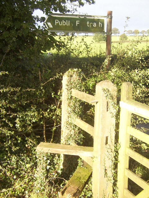
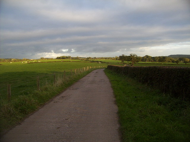
Visitors to Bear's Rough can enjoy a range of outdoor activities. There are several walking trails that meander through the woodland, offering breathtaking views of the surrounding countryside. The forest also boasts cycling routes, making it a popular destination for cyclists of all levels. Additionally, Bear's Rough provides opportunities for wildlife spotting and nature photography, with designated bird hides and observation points scattered throughout the area.

For those seeking a more tranquil experience, Bear's Rough offers peaceful picnic spots and secluded areas for relaxation. The forest is well-maintained, with facilities such as toilets and car parks provided for visitors' convenience. Moreover, the area is managed by the Forestry Commission, ensuring its preservation and protection for future generations to enjoy.

In conclusion, Bear's Rough in Staffordshire is a stunning woodland area that offers a range of recreational activities amidst its beautiful natural surroundings. Whether it's hiking, cycling, or simply immersing oneself in the tranquility of nature, this forest provides an idyllic escape from the hustle and bustle of everyday life.

If you have any feedback on the listing, please let us know in the comments section below.
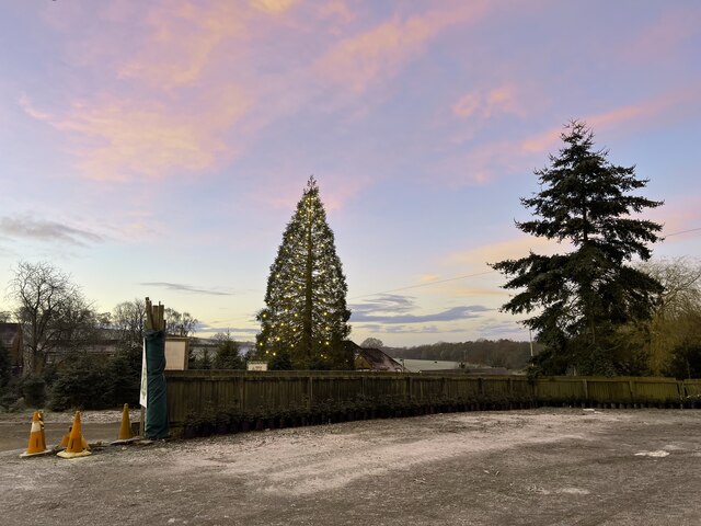
Bear's Rough Images

Images are sourced within 2km of 52.999128/-2.28467 or Grid Reference SJ8044. Thanks to Geograph Open Source API. All images are credited.

Trees at Keele Christmas Tree Farm
Keele Christmas Tree Farm
Merrily Munching Cows A lot of the region around this area is devoted to cattle, mostly dairy cattle. Here is a herd of calves, apparently all male (I didn't check!), presumably being fattened up to make beefburgers. Curiously enough, the map charts a railway not far behind the woodland at the rear of the image, which continues down into <a href="https://www.geograph.org.uk/gridref/SJ7944">SJ7944</a>, yet no evidence of it is visible, save some abandoned cuttings.
Merrily Munching Cows
A lot of the region around this area is devoted to cattle, mostly dairy cattle. Here is a herd of calves, apparently all male (I didn't check!), presumably being fattened up to make beefburgers. Curiously enough, the map charts a railway not far behind the woodland at the rear of the image, which continues down into SJ7944, yet no evidence of it is visible, save some abandoned cuttings.
Stile near Highway Farm Any more iconic and this would be on a shortbread tin... at least up in Scotland! This square also contains the North Staffordshire Railway, which, despite being closed down as part of the Beeching plan, is still shown as being very much alive on maps today.
Stile near Highway Farm
Any more iconic and this would be on a shortbread tin... at least up in Scotland! This square also contains the North Staffordshire Railway, which, despite being closed down as part of the Beeching plan, is still shown as being very much alive on maps today.
Track near Stoney Low A pleasant walk on an autumn afternoon, this track forms part of a path that leads from the village of Madeley to Keele Service Station on the M6.
Track near Stoney Low
A pleasant walk on an autumn afternoon, this track forms part of a path that leads from the village of Madeley to Keele Service Station on the M6.
Fields near Highway Farm The farmland near Highway farm.
Fields near Highway Farm
The farmland near Highway farm.
Field and fertiliser The field has recently been spread with manure,and chain harrowed.
Field and fertiliser
The field has recently been spread with manure,and chain harrowed.
Railway Bridge, A525, Keele The line is no longer in use
Railway Bridge, A525, Keele
The line is no longer in use
M6 motorway - Silverdale branch railway bridge
Disused railway bridge crosses M6 North
Footpath to Honeywall Farm The footpath bears off Highway Lane
Footpath to Honeywall Farm
The footpath bears off Highway Lane
Hedge Near Highway Farm Pasture land south-west of Keele
Hedge Near Highway Farm
Pasture land south-west of Keele
Railway Bridge, M6 The M6 motorway runs from junction 19 of the M1 at the Catthorpe Interchange, near Rugby to the Gretna junction (J45). Here it becomes the A74(M) and M74 which continues to Glasgow.

The M6 is the longest motorway in the United Kingdom (232 miles) and one of the busiest. It incorporates the first length of motorway opened in the UK (the Preston bypass in 1958) and forms part of a motorway "Backbone of Britain", running north-south between London and Glasgow via the industrial north of England. It is also part of the east-west route between the Midlands and the east coast ports.
Railway Bridge, M6
The M6 motorway runs from junction 19 of the M1 at the Catthorpe Interchange, near Rugby to the Gretna junction (J45). Here it becomes the A74(M) and M74 which continues to Glasgow. The M6 is the longest motorway in the United Kingdom (232 miles) and one of the busiest. It incorporates the first length of motorway opened in the UK (the Preston bypass in 1958) and forms part of a motorway "Backbone of Britain", running north-south between London and Glasgow via the industrial north of England. It is also part of the east-west route between the Midlands and the east coast ports.
Disused railway bridge over M6 west of Keele services
M6 south approaching disused railway bridge
Footpath to Finney Green At the end of the drive are some substantial gates the footpath continues past them, if you keep your eyes peeled you will see the waymark on the left before wandering into a private garden.
Footpath to Finney Green
At the end of the drive are some substantial gates the footpath continues past them, if you keep your eyes peeled you will see the waymark on the left before wandering into a private garden.
Footpath to Station Rd This footpath connects with <a href="https://www.geograph.org.uk/photo/3112685">SJ8045 : Station Road Keele</a>
Footpath to Station Rd
This footpath connects with SJ8045 : Station Road Keele
The Drive to Highway Farm If you get this far you have missed the point where the bridleway leaves the farm track!
The Drive to Highway Farm
If you get this far you have missed the point where the bridleway leaves the farm track!
Show me another place!

Bear's Rough is located at Grid Ref: SJ8044 (Lat: 52.999128, Lng: -2.28467)

Administrative County: Staffordshire

District: Newcastle-under-Lyme

Police Authority: Staffordshire

What 3 Words

///calls.desire.goat. Near Keele, Staffordshire

Related Wikis

Keele

Keele is a village and civil parish in the Borough of Newcastle-under-Lyme in Staffordshire, England. It is approximately 3 miles (4.8 km) west of Newcastle...

Keele (ward)

Keele Ward is a local council ward in the borough of Newcastle-under-Lyme. It covers the village of Keele and the neighbouring University of Keele's campus...

Keele services

Keele services is a motorway service station, between junctions 15 and 16 of the M6 motorway near Keele in England. Operated by Welcome Break, it was built...

Keele University Science & Business Park

Keele University Science and Innovation Park is a science and business development facility located on the campus of Keele University in North Staffordshire...

Keele University

Keele University, officially known as the University of Keele, is a public research university in Keele, approximately three miles (five kilometres) from...

Keele Hall

Keele Hall is a 19th-century mansion house at Keele, Staffordshire, England, now standing on the campus of Keele University and serving as the university...

Hollywood Music Festival

The Hollywood Music Festival was held at Leycett in an area called Hollywood on the grounds of Ted Askey's Lower (pig) Farm at Finney Green, between Silverdale...

Keele University School of Medicine

Keele University School of Medicine is a medical school located in Newcastle-under-Lyme and Shrewsbury. The first two years of the school's MBChB degree...

Nearby Amenities

Located within 500m of 52.999128,-2.28467
Bus Stop
Holly Cross Hall
Bus: yes
Naptan AtcoCode: 3800C542501
Naptan Bearing: W
Naptan BusStopType: CUS
Naptan CommonName: Holly Cross Hall
Naptan Indicator: Adj
Naptan Landmark: Holly Cross Hall
Naptan PlusbusZoneRef: STOKEOT
Naptan Street: Main Rd
Naptan Verified: no
Public Transport: platform
Source: naptan_import
Lat/Long: 53.0021299/-2.2805963
Bus Stop
Holly Cross Hall
Bus: yes
Naptan AtcoCode: 3800C542502
Naptan Bearing: E
Naptan CommonName: Holly Cross Hall
Naptan Indicator: Opp
Naptan Landmark: Holly Cross Hall
Naptan PlusbusZoneRef: STOKEOT
Naptan Street: Main Rd
Naptan Verified: no
Public Transport: platform
Source: naptan_import
Lat/Long: 53.0022023/-2.280418
Parking
Lat/Long: 53.0030812/-2.2882117
Crossing
Crossing Ref: zebra
Lat/Long: 53.0024174/-2.2841426
The data included in this document is from www.openstreetmap.org. The data is made available under ODbL.

Have you been to Bear's Rough?

Leave your review of Bear's Rough below (or comments, questions and feedback).