Ardintoul

Settlement in Ross-shire

Scotland

Ardintoul

Path meets the forest road The small cairn lower left marks the junction with the path from Glen More.
Path meets the forest road Credit: Jim Barton

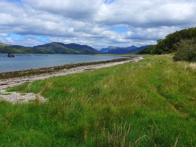
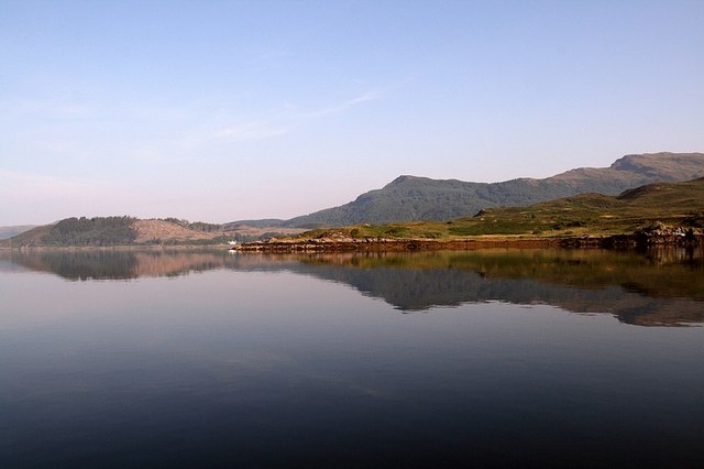
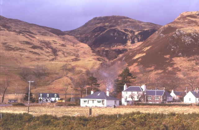
Ardintoul is a small village located in the county of Ross-shire, in the Highlands region of Scotland. Situated on the northwest coast, it is nestled between the picturesque Loch Duich and the majestic mountains of the Scottish Highlands. With a population of around 100 residents, Ardintoul offers a tranquil and serene setting.

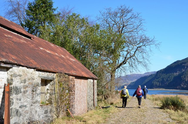
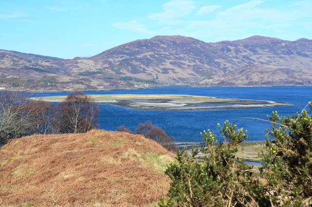
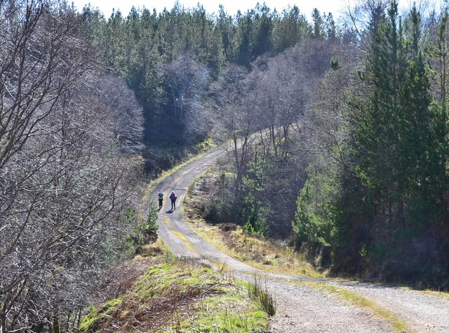
The village is known for its stunning natural beauty, with breathtaking landscapes that attract outdoor enthusiasts and nature lovers alike. The surrounding area is abundant in wildlife, including red deer, otters, and a variety of bird species. Additionally, Ardintoul boasts an impressive variety of flora, with heather-covered moorlands and ancient Caledonian pine forests.

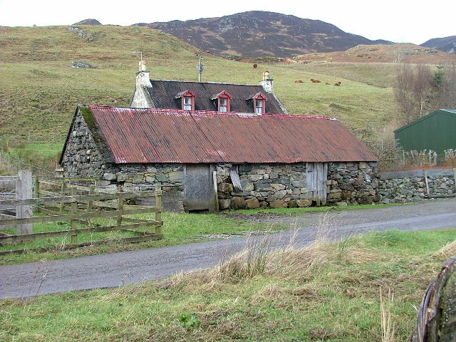
The village itself consists of a few scattered houses, maintaining a close-knit and friendly community spirit. Although lacking in amenities, Ardintoul is just a short drive away from the nearby town of Kyle of Lochalsh, where residents can find shops, restaurants, and other essential services.

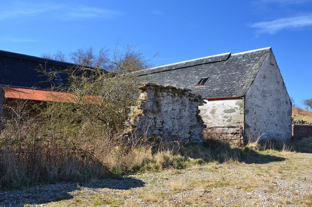
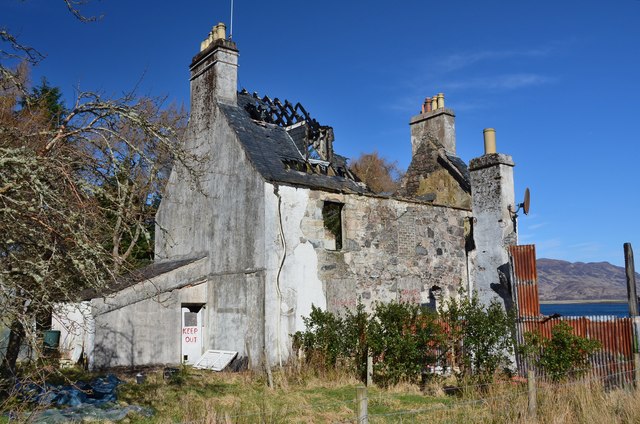
A prominent feature in Ardintoul is the historic Ardintoul House, a grand Georgian mansion that dates back to the 18th century. This impressive building adds to the charm and character of the village, reflecting its rich history.

Overall, Ardintoul offers a perfect escape from the hustle and bustle of city life, providing a peaceful retreat for those seeking tranquility amidst stunning natural surroundings.

If you have any feedback on the listing, please let us know in the comments section below.

Ardintoul Images

Images are sourced within 2km of 57.255029/-5.5992971 or Grid Reference NG8324. Thanks to Geograph Open Source API. All images are credited.

Path meets the forest road The small cairn lower left marks the junction with the path from Glen More.
Path meets the forest road
The small cairn lower left marks the junction with the path from Glen More.
Forest road near Glas Bheinn A tarmac surfaced forest road between Glen Bernera and Ardintoul.
Forest road near Glas Bheinn
A tarmac surfaced forest road between Glen Bernera and Ardintoul.
Camas nan Gall Looking across the bay of Camas nan Gall to the flat ground of Ardintoul Point. On the far shore is Dornie with the peak of Sguman Coinntich prominent.
Camas nan Gall
Looking across the bay of Camas nan Gall to the flat ground of Ardintoul Point. On the far shore is Dornie with the peak of Sguman Coinntich prominent.
Shingle beach, Camas nan Gall Dornie is ahead with the mountains near Loch Long in the background. The cylindrical object is part of a fish farm.
Shingle beach, Camas nan Gall
Dornie is ahead with the mountains near Loch Long in the background. The cylindrical object is part of a fish farm.
Fish farm, Camas nan Gall Near the coast beyond the exit from Kyle Rhea to Loch Alsh.
Fish farm, Camas nan Gall
Near the coast beyond the exit from Kyle Rhea to Loch Alsh.
Beach, Camas nan Gall Shingle and coarse sand on the beach not far from the flat grassy point at Ardintoul.
Beach, Camas nan Gall
Shingle and coarse sand on the beach not far from the flat grassy point at Ardintoul.
Coastal path at Ardintoul A waymark on the post indicates a turn right to the old farm buildings.
Coastal path at Ardintoul
A waymark on the post indicates a turn right to the old farm buildings.
Old farm buildings, Ardintoul Barns arranged around a courtyard, now overgrown.
Old farm buildings, Ardintoul
Barns arranged around a courtyard, now overgrown.
Track at Ardintoul The track passes old farm buildings and the burnt-out remains of Ardintoul House.
Track at Ardintoul
The track passes old farm buildings and the burnt-out remains of Ardintoul House.
Remains of Ardintoul House Destroyed by fire in 2012, the remains now carry 'Keep out' signs.
Remains of Ardintoul House
Destroyed by fire in 2012, the remains now carry 'Keep out' signs.
Loch Alsh from Ardintoul Point Looking across the low flat island of Glas Eilean to Dornie and the hills around Loch Long.
Loch Alsh from Ardintoul Point
Looking across the low flat island of Glas Eilean to Dornie and the hills around Loch Long.
Steep road down to Ardintoul A tarmacked section of the forest road on the descent to Ardintoul.
Steep road down to Ardintoul
A tarmacked section of the forest road on the descent to Ardintoul.
Glas Eilean and Ardintoul Bay The flat grassy island in Loch Alsh being put to good use, as sheep were grazing there.
Glas Eilean and Ardintoul Bay
The flat grassy island in Loch Alsh being put to good use, as sheep were grazing there.
Forest road from Ardintoul The forest road crossing the Allt an Stuchdain in Ardintoul Wood.
Forest road from Ardintoul
The forest road crossing the Allt an Stuchdain in Ardintoul Wood.
Glas Bheinn Only 394m in height but the shapely steep side of this hill stands out above Glen Bernera. Much of the forest plantation on this side has been clear felled.
Glas Bheinn
Only 394m in height but the shapely steep side of this hill stands out above Glen Bernera. Much of the forest plantation on this side has been clear felled.
Camas nan Gall The Kintail hills in the distance with the waters of Loch Alsh before.
Camas nan Gall
The Kintail hills in the distance with the waters of Loch Alsh before.
Eastern shores of Camas nan Gall A fish farm in the waters of Loch Alsh to the left with the mountains of Kintail beyond.

The pleasant path to Ardintoul showing in the grass.
Eastern shores of Camas nan Gall
A fish farm in the waters of Loch Alsh to the left with the mountains of Kintail beyond. The pleasant path to Ardintoul showing in the grass.
Wall next the shore at Ardintoul Point The waters of Loch Alsh to the left.
Wall next the shore at Ardintoul Point
The waters of Loch Alsh to the left.
Show me another place!

Ardintoul is located at Grid Ref: NG8324 (Lat: 57.255029, Lng: -5.5992971)

Unitary Authority: Highland

Police Authority: Highlands and Islands

What 3 Words

///flies.coining.suave. Near Glenelg, Highland

Related Wikis

Avernish

Avernish (Scottish Gaelic: Abhairnis) is a small, scenic, rural community located in the Highlands of Scotland. Nearby attractions include The Eilean...

Kyle Rhea

Kyle Rhea is a strait of water in the Highland area of Scotland. It runs from the Inner Seas off the West Coast of Scotland in the southwest to Loch Alsh...

Ardelve

Ardelve (Scottish Gaelic: Àird Eilbh) is a village in Highland, Scotland, on Loch Alsh. It overlooks the Eilean Donan Castle, which is in Dornie, also...

Auchtertyre

Auchtertyre (Scottish Gaelic: Uachdar Thìre, "Upper Land") is a village, lying half a mile from the north shore of Loch Alsh near Kyle of Lochalsh, in...

Balmacara Square

Balmacara Square (Scottish Gaelic: Ceàrnag Bhaile Mac Carra) is a small village, close to Balmacara, in Lochlash, Scottish Highlands and is in the council...

Balmacara

Balmacara (Scottish Gaelic: Baile MacRath) is a scattered village on the north shore of Loch Alsh near Kyle of Lochalsh, Ross-shire, Highland and is in...
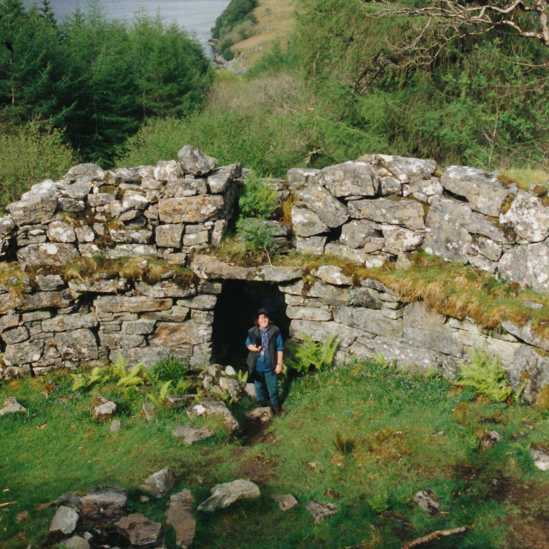
Caisteal Grugaig

Caisteal Grugaig (or Dun Totaig) is an Iron Age broch near the eastern end of Loch Alsh in the Scottish Highlands (grid reference NG86682508). == Location... ==

Loch Alsh

Loch Alsh (from the Scottish Gaelic Loch Aillse, "foaming lake") is a sea inlet between the isle of Skye in the Inner Hebrides and the Northwest Highlands...

Nearby Amenities

Located within 500m of 57.255029,-5.5992971
Source: PGS
Lat/Long: 57.2564795/-5.5920403
Source: PGS
Lat/Long: 57.2566762/-5.592412
Source: PGS
Lat/Long: 57.2571501/-5.5929823
Created By: almien_coastlines
Source: PGS
Lat/Long: 57.257392/-5.593169
Source: PGS
Lat/Long: 57.2576007/-5.5932178
Source: PGS
Lat/Long: 57.25777/-5.5933007
Source: PGS
Lat/Long: 57.2580052/-5.5934592
Source: PGS
Lat/Long: 57.258189/-5.593626
Source: PGS
Lat/Long: 57.258379/-5.5938057
Source: PGS
Lat/Long: 57.2592104/-5.5962755
Source: PGS
Lat/Long: 57.2591807/-5.596551
Source: PGS
Lat/Long: 57.2591312/-5.5974052
Source: PGS
Lat/Long: 57.2589404/-5.5986801
Source: PGS
Lat/Long: 57.2588192/-5.5990245
Source: PGS
Lat/Long: 57.2584839/-5.5998313
Created By: almien_coastlines
Source: PGS
Lat/Long: 57.258141/-5.600311
Source: PGS
Lat/Long: 57.2576637/-5.600972
Source: PGS
Lat/Long: 57.2572871/-5.60148
Source: PGS
Lat/Long: 57.2568304/-5.6020074
Source: PGS
Lat/Long: 57.2560986/-5.6027911
Source: PGS
Lat/Long: 57.2557673/-5.6032069
Source: PGS
Lat/Long: 57.2555201/-5.603562
Source: PGS
Lat/Long: 57.2554204/-5.6038793
Source: PGS
Lat/Long: 57.2552385/-5.6045756
Source: PGS
Lat/Long: 57.2549249/-5.6049707
Source: PGS
Lat/Long: 57.2546718/-5.6056672
Source: PGS
Lat/Long: 57.2542155/-5.606624
Source: PGS
Lat/Long: 57.2541119/-5.6069037
Ardintoul
Name Gd: Àird an t-Sabhail
Place: hamlet
Source: OSM
Lat/Long: 57.2548637/-5.5913946
BBC Ardintoul TV transmitting station
Man Made: tower
Lat/Long: 57.2568952/-5.5952485
Site of bunder fuel tank
Historic: ruins
Lat/Long: 57.2571695/-5.596154
Site of bunder fuel tank
Historic: ruins
Lat/Long: 57.257416/-5.5952761
Source: PGS
Lat/Long: 57.2564845/-5.6023587
The data included in this document is from www.openstreetmap.org. The data is made available under ODbL.

Have you been to Ardintoul?

Leave your review of Ardintoul below (or comments, questions and feedback).