Ardintoul Bay

Bay in Ross-shire

Scotland

Ardintoul Bay

Loch Alsh from Avernish
Loch Alsh from Avernish Credit: Jennifer Jones

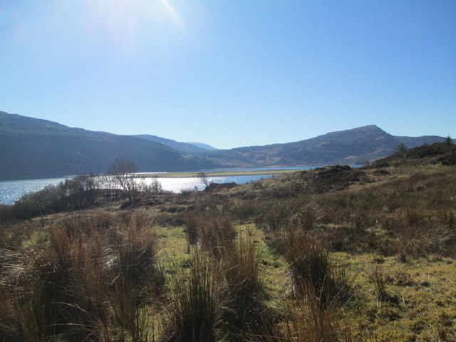
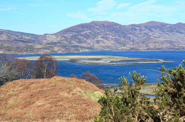
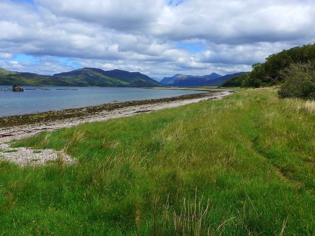
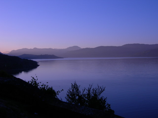
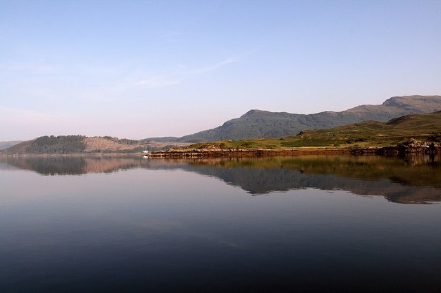
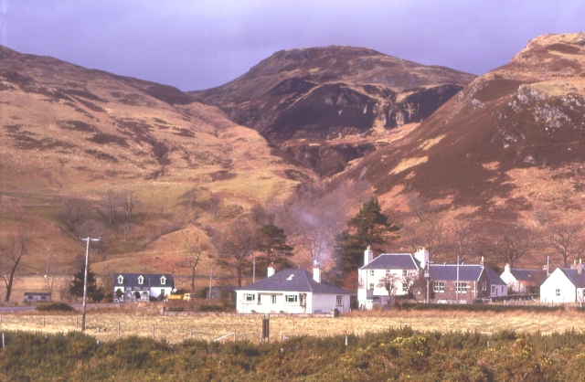
Ardintoul Bay is a picturesque bay located in Ross-shire, a county in the Highland region of Scotland. Situated on the west coast of the Scottish Highlands, the bay offers breathtaking views of the surrounding landscape and the Isle of Skye in the distance.

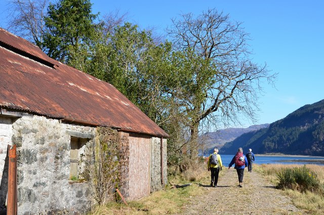
The bay itself is nestled between rolling hills and cliffs, creating a sheltered and serene environment. The coastline features a combination of rocky shores and sandy beaches, providing an ideal setting for beachcombing, picnicking, or simply enjoying a leisurely stroll along the shore.

Ardintoul Bay is also renowned for its wildlife diversity. The area is a haven for various bird species, making it a popular spot for birdwatching enthusiasts. Seals can often be spotted swimming and sunbathing on the rocks near the bay, adding to the natural beauty and charm of the area.

For those seeking outdoor activities, Ardintoul Bay offers excellent opportunities for water sports such as kayaking, paddleboarding, and fishing. The calm waters of the bay provide a safe and tranquil environment for these activities, attracting both locals and tourists alike.

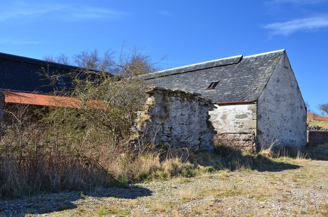
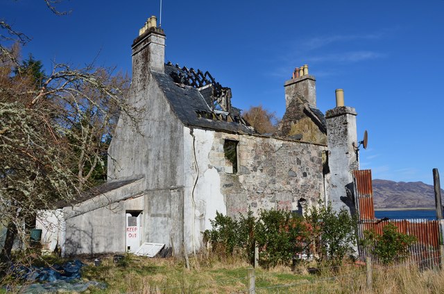
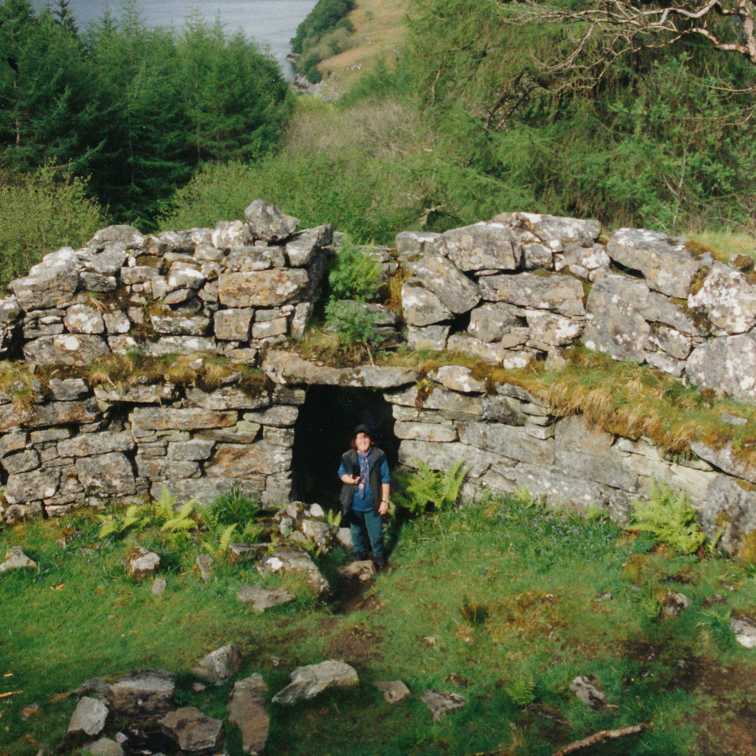
In addition to its natural beauty, Ardintoul Bay is steeped in history. The remains of an Iron Age fort can be found on the cliffs overlooking the bay, serving as a reminder of the area's ancient past.

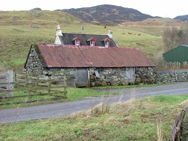
Overall, Ardintoul Bay is a hidden gem on the Scottish coast, offering visitors a chance to immerse themselves in the stunning scenery, abundant wildlife, and rich history of the region.

If you have any feedback on the listing, please let us know in the comments section below.

Ardintoul Bay Images

Images are sourced within 2km of 57.257562/-5.5849293 or Grid Reference NG8324. Thanks to Geograph Open Source API. All images are credited.

Loch Alsh from Avernish
Fish farm, Camas nan Gall Near the coast beyond the exit from Kyle Rhea to Loch Alsh.
Fish farm, Camas nan Gall
Near the coast beyond the exit from Kyle Rhea to Loch Alsh.
Beach, Camas nan Gall Shingle and coarse sand on the beach not far from the flat grassy point at Ardintoul.
Beach, Camas nan Gall
Shingle and coarse sand on the beach not far from the flat grassy point at Ardintoul.
Coastal path at Ardintoul A waymark on the post indicates a turn right to the old farm buildings.
Coastal path at Ardintoul
A waymark on the post indicates a turn right to the old farm buildings.
Old farm buildings, Ardintoul Barns arranged around a courtyard, now overgrown.
Old farm buildings, Ardintoul
Barns arranged around a courtyard, now overgrown.
Track at Ardintoul The track passes old farm buildings and the burnt-out remains of Ardintoul House.
Track at Ardintoul
The track passes old farm buildings and the burnt-out remains of Ardintoul House.
Remains of Ardintoul House Destroyed by fire in 2012, the remains now carry 'Keep out' signs.
Remains of Ardintoul House
Destroyed by fire in 2012, the remains now carry 'Keep out' signs.
Loch Alsh from Ardintoul Point Looking across the low flat island of Glas Eilean to Dornie and the hills around Loch Long.
Loch Alsh from Ardintoul Point
Looking across the low flat island of Glas Eilean to Dornie and the hills around Loch Long.
Steep road down to Ardintoul A tarmacked section of the forest road on the descent to Ardintoul.
Steep road down to Ardintoul
A tarmacked section of the forest road on the descent to Ardintoul.
Glas Eilean and Ardintoul Bay The flat grassy island in Loch Alsh being put to good use, as sheep were grazing there.
Glas Eilean and Ardintoul Bay
The flat grassy island in Loch Alsh being put to good use, as sheep were grazing there.
Forest road from Ardintoul The forest road crossing the Allt an Stuchdain in Ardintoul Wood.
Forest road from Ardintoul
The forest road crossing the Allt an Stuchdain in Ardintoul Wood.
Eastern shores of Camas nan Gall A fish farm in the waters of Loch Alsh to the left with the mountains of Kintail beyond.

The pleasant path to Ardintoul showing in the grass.
Eastern shores of Camas nan Gall
A fish farm in the waters of Loch Alsh to the left with the mountains of Kintail beyond. The pleasant path to Ardintoul showing in the grass.
Wall next the shore at Ardintoul Point The waters of Loch Alsh to the left.
Wall next the shore at Ardintoul Point
The waters of Loch Alsh to the left.
Ruin at Ardintoul There are a number of new and occupied houses at Ardintoul, but this is not one of them.
Ruin at Ardintoul
There are a number of new and occupied houses at Ardintoul, but this is not one of them.
Track by Ardintoul Bay Looking over to Balmacara on the Kyle of Lochalsh road.
Track by Ardintoul Bay
Looking over to Balmacara on the Kyle of Lochalsh road.
The track from Ardintoul Heading back to Glen Bernera and Glenelg.
The track from Ardintoul
Heading back to Glen Bernera and Glenelg.
Track through the forest from Ardintoul No tar here on the track, but walking from Ardintoul, when you see tarmacadam ahead it presages a steep climb!  The tar is to prevent erosion on this well-used track to a number of houses at the settlement.
Track through the forest from Ardintoul
No tar here on the track, but walking from Ardintoul, when you see tarmacadam ahead it presages a steep climb! The tar is to prevent erosion on this well-used track to a number of houses at the settlement.
Loch Alsh in early morning light
Show me another place!

Ardintoul Bay is located at Grid Ref: NG8324 (Lat: 57.257562, Lng: -5.5849293)

Unitary Authority: Highland

Police Authority: Highlands and Islands

What 3 Words

///linguists.flips.epic. Near Glenelg, Highland

Related Wikis

Avernish

Avernish (Scottish Gaelic: Abhairnis) is a small, scenic, rural community located in the Highlands of Scotland. Nearby attractions include The Eilean...

Ardelve

Ardelve (Scottish Gaelic: Àird Eilbh) is a village in Highland, Scotland, on Loch Alsh. It overlooks the Eilean Donan Castle, which is in Dornie, also...

Caisteal Grugaig

Caisteal Grugaig (or Dun Totaig) is an Iron Age broch near the eastern end of Loch Alsh in the Scottish Highlands (grid reference NG86682508). == Location... ==

Auchtertyre

Auchtertyre (Scottish Gaelic: Uachdar Thìre, "Upper Land") is a village, lying half a mile from the north shore of Loch Alsh near Kyle of Lochalsh, in...

Kyle Rhea

Kyle Rhea is a strait of water in the Highland area of Scotland. It runs from the Inner Seas off the West Coast of Scotland in the southwest to Loch Alsh...

Nostie

Nostie (Scottish Gaelic: Ceann na Mòna) is a small remote hamlet, lying on Nostie Bay, an inlet at the northeastern end of the sea loch, Loch Alsh in the...

Balmacara Square

Balmacara Square (Scottish Gaelic: Ceàrnag Bhaile Mac Carra) is a small village, close to Balmacara, in Lochlash, Scottish Highlands and is in the council...

Balmacara

Balmacara (Scottish Gaelic: Baile MacRath) is a scattered village on the north shore of Loch Alsh near Kyle of Lochalsh, Ross-shire, Highland and is in...

Nearby Amenities

Located within 500m of 57.257562,-5.5849293
Source: PGS
Lat/Long: 57.257776/-5.5768563
Source: PGS
Lat/Long: 57.2575592/-5.5777168
Source: PGS
Lat/Long: 57.257373/-5.578685
Source: PGS
Lat/Long: 57.2570689/-5.5801973
Source: PGS
Lat/Long: 57.2569792/-5.5806371
Source: PGS
Lat/Long: 57.2568101/-5.5807112
Source: PGS
Lat/Long: 57.2567999/-5.5809113
Source: PGS
Lat/Long: 57.2570944/-5.5807487
Source: PGS
Lat/Long: 57.2570796/-5.5813111
Source: PGS
Lat/Long: 57.2570944/-5.5822985
Source: PGS
Lat/Long: 57.2569697/-5.5839679
Source: PGS
Lat/Long: 57.2566494/-5.5845974
Source: PGS
Lat/Long: 57.2569087/-5.5856529
Source: PGS
Lat/Long: 57.256862/-5.5860874
Source: PGS
Lat/Long: 57.2566241/-5.5871436
Source: PGS
Lat/Long: 57.2562671/-5.5886154
Source: PGS
Lat/Long: 57.2559715/-5.5899557
Source: PGS
Lat/Long: 57.2564795/-5.5920403
Source: PGS
Lat/Long: 57.2566762/-5.592412
Source: PGS
Lat/Long: 57.2571501/-5.5929823
Created By: almien_coastlines
Source: PGS
Lat/Long: 57.257392/-5.593169
Source: PGS
Lat/Long: 57.2576007/-5.5932178
Ardintoul
Name Gd: Àird an t-Sabhail
Place: hamlet
Source: OSM
Lat/Long: 57.2548637/-5.5913946
The data included in this document is from www.openstreetmap.org. The data is made available under ODbL.

Have you been to Ardintoul Bay?

Leave your review of Ardintoul Bay below (or comments, questions and feedback).