Tucking Mill Hanging

Wood, Forest in Wiltshire

England

Tucking Mill Hanging

Road junction near Stourhead The car is moving south along Bells Lane, which passes the access road to Stourhead 1 km north. Deep in the hedge opposite is a benchmark <a href="https://www.geograph.org.uk/photo/6935231">ST7733 : A hard fought-for benchmark</a>.
Road junction near Stourhead Credit: Neville Goodman

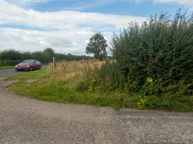
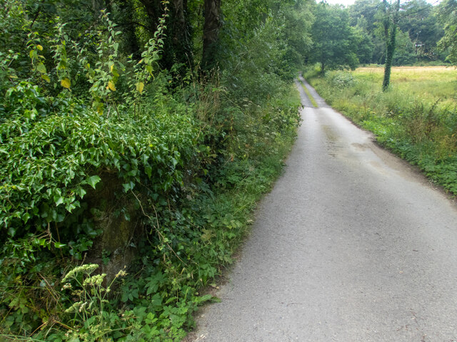
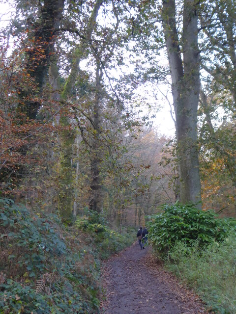
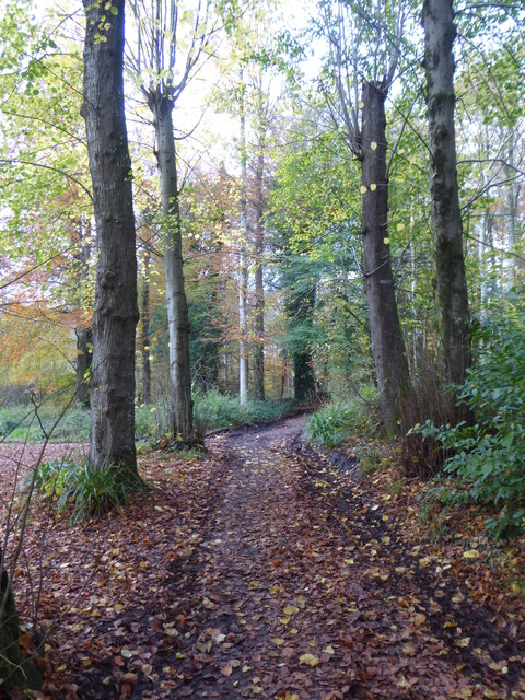
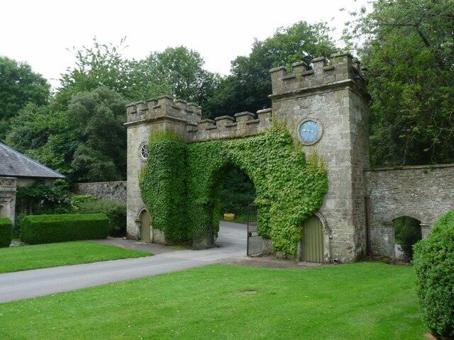
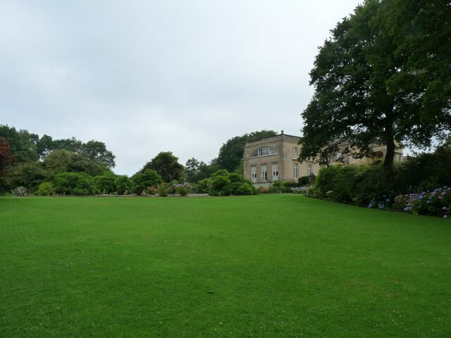
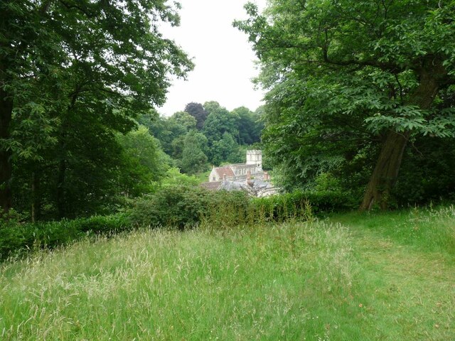
Tucking Mill Hanging is a woodland area located in Wiltshire, England. It is situated near the village of Tucking Mill and covers an approximate area of 50 acres. The hanging refers to the sloping nature of the woodland, which is positioned on a steep hillside.

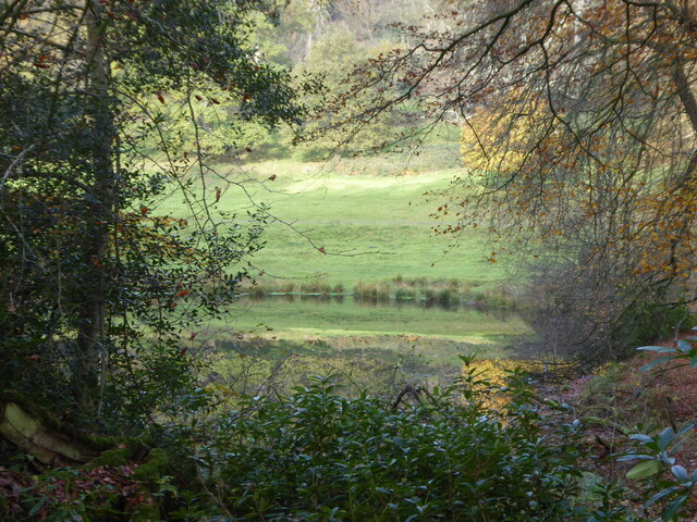
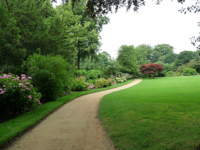
The woodland consists predominantly of broadleaf trees, including oak, beech, and ash. These trees create a dense canopy that provides shelter and habitat for a variety of wildlife species. The forest floor is covered with a rich carpet of ferns, wildflowers, and mosses, creating a vibrant and diverse ecosystem.

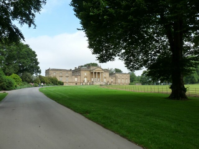
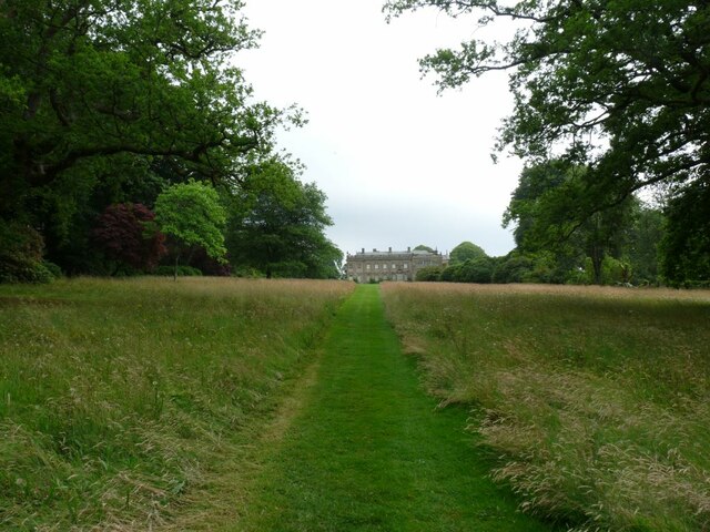
Tucking Mill Hanging is known for its scenic beauty, with picturesque views of the surrounding countryside. The woodland is crisscrossed by a network of footpaths, allowing visitors to explore the area and enjoy peaceful walks amidst nature. The trails vary in difficulty, catering to both casual strollers and more adventurous hikers.

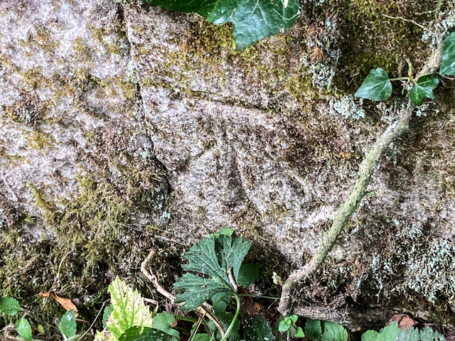
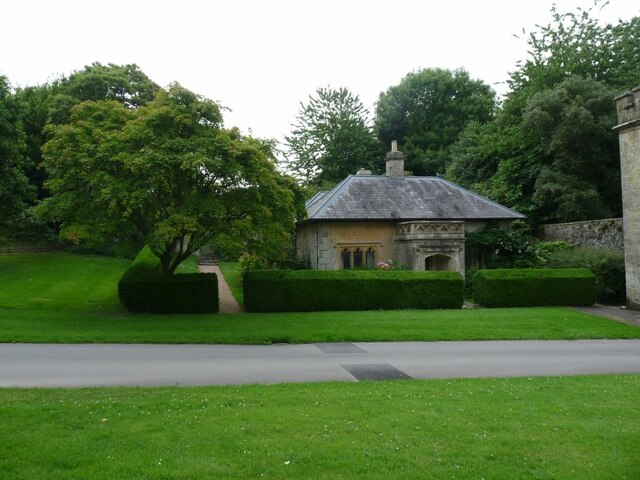
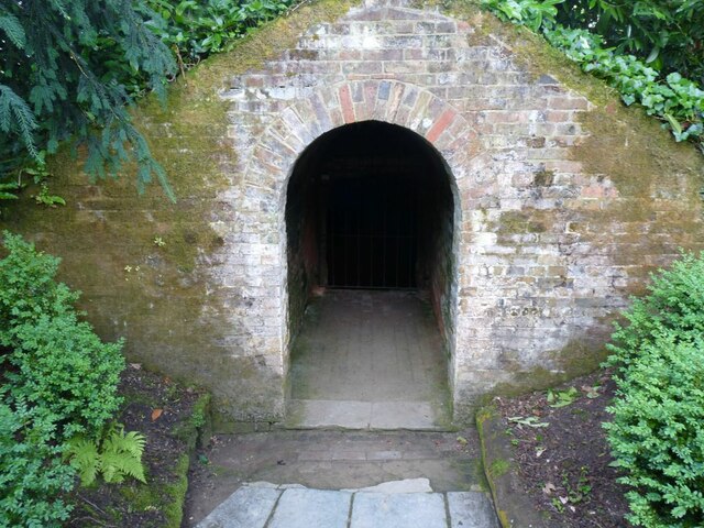
The woodland holds historical significance as well. It was once part of a larger estate owned by the Tucking Mill Manor, dating back to the medieval period. Today, remnants of old boundary walls and ditches can still be seen within the woodland, providing a glimpse into its past.

Tucking Mill Hanging is a popular destination for nature enthusiasts, photographers, and those seeking tranquility. Its natural beauty, diverse flora and fauna, and historical elements make it an attractive and fascinating location for visitors to Wiltshire.

If you have any feedback on the listing, please let us know in the comments section below.

Tucking Mill Hanging Images

Images are sourced within 2km of 51.107905/-2.3374078 or Grid Reference ST7634. Thanks to Geograph Open Source API. All images are credited.

Road junction near Stourhead The car is moving south along Bells Lane, which passes the access road to Stourhead 1 km north. Deep in the hedge opposite is a benchmark <a href="https://www.geograph.org.uk/photo/6935231">ST7733 : A hard fought-for benchmark</a>.
Road junction near Stourhead
The car is moving south along Bells Lane, which passes the access road to Stourhead 1 km north. Deep in the hedge opposite is a benchmark ST7733 : A hard fought-for benchmark.
A hard fought-for benchmark This benchmark (OS description: NBM CONCRETE P FENCE JUNC N SIDE CRAB LANE, see <a href="https://www.geograph.org.uk/photo/6935227">ST7733 : Road junction near Stourhead</a>) took some finding. Once the nettles had been beaten out of the way, I was able to take the photograph.
A hard fought-for benchmark
This benchmark (OS description: NBM CONCRETE P FENCE JUNC N SIDE CRAB LANE, see ST7733 : Road junction near Stourhead) took some finding. Once the nettles had been beaten out of the way, I was able to take the photograph.
A lane into the estate The view is along Top Lane, which is in the Stourhead estate. There is a benchmark on the left which took some effort to free from the undergrowth. The wall mentioned in the OS description (see <a href="https://www.geograph.org.uk/photo/6935237">ST7633 : Benchmark freed from nettles and ivy</a>) is actually the lower parapet over the stream connecting the various ornamental lakes – the headwaters of the River Stour.
A lane into the estate
The view is along Top Lane, which is in the Stourhead estate. There is a benchmark on the left which took some effort to free from the undergrowth. The wall mentioned in the OS description (see ST7633 : Benchmark freed from nettles and ivy) is actually the lower parapet over the stream connecting the various ornamental lakes – the headwaters of the River Stour.
Benchmark freed from nettles and ivy Once the ivy, nettles, brambles, moss and various other bits and pieces had been scraped aside <a href="https://www.geograph.org.uk/photo/6935234">ST7633 : A lane into the estate</a>, the benchmark (NBM WALL SW SIDE TOP LANE NE FACE E ANG) was revealed as remarkably undamaged.
Benchmark freed from nettles and ivy
Once the ivy, nettles, brambles, moss and various other bits and pieces had been scraped aside ST7633 : A lane into the estate, the benchmark (NBM WALL SW SIDE TOP LANE NE FACE E ANG) was revealed as remarkably undamaged.
Looking from the woods across the pool above the Lily Pond
Path through the woods by Six Wells Bottom
Path through the woods west of Iron Bridge
Willow Sculpture Tunnel made from Willows at Stourhead Park.
Willow Sculpture
Tunnel made from Willows at Stourhead Park.
Footbridge near the Eagle Courtyard Part of the N.T. property at Stourhead.
Footbridge near the Eagle Courtyard
Part of the N.T. property at Stourhead.
Gate House at Stourhead The entrance to Stourhead House.
Gate House at Stourhead
The entrance to Stourhead House.
The Gate keeper's Cottage By the entrance to Stourhead House.
The Gate keeper's Cottage
By the entrance to Stourhead House.
Stourhead House 18th C. Palladian mansion, with extensive parkland and gardens.
Stourhead House
18th C. Palladian mansion, with extensive parkland and gardens.
Hydrangeas in the border at Stourhead Pink Hydrangeas.
Hydrangeas in the border at Stourhead
Pink Hydrangeas.
Across the lawn to Stourhead House View is of the side of the House.
Across the lawn to Stourhead House
View is of the side of the House.
The Ice House at Stourhead House Ice from the lakes was stored here for Summer use.
The Ice House at Stourhead House
Ice from the lakes was stored here for Summer use.
Herbaceous flower bed at Stourhead House Taken in the Walled Garden.
Herbaceous flower bed at Stourhead House
Taken in the Walled Garden.
Grass path down to Stourhead House Looking at the rear of the property.
Grass path down to Stourhead House
Looking at the rear of the property.
St. Peter's church View through the trees to the Church.
St. Peter's church
View through the trees to the Church.
Show me another place!

Tucking Mill Hanging is located at Grid Ref: ST7634 (Lat: 51.107905, Lng: -2.3374078)

Unitary Authority: Wiltshire

Police Authority: Wiltshire

What 3 Words

///homeward.jumpy.baked. Near Kilmington, Wiltshire

Related Wikis

Heath Hill Farm

Heath Hill Farm (grid reference ST757336) is a 20.73 hectare biological Site of Special Scientific Interest near Stourton in Wiltshire, notified in 1997...

Bristol High Cross

Bristol High Cross is a monumental market cross erected in 1373 in the centre of Bristol. It was built in Decorated Gothic style on the site of an earlier...
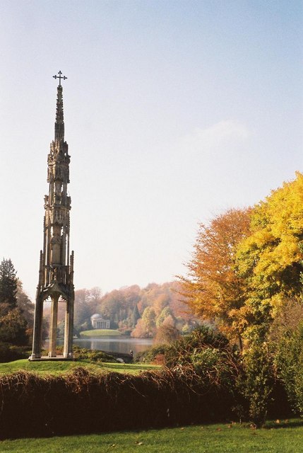
Stourhead

Stourhead () is a 1,072-hectare (2,650-acre) estate at the source of the River Stour in the southwest of the English county of Wiltshire, extending into...

Stourton with Gasper

Stourton with Gasper is a civil parish in the southwest of the English county of Wiltshire. Its main settlement is the village of Stourton, along with...

Kenwalch's Castle

Kenwalch's Castle is probably an Iron Age hill fort that may have been converted into a Roman fortress, near Penselwood, Somerset, England, 6.6 kilometres...

Nozarego

Nozarego is a village in the commune of Santa Margherita Ligure in Liguria, Italy. It is a natural terrace over the Bay of Tigullio. Here there is the...

RAF Zeals

Royal Air Force Zeals, or more simply RAF Zeals, is a former Royal Air Force station in Wiltshire, sited to the north of the village of Zeals, next to...

King Alfred's Tower

Alfred's Tower is a folly in Somerset, England, on the edge of the border with Wiltshire, on the Stourhead estate. The tower stands on Kingsettle Hill...

Nearby Amenities

Located within 500m of 51.107905,-2.3374078
Park Hill
Archaeological Site: fortification
Fortification Type: hill_fort
Historic: archaeological_site
Name Ru: Парковый холм
Wikidata: Q17643338
Lat/Long: 51.1112289/-2.3392111
Barrier: stile
Lat/Long: 51.1075756/-2.3385663
The data included in this document is from www.openstreetmap.org. The data is made available under ODbL.

Have you been to Tucking Mill Hanging?

Leave your review of Tucking Mill Hanging below (or comments, questions and feedback).