New Close Plantation

Wood, Forest in Yorkshire Craven

England

New Close Plantation

Ford at Wharfe This ford is found on White Stone Lane in Wharfe. Access to the hamlet was restricted to pedestrians only.
Ford at Wharfe Credit: John Walton

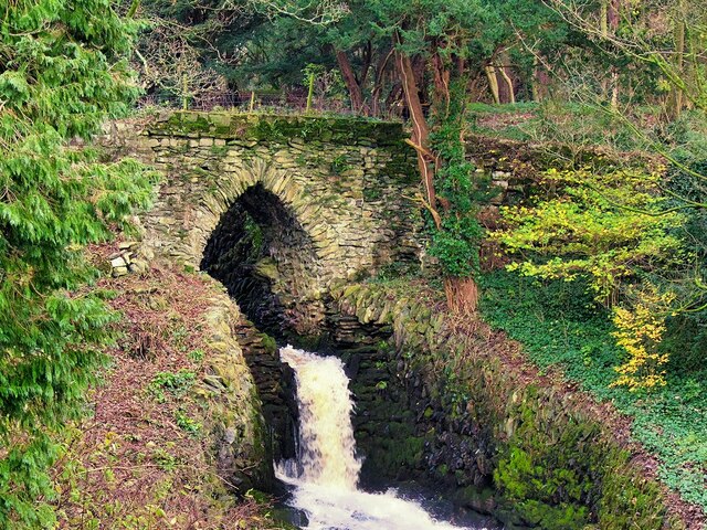
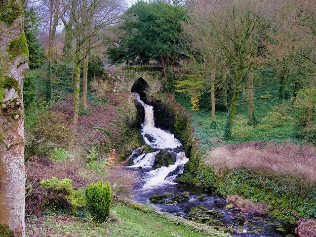
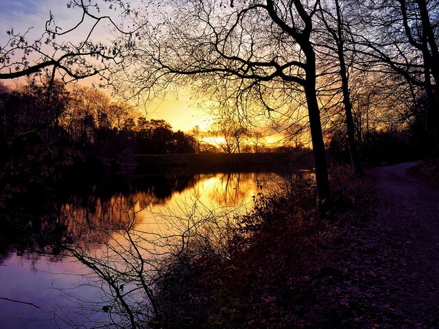
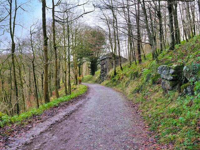
New Close Plantation is a picturesque woodland located in the heart of Yorkshire, England. Situated near the village of Wood, it covers an expansive area of lush greenery and is known for its stunning natural beauty. The plantation is part of the larger Forest of Yorkshire, which is renowned for its diverse range of flora and fauna.

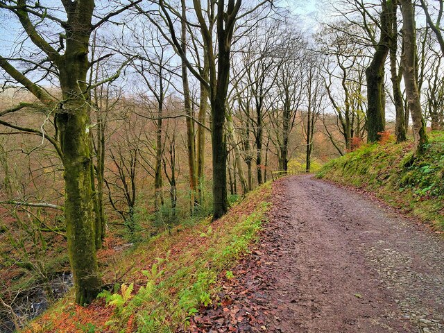
The plantation is characterized by its dense canopy of tall, mature trees, creating a serene and peaceful atmosphere. The woodland is predominantly made up of deciduous trees such as oak, beech, and birch, providing a habitat for a variety of wildlife species. Visitors can expect to encounter squirrels, rabbits, and various species of birds, making it a haven for nature enthusiasts and birdwatchers.

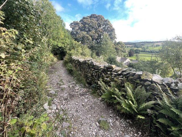
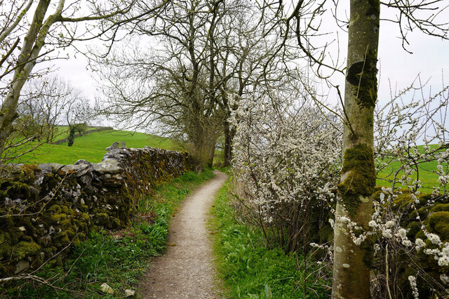
New Close Plantation offers a network of well-maintained walking trails, allowing visitors to explore the woodland at their own pace. These trails wind through the plantation, offering glimpses of the surrounding countryside and providing opportunities to admire the natural beauty of the area. The plantation is particularly popular during the spring months when the forest floor comes alive with a vibrant display of wildflowers.

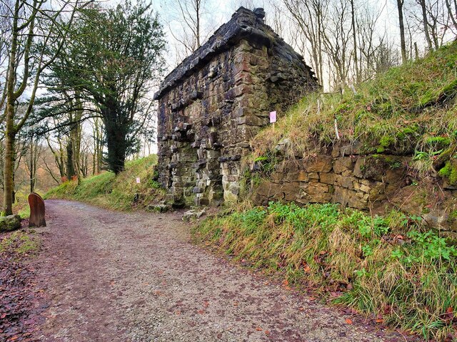
In addition to its natural beauty, New Close Plantation also boasts a rich history. It has been a working woodland for centuries, providing timber for the local area. Today, it is managed by the Yorkshire Wildlife Trust, ensuring the preservation and conservation of this remarkable woodland for future generations to enjoy.

If you have any feedback on the listing, please let us know in the comments section below.

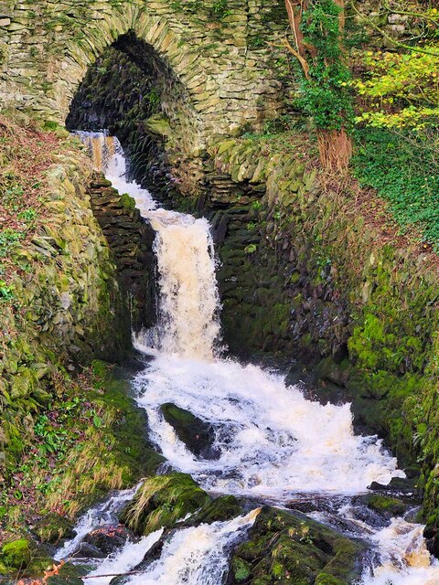
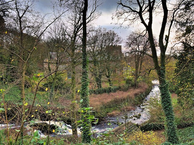
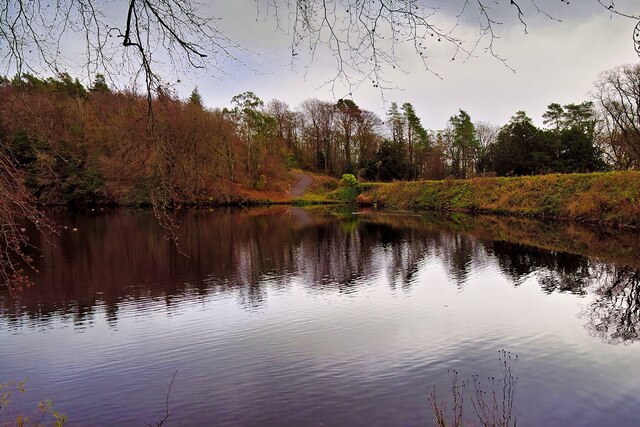
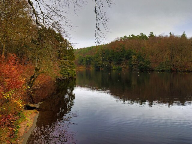
New Close Plantation Images

Images are sourced within 2km of 54.119364/-2.3616335 or Grid Reference SD7669. Thanks to Geograph Open Source API. All images are credited.

Ford at Wharfe This ford is found on White Stone Lane in Wharfe. Access to the hamlet was restricted to pedestrians only.
Ford at Wharfe
This ford is found on White Stone Lane in Wharfe. Access to the hamlet was restricted to pedestrians only.
Bridge over Clapham Beck Waterfall Clapham Falls is a man-made waterfall which sees Clapham Beck drop below a bridge, in  three separate tiers, from the lake above into Clapham itself. The waterfall was constructed in 1837 by Oliver and James William Farrar as part of the remodelling of the estate of Ingleborough Hall.
Bridge over Clapham Beck Waterfall
Clapham Falls is a man-made waterfall which sees Clapham Beck drop below a bridge, in three separate tiers, from the lake above into Clapham itself. The waterfall was constructed in 1837 by Oliver and James William Farrar as part of the remodelling of the estate of Ingleborough Hall.
St James' Church, Clapham Looking across Clapham Beck towards the Church of St James at Clapham. 
The majority of the current church dates from 1814 although the tower has been retained from an earlier, fifteenth century, church. It is a Grade II listed building (List Entry Number: 1132398 <span class="nowrap"><a title="https://historicengland.org.uk/listing/the-list/list-entry/1132398" rel="nofollow ugc noopener" href="https://historicengland.org.uk/listing/the-list/list-entry/1132398">Link</a><img style="margin-left:2px;" alt="External link" title="External link - shift click to open in new window" src="https://s1.geograph.org.uk/img/external.png" width="10" height="10"/></span> Historic England)
St James' Church, Clapham
Looking across Clapham Beck towards the Church of St James at Clapham. The majority of the current church dates from 1814 although the tower has been retained from an earlier, fifteenth century, church. It is a Grade II listed building (List Entry Number: 1132398 LinkExternal link Historic England)
Clapham Falls Clapham Falls is a man-made waterfall which sees Clapham Beck drop below a bridge, in  three separate tiers, from the lake above into Clapham itself. The waterfall was constructed in 1837 by Oliver and James William Farrar as part of the remodelling of the estate of Ingleborough Hall.
Clapham Falls
Clapham Falls is a man-made waterfall which sees Clapham Beck drop below a bridge, in three separate tiers, from the lake above into Clapham itself. The waterfall was constructed in 1837 by Oliver and James William Farrar as part of the remodelling of the estate of Ingleborough Hall.
Clapham Beck Waterfall Clapham Falls is a man-made waterfall which sees Clapham Beck drop below a bridge, in  three separate tiers, from the lake above into Clapham itself. The waterfall was constructed in 1837 by Oliver and James William Farrar as part of the remodelling of the estate of Ingleborough Hall.
Clapham Beck Waterfall
Clapham Falls is a man-made waterfall which sees Clapham Beck drop below a bridge, in three separate tiers, from the lake above into Clapham itself. The waterfall was constructed in 1837 by Oliver and James William Farrar as part of the remodelling of the estate of Ingleborough Hall.
Clapham Beck and the Church of St James Looking across Clapham Beck towards the Church of St James at Clapham. 
The majority of the current church dates from 1814 although the tower has been retained from an earlier, fifteenth century, church. It is a Grade II listed building (List Entry Number: 1132398 <span class="nowrap"><a title="https://historicengland.org.uk/listing/the-list/list-entry/1132398" rel="nofollow ugc noopener" href="https://historicengland.org.uk/listing/the-list/list-entry/1132398">Link</a><img style="margin-left:2px;" alt="External link" title="External link - shift click to open in new window" src="https://s1.geograph.org.uk/img/external.png" width="10" height="10"/></span> Historic England)
Clapham Beck and the Church of St James
Looking across Clapham Beck towards the Church of St James at Clapham. The majority of the current church dates from 1814 although the tower has been retained from an earlier, fifteenth century, church. It is a Grade II listed building (List Entry Number: 1132398 LinkExternal link Historic England)
Clapham Lake Clapham Lake is a man-made ornamental lake in Clapdale, just above the village of Clapham. It is surrounded by woodland and is seen here from Clapdale Drive, a wide track that passes along the western side of the lake on its through Clapdale Wood towards Ingleborough Cave.

Known simply as The Lake, this artificial lake was constructed in the 18th century as part of the remodelling of the Ingleborough estate by the Farrar family who built a dam to hold back the waters of Clapham Beck, which drains via the artificial watercourse of Clapham Falls.
Clapham Lake
Clapham Lake is a man-made ornamental lake in Clapdale, just above the village of Clapham. It is surrounded by woodland and is seen here from Clapdale Drive, a wide track that passes along the western side of the lake on its through Clapdale Wood towards Ingleborough Cave. Known simply as The Lake, this artificial lake was constructed in the 18th century as part of the remodelling of the Ingleborough estate by the Farrar family who built a dam to hold back the waters of Clapham Beck, which drains via the artificial watercourse of Clapham Falls.
Lake at Clapham Known simply as The Lake, this artificial lake, just above the village of Clapham, was constructed in the 18th century as part of the remodelling of the Ingleborough estate by the Farrar family who built a dam to hold back the waters of Clapham Beck, which drains via the artificial watercourse of Clapham Falls.

The ornamental lake is surrounded by woodland and is seen here from Clapdale Drive, a wide track that passes along the western side of the lake on its through Clapdale Wood towards Ingleborough Cave.
Lake at Clapham
Known simply as The Lake, this artificial lake, just above the village of Clapham, was constructed in the 18th century as part of the remodelling of the Ingleborough estate by the Farrar family who built a dam to hold back the waters of Clapham Beck, which drains via the artificial watercourse of Clapham Falls. The ornamental lake is surrounded by woodland and is seen here from Clapdale Drive, a wide track that passes along the western side of the lake on its through Clapdale Wood towards Ingleborough Cave.
Cat Hole Sike The shallow streambed that passes beneath Clapdale Drive is called Cat Hole Syke. ("Syke" or "sike" is a colloquial term for a small stream). The steeply dipping Ordovician rocks, some more than 400 million years old, were pushed to the surface by a major disturbance in the earth's crust which caused massive earth movements tilting them to their present angle. This is part of the Craven Fault System <span class="nowrap"><a title="https://en.wikipedia.org/wiki/Craven_Fault_System" rel="nofollow ugc noopener" href="https://en.wikipedia.org/wiki/Craven_Fault_System">Link</a><img style="margin-left:2px;" alt="External link" title="External link - shift click to open in new window" src="https://s1.geograph.org.uk/img/external.png" width="10" height="10"/></span> .
Cat Hole Sike
The shallow streambed that passes beneath Clapdale Drive is called Cat Hole Syke. ("Syke" or "sike" is a colloquial term for a small stream). The steeply dipping Ordovician rocks, some more than 400 million years old, were pushed to the surface by a major disturbance in the earth's crust which caused massive earth movements tilting them to their present angle. This is part of the Craven Fault System LinkExternal link .
The Lake, Clapham Known simply as The Lake, this artificial lake, just above the village of Clapham, was constructed in the 18th century as part of the remodelling of the Ingleborough estate by the Farrar family who built a dam to hold back the waters of Clapham Beck, which drains via the artificial watercourse of Clapham Falls.

The ornamental lake is surrounded by woodland and is seen here from Clapdale Drive, a wide track that passes along the western side of the lake on its route through Clapdale Wood towards Ingleborough Cave.
The Lake, Clapham
Known simply as The Lake, this artificial lake, just above the village of Clapham, was constructed in the 18th century as part of the remodelling of the Ingleborough estate by the Farrar family who built a dam to hold back the waters of Clapham Beck, which drains via the artificial watercourse of Clapham Falls. The ornamental lake is surrounded by woodland and is seen here from Clapdale Drive, a wide track that passes along the western side of the lake on its route through Clapdale Wood towards Ingleborough Cave.
Blackthorn blossom along the Pennine Bridleway Looking west towards Austwick
Blackthorn blossom along the Pennine Bridleway
Looking west towards Austwick
Church Avenue, Clapham Looking northward.
Church Avenue, Clapham
Looking northward.
Ordnance Survey Cut Mark This Mark can be found on the parapet wall of Clapham Beck Bridge, Clapham.
The recorded details give a height of 155.9601 metres above sea level.
For more detail see : <span class="nowrap"><a title="https://www.bench-marks.org.uk/bm46324" rel="nofollow ugc noopener" href="https://www.bench-marks.org.uk/bm46324">Link</a><img style="margin-left:2px;" alt="External link" title="External link - shift click to open in new window" src="https://s1.geograph.org.uk/img/external.png" width="10" height="10"/></span>
Ordnance Survey Cut Mark
This Mark can be found on the parapet wall of Clapham Beck Bridge, Clapham. The recorded details give a height of 155.9601 metres above sea level. For more detail see : LinkExternal link
Clapham Road - Austwick
Clapdale Drive, Clapdale Wood Clapdale Drive is a wide track that passes along the western side of the lake and above Clapham Beck as it climbs from Clapham village, through Clapdale Wood towards Ingleborough Cave.
Clapdale Drive, Clapdale Wood
Clapdale Drive is a wide track that passes along the western side of the lake and above Clapham Beck as it climbs from Clapham village, through Clapdale Wood towards Ingleborough Cave.
The Grotto, Clapdale Drive The Grotto is a late-nineteenth century folly commissioned by the Farrer family as a place to sit and enjoy the views of Thwaite Scars. It was constructed of large pieces of limestone set back against the steep hillside.

Although it has become rather dilapidated, it is still a useful place to shelter when caught out by the weather.
The Grotto, Clapdale Drive
The Grotto is a late-nineteenth century folly commissioned by the Farrer family as a place to sit and enjoy the views of Thwaite Scars. It was constructed of large pieces of limestone set back against the steep hillside. Although it has become rather dilapidated, it is still a useful place to shelter when caught out by the weather.
Ingleborough Estate Trail, Clapdale Drive Clapdale Drive is a wide track that passes along the western side of the lake and above Clapham Beck as it climbs from Clapham village, through Clapdale Wood towards Ingleborough Cave.
Ingleborough Estate Trail, Clapdale Drive
Clapdale Drive is a wide track that passes along the western side of the lake and above Clapham Beck as it climbs from Clapham village, through Clapdale Wood towards Ingleborough Cave.
Footbridge over Clapham Beck Footbridge looking over from the Ingleborough Nature Trail path. A view of the footbridge from the opposite side of the Beck can be seen here  - <a title="https://www.geograph.org.uk/photo/1813070" href="https://www.geograph.org.uk/photo/1813070">Link</a>
Footbridge over Clapham Beck
Footbridge looking over from the Ingleborough Nature Trail path. A view of the footbridge from the opposite side of the Beck can be seen here - Link
Show me another place!

New Close Plantation is located at Grid Ref: SD7669 (Lat: 54.119364, Lng: -2.3616335)

Division: West Riding

Administrative County: North Yorkshire

District: Craven

Police Authority: North Yorkshire

What 3 Words

///stunt.sprouts.proofs. Near Ingleton, North Yorkshire

Related Wikis

Norber erratics

The Norber erratics are one of the finest groups of glacial erratic boulders in Britain. They are found on the southern slopes of Ingleborough, close to...
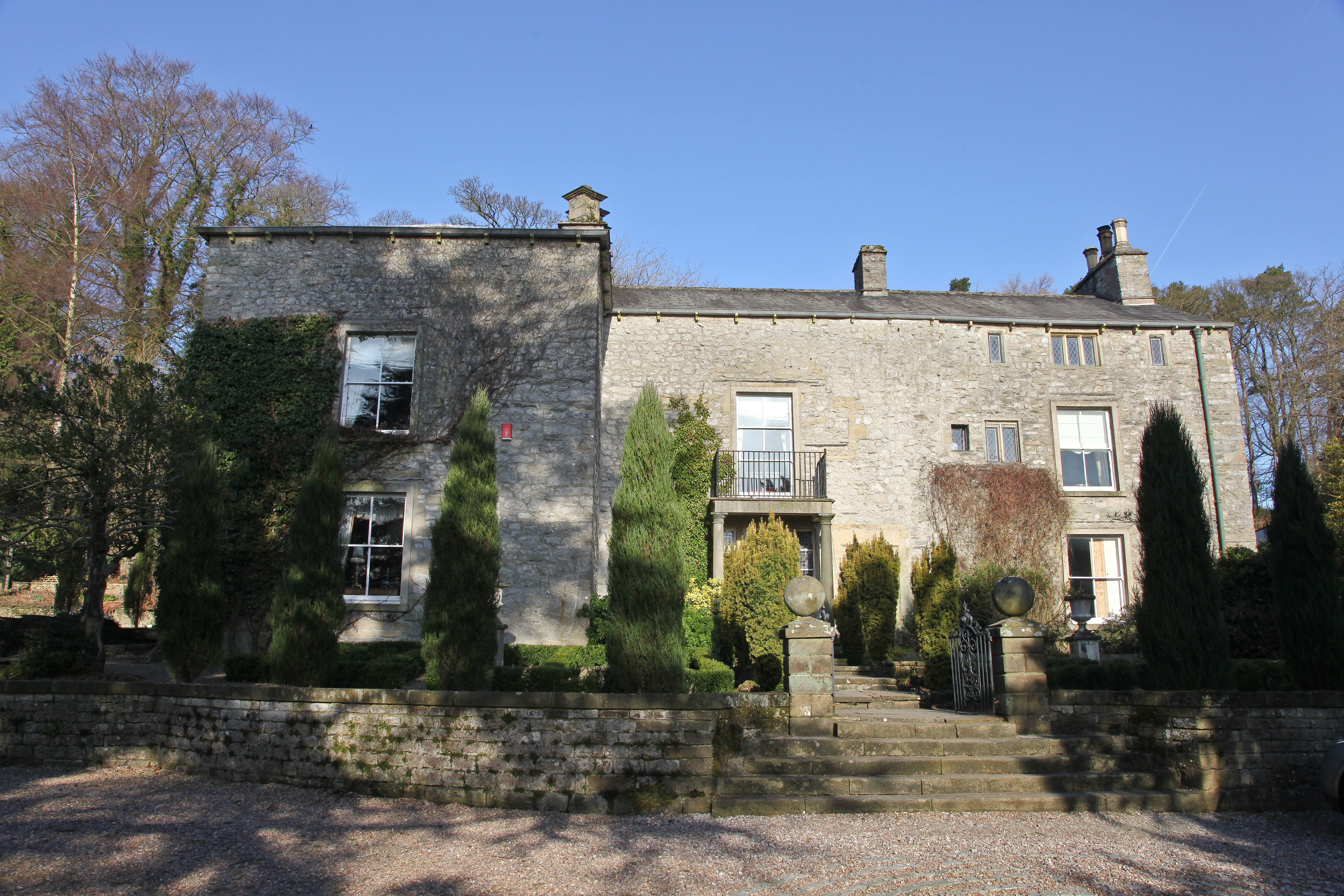
Austwick Hall

Austwick Hall is an historic manor house situated above the village of Austwick in North Yorkshire, England. The house is a Grade II listed building and...

Austwick

Austwick is a village and civil parish in the Craven district of North Yorkshire, England, about 5 miles (8 km) north-west of Settle. The village is on...

Wharfe, North Yorkshire

Wharfe is a hamlet about a mile north east of the village of Austwick, North Yorkshire, England. Its postcode is LA2 8DQ. The name means 'The bend',...

Nearby Amenities

Located within 500m of 54.119364,-2.3616335
Fixme: Does this wall connect with the wall by the track?
Lat/Long: 54.1183628/-2.3571704
Barrier: stile
Image: https://www.geograph.org.uk/photo/3592683
Stile: ladder
Lat/Long: 54.117767/-2.3679846
Barrier: stile
Stile: ladder
Lat/Long: 54.1180187/-2.3585851
Barrier: stile
Image: https://www.geograph.org.uk/photo/5368997
Stile: ladder
Lat/Long: 54.1212508/-2.3634707
Parking
Access: yes
Capacity: 4
Fee: no
Parking: lane
Surface: compacted
Lat/Long: 54.1181499/-2.3545328
Bicycle: yes
Hiking: yes
Horse: yes
Information: guidepost
Tourism: information
Lat/Long: 54.1181726/-2.3542681
Barrier: entrance
Lat/Long: 54.1202087/-2.3627319
Hiking: yes
Image: https://www.geograph.org.uk/photo/5369001
Information: guidepost
Tourism: information
Lat/Long: 54.122631/-2.358634
The data included in this document is from www.openstreetmap.org. The data is made available under ODbL.

Have you been to New Close Plantation?

Leave your review of New Close Plantation below (or comments, questions and feedback).