Amsterdam Covert

Wood, Forest in Cheshire

England

Amsterdam Covert

Peover Hall and Gardens Peover Hall, its extensive gardens and 15th-Century chapel are open to the public as a museum.
Peover Hall and Gardens Credit: Iain McDonald

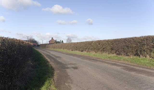
Amsterdam Covert, Cheshire, also known as Wood or Forest, is a picturesque area located in the county of Cheshire, England. Nestled within the charming village of Amsterdam, this covert is a hidden gem for nature enthusiasts and those seeking tranquility.

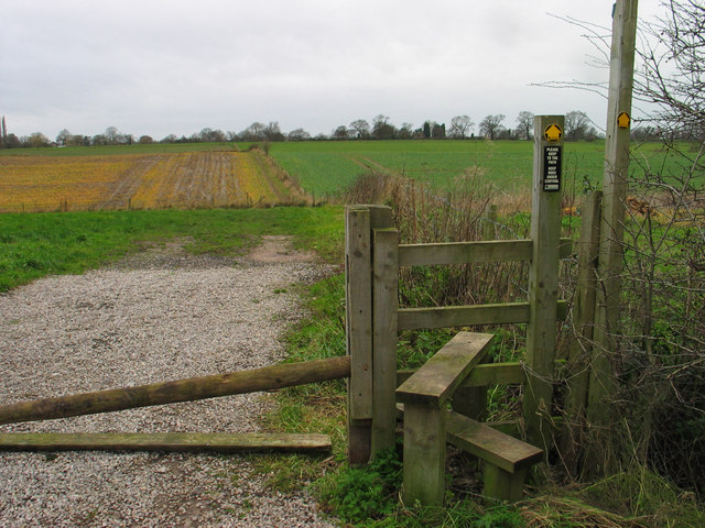
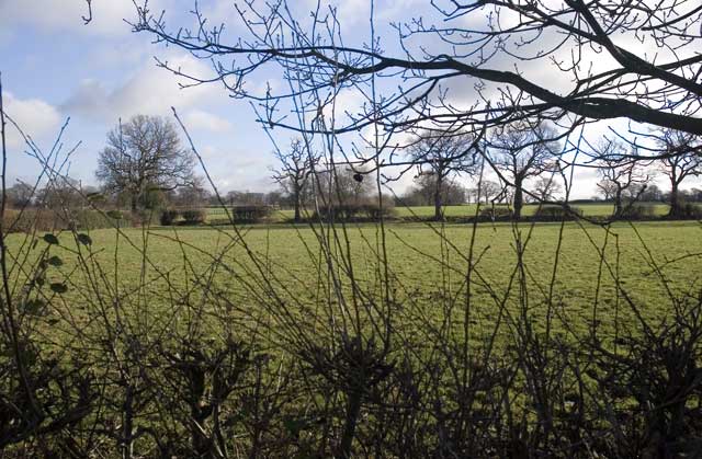
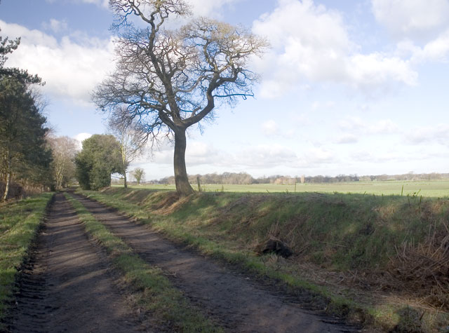
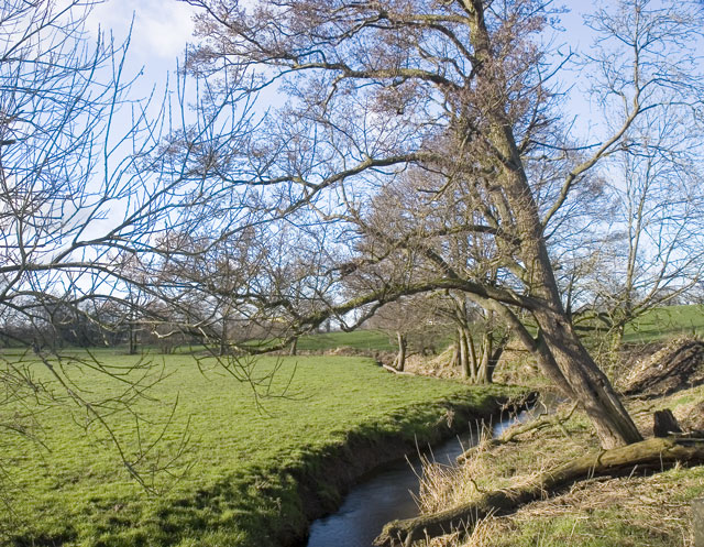
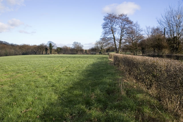
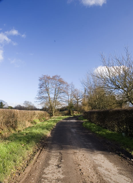
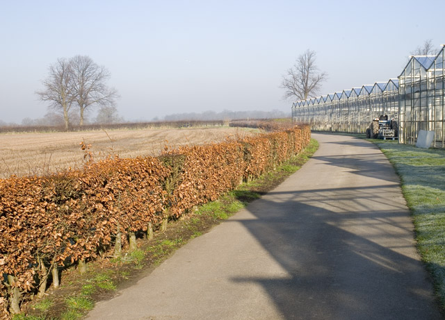
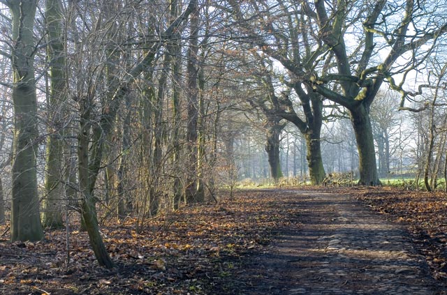
Covering an area of approximately 100 hectares, Amsterdam Covert is characterized by its dense woodlands, lush greenery, and diverse wildlife. The covert is predominantly made up of deciduous trees such as oak, beech, and birch, creating a rich and vibrant canopy that provides shade during the summer months. The forest floor is carpeted with an array of wildflowers, ferns, and mosses, adding to the beauty and biodiversity of the area.

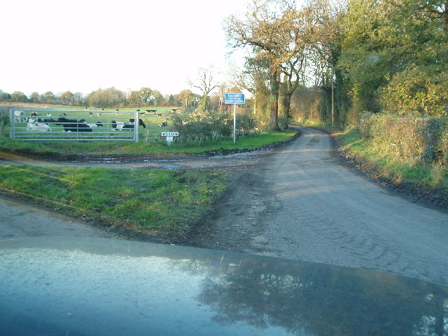
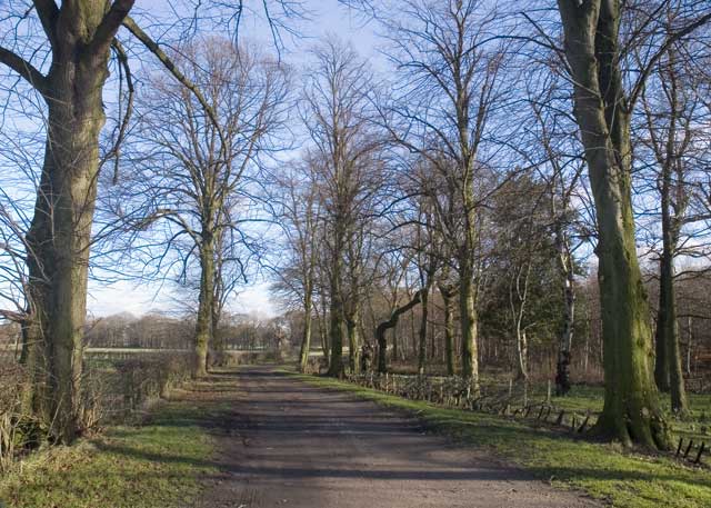
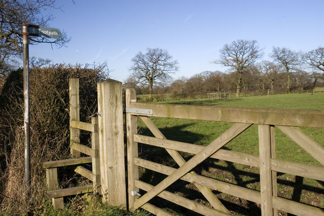
The covert is crisscrossed by a network of well-maintained footpaths, allowing visitors to explore its enchanting surroundings. These paths meander through the woods, offering stunning views of the flora and fauna that call Amsterdam Covert their home. Birdwatchers will be delighted to spot various species of woodland birds, including woodpeckers, owls, and songbirds. Additionally, the covert is home to small mammals such as squirrels, foxes, and badgers, making it a haven for wildlife enthusiasts.

Amsterdam Covert also boasts a picnic area, providing the perfect spot for visitors to relax and enjoy the serenity of the forest. The peaceful ambiance, coupled with the gentle rustling of leaves and the melodious songs of birds, makes it an ideal place for meditation or simply escaping the hustle and bustle of everyday life.

Overall, Amsterdam Covert, Cheshire, is a captivating woodland retreat that offers a tranquil escape and a chance to reconnect with nature in a truly idyllic setting.

If you have any feedback on the listing, please let us know in the comments section below.

Amsterdam Covert Images

Images are sourced within 2km of 53.249333/-2.3592409 or Grid Reference SJ7672. Thanks to Geograph Open Source API. All images are credited.

Peover Hall and Gardens Peover Hall, its extensive gardens and 15th-Century chapel are open to the public as a museum.
Peover Hall and Gardens
Peover Hall, its extensive gardens and 15th-Century chapel are open to the public as a museum.
Road Junction Junction of Heath Lane,(Ahead) Sandy Lane, (To left)& Townfield Lane (Behind)
Road Junction
Junction of Heath Lane,(Ahead) Sandy Lane, (To left)& Townfield Lane (Behind)
Drovers Arms, Allostock
Townfield Farm Townfield Farm, Townfield Lane near Allostock. One of many simple, but attractive farms built from red Cheshire bricks.
Townfield Farm
Townfield Farm, Townfield Lane near Allostock. One of many simple, but attractive farms built from red Cheshire bricks.
Path across the fields, Lower Peover Path from Mill Bank Farm, Lower Peover to Swan Green. The collapsed gate renders the stile almost redundant.
Path across the fields, Lower Peover
Path from Mill Bank Farm, Lower Peover to Swan Green. The collapsed gate renders the stile almost redundant.
Looking towards Jodrell Bank Taken from the public road to Winterbottom Farm, Goostrey. In the distance is the Jodrell Bank telescope, pointing directly upwards.
Looking towards Jodrell Bank
Taken from the public road to Winterbottom Farm, Goostrey. In the distance is the Jodrell Bank telescope, pointing directly upwards.
Road to Boots Green Taken at the junction of Brick Bank Lane and Booth Bank Lane, of which this is a picture. The building on the horizon is Boothbed Farm.
Road to Boots Green
Taken at the junction of Brick Bank Lane and Booth Bank Lane, of which this is a picture. The building on the horizon is Boothbed Farm.
Hales Pasture Taken on the public footpath with a field known as Hales Pasture to the right of the image and to the left, out of view and surrounded by private woodlands, is a small lake.
Hales Pasture
Taken on the public footpath with a field known as Hales Pasture to the right of the image and to the left, out of view and surrounded by private woodlands, is a small lake.
River scene Taken on the bridge carrying the road from Goostrey to Boots Green
River scene
Taken on the bridge carrying the road from Goostrey to Boots Green
Field next to Fullers Gate To the right, just over the hedge, is the road from Boots Green to Woodend Farm. To the left is woodland on the banks of the Peover Eye.
Field next to Fullers Gate
To the right, just over the hedge, is the road from Boots Green to Woodend Farm. To the left is woodland on the banks of the Peover Eye.
The Path to Peover Hall Near to Longland Farm, this public footpath skirts a field to the left of the image and woodland to the right.
The Path to Peover Hall
Near to Longland Farm, this public footpath skirts a field to the left of the image and woodland to the right.
Stile, Gate and Footpath Taken from the road to Smithy Green from Allostock and Goostrey.
Stile, Gate and Footpath
Taken from the road to Smithy Green from Allostock and Goostrey.
Bridleway to Freegreen Farm This bridleway passes through a small wood before going through Freegreen Farm.
Bridleway to Freegreen Farm
This bridleway passes through a small wood before going through Freegreen Farm.
Fullers Gate The road to Woodend Farm
Fullers Gate
The road to Woodend Farm
Bridleway through Freegreen Farm Taken at the gate into the farmyard, the bridleway runs straight through to the open fields beyond.
Bridleway through Freegreen Farm
Taken at the gate into the farmyard, the bridleway runs straight through to the open fields beyond.
Long Lane Taken near Longlane Farm, towards the junction with the A50.
Long Lane
Taken near Longlane Farm, towards the junction with the A50.
Path running parallel to a nursery Image taken facing Long Lane
Path running parallel to a nursery
Image taken facing Long Lane
Three Trees Taken on the path from Peover Hall, towards Longlane Farm.
Three Trees
Taken on the path from Peover Hall, towards Longlane Farm.
Show me another place!

Amsterdam Covert is located at Grid Ref: SJ7672 (Lat: 53.249333, Lng: -2.3592409)

Unitary Authority: Cheshire East

Police Authority: Cheshire

What 3 Words

///plod.advising.thrashed. Near Peover Superior, Cheshire

Related Wikis

St Lawrence's Church, Over Peover

St Lawrence's Church, Over Peover is in the civil parish of Peover Superior. Close to Peover Hall and farm. It lies some 3 miles (5 km) south of the...

Peover Hall Stable Block

Peover Hall Stable Block is in the grounds of Peover Hall, Cheshire, England. It is recorded in the National Heritage List for England as a designated...
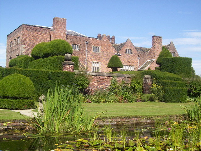
Peover Hall

Peover Hall ( PEE-vər) is a country house in the civil parish of Peover Superior, commonly known as Over Peover, Cheshire, England. It is recorded in...

Peover

Peover ( PEE-vər) is a rural area in Cheshire, England straddling the boundary of Cheshire West and Cheshire East. It is southwest of Chelford and northwest...

St Oswald's Church, Padgate

St Oswald's Church is an active Roman Catholic church in the Padgate suburb of Warrington, Cheshire, England. The parish was founded by Benedictine monks...

Peover Superior

Peover Superior is a former civil parish, now in the parish of Peover Superior and Snelson, in the unitary authority area of Cheshire East and the ceremonial...

Allostock

Allostock is a village and civil parish in the unitary authority of Cheshire West and Chester and the ceremonial county of Cheshire, England, about five...

St Oswald's Church, Lower Peover

St Oswald's Church is in the village of Lower Peover, Cheshire, England. It is recorded in the National Heritage List for England as a designated Grade...

Nearby Amenities

Located within 500m of 53.249333,-2.3592409
Boots Green
Place: hamlet
Lat/Long: 53.2468128/-2.3651823
The data included in this document is from www.openstreetmap.org. The data is made available under ODbL.

Have you been to Amsterdam Covert?

Leave your review of Amsterdam Covert below (or comments, questions and feedback).