Spinney Wood

Wood, Forest in Cheshire

England

Spinney Wood

Peover Hall and Gardens Peover Hall, its extensive gardens and 15th-Century chapel are open to the public as a museum.
Peover Hall and Gardens Credit: Iain McDonald

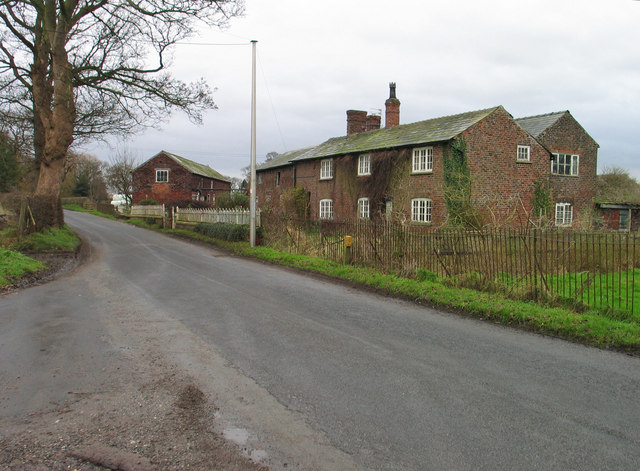
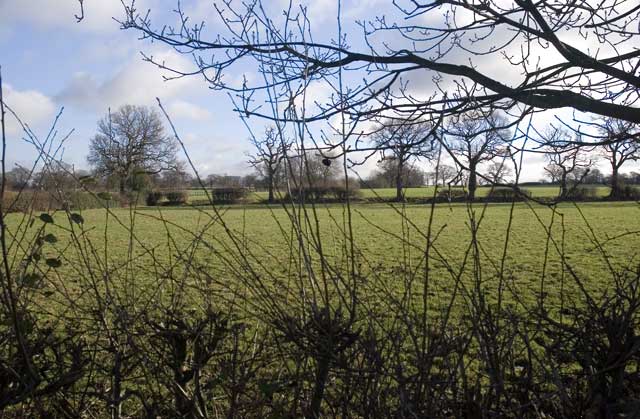
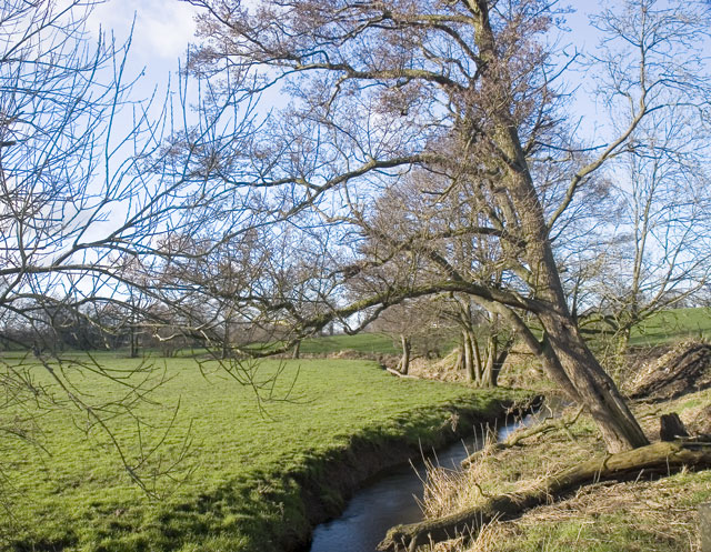
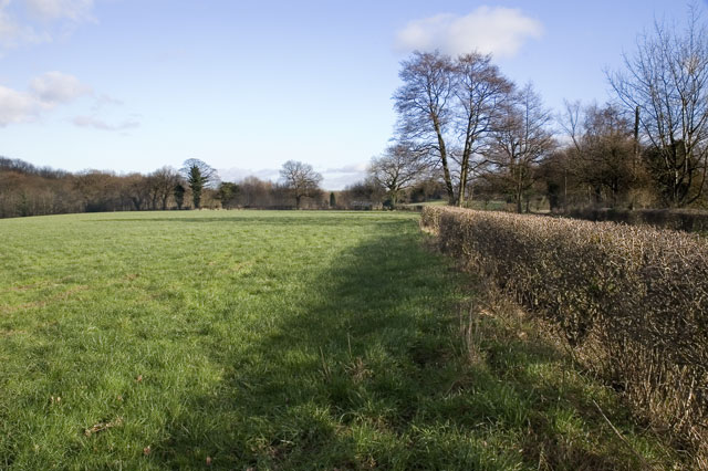
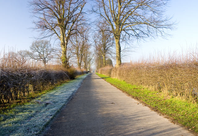
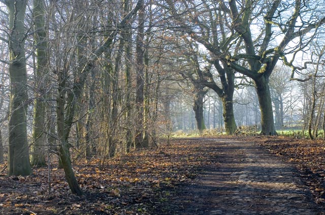
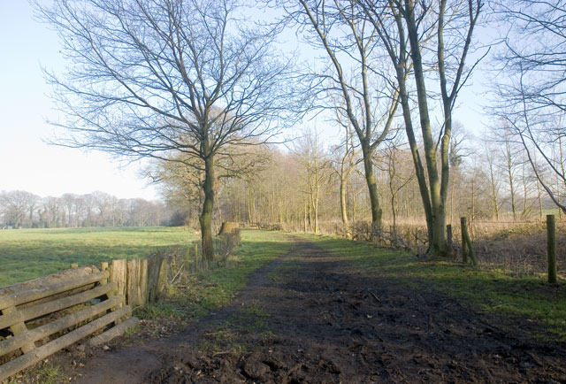
Spinney Wood is a charming woodland located in Cheshire, England. Situated near the village of Tarporley, this forested area covers a total of approximately 50 acres. The wood is primarily composed of a mix of broadleaf and coniferous trees, creating a diverse and picturesque landscape.

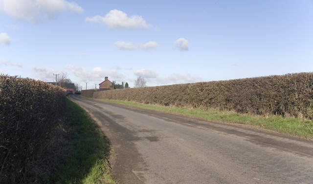
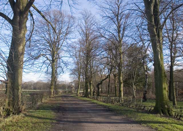
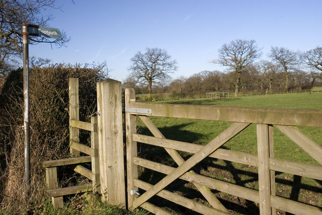
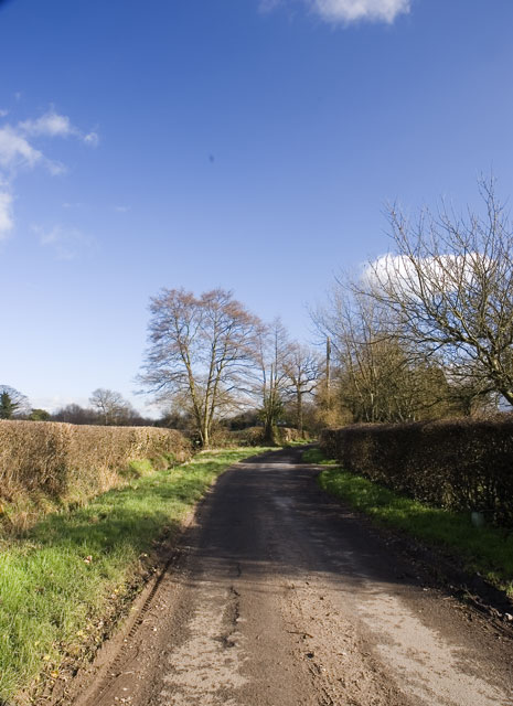
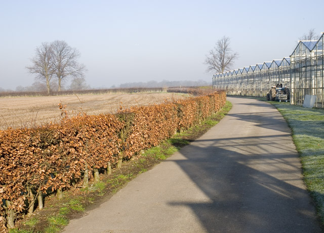
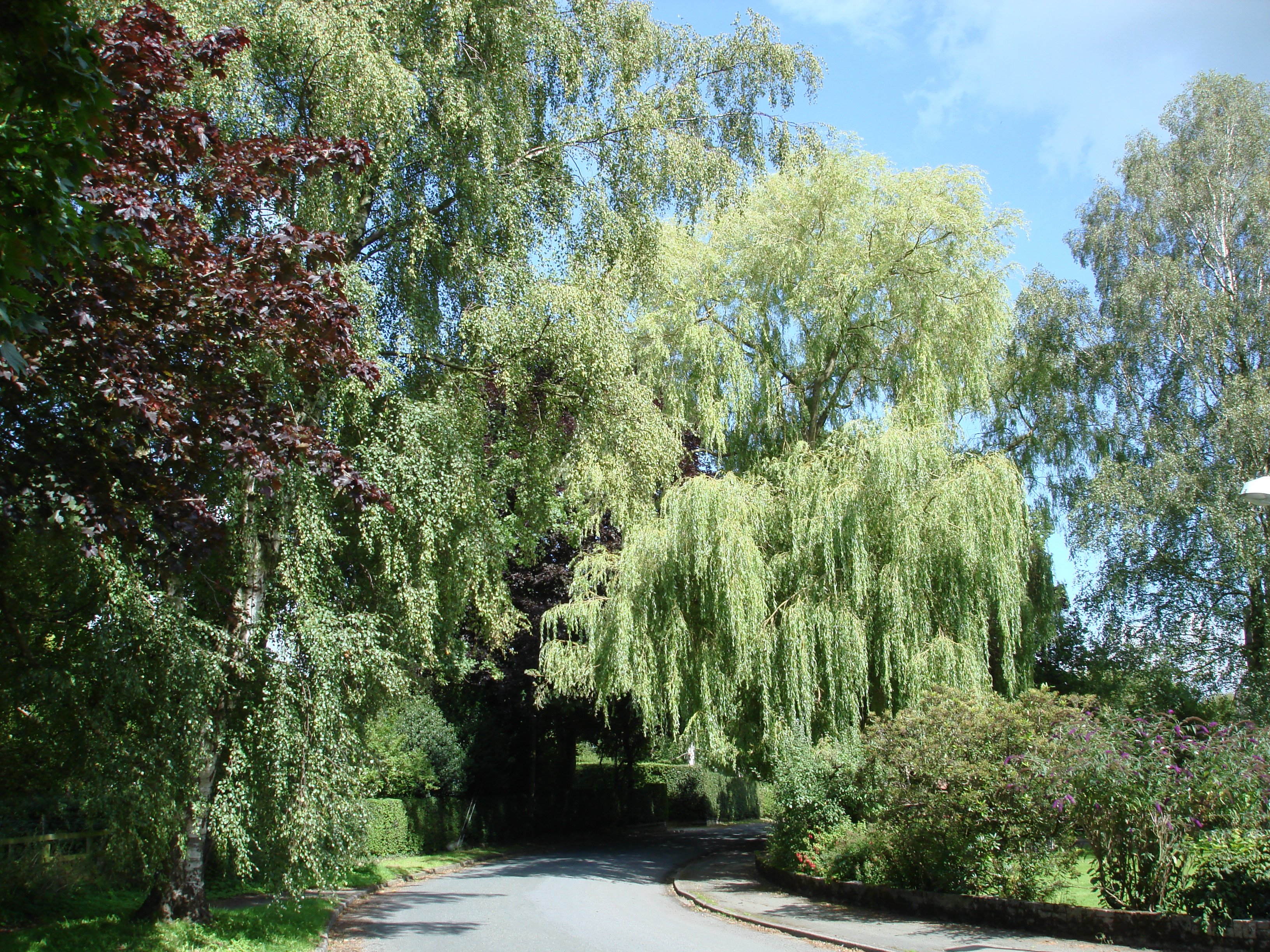
The main entrance to Spinney Wood is through a small gate, which leads visitors onto a well-maintained footpath that winds through the forest. The path is surrounded by an abundance of flora and fauna, including oak, birch, and beech trees, as well as bluebells, wild garlic, and various ferns during the spring and summer months.

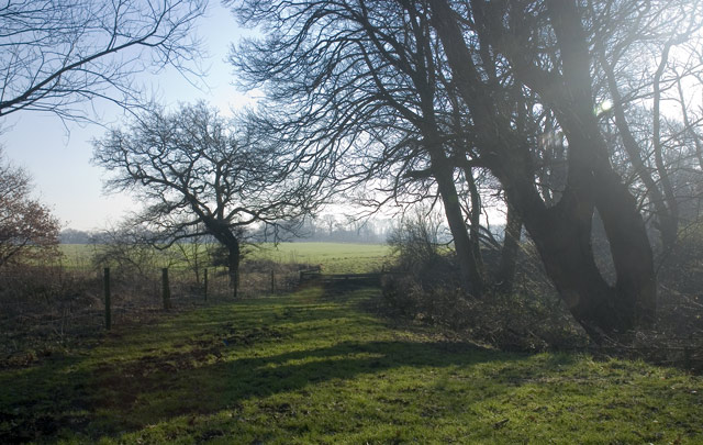
The woodland is home to a wide range of wildlife, providing a haven for birds, small mammals, and insects. It is not uncommon to spot woodpeckers, squirrels, and rabbits while exploring the area. The tranquil atmosphere and natural beauty of Spinney Wood make it a popular spot for nature enthusiasts, walkers, and photographers.

The wood is well-equipped with benches and picnic areas, allowing visitors to take a moment to relax and enjoy the peaceful surroundings. Additionally, there are designated trails and signposts throughout the forest to guide visitors and prevent any damage to the ecosystem.

Spinney Wood offers a tranquil escape from the hustle and bustle of everyday life, providing a serene environment for individuals to connect with nature. Its accessibility, well-maintained paths, and diverse wildlife make it an ideal destination for outdoor enthusiasts and those seeking a peaceful retreat in the heart of Cheshire.

If you have any feedback on the listing, please let us know in the comments section below.

Spinney Wood Images

Images are sourced within 2km of 53.249643/-2.351705 or Grid Reference SJ7672. Thanks to Geograph Open Source API. All images are credited.

Peover Hall and Gardens Peover Hall, its extensive gardens and 15th-Century chapel are open to the public as a museum.
Peover Hall and Gardens
Peover Hall, its extensive gardens and 15th-Century chapel are open to the public as a museum.
Signpost at Grotto Lane Farmland scene typical of those in the Peover and Goostrey region. Over Peover lies beyond the trees in the distance.
Signpost at Grotto Lane
Farmland scene typical of those in the Peover and Goostrey region. Over Peover lies beyond the trees in the distance.
Road Junction Junction of Heath Lane,(Ahead) Sandy Lane, (To left)& Townfield Lane (Behind)
Road Junction
Junction of Heath Lane,(Ahead) Sandy Lane, (To left)& Townfield Lane (Behind)
Drovers Arms, Allostock
Townfield Farm Townfield Farm, Townfield Lane near Allostock. One of many simple, but attractive farms built from red Cheshire bricks.
Townfield Farm
Townfield Farm, Townfield Lane near Allostock. One of many simple, but attractive farms built from red Cheshire bricks.
Looking towards Jodrell Bank Taken from the public road to Winterbottom Farm, Goostrey. In the distance is the Jodrell Bank telescope, pointing directly upwards.
Looking towards Jodrell Bank
Taken from the public road to Winterbottom Farm, Goostrey. In the distance is the Jodrell Bank telescope, pointing directly upwards.
Road to Boots Green Taken at the junction of Brick Bank Lane and Booth Bank Lane, of which this is a picture. The building on the horizon is Boothbed Farm.
Road to Boots Green
Taken at the junction of Brick Bank Lane and Booth Bank Lane, of which this is a picture. The building on the horizon is Boothbed Farm.
River scene Taken on the bridge carrying the road from Goostrey to Boots Green
River scene
Taken on the bridge carrying the road from Goostrey to Boots Green
Field next to Fullers Gate To the right, just over the hedge, is the road from Boots Green to Woodend Farm. To the left is woodland on the banks of the Peover Eye.
Field next to Fullers Gate
To the right, just over the hedge, is the road from Boots Green to Woodend Farm. To the left is woodland on the banks of the Peover Eye.
The Path to Peover Hall Near to Longland Farm, this public footpath skirts a field to the left of the image and woodland to the right.
The Path to Peover Hall
Near to Longland Farm, this public footpath skirts a field to the left of the image and woodland to the right.
Stile, Gate and Footpath Taken from the road to Smithy Green from Allostock and Goostrey.
Stile, Gate and Footpath
Taken from the road to Smithy Green from Allostock and Goostrey.
Fullers Gate The road to Woodend Farm
Fullers Gate
The road to Woodend Farm
Long Lane Taken near Longlane Farm, towards the junction with the A50.
Long Lane
Taken near Longlane Farm, towards the junction with the A50.
Path running parallel to a nursery Image taken facing Long Lane
Path running parallel to a nursery
Image taken facing Long Lane
Three Trees Taken on the path from Peover Hall, towards Longlane Farm.
Three Trees
Taken on the path from Peover Hall, towards Longlane Farm.
Beginning of Woodland Taken from the path from Peover Hall
Beginning of Woodland
Taken from the path from Peover Hall
The Path to Peover Hall (2) The public footpath from Long Lane to Peover Hall.
The Path to Peover Hall (2)
The public footpath from Long Lane to Peover Hall.
Woodland and Field Image traces the edge of untitled woodland near Peover Hall.
Woodland and Field
Image traces the edge of untitled woodland near Peover Hall.
Show me another place!

Spinney Wood is located at Grid Ref: SJ7672 (Lat: 53.249643, Lng: -2.351705)

Unitary Authority: Cheshire East

Police Authority: Cheshire

What 3 Words

///poodle.cling.overhear. Near Peover Superior, Cheshire

Related Wikis

Peover Hall Stable Block

Peover Hall Stable Block is in the grounds of Peover Hall, Cheshire, England. It is recorded in the National Heritage List for England as a designated...

St Lawrence's Church, Over Peover

St Lawrence's Church, Over Peover is in the civil parish of Peover Superior. Close to Peover Hall and farm. It lies some 3 miles (5 km) south of the...
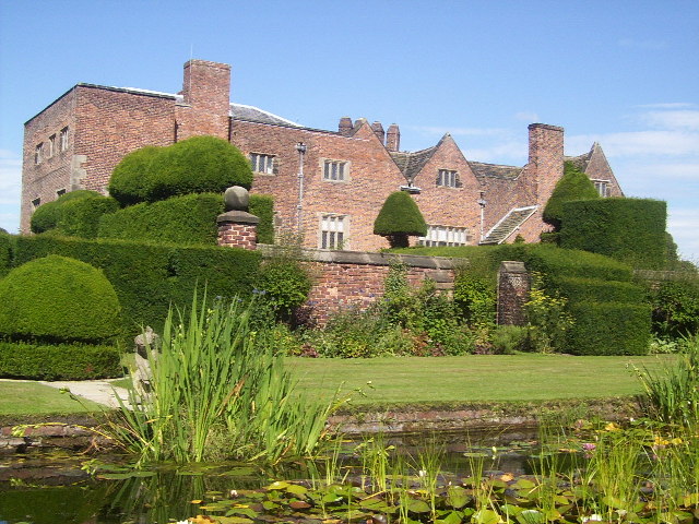
Peover Hall

Peover Hall ( PEE-vər) is a country house in the civil parish of Peover Superior, commonly known as Over Peover, Cheshire, England. It is recorded in...

St Oswald's Church, Padgate

St Oswald's Church is an active Roman Catholic church in the Padgate suburb of Warrington, Cheshire, England. The parish was founded by Benedictine monks...

Peover

Peover ( PEE-vər) is a rural area in Cheshire, England straddling the boundary of Cheshire West and Cheshire East. It is southwest of Chelford and northwest...

Peover Superior

Peover Superior is a former civil parish, now in the parish of Peover Superior and Snelson, in the unitary authority area of Cheshire East and the ceremonial...

Goostrey

Goostrey is a village and civil parish in the unitary authority of Cheshire East and the ceremonial county of Cheshire, England. It is in open countryside...

Radbroke Hall

Radbroke Hall is a white French chateau-style former country house in Peover Superior, Cheshire, England. It takes its name from the Red Brook stream that...

Nearby Amenities

Located within 500m of 53.249643,-2.351705
Generator Method: photovoltaic
Generator Output Electricity: yes
Generator Source: solar
Generator Type: solar_photovoltaic_panel
Location: roof
Power: generator
Lat/Long: 53.2469892/-2.351425
The data included in this document is from www.openstreetmap.org. The data is made available under ODbL.

Have you been to Spinney Wood?

Leave your review of Spinney Wood below (or comments, questions and feedback).