Lord's Yard Coppice

Wood, Forest in Worcestershire Wyre Forest

England

Lord's Yard Coppice

Fields at Cook's Green Farm
Fields at Cook's Green Farm Credit: Alex McGregor

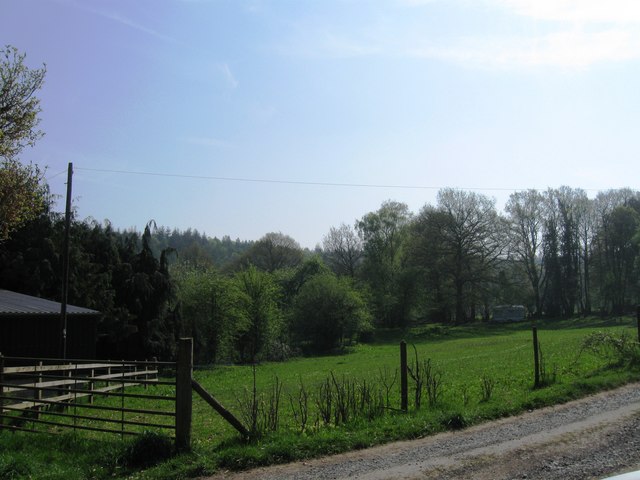
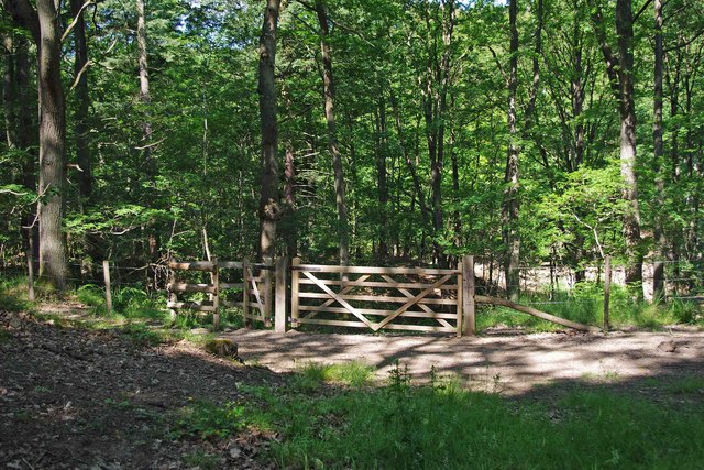
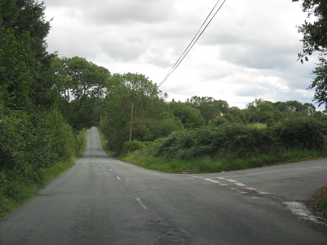
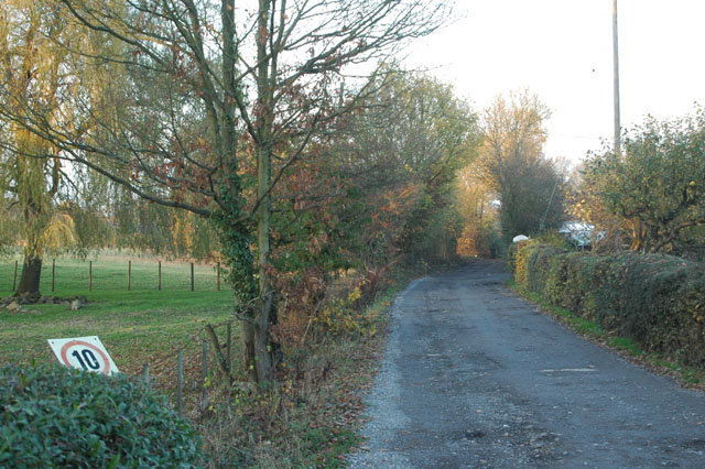
Lord's Yard Coppice is a picturesque woodland located in Worcestershire, England. Covering an area of approximately 50 acres, this ancient woodland is a haven for nature lovers and outdoor enthusiasts. The coppice is situated within close proximity to the village of Worcestershire and is easily accessible to visitors.

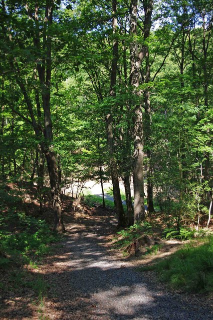
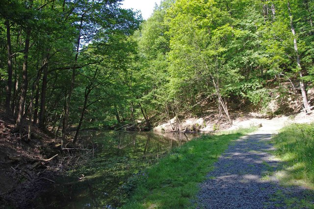
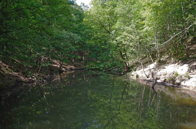
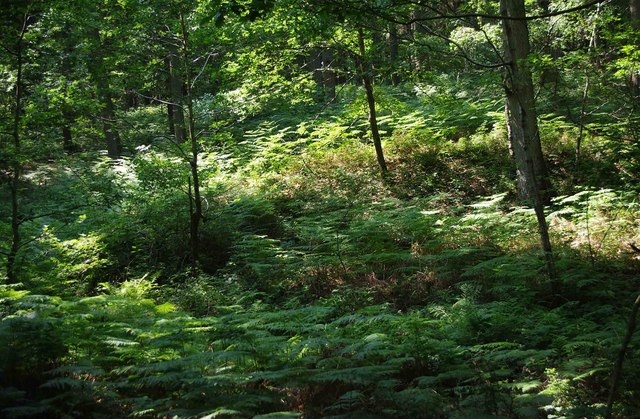
The woodland is characterized by its diverse range of tree species, including oak, ash, birch, and beech. These trees are densely packed, creating a canopy that provides shade and shelter for a variety of wildlife. The forest floor is carpeted with a plethora of wildflowers, ferns, and mosses, adding to the enchanting atmosphere of the coppice.

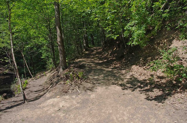
Visitors to Lord's Yard Coppice can enjoy a network of well-maintained walking trails that wind through the woodland. These trails offer stunning views of the surrounding countryside and provide an opportunity to observe the abundant wildlife that calls the coppice home. Birdwatchers will delight in the numerous species that inhabit the area, such as woodpeckers, nightingales, and buzzards.

The woodland is also home to a diverse range of mammals, including deer, badgers, and foxes. Nature enthusiasts may also spot smaller creatures such as squirrels, rabbits, and hedgehogs. The peaceful ambiance of Lord's Yard Coppice makes it an ideal location for nature photography or simply enjoying a tranquil walk in nature.

Overall, Lord's Yard Coppice is a captivating woodland that offers a rich tapestry of flora and fauna. Its accessibility and natural beauty make it a popular destination for both locals and tourists seeking a peaceful retreat in the heart of Worcestershire.

If you have any feedback on the listing, please let us know in the comments section below.

Lord's Yard Coppice Images

Images are sourced within 2km of 52.374014/-2.3570857 or Grid Reference SO7575. Thanks to Geograph Open Source API. All images are credited.

Fields at Cook's Green Farm
Car park off Dry Mill Lane This is a new car park for people walking in the Wyre Forest and is the recommended car park for visitors to Knowles Mill. A fellow collaborator has kindly confirmed my position and view direction.
Car park off Dry Mill Lane
This is a new car park for people walking in the Wyre Forest and is the recommended car park for visitors to Knowles Mill. A fellow collaborator has kindly confirmed my position and view direction.
Knowles Mill Preserved derelict flour mill on the Dowles Brook in the Wyre Forest. The remains of the overshot waterwheel are behind the curved wall in the foreground and the tail race is in a tunnel.
Knowles Mill
Preserved derelict flour mill on the Dowles Brook in the Wyre Forest. The remains of the overshot waterwheel are behind the curved wall in the foreground and the tail race is in a tunnel.
Knowles Mill - the remains of the waterwheel This was an overshot waterwheel with the leat coming in at high level on the left and the portal of the tail race tunnel visible to the right.
Knowles Mill - the remains of the waterwheel
This was an overshot waterwheel with the leat coming in at high level on the left and the portal of the tail race tunnel visible to the right.
Knowles Mill - machinery A nineteenth century watermill that went out of use in 1891 when it was damaged by a flood following a big freeze. It is the only recognisable mill in the Wyre Forest.

This somewhat sharpened (really!) shot shows the pit wheel, wallower, great spur wheel and crown wheel. There is a surviving stone nut and quant on the right with a bed stone on the floor above. The other stone nut and the other stones have gone. There is a fragmented French burr stone on the ground inside.
Knowles Mill - machinery
A nineteenth century watermill that went out of use in 1891 when it was damaged by a flood following a big freeze. It is the only recognisable mill in the Wyre Forest. This somewhat sharpened (really!) shot shows the pit wheel, wallower, great spur wheel and crown wheel. There is a surviving stone nut and quant on the right with a bed stone on the floor above. The other stone nut and the other stones have gone. There is a fragmented French burr stone on the ground inside.
Knowles Mill Nineteenth century watermill that has been out of use since 1891 and is now preserved by the National Trust. The bridge in the foreground crosses the Dowles Brook.
Knowles Mill
Nineteenth century watermill that has been out of use since 1891 and is now preserved by the National Trust. The bridge in the foreground crosses the Dowles Brook.
Gated entrance to track in Wyre Forest near Bewdley There is both a kissing gate here, and a gate wide enough to let a vehicle pass through. On the other side is a track, with a rough stone surface, which makes a steep descent down to a pond and a steam.

<a href="https://www.geograph.org.uk/photo/2487006">SO7676 : Track to pond in Wyre Forest, near Bewdley</a>.
<a href="https://www.geograph.org.uk/photo/2487032">SO7676 : Pond and track in the Wyre Forest near Bewdley</a>.
Gated entrance to track in Wyre Forest near Bewdley
There is both a kissing gate here, and a gate wide enough to let a vehicle pass through. On the other side is a track, with a rough stone surface, which makes a steep descent down to a pond and a steam. SO7676 : Track to pond in Wyre Forest, near Bewdley. SO7676 : Pond and track in the Wyre Forest near Bewdley.
Track to pond in Wyre Forest, near Bewdley The pond is at the bottom of the track, but not visible in this photograph.

<a href="https://www.geograph.org.uk/photo/2486986">SO7676 : Gated entrance to track in Wyre Forest near Bewdley</a>.
<a href="https://www.geograph.org.uk/photo/2487032">SO7676 : Pond and track in the Wyre Forest near Bewdley</a>.
Track to pond in Wyre Forest, near Bewdley
The pond is at the bottom of the track, but not visible in this photograph. SO7676 : Gated entrance to track in Wyre Forest near Bewdley. SO7676 : Pond and track in the Wyre Forest near Bewdley.
Pond and track in the Wyre Forest near Bewdley The pond is on the left but difficult to see, as its surface is reflecting the trees which hang overhead. It is one of several which are linked by a small stream, and appears to be either artificial or enlarged from the original.

<a href="https://www.geograph.org.uk/photo/2486986">SO7676 : Gated entrance to track in Wyre Forest near Bewdley</a>.
<a href="https://www.geograph.org.uk/photo/2487006">SO7676 : Track to pond in Wyre Forest, near Bewdley</a>.
<a href="https://www.geograph.org.uk/photo/2487054">SO7676 : Pond in Wyre Forest near Bewdley</a>.
Pond and track in the Wyre Forest near Bewdley
The pond is on the left but difficult to see, as its surface is reflecting the trees which hang overhead. It is one of several which are linked by a small stream, and appears to be either artificial or enlarged from the original. SO7676 : Gated entrance to track in Wyre Forest near Bewdley. SO7676 : Track to pond in Wyre Forest, near Bewdley. SO7676 : Pond in Wyre Forest near Bewdley.
Pond in Wyre Forest near Bewdley The pond may be artificial or artificially enlarged. It lies on a stream which runs through the forest.

<a href="https://www.geograph.org.uk/photo/2487032">SO7676 : Pond and track in the Wyre Forest near Bewdley</a>.
Pond in Wyre Forest near Bewdley
The pond may be artificial or artificially enlarged. It lies on a stream which runs through the forest. SO7676 : Pond and track in the Wyre Forest near Bewdley.
Junction of two paths in the Wyre Forest near Bewdley The lower path runs alongside a pond. The other path climbs steeply.

<a href="https://www.geograph.org.uk/photo/2487054">SO7676 : Pond in Wyre Forest near Bewdley</a>.
Junction of two paths in the Wyre Forest near Bewdley
The lower path runs alongside a pond. The other path climbs steeply. SO7676 : Pond in Wyre Forest near Bewdley.
Ferns in the Wyre Forest near Bewdley Ferns were flourishing in this area.
Ferns in the Wyre Forest near Bewdley
Ferns were flourishing in this area.
A456 at Alton Nursery
Lane junction at Cross Bank
The Royal Forester
The Royal Forester
The Duke William
The Duke William
Keep your speed down
A456 at Long Bank
A456 at Long Bank
Show me another place!

Lord's Yard Coppice is located at Grid Ref: SO7575 (Lat: 52.374014, Lng: -2.3570857)

Administrative County: Worcestershire

District: Wyre Forest

Police Authority: West Mercia

What 3 Words

///husbands.underline.scrapping. Near Bewdley, Worcestershire

Related Wikis

Wyre Forest

Wyre Forest is a large, semi-natural (partially unmanaged) woodland and forest measuring 26.34 square kilometres (10.17 sq mi) which straddles the borders...
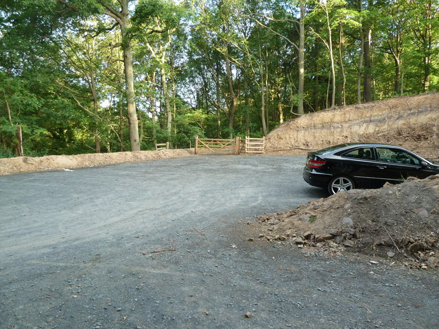
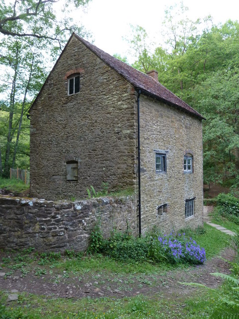
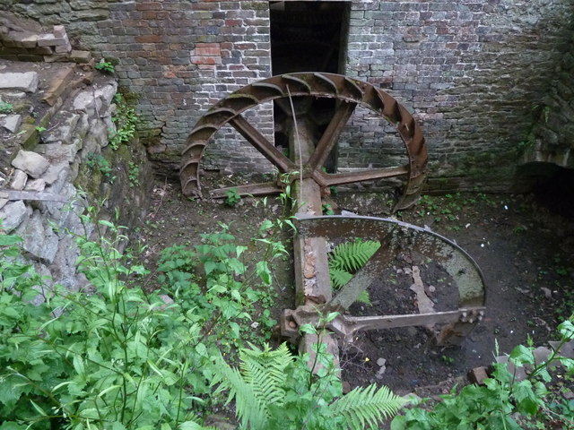
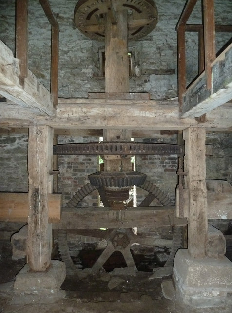
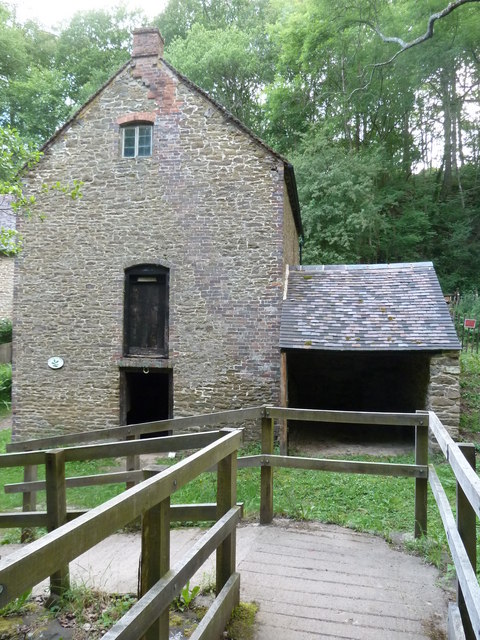
Knowles Mill

Knowles Mill is the remains of an eighteenth-century water-powered grain mill, located in the Wyre Forest in Worcestershire, England. The mill has been...

A456 road

Known as the Hagley Road in Birmingham, the A456 is a main road in England running between Central Birmingham and Woofferton, Shropshire, south of Ludlow...

Dowles

Dowles is a hamlet in the civil parish of Upper Arley, in the Wyre Forest district, in the county of Worcestershire, England. It is about 3 miles from...

Fingerpost, Worcestershire

Fingerpost is a hamlet and road junction in north Worcestershire, England, approximately 3 miles (4.8 km) west of Bewdley. It is located at the junction...

Dowles Brook

Dowles Brook flows through the heart of the Wyre Forest, into the former civil parish of Dowles and into the River Severn. == History == In 1902, ornithologist...

Ribbesford

Ribbesford is a village and civil parish in the Wyre Forest District of Worcestershire, England. At the 2001 census it had a population of 237.Notable...

Tickenhill Palace

Tickenhill Palace (also known as Tickenhill House or Tickenhall Manor) is a historic building in Bewdley, Worcestershire, England. It is a grade II* listed...

Have you been to Lord's Yard Coppice?

Leave your review of Lord's Yard Coppice below (or comments, questions and feedback).