Stockton's Coppice

Wood, Forest in Worcestershire

England

Stockton's Coppice

Cowleigh Gate Farm From near the ford through Whippets Brook in Cowleigh Park.
Cowleigh Gate Farm Credit: Bob Embleton

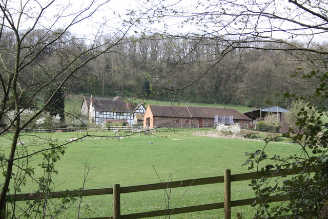
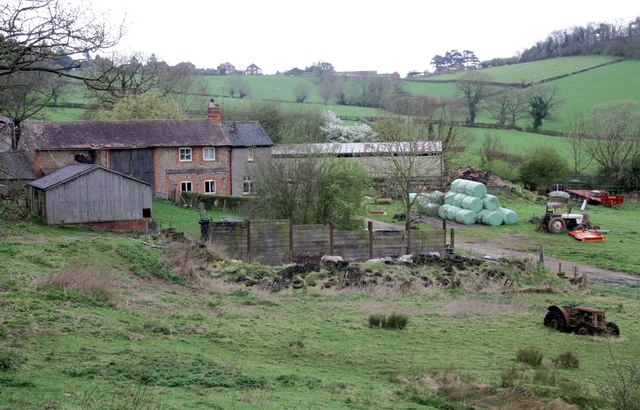
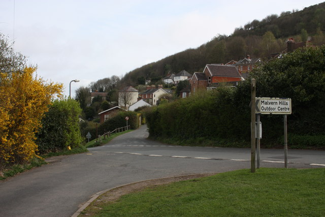
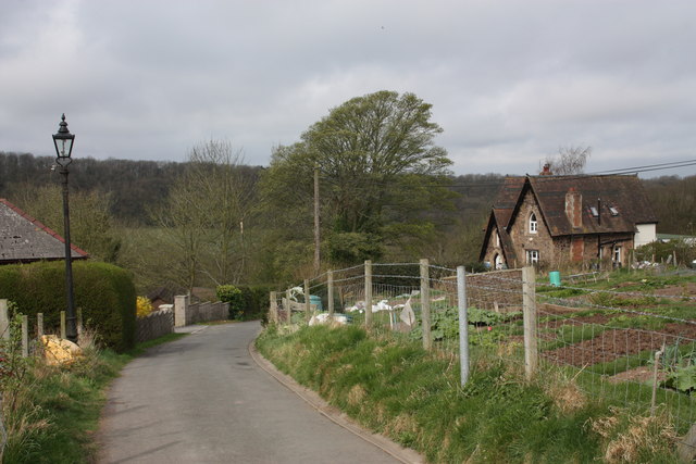
Stockton's Coppice is a picturesque woodland located in the county of Worcestershire, England. Stretching over an area of approximately 100 acres, this ancient forest is a haven of natural beauty and biodiversity. The coppice is situated near the village of Stockton, nestled between the towns of Droitwich Spa and Bromsgrove.

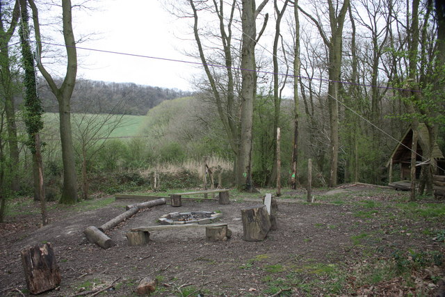
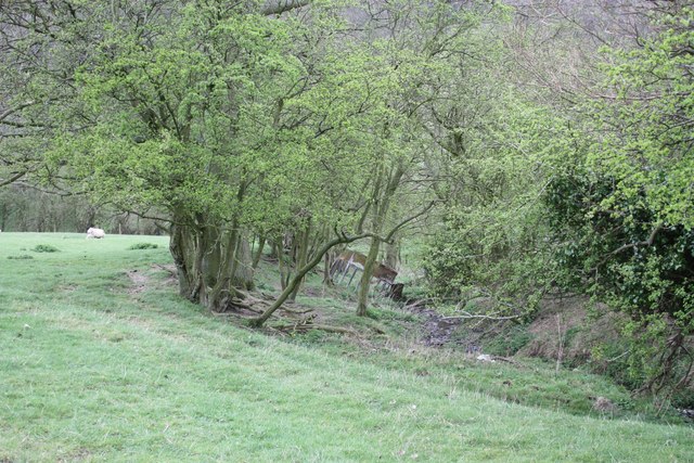
The woodland is predominantly composed of broadleaf trees, including oak, ash, beech, and hazel, which create a dense canopy overhead. These trees have been managed in a coppicing system for centuries, where new shoots are periodically cut to produce timber and promote regrowth. This traditional practice has led to a unique and diverse ecosystem within the woodland.

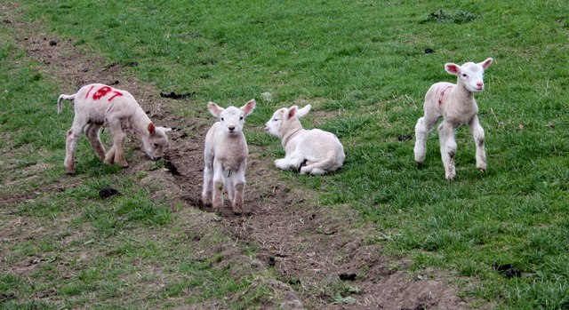
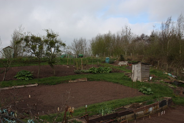
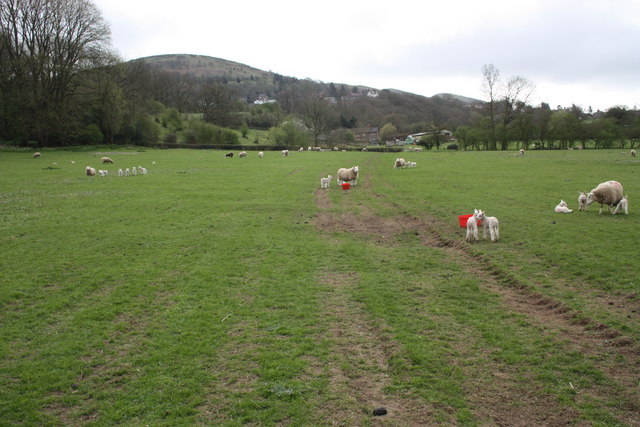
Walking through Stockton's Coppice, visitors are greeted with a tranquil and serene atmosphere. The forest floor is blanketed with a rich carpet of ferns, bluebells, and wildflowers, creating a vibrant tapestry of colors during springtime. The woodland provides a vital habitat for a variety of wildlife, including deer, badgers, foxes, and a wide array of bird species.

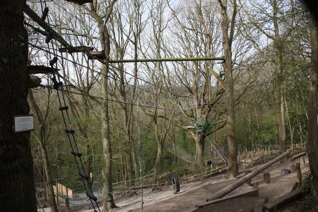
The coppice also offers several walking trails and paths, enabling visitors to explore the woodland's beauty at their own pace. These trails are well-maintained and signposted, ensuring a safe and enjoyable experience for all. Additionally, the forest is often used as an educational resource, with guided tours and workshops organized to teach visitors about the importance of woodland conservation and sustainable management practices.

Overall, Stockton's Coppice is a cherished natural treasure in Worcestershire, offering visitors a unique opportunity to immerse themselves in the beauty of an ancient woodland and learn about its ecological significance.

If you have any feedback on the listing, please let us know in the comments section below.

Stockton's Coppice Images

Images are sourced within 2km of 52.111553/-2.3645483 or Grid Reference SO7545. Thanks to Geograph Open Source API. All images are credited.

Cowleigh Gate Farm From near the ford through Whippets Brook in Cowleigh Park.
Cowleigh Gate Farm
From near the ford through Whippets Brook in Cowleigh Park.
Birches Farm In the valley of the Whippets Brook between the limestone ridge to the west and the granite of the Malvern Hills to the east.
Birches Farm
In the valley of the Whippets Brook between the limestone ridge to the west and the granite of the Malvern Hills to the east.
Young lambs near Birches Farm The lambs are numbered to match their mothers.
They seemed to gather on the footpath and appeared more curious than cautious - until their anxious mothers called to them.
Young lambs near Birches Farm
The lambs are numbered to match their mothers. They seemed to gather on the footpath and appeared more curious than cautious - until their anxious mothers called to them.
Reception, West Malvern Outdoor Centre Dating back to the open air school of 1914.
"The main focus of a visit to the centre is the residential experience, incorporating activities designed to challenge and stretch participants."
<span class="nowrap"><a title="http://www.worcestershire.gov.uk/cms/education-and-learning/be-healthy/outdoor-education-centres/malvern-hills-oec.aspx" rel="nofollow ugc noopener" href="http://www.worcestershire.gov.uk/cms/education-and-learning/be-healthy/outdoor-education-centres/malvern-hills-oec.aspx">Link</a><img style="margin-left:2px;" alt="External link" title="External link - shift click to open in new window" src="https://s1.geograph.org.uk/img/external.png" width="10" height="10"/></span>
Reception, West Malvern Outdoor Centre
Dating back to the open air school of 1914. "The main focus of a visit to the centre is the residential experience, incorporating activities designed to challenge and stretch participants." LinkExternal link
Old Hollow, West Malvern The junction with the narrow road to the outdoor education centre.
Old Hollow, West Malvern
The junction with the narrow road to the outdoor education centre.
The road to West Malvern Outdoor Centre The narrow lane is still lit with the old gas lamps.
The building on the right is the reception office for the outdoor centre.
The road to West Malvern Outdoor Centre
The narrow lane is still lit with the old gas lamps. The building on the right is the reception office for the outdoor centre.
West Malvern allotments Just off the road to the outdoor centre.
The apple trees are bristling with mistletoe.
West Malvern allotments
Just off the road to the outdoor centre. The apple trees are bristling with mistletoe.
Confidence course The plaque on the tree reads:
This Confidence Course at
West Malvern Outdoor Education Centre
was designed and erected by
the staff of the centre and opened for use by
Colonel J.N. Blashford Snell MBE
on January 12th 1991
"To encourage the development of confidence, trust and self-control"
Education Department
Hereford and Worcester County Council
Confidence course
The plaque on the tree reads: This Confidence Course at West Malvern Outdoor Education Centre was designed and erected by the staff of the centre and opened for use by Colonel J.N. Blashford Snell MBE on January 12th 1991 "To encourage the development of confidence, trust and self-control" Education Department Hereford and Worcester County Council
Camp fire, West Malvern Outdoor Education Centre Just below the ropes and confidence course.
Camp fire, West Malvern Outdoor Education Centre
Just below the ropes and confidence course.
Field boundary and stream near Birches Farm The trees are slowly spreading into the field.
Field boundary and stream near Birches Farm
The trees are slowly spreading into the field.
Ewes and lambs near Birches Farm Looking back along the bridleway towards the farm with West Malvern and North hill beyond.
Ewes and lambs near Birches Farm
Looking back along the bridleway towards the farm with West Malvern and North hill beyond.
Bilberry patches on the Malvern Hills On the eastern side of Worcestershire Beacon large near-circular patches of bilberry plants are expanding year by year.
These stand out as lighter green patches at this time of the year when the light is right.
The berries are often smaller than those commercially farmed, but are free and in a wonderful setting.
Late August to late September are good times to get one's hands stained blue.
Bilberry patches on the Malvern Hills
On the eastern side of Worcestershire Beacon large near-circular patches of bilberry plants are expanding year by year. These stand out as lighter green patches at this time of the year when the light is right. The berries are often smaller than those commercially farmed, but are free and in a wonderful setting. Late August to late September are good times to get one's hands stained blue.
West of the Worcestershire Beacon This autumn view west from the ridge-top encompasses much of Herefordshire. On the left is Oyster Hill and beyond sticking out of the mist is the Marcle Ridge.
West of the Worcestershire Beacon
This autumn view west from the ridge-top encompasses much of Herefordshire. On the left is Oyster Hill and beyond sticking out of the mist is the Marcle Ridge.
The toposcope on the Worcester Beacon Looking north-west with Table Hill on the right. In the middle distance the Suckley Hills poke out of the mist and at the back are the Abberley Hills. The inscription reads "Erected in commemoration of the sixtieth year of Queen Victoria's reign 1897".
The toposcope on the Worcester Beacon
Looking north-west with Table Hill on the right. In the middle distance the Suckley Hills poke out of the mist and at the back are the Abberley Hills. The inscription reads "Erected in commemoration of the sixtieth year of Queen Victoria's reign 1897".
Overlooking Great Malvern Looking north-east from near the top of the Worcestershire Beacon on a misty November morning. The Seven Valley is completely covered in mist right up to the lower parts of Great Malvern. The higher part of the town and the Malvern Hills are bathed in sunlight. The brown patches below are bracken, which has been mowed by the Malvern Hills Conservators (the straight-line tractor tracks are still visible).
Overlooking Great Malvern
Looking north-east from near the top of the Worcestershire Beacon on a misty November morning. The Seven Valley is completely covered in mist right up to the lower parts of Great Malvern. The higher part of the town and the Malvern Hills are bathed in sunlight. The brown patches below are bracken, which has been mowed by the Malvern Hills Conservators (the straight-line tractor tracks are still visible).
The Malverns in autumn Looking north across Green Valley to North Hill. The temperature inversion has created a mist pool in the Severn-Teme valley below.
The Malverns in autumn
Looking north across Green Valley to North Hill. The temperature inversion has created a mist pool in the Severn-Teme valley below.
Sheep grazing on North Hill Looking east across the Severn-Avon Valley to Bredon Hill and the Cotswold escarpment sticking out of the thick mist. The flock of Cheviot sheep is used to keep the scrub down on the northern parts of the Malvern Hills.
Sheep grazing on North Hill
Looking east across the Severn-Avon Valley to Bredon Hill and the Cotswold escarpment sticking out of the thick mist. The flock of Cheviot sheep is used to keep the scrub down on the northern parts of the Malvern Hills.
Cattle on the Malvern Hills A small herd of mainly Galloway cattle is used on the northern Malverns to help keep the scrub down. This member of the herd was very accommodating when told to smile for the camera. Lady Howard de Walden Drive below - a mainly flat path which encircles the top of North Hill. The Severn-Teme valley in the background is covered by autumn mist.
Cattle on the Malvern Hills
A small herd of mainly Galloway cattle is used on the northern Malverns to help keep the scrub down. This member of the herd was very accommodating when told to smile for the camera. Lady Howard de Walden Drive below - a mainly flat path which encircles the top of North Hill. The Severn-Teme valley in the background is covered by autumn mist.
Show me another place!

Stockton's Coppice is located at Grid Ref: SO7545 (Lat: 52.111553, Lng: -2.3645483)

Unitary Authority: County of Herefordshire

Police Authority: West Mercia

What 3 Words

///hurricane.winter.region. Near Great Malvern, Worcestershire

Related Wikis

Regents Theological College

Regents Theological College is a theological college in Malvern, Worcestershire, England. It is the training centre of the Elim Pentecostal Church. First...

West Malvern

West Malvern is a village and a civil parish on the west side of the north part of the Malvern Hills, on the western edge of Worcestershire, England. It...

Mathon, Herefordshire

Mathon is a small village and civil parish in eastern Herefordshire, England, lying just to the west of the Malvern Hills between Malvern and Ledbury....

Sugarloaf Hill, Malvern

Sugarloaf Hill lies between the Worcestershire Beacon and North Hill in the range of Malvern Hills that runs about 13 kilometres (8 mi) north-south along...

Nearby Amenities

Located within 500m of 52.111553,-2.3645483
Barrier: stile
Lat/Long: 52.1145005/-2.3592384
Fixme: incomplete
Lat/Long: 52.1146327/-2.3600744
Barrier: swing_gate
Foot: yes
Lat/Long: 52.1133612/-2.3704187
Barrier: swing_gate
Foot: yes
Lat/Long: 52.113385/-2.3708273
Stockton Coppice
Power: pole
Transformer: distribution
Voltage Primary: 11000
Lat/Long: 52.1144437/-2.3652651
Power: pole
Lat/Long: 52.1137449/-2.3647816
Power: pole
Lat/Long: 52.1134011/-2.3639414
Power: pole
Lat/Long: 52.1128555/-2.3637336
Power: pole
Lat/Long: 52.1122888/-2.3635123
Power: pole
Lat/Long: 52.1116732/-2.3632763
Power: pole
Lat/Long: 52.1110213/-2.3630235
Power: pole
Lat/Long: 52.1111255/-2.357486
Power: pole
Lat/Long: 52.1109472/-2.3584208
West Malvern Pumping Station
Power: pole
Transformer: distribution
Voltage Primary: 11000
Lat/Long: 52.1107829/-2.3592462
Power: pole
Lat/Long: 52.1105683/-2.3603077
Power: pole
Lat/Long: 52.1104291/-2.3610199
Power: pole
Lat/Long: 52.1104094/-2.3616998
Power: pole
Lat/Long: 52.1103879/-2.362778
Power: pole
Lat/Long: 52.1085858/-2.3667672
Power: pole
Lat/Long: 52.1090001/-2.3686172
Stockton House
Power: pole
Transformer: distribution
Voltage Primary: 11000
Lat/Long: 52.1097677/-2.3625433
Power: pole
Lat/Long: 52.1093806/-2.363757
Power: pole
Lat/Long: 52.1093325/-2.364667
Power: pole
Lat/Long: 52.1089931/-2.3652383
Power: pole
Lat/Long: 52.1084433/-2.3661348
Power: pole
Lat/Long: 52.108767/-2.3675819
Power: pole
Lat/Long: 52.1088416/-2.3699174
Power: pole
Lat/Long: 52.1092398/-2.3697069
Power: pole
Lat/Long: 52.1091006/-2.3705564
The data included in this document is from www.openstreetmap.org. The data is made available under ODbL.

Have you been to Stockton's Coppice?

Leave your review of Stockton's Coppice below (or comments, questions and feedback).