Collinpark Wood

Wood, Forest in Gloucestershire Forest of Dean

England

Collinpark Wood

Upleadon Village, Detached dwelling Detached dwelling on the outskirts of Upleadon village, Gloucestershire.
Upleadon Village, Detached dwelling Credit: Colin Manton

Collinpark Wood is a picturesque woodland located in the county of Gloucestershire, England. Spanning over an area of approximately 200 acres, this ancient forest is a haven for nature enthusiasts and provides a tranquil escape from the bustling city life.

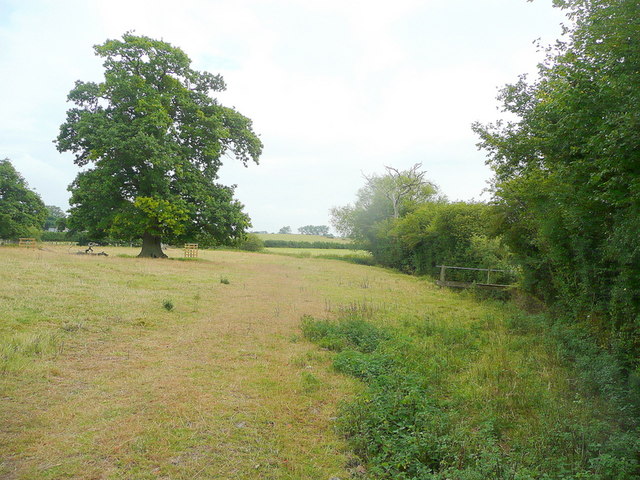
The woodland is predominantly composed of deciduous trees, such as oak, beech, and birch, which create a stunning canopy during the summer months. The forest floor is adorned with a plethora of wildflowers, ferns, and mosses, adding to the enchanting atmosphere of the wood.

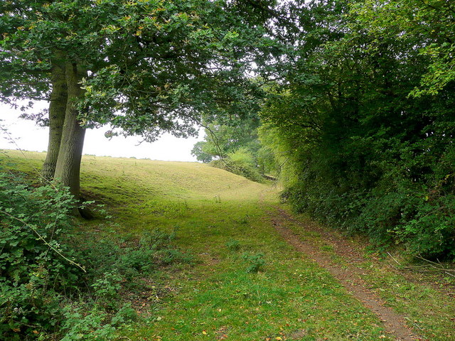
Walking through Collinpark Wood, visitors can enjoy a variety of well-maintained footpaths and trails that meander through the forest, allowing them to explore its hidden corners and discover its abundant flora and fauna. The wood is home to a diverse range of wildlife, including deer, foxes, badgers, and numerous species of birds, making it a popular spot for birdwatching and wildlife photography.

The management of Collinpark Wood is focused on preservation and conservation, with efforts made to maintain the natural balance of the ecosystem. This includes selective tree felling to encourage new growth and the creation of small clearings to support a wider diversity of plant life.

The wood is open to the public throughout the year and offers a range of amenities, including picnic areas, benches, and information boards that provide insight into the local flora and fauna. It is a popular destination for families, dog walkers, and nature lovers, who can enjoy the serenity and beauty of this ancient woodland.

If you have any feedback on the listing, please let us know in the comments section below.

Collinpark Wood Images

Images are sourced within 2km of 51.949216/-2.3648301 or Grid Reference SO7527. Thanks to Geograph Open Source API. All images are credited.

Upleadon Village, Detached dwelling Detached dwelling on the outskirts of Upleadon village, Gloucestershire.
Upleadon Village, Detached dwelling
Detached dwelling on the outskirts of Upleadon village, Gloucestershire.
Upleadon Crossroads Upleadon Crossroads, Gloucestershire. Note the Public telephone box. Most of these are disappearing due to the dominance of mobile phones.
Upleadon Crossroads
Upleadon Crossroads, Gloucestershire. Note the Public telephone box. Most of these are disappearing due to the dominance of mobile phones.
Edge of pasture The public footpath from the Leadon to Upleadon follows the field edge here.
Edge of pasture
The public footpath from the Leadon to Upleadon follows the field edge here.
Collinpark Wood 1 Straight path through the wood looking north-east.
Collinpark Wood 1
Straight path through the wood looking north-east.
Collinpark Wood 2 The opposite view to <a href="https://www.geograph.org.uk/photo/2549365">SO7527 : Collinpark Wood 1</a>.
Collinpark Wood 2
The opposite view to SO7527 : Collinpark Wood 1.
Wheat field in the Vale of Leadon The footpath follows the field edge to the right.
In the distance is Chase End Hill - the southerly outpost of the Malvern Hills.
Wheat field in the Vale of Leadon
The footpath follows the field edge to the right. In the distance is Chase End Hill - the southerly outpost of the Malvern Hills.
Footpath junction ahead Looking north-east towards the Leadon Bridge just beyond the oak.
The path to Upleadon joins at the footbridge to the right.
Footpath junction ahead
Looking north-east towards the Leadon Bridge just beyond the oak. The path to Upleadon joins at the footbridge to the right.
Pastoral land To the east of Everes's Farm; the footpath to Witherdine follows the field edge.
Pastoral land
To the east of Everes's Farm; the footpath to Witherdine follows the field edge.
The Vale of Leadon Watermeadows south of Everes's Farm.
The Vale of Leadon
Watermeadows south of Everes's Farm.
Fallen oak By the path to Upleadon from Witherdine.
Fallen oak
By the path to Upleadon from Witherdine.
View from Eden's Hill Looking south-west towards the ubiguitous view of May Hill.
View from Eden's Hill
Looking south-west towards the ubiguitous view of May Hill.
Bridleway by The Woodings Eden's Hill forms the backdrop to the scene.
Bridleway by The Woodings
Eden's Hill forms the backdrop to the scene.
Green Lane at Chapel Farm There is some confusion about the name of this lane. The map shows 'Green Lane' here, but 'Chapel Lane' a short distance north. The lane to the east is clearly labelled 'Chapel Lane' on the ground (not on the map). I am unable to explain this apparent anomaly.
Green Lane at Chapel Farm
There is some confusion about the name of this lane. The map shows 'Green Lane' here, but 'Chapel Lane' a short distance north. The lane to the east is clearly labelled 'Chapel Lane' on the ground (not on the map). I am unable to explain this apparent anomaly.
St John the Evangelist church, Pauntley
Farmland at Pauntley Court
The Poolhill Road at Compton Green
Farm track up a hill Looking north-east from Stream Lane.
Farm track up a hill
Looking north-east from Stream Lane.
St John, Pauntley Church, Court and dovecote make a memorable group at the end of a long lane.
St John, Pauntley
Church, Court and dovecote make a memorable group at the end of a long lane.
Show me another place!

Collinpark Wood is located at Grid Ref: SO7527 (Lat: 51.949216, Lng: -2.3648301)

Administrative County: Gloucestershire

District: Forest of Dean

Police Authority: Gloucestershire

What 3 Words

///hilltop.plugs.composers. Near Newent, Gloucestershire

Related Wikis

Collinpark Wood SSSI

Collinpark Wood (grid reference SO750278) is a 66.69-hectare (164.8-acre) biological Site of Special Scientific Interest in Gloucestershire, notified in...

Brand Green

Brand Green is a village in Gloucestershire, England. == References == == External links == Media related to Brand Green at Wikimedia Commons

Upleadon

Upleadon is a village and civil parish situated 10.5 km north-west of Gloucester. Soon after the Norman conquest Upleadon became part of the estates of...

Malswick Halt railway station

Malswick Halt was a request stop on the former Ledbury and Gloucester Railway. It opened on 1st February 1938 and was closed in 1959 when the line was...

Newent Town F.C.

Newent Town Association Football Club is a football club based in Newent, Gloucestershire, England. They were established in 1920. Affiliated to the Gloucestershire...

Newent

Newent (; originally called "Noent") is a market town and civil parish in the Forest of Dean in Gloucestershire, England. The town is 11 miles (18 km)...

Okle Green

Okle Green is a village in Gloucestershire, England.

Newent railway station

Newent railway station served the town of Newent in Gloucestershire, England. It opened on 27 July 1885 when the Newent Railway and the Ross and Ledbury...

Nearby Amenities

Located within 500m of 51.949216,-2.3648301
Bus Stop
Brand Green Fruit Farm
Naptan AtcoCode: 1600GL607
Naptan Bearing: NW
Naptan CommonName: Brand Green Fruit Farm
Naptan NaptanCode: gloapgja
Naptan Street: Upleadon Rd
Naptan Verified: no
Source: naptan_import
Lat/Long: 51.9467961/-2.3700467
Bus Stop
Brand Green Fruit Farm
Naptan AtcoCode: 1600GL608
Naptan Bearing: SE
Naptan CommonName: Brand Green Fruit Farm
Naptan NaptanCode: gloapgdt
Naptan Street: Upleadon Rd
Naptan Verified: no
Source: naptan_import
Lat/Long: 51.9469484/-2.3702225
Colin Park Wood
Power: pole
Transformer: distribution
Voltage Primary: 11000
Lat/Long: 51.9465167/-2.3676798
Power: pole
Lat/Long: 51.9465878/-2.3682189
Power: pole
Lat/Long: 51.9466812/-2.3688425
Power: pole
Lat/Long: 51.9468011/-2.3697008
Power: pole
Lat/Long: 51.9465928/-2.3704357
The data included in this document is from www.openstreetmap.org. The data is made available under ODbL.

Have you been to Collinpark Wood?

Leave your review of Collinpark Wood below (or comments, questions and feedback).