Hill Wood

Wood, Forest in Gloucestershire Forest of Dean

England

Hill Wood

Upleadon Mill A disused watermill that still retains some machinery and has a wheel thought to be a Poncelet design. Unfortunately the wheel is so overgrown that it is barely visible. It might be clearer in the winter.
Upleadon Mill Credit: Chris Allen

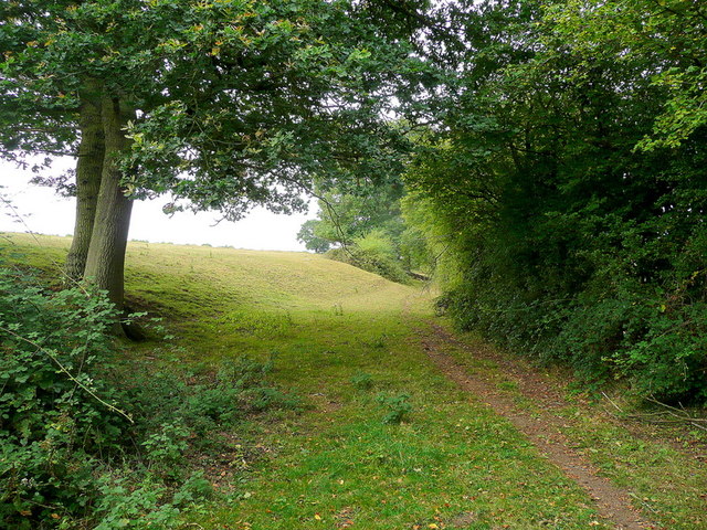
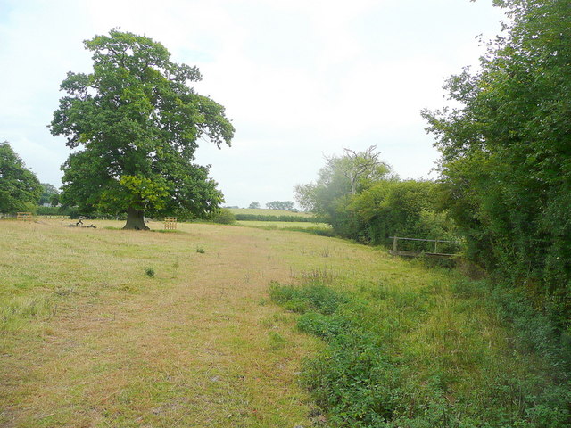
Hill Wood is a picturesque forest located in Gloucestershire, England. Covering an area of approximately 100 acres, this woodland is known for its captivating beauty and diverse flora and fauna. It is situated on the slopes of a hill, offering visitors breathtaking views of the surrounding countryside.

The wood is predominantly made up of deciduous trees, including oak, beech, and ash, which provide a dense canopy that filters sunlight and creates a tranquil and shaded atmosphere. The forest floor is adorned with a rich carpet of wildflowers, ferns, and mosses, adding to its natural charm.

Hill Wood is home to a variety of wildlife species, making it a popular destination for nature enthusiasts and birdwatchers. Visitors may catch a glimpse of deer, foxes, badgers, and a wide array of bird species, including woodpeckers, owls, and thrushes.

The wood is crisscrossed with winding footpaths, allowing visitors to explore its hidden corners and discover its hidden treasures. These trails are well-maintained and clearly marked, making it easy for hikers and nature lovers to navigate through the forest.

Hill Wood also holds historical significance, with remnants of ancient settlements and earthworks present within its boundaries. Archaeological findings suggest that the area has been inhabited for thousands of years, adding a layer of intrigue to this natural paradise.

Overall, Hill Wood is a captivating forest that offers a peaceful retreat for those seeking solace in nature. With its scenic beauty, diverse wildlife, and historical significance, it is a must-visit destination for both locals and tourists alike.

If you have any feedback on the listing, please let us know in the comments section below.
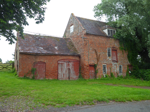
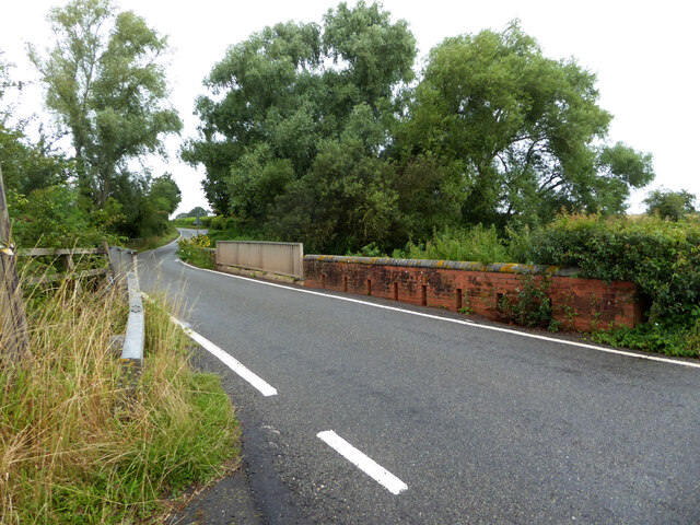
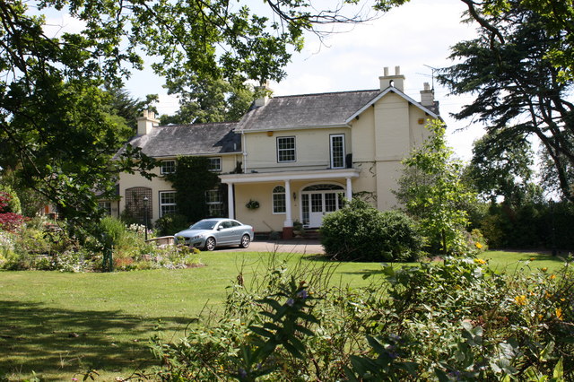
Hill Wood Images

Images are sourced within 2km of 51.943363/-2.3620185 or Grid Reference SO7527. Thanks to Geograph Open Source API. All images are credited.

Upleadon Mill A disused watermill that still retains some machinery and has a wheel thought to be a Poncelet design. Unfortunately the wheel is so overgrown that it is barely visible. It might be clearer in the winter.
Upleadon Mill
A disused watermill that still retains some machinery and has a wheel thought to be a Poncelet design. Unfortunately the wheel is so overgrown that it is barely visible. It might be clearer in the winter.
Road over the River Leadon Upleadon Mill is hidden behind the trees to the right of the road.
Road over the River Leadon
Upleadon Mill is hidden behind the trees to the right of the road.
St Mary the Virgin Church, Upleadon
Upleadon Court
Upleadon Court
Upleadon - Church of St Mary
Upleadon Village, Detached dwelling Detached dwelling on the outskirts of Upleadon village, Gloucestershire.
Upleadon Village, Detached dwelling
Detached dwelling on the outskirts of Upleadon village, Gloucestershire.
Upleadon Crossroads Upleadon Crossroads, Gloucestershire. Note the Public telephone box. Most of these are disappearing due to the dominance of mobile phones.
Upleadon Crossroads
Upleadon Crossroads, Gloucestershire. Note the Public telephone box. Most of these are disappearing due to the dominance of mobile phones.
Upleadon Court Upleadon Court with Church - Note the timber framing within the church building.
Upleadon Court
Upleadon Court with Church - Note the timber framing within the church building.
St. Mary's church and Upleadon Court Viewed from the north, across the gridline.
St. Mary's church and Upleadon Court
Viewed from the north, across the gridline.
Edge of pasture The public footpath from the Leadon to Upleadon follows the field edge here.
Edge of pasture
The public footpath from the Leadon to Upleadon follows the field edge here.
Collinpark Wood 1 Straight path through the wood looking north-east.
Collinpark Wood 1
Straight path through the wood looking north-east.
Collinpark Wood 2 The opposite view to <a href="https://www.geograph.org.uk/photo/2549365">SO7527 : Collinpark Wood 1</a>.
Collinpark Wood 2
The opposite view to SO7527 : Collinpark Wood 1.
Wheat field in the Vale of Leadon The footpath follows the field edge to the right.
In the distance is Chase End Hill - the southerly outpost of the Malvern Hills.
Wheat field in the Vale of Leadon
The footpath follows the field edge to the right. In the distance is Chase End Hill - the southerly outpost of the Malvern Hills.
Footpath junction ahead Looking north-east towards the Leadon Bridge just beyond the oak.
The path to Upleadon joins at the footbridge to the right.
Footpath junction ahead
Looking north-east towards the Leadon Bridge just beyond the oak. The path to Upleadon joins at the footbridge to the right.
Pastoral land To the east of Everes's Farm; the footpath to Witherdine follows the field edge.
Pastoral land
To the east of Everes's Farm; the footpath to Witherdine follows the field edge.
The Vale of Leadon Watermeadows south of Everes's Farm.
The Vale of Leadon
Watermeadows south of Everes's Farm.
Fallen oak By the path to Upleadon from Witherdine.
Fallen oak
By the path to Upleadon from Witherdine.
View from Eden's Hill Looking south-west towards the ubiguitous view of May Hill.
View from Eden's Hill
Looking south-west towards the ubiguitous view of May Hill.
Show me another place!

Hill Wood is located at Grid Ref: SO7527 (Lat: 51.943363, Lng: -2.3620185)

Administrative County: Gloucestershire

District: Forest of Dean

Police Authority: Gloucestershire

What 3 Words

///ideals.spare.gearbox. Near Newent, Gloucestershire

Related Wikis

Upleadon

Upleadon is a village and civil parish situated 10.5 km north-west of Gloucester. Soon after the Norman conquest Upleadon became part of the estates of...

Collinpark Wood SSSI

Collinpark Wood (grid reference SO750278) is a 66.69-hectare (164.8-acre) biological Site of Special Scientific Interest in Gloucestershire, notified in...

Brand Green

Brand Green is a village in Gloucestershire, England. == References == == External links == Media related to Brand Green at Wikimedia Commons

Malswick Halt railway station

Malswick Halt was a request stop on the former Ledbury and Gloucester Railway. It opened on 1st February 1938 and was closed in 1959 when the line was...

Newent Town F.C.

Newent Town Association Football Club is a football club based in Newent, Gloucestershire, England. They were established in 1920. Affiliated to the Gloucestershire...

Okle Green

Okle Green is a village in Gloucestershire, England.

Newent

Newent (; originally called "Noent") is a market town and civil parish in the Forest of Dean in Gloucestershire, England. The town is 11 miles (18 km)...

Newent railway station

Newent railway station served the town of Newent in Gloucestershire, England. It opened on 27 July 1885 when the Newent Railway and the Ross and Ledbury...

Nearby Amenities

Located within 500m of 51.943363,-2.3620185
Public Bookcase
Upleadon Book Box
Booth: K6
Disused Amenity: telephone
Man Made: telephone_box
Public Bookcase Type: phone_box
Lat/Long: 51.9412354/-2.3626367
Bus Stop
The Cross
Naptan AtcoCode: 1600GL4965
Naptan Bearing: NW
Naptan CommonName: The Cross
Naptan NaptanCode: gloapmam
Naptan Street: Gloucester Rd
Naptan Verified: no
Source: naptan_import
Lat/Long: 51.9411729/-2.3625666
Bus Stop
The Cross
Naptan AtcoCode: 1600GL4966
Naptan Bearing: SE
Naptan CommonName: The Cross
Naptan NaptanCode: gloapmdm
Naptan Street: Gloucester Rd
Naptan Verified: no
Source: naptan_import
Lat/Long: 51.9410391/-2.3622309
Bus Stop
The Cross
Naptan AtcoCode: 1600GLN096
Naptan Bearing: S
Naptan CommonName: The Cross
Naptan NaptanCode: glogmagj
Naptan Street: Eden's Hill
Naptan Verified: no
Source: naptan_import
Lat/Long: 51.941353/-2.3624808
Post Box
Post Box Type: wall
Ref: GL18 41
Royal Cypher: VR
Royal Cypher Wikidata: Q33102356
Lat/Long: 51.941297/-2.3624352
Historic: memorial
Memorial: war_memorial
Lat/Long: 51.9411595/-2.3623272
Power: pole
Lat/Long: 51.9404933/-2.3570663
Power: pole
Lat/Long: 51.9412159/-2.3562133
Hill Farm Upleadon
Power: pole
Transformer: distribution
Voltage Primary: 11000
Lat/Long: 51.9419253/-2.3561141
Hill Farm Sewage
Power: pole
Transformer: distribution
Voltage Primary: 11000
Lat/Long: 51.9423056/-2.3551565
Upleadon School
Power: pole
Transformer: distribution
Voltage Primary: 11000
Lat/Long: 51.9399476/-2.3595809
Location Transition: yes
Power: pole
Lat/Long: 51.9407724/-2.3598309
Power: pole
Lat/Long: 51.9408364/-2.3583095
Power: pole
Lat/Long: 51.9409009/-2.3569577
Power: pole
Lat/Long: 51.9408704/-2.3561919
Power: pole
Lat/Long: 51.9404586/-2.3597203
Madams Wood Reservoir
Power: pole
Transformer: distribution
Voltage Primary: 11000
Lat/Long: 51.9431257/-2.3639515
Location Transition: yes
Power: pole
Lat/Long: 51.9424635/-2.3636498
Buller Trees
Power: pole
Transformer: distribution
Voltage Primary: 11000
Lat/Long: 51.9425296/-2.3691309
Power: pole
Lat/Long: 51.9426156/-2.3677804
Power: pole
Lat/Long: 51.9424693/-2.3667544
Power: pole
Lat/Long: 51.942332/-2.3658009
Power: pole
Lat/Long: 51.9421708/-2.3646945
Edens Hill
Power: pole
Transformer: distribution
Voltage Primary: 11000
Lat/Long: 51.9421005/-2.3631616
Power: pole
Lat/Long: 51.9420212/-2.3636659
Power: pole
Lat/Long: 51.9415991/-2.3637121
Location Transition: yes
Power: pole
Lat/Long: 51.9412618/-2.3634861
Upleadon
Power: pole
Transformer: distribution
Voltage Primary: 11000
Lat/Long: 51.9406318/-2.3618487
The data included in this document is from www.openstreetmap.org. The data is made available under ODbL.

Have you been to Hill Wood?

Leave your review of Hill Wood below (or comments, questions and feedback).