Pond Wood

Wood, Forest in Gloucestershire

England

Pond Wood

Wallsend Lane
Wallsend Lane Credit: don cload

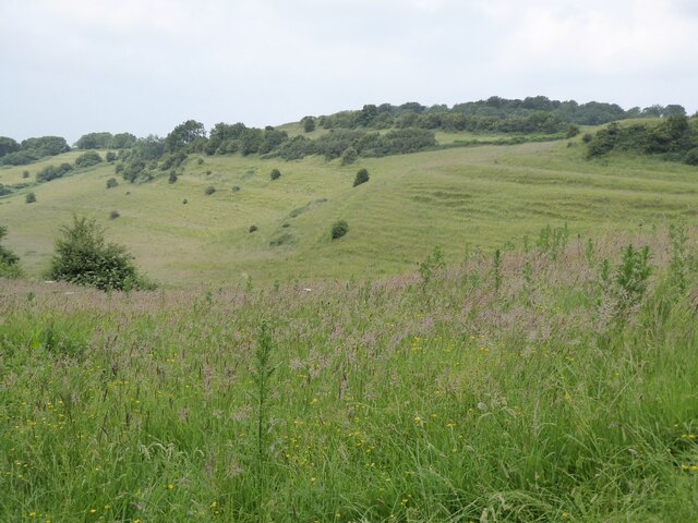
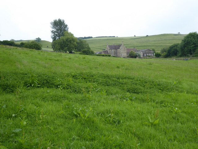
Pond Wood is a picturesque woodland located in the county of Gloucestershire, England. Situated in the heart of the Forest of Dean, this ancient woodland covers an area of approximately 50 acres and is renowned for its natural beauty and diverse wildlife.

The wood is predominantly made up of a mixed deciduous forest, with a variety of tree species including oak, beech, birch, and ash. The dense canopy of trees provides a tranquil and shady environment, perfect for those seeking respite from the hustle and bustle of everyday life.

As the name suggests, Pond Wood is home to several small ponds that dot the landscape. These ponds attract a wide range of aquatic wildlife, including frogs, newts, and various species of water insects. The surrounding woodland also provides a habitat for a multitude of bird species, making it a popular spot for birdwatchers.

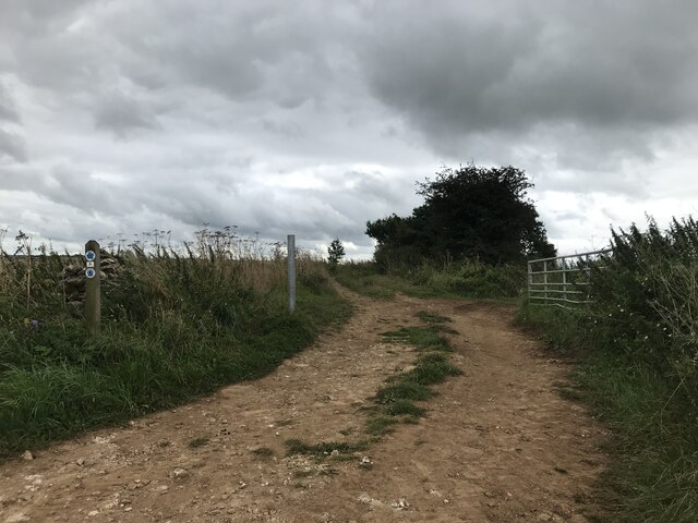
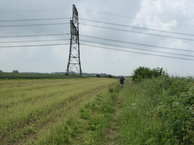
The wood is crisscrossed by a network of footpaths and trails, allowing visitors to explore its natural wonders at their own pace. These paths are well-maintained and offer accessibility for all, making Pond Wood a popular destination for families and nature enthusiasts alike.

In addition to its natural beauty, Pond Wood also holds historical significance. It is believed that the wood has been in existence for centuries and has witnessed various historical events. The remnants of old boundary walls and earthworks can still be seen, giving visitors a glimpse into the area's rich past.

Overall, Pond Wood offers a delightful and immersive experience for those seeking to connect with nature and explore the beauty of Gloucestershire's woodlands.

If you have any feedback on the listing, please let us know in the comments section below.

Pond Wood Images

Images are sourced within 2km of 51.480869/-2.3667231 or Grid Reference ST7475. Thanks to Geograph Open Source API. All images are credited.

Wallsend Lane
Wallsend Lane
Ruined barn
Ruined barn
Lake in the valley
Lake in the valley
The Cotswold Way The Cotswold Way approaching a power pylon in Hinton Hill.
The Cotswold Way
The Cotswold Way approaching a power pylon in Hinton Hill.
Farmland on Hinton Hill The Cotswold Way follows the field edge by the hedge on the left.
Farmland on Hinton Hill
The Cotswold Way follows the field edge by the hedge on the left.
Minor road on Hinton Hill View west along this road towards Corporation Plantation from where the Cotswold Way long distance footpath crosses the road.
Minor road on Hinton Hill
View west along this road towards Corporation Plantation from where the Cotswold Way long distance footpath crosses the road.
Strip Lynchets Strip Lynchets on Hinton Hill, viewed from the Cotswold Way.
Strip Lynchets
Strip Lynchets on Hinton Hill, viewed from the Cotswold Way.
Farmland on the Cotswold escarpment Grassland on the Cotswold escarpment beside the Cotswold Way near Dyrham Park.
Farmland on the Cotswold escarpment
Grassland on the Cotswold escarpment beside the Cotswold Way near Dyrham Park.
Trees in a hedgerow Trees, lime a believe in a roadside hedgerow viewed from the Cotswold Way near Dyrham Park.
Trees in a hedgerow
Trees, lime a believe in a roadside hedgerow viewed from the Cotswold Way near Dyrham Park.
Dyrham Church St Peter's church and Dyrham Park viewed from the west.
Dyrham Church
St Peter's church and Dyrham Park viewed from the west.
Dyrham Park Dyrham Park viewed from the west with St Peter's church up on the left.  The present house was built at the beginning of the 18th century. The house was built for William Blathwayt. The house is in the care of the National Trust.
Dyrham Park
Dyrham Park viewed from the west with St Peter's church up on the left. The present house was built at the beginning of the 18th century. The house was built for William Blathwayt. The house is in the care of the National Trust.
Lodge at Dyrham A small lodge beside an entrance to Dyrham Park.
Lodge at Dyrham
A small lodge beside an entrance to Dyrham Park.
Sands Farm Sands Farm viewed from the Cotswold Way south of Dyrham.
Sands Farm
Sands Farm viewed from the Cotswold Way south of Dyrham.
Farmland near Dyrham Farmland near Dyrham viewed from the Cotswold Way.
Farmland near Dyrham
Farmland near Dyrham viewed from the Cotswold Way.
Farmland near Sands Farm Farmland near Sands Farm viewed from the Cotswold Way south of Dyrham,
Farmland near Sands Farm
Farmland near Sands Farm viewed from the Cotswold Way south of Dyrham,
Wind Turbine above Hollow Brake
The Tollgate, Dyrham Grade II listed former gatehouse, now a cafe not far from Dyrham Park
The Tollgate, Dyrham
Grade II listed former gatehouse, now a cafe not far from Dyrham Park
Bend in the drive, Dyrham Park Dyrham Park is a National Trust property.
Bend in the drive, Dyrham Park
Dyrham Park is a National Trust property.
Show me another place!

Pond Wood is located at Grid Ref: ST7475 (Lat: 51.480869, Lng: -2.3667231)

Unitary Authority: South Gloucestershire

Police Authority: Avon and Somerset

What 3 Words

///punctual.kettles.cloak. Near Hinton, Gloucestershire

Related Wikis

Dyrham

Dyrham is a village and parish in South Gloucestershire, England. == Location and communications == Dyrham is at lat. 51° 29' north, long. 2° 22' west...

Dyrham Park

Dyrham Park () is a baroque English country house in an ancient deer park near the village of Dyrham in South Gloucestershire, England. The house, with...

South Gloucestershire

South Gloucestershire is a unitary authority area in the ceremonial county of Gloucestershire, South West England. Towns in the area include Yate, Chipping...

Battle of Deorham

The Battle of Deorham (or Dyrham) is portrayed by the Anglo-Saxon Chronicle as an important military encounter between the West Saxons and the Britons...

West Littleton

West Littleton is a village and former civil parish, now in the parish of Tormarton, in the South Gloucestershire district, in the ceremonial county of...

Hinton, South Gloucestershire

Hinton is a village in South Gloucestershire, England. It is one mile north of Dyrham and forms part of the civil parish of Dyrham and Hinton. The Bull...

Pennsylvania, Gloucestershire

Pennsylvania is a small village in South Gloucestershire, England. It is situated on the A46 near the historic cities of Bristol (to the west) and Bath...

Doynton

Doynton is a village in South Gloucestershire, England. The population of this village taken at the 2011 census was 320. == Setting == Doynton is a village...

Nearby Amenities

Located within 500m of 51.480869,-2.3667231
Bus Stop
Dyrham Park Entrance
Naptan AtcoCode: 0170SGX38454
Naptan Bearing: N
Naptan CommonName: Dyrham Park Entrance
Naptan NaptanCode: sglpama
Naptan Street: A46
Naptan Verified: no
Source: naptan_import
Lat/Long: 51.4806777/-2.3622012
Bus Stop
Dyrham Park House
Bench: no
Bin: no
Lit: no
Naptan AtcoCode: 0170SGX38456
Naptan Bearing: NW
Naptan CommonName: Dyrham Park House
Naptan NaptanCode: sglpagm
Naptan Street: Drive
Naptan Verified: no
Shelter: no
Source: naptan_import
Tactile Paving: no
Wheelchair: yes
Lat/Long: 51.4797715/-2.3733644
Barrier: cattle_grid
Bicycle: yes
Foot: no
Motorcycle: yes
Lat/Long: 51.4797798/-2.3629626
Barrier: cattle_grid
Lat/Long: 51.4796974/-2.3726202
Bus Stop
Dyrham Park Entrance
Naptan AtcoCode: 0170SGX38453
Naptan Bearing: S
Naptan CommonName: Dyrham Park Entrance
Naptan NaptanCode: sglpamd
Naptan Street: A46
Naptan Verified: no
Source: naptan_import
Lat/Long: 51.4805395/-2.3620979
Neptune
Artwork Type: statue
Tourism: artwork
Wheelchair: no
Lat/Long: 51.4793497/-2.3694382
Leisure: picnic_table
Lat/Long: 51.477325/-2.3623088
Toilets
Fee: no
Female: yes
Male: yes
Wheelchair: yes
Lat/Long: 51.4796629/-2.3626039
Bench
Lat/Long: 51.4798041/-2.3677001
National Trust Gift Shop
Opening Hours: Mo-Su 11:00-16:00
Shop: gift
Wheelchair: yes
Lat/Long: 51.4797707/-2.3734655
Bench
Lat/Long: 51.4798542/-2.3676679
Barrier: entrance
Note: photo at this point : https://goo.gl/photos/t9xs5VieVUm8HY45A
Lat/Long: 51.4815298/-2.3704116
Entrance: yes
Lat/Long: 51.4815317/-2.3701746
Barrier: cattle_grid
Bicycle: yes
Foot: no
Motorcycle: yes
Lat/Long: 51.4772198/-2.3626776
Toilets
Access: customers
Female: yes
Male: yes
Wheelchair: yes
Lat/Long: 51.479805/-2.3734153
Note: "HP GAS"
Pipeline: marker
Substance: gas
Support: pole
Lat/Long: 51.4839536/-2.3622027
Power: pole
Lat/Long: 51.4839767/-2.3618007
Material: wood
Power: pole
Lat/Long: 51.4837295/-2.3623121
Material: wood
Power: pole
Lat/Long: 51.4832773/-2.3632484
Defibrillator
Emergency: defibrillator
Ref GB The Circuit: 4A42DADD-F4E3-4727-A726-ADC800BC91CE
Lat/Long: 51.4798099/-2.3627192
Cafe
Wheelchair: yes
Lat/Long: 51.4815491/-2.370142
Natural: spring
Lat/Long: 51.481056/-2.3662506
Waterway: waterfall
Lat/Long: 51.4806569/-2.3683974
Man Made: manhole
Lat/Long: 51.4806475/-2.3685123
Watering Place
Lat/Long: 51.4822871/-2.3710671
The data included in this document is from www.openstreetmap.org. The data is made available under ODbL.

Have you been to Pond Wood?

Leave your review of Pond Wood below (or comments, questions and feedback).