Garter Plantation

Wood, Forest in Northumberland

England

Garter Plantation

Burngrange Moor from the air The distinctive shaped woodlands are on Burngrange Moor.
Burngrange Moor from the air Credit: Thomas Nugent

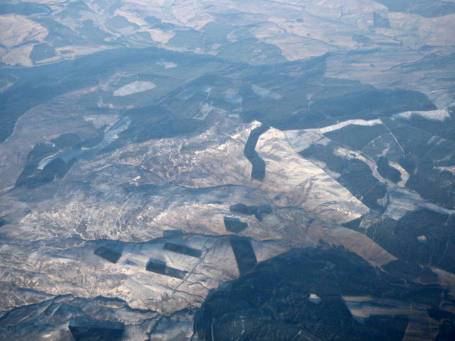
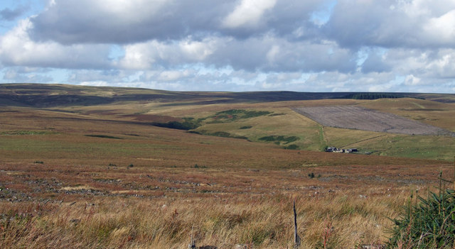
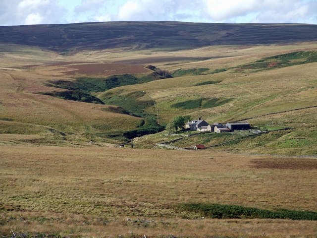
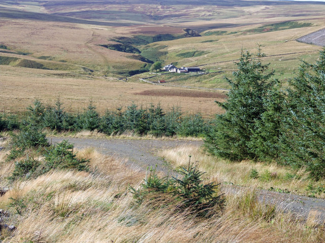
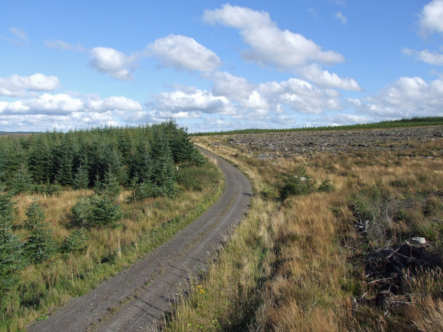
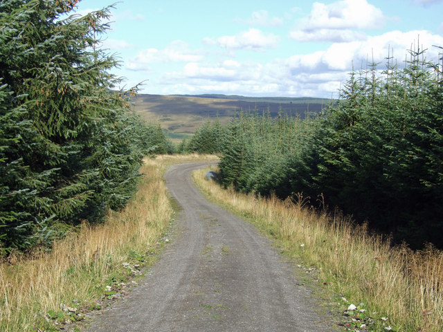
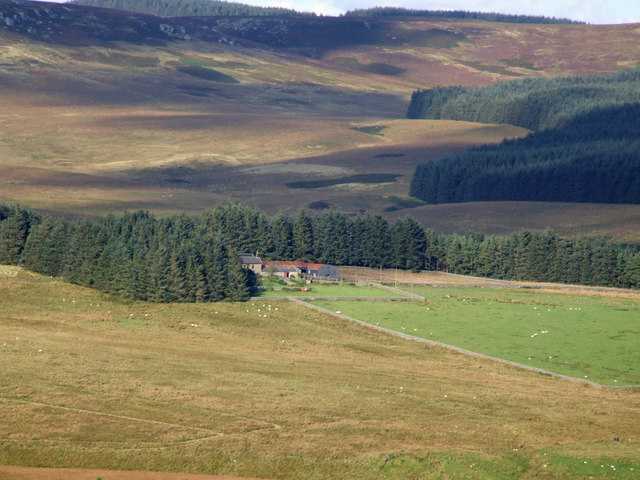
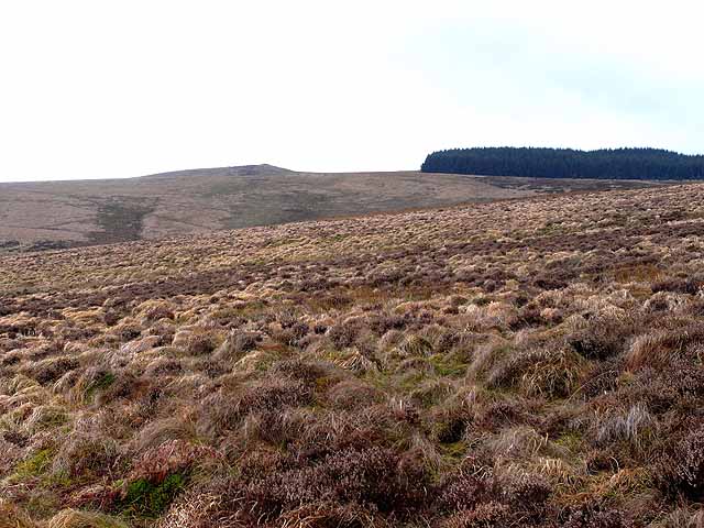
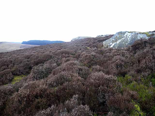
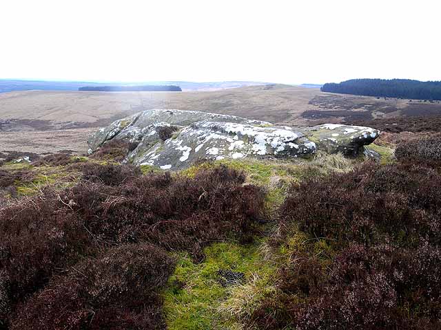
Garter Plantation is a picturesque woodland located in the Northumberland region of England. Spanning over several acres, this woodland is a part of the wider Northumberland Forest and is known for its natural beauty and diverse ecosystem.

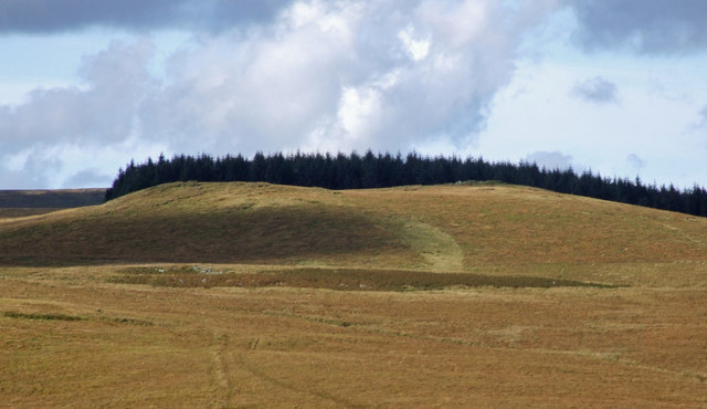
The plantation is primarily made up of garter trees, which are a species of deciduous trees known for their vibrant green foliage and slender trunks. These trees create a dense canopy that provides shelter and habitat for a variety of wildlife, including birds, small mammals, and insects. The woodland floor is covered in a thick layer of moss and fallen leaves, creating a soft and serene environment.

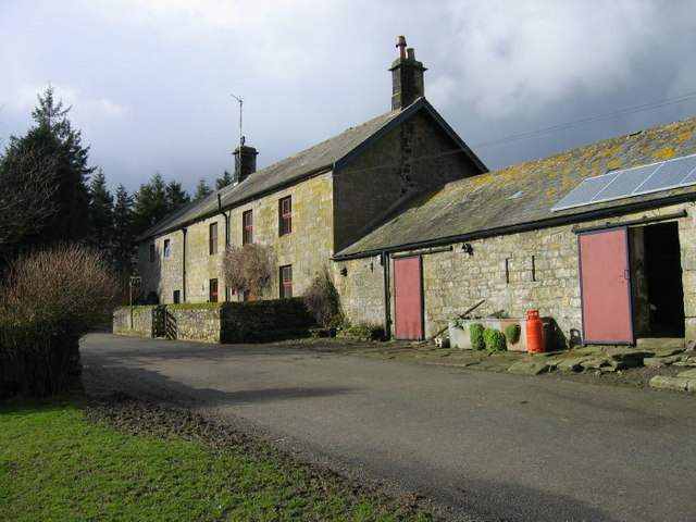
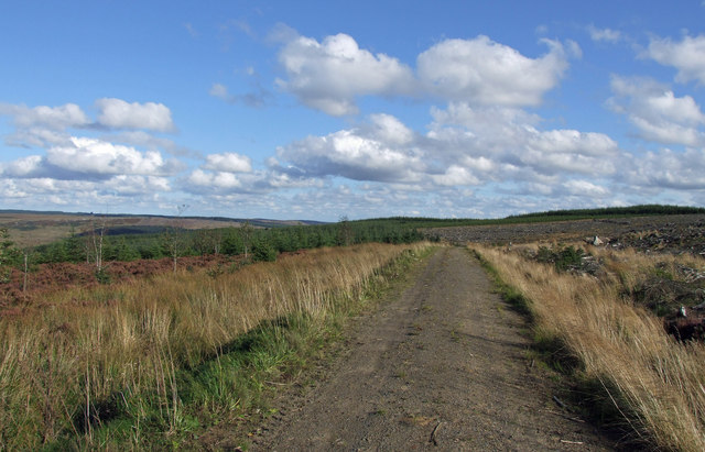
Visitors to Garter Plantation can enjoy a peaceful walk through the woodland, exploring its winding paths and taking in the tranquil surroundings. The plantation is also home to a number of well-maintained picnic areas, making it an ideal spot for a family outing or a leisurely lunch amidst nature.

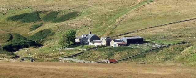
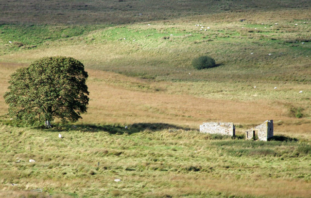
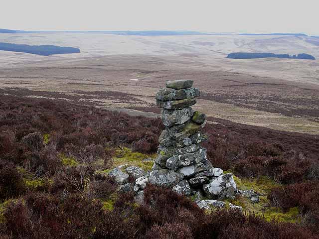
In addition to its natural beauty, Garter Plantation is also of historical significance. It is believed that the woodland has been in existence for centuries, and remnants of ancient settlements and structures have been discovered within its boundaries. These historical remains add an extra layer of intrigue to the plantation, making it a fascinating destination for history enthusiasts.

Overall, Garter Plantation is a remarkable woodland that offers a perfect blend of natural beauty, wildlife, and historical significance. Whether one is seeking solace in nature or a chance to explore the region's history, this woodland is a must-visit destination in Northumberland.

If you have any feedback on the listing, please let us know in the comments section below.

Garter Plantation Images

Images are sourced within 2km of 55.248206/-2.4237401 or Grid Reference NY7394. Thanks to Geograph Open Source API. All images are credited.

Burngrange Moor from the air The distinctive shaped woodlands are on Burngrange Moor.
Burngrange Moor from the air
The distinctive shaped woodlands are on Burngrange Moor.
Emblehope Farm
Emblehope Farm
March Sike View looking across March Sike towards Hunter's Burn.  Burn Grange Farm can be seen on the right of the picture.
March Sike
View looking across March Sike towards Hunter's Burn. Burn Grange Farm can be seen on the right of the picture.
Burn Grange Burn Grange Farm on Burngrange Moor.
Burn Grange
Burn Grange Farm on Burngrange Moor.
Coal Cleugh View looking up Coal Cleugh on Burngrange Moor.
Coal Cleugh
View looking up Coal Cleugh on Burngrange Moor.
Round Law on Burngrange Moor Black Hag Plantation on Round Law
Round Law on Burngrange Moor
Black Hag Plantation on Round Law
March Sike View of turn in the Forest Track above March Sike in Kielder Forest.  Burn Grange is in the distance.
March Sike
View of turn in the Forest Track above March Sike in Kielder Forest. Burn Grange is in the distance.
Forest Track Track near The Dodd in Kielder Forest.
Forest Track
Track near The Dodd in Kielder Forest.
Pit Sike Track crossing Pit Sike near The Dodd in Kielder Forest.
Pit Sike
Track crossing Pit Sike near The Dodd in Kielder Forest.
Green Knowes Bend in the track at Green Knowes in Kielder Forest.
Green Knowes
Bend in the track at Green Knowes in Kielder Forest.
Emblehope Farm View of Emblehope Farm as seen from Green Knowes.  Reedswood Crag can be seen in the distance at the top of the picture.
Emblehope Farm
View of Emblehope Farm as seen from Green Knowes. Reedswood Crag can be seen in the distance at the top of the picture.
Burn Grange The derelict buildings at Burn Grange.
 Lesley Fishwick adds, July 2012:
The old school house closed approx 1934/35. Children would take their lunch as well as peat for school fire. The teacher rode 5 miles on a pony each day to the school from Falstone, and then back again, after class ended.
Burn Grange
The derelict buildings at Burn Grange. Lesley Fishwick adds, July 2012: The old school house closed approx 1934/35. Children would take their lunch as well as peat for school fire. The teacher rode 5 miles on a pony each day to the school from Falstone, and then back again, after class ended.
Round Law and Black Hag Plantation Seen from Long Crag. Part of an extremely remote and inaccessible area in northern Northumberland, an enclave of some 40 square Kilometres comprising just two farms and an extensive area of very rough wet moorland, almost totally surrounded by Kielder Forest. There are a number of small plantations within this area - Black Hag being one of them.
Round Law and Black Hag Plantation
Seen from Long Crag. Part of an extremely remote and inaccessible area in northern Northumberland, an enclave of some 40 square Kilometres comprising just two farms and an extensive area of very rough wet moorland, almost totally surrounded by Kielder Forest. There are a number of small plantations within this area - Black Hag being one of them.
Cairn on Long Crag The middle of three cairns crowning the summit of Long Crag. Beyond can be seen part of an extremely remote and inaccessible area in northern Northumberland, an enclave of some 40 square Kilometres comprising just two farms and an extensive area of very rough wet moorland, almost totally surrounded by Kielder Forest. There are a number of small plantations within this area. The main body of Redesdale Forest (part of the Kielder group) can be seen on the skyline.
Cairn on Long Crag
The middle of three cairns crowning the summit of Long Crag. Beyond can be seen part of an extremely remote and inaccessible area in northern Northumberland, an enclave of some 40 square Kilometres comprising just two farms and an extensive area of very rough wet moorland, almost totally surrounded by Kielder Forest. There are a number of small plantations within this area. The main body of Redesdale Forest (part of the Kielder group) can be seen on the skyline.
Rock outcrop on Long Crag Part of an extremely remote and inaccessible area in northern Northumberland, an enclave of some 40 square Kilometres comprising just two farms and an extensive area of very rough wet moorland, almost totally surrounded by Kielder Forest.
Rock outcrop on Long Crag
Part of an extremely remote and inaccessible area in northern Northumberland, an enclave of some 40 square Kilometres comprising just two farms and an extensive area of very rough wet moorland, almost totally surrounded by Kielder Forest.
Rock outcrop on Long Crag Part of an extremely remote and inaccessible area in northern Northumberland, an enclave of some 40 square Kilometres comprising just two farms and an extensive area of very rough wet moorland, almost totally surrounded by Kielder Forest. Heather and bilberry predominate at the top of this crag.
Rock outcrop on Long Crag
Part of an extremely remote and inaccessible area in northern Northumberland, an enclave of some 40 square Kilometres comprising just two farms and an extensive area of very rough wet moorland, almost totally surrounded by Kielder Forest. Heather and bilberry predominate at the top of this crag.
Long Crag Part of an extremely remote and inaccessible area in northern Northumberland, an enclave of some 40 square Kilometres comprising just two farms and an extensive area of very rough wet moorland, almost totally surrounded by Kielder Forest. Heather and bilberry predominate at the top of this crag. There are a number of small plantations within this area - Black Hag Plantation <a href="https://www.geograph.org.uk/gridref/NY7295">NY7295</a> can be seen on the skyline.
Long Crag
Part of an extremely remote and inaccessible area in northern Northumberland, an enclave of some 40 square Kilometres comprising just two farms and an extensive area of very rough wet moorland, almost totally surrounded by Kielder Forest. Heather and bilberry predominate at the top of this crag. There are a number of small plantations within this area - Black Hag Plantation NY7295 can be seen on the skyline.
Long Crag Part of an extremely remote and inaccessible area in northern Northumberland, an enclave of some 40 square Kilometres comprising just two farms and an extensive area of very rough wet moorland, almost totally surrounded by Kielder Forest. Some low rocky escarpments break up the area, and here heather and bilberry predominate. There are a number of small plantations within this area including Black Hag Plantation <a href="https://www.geograph.org.uk/gridref/NY7295">NY7295</a> to the right. The hill to the left of the plantation is Round Law.
Long Crag
Part of an extremely remote and inaccessible area in northern Northumberland, an enclave of some 40 square Kilometres comprising just two farms and an extensive area of very rough wet moorland, almost totally surrounded by Kielder Forest. Some low rocky escarpments break up the area, and here heather and bilberry predominate. There are a number of small plantations within this area including Black Hag Plantation NY7295 to the right. The hill to the left of the plantation is Round Law.
Show me another place!

Garter Plantation is located at Grid Ref: NY7394 (Lat: 55.248206, Lng: -2.4237401)

Unitary Authority: Northumberland

Police Authority: Northumbria

What 3 Words

///powering.airbag.stubble. Near Rochester, Northumberland

Related Wikis

Kielderhead and Emblehope Moors

Kielderhead and Emblehope Moors are contiguous areas of moorland in northern Northumberland, England. A section of Kielderhead Moor is part of neighbouring...

Border Moors and Forests

Border Moors and Forests NCA is an upland plateau region in Northern England between the North East and North West regions, and touching the Anglo-Scottish...

Black Middens Bastle House

Black Middens Bastle House lies about 7 miles (11 km) northwest of Bellingham, Northumberland. It is a two-storey fortified stone farmhouse from the 16th...

Plashetts

Plashetts is a small settlement in Northumberland, in England south east of Kielder, Northumberland. It is about 22 miles (35 km) north west of Hexham...

Have you been to Garter Plantation?

Leave your review of Garter Plantation below (or comments, questions and feedback).