Fir Coppice

Wood, Forest in Dorset

England

Fir Coppice

The Smugglers Inn, Osmington Mills Several hundred years ago this pub was notorious for its connections with smuggling, then called The Crown.  The landlord of that time, Emmanuel Carless, worked closely with a famous smuggler Pierre Latour (known as French Peter) to land contraband from his fast boat L'Hirondelle.  Pierre was a gang leader who lived in Weymouth.  He managed to slip through the hands of the Revenue officers and eventually retired marrying Emmanuel's daughter, Arabella Carless.  The pub is situated off the beaten track and lies down in a dip above the beach.
The Smugglers Inn, Osmington Mills Credit: Sarah Smith

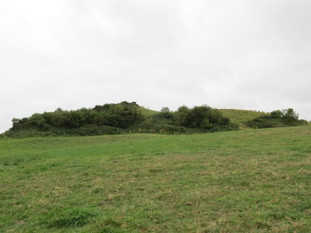
Fir Coppice is a picturesque woodland located in the county of Dorset, England. Situated near the village of Milborne St. Andrew, it covers an area of approximately 50 acres and is known for its dense population of fir trees.

The woodland is a classic example of a coppiced forest, where trees are periodically cut down to ground level to encourage the growth of new shoots. This traditional method of woodland management has been practiced for centuries and helps to maintain a diverse ecosystem within the woodland.

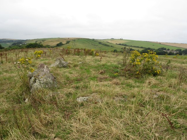
Fir Coppice is home to a wide variety of flora and fauna, including several species of birds such as woodpeckers, nightjars, and tawny owls. The dense canopy of fir trees provides a suitable habitat for these bird species, as well as offering protection and nesting opportunities.

Walking through Fir Coppice, visitors can enjoy the tranquil atmosphere and admire the majestic beauty of the tall, straight fir trees that dominate the landscape. The woodland floor is covered in a thick carpet of mosses, ferns, and wildflowers, adding to the enchanting ambiance of the forest.

There are several well-maintained footpaths and trails that wind through Fir Coppice, allowing visitors to explore the woodland at their own pace. These paths are suitable for walkers of all abilities and provide an opportunity to spot a variety of woodland creatures, such as squirrels, foxes, and deer.

Overall, Fir Coppice offers a peaceful and serene escape from the hustle and bustle of everyday life, providing a perfect setting for nature lovers and outdoor enthusiasts to immerse themselves in the beauty of Dorset's natural landscapes.

If you have any feedback on the listing, please let us know in the comments section below.

Fir Coppice Images

Images are sourced within 2km of 50.6459/-2.3810699 or Grid Reference SY7382. Thanks to Geograph Open Source API. All images are credited.

The Smugglers Inn, Osmington Mills Several hundred years ago this pub was notorious for its connections with smuggling, then called The Crown.  The landlord of that time, Emmanuel Carless, worked closely with a famous smuggler Pierre Latour (known as French Peter) to land contraband from his fast boat L'Hirondelle.  Pierre was a gang leader who lived in Weymouth.  He managed to slip through the hands of the Revenue officers and eventually retired marrying Emmanuel's daughter, Arabella Carless.  The pub is situated off the beaten track and lies down in a dip above the beach.
The Smugglers Inn, Osmington Mills
Several hundred years ago this pub was notorious for its connections with smuggling, then called The Crown. The landlord of that time, Emmanuel Carless, worked closely with a famous smuggler Pierre Latour (known as French Peter) to land contraband from his fast boat L'Hirondelle. Pierre was a gang leader who lived in Weymouth. He managed to slip through the hands of the Revenue officers and eventually retired marrying Emmanuel's daughter, Arabella Carless. The pub is situated off the beaten track and lies down in a dip above the beach.
Cliff edge - Osmington Mills This is the view looking westwards from the carpark.  The Jurassic Coast has many areas of geological interest for example here there is a Corallian strata limestone barrier and some Kimmeridge Clay and other types of rock. There are also fossils which in the main are hard to knock out.
Cliff edge - Osmington Mills
This is the view looking westwards from the carpark. The Jurassic Coast has many areas of geological interest for example here there is a Corallian strata limestone barrier and some Kimmeridge Clay and other types of rock. There are also fossils which in the main are hard to knock out.
Coastline cruising near Osmington Mills This boat probably comes from Weymouth.  It was filled with sightseers, and fortunately the sea was calm despite a slight breeze!  A good way to view the Jurassic Coast on a fine day.
Coastline cruising near Osmington Mills
This boat probably comes from Weymouth. It was filled with sightseers, and fortunately the sea was calm despite a slight breeze! A good way to view the Jurassic Coast on a fine day.
Osmington: phone box and thatched bus shelter A traditional red phone box stands alongside a thatched bus shelter on the A353 in the centre of the village.
Osmington: phone box and thatched bus shelter
A traditional red phone box stands alongside a thatched bus shelter on the A353 in the centre of the village.
Ringstead: ford on a track where footpaths meet This is the meeting place of three public footpaths, two leading along the gravel track (foreground, left and right) and the third ahead of us, coming down through a field from Upton Fort. Access to/from the latter requires the crossing of a shallow ford, and a line of smallish stones has been considerately laid out to assist.
Ringstead: ford on a track where footpaths meet
This is the meeting place of three public footpaths, two leading along the gravel track (foreground, left and right) and the third ahead of us, coming down through a field from Upton Fort. Access to/from the latter requires the crossing of a shallow ford, and a line of smallish stones has been considerately laid out to assist.
Osmington Mills: looking back at a thatched cottage The inland footpath to Ringstead runs diagonally through this field, all yellow with buttercups. We look back just as a thatched cottage starts disappearing from view thanks to the gradient.
Osmington Mills: looking back at a thatched cottage
The inland footpath to Ringstead runs diagonally through this field, all yellow with buttercups. We look back just as a thatched cottage starts disappearing from view thanks to the gradient.
Osmington Mills: a waterfall and the cliffs of Bran Point A stream issues into Ringstead Bay here at Osmington Mills and its final manoeuvre before doing so is to cascade over the little ledge, 3 feet or so in height, onto the large stones of the beach.

In the background, we see the green slopes of Bran Point - the actual point of the headland is in the next square east, beyond what is visible here.
Osmington Mills: a waterfall and the cliffs of Bran Point
A stream issues into Ringstead Bay here at Osmington Mills and its final manoeuvre before doing so is to cascade over the little ledge, 3 feet or so in height, onto the large stones of the beach. In the background, we see the green slopes of Bran Point - the actual point of the headland is in the next square east, beyond what is visible here.
Osmington Mills: canoeists negotiate Hannah’s Ledge These canoeists set off from Ringstead, a mile or so east, and kept more or less exact time with me as I walked along the cliff-top path to Osmington Mills. Here, we look down on them as they pass Hannah's Ledge, a stretch of tidal rocks projecting from the beach.
Osmington Mills: canoeists negotiate Hannah’s Ledge
These canoeists set off from Ringstead, a mile or so east, and kept more or less exact time with me as I walked along the cliff-top path to Osmington Mills. Here, we look down on them as they pass Hannah's Ledge, a stretch of tidal rocks projecting from the beach.
Osmington Mills: the coast path from Bran Point The cliff-top path starts to descend into the village of Osmington Mills and is separated from the cliff face by a hedge shaped distinctively by the prevailing southwesterly winds.
Osmington Mills: the coast path from Bran Point
The cliff-top path starts to descend into the village of Osmington Mills and is separated from the cliff face by a hedge shaped distinctively by the prevailing southwesterly winds.
Osmington Mills: steps on the descent from Bran Point The next part of the coast path after <a href="https://www.geograph.org.uk/photo/4965243">SY7381 : Osmington Mills: the coast path from Bran Point</a>, the gradient is steep enough now to warrant steps on the path.

The coast path does not cross the stile in the background; it continues to the left of the fence - but the stile allows access to other, more inland routes.
Osmington Mills: steps on the descent from Bran Point
The next part of the coast path after SY7381 : Osmington Mills: the coast path from Bran Point, the gradient is steep enough now to warrant steps on the path. The coast path does not cross the stile in the background; it continues to the left of the fence - but the stile allows access to other, more inland routes.
Osmington Mills: pillbox on Bran Point and view of White Nothe A wartime lookout cuts a rather bleak figure on the top of Bran Point, just inland from the cliff-top path. From this angle it appears almost to be gobbling up the scenery of White Nothe, the next headland a couple of miles distant.
Osmington Mills: pillbox on Bran Point and view of White Nothe
A wartime lookout cuts a rather bleak figure on the top of Bran Point, just inland from the cliff-top path. From this angle it appears almost to be gobbling up the scenery of White Nothe, the next headland a couple of miles distant.
Osmington Mills: patch of buttercups on Bran Point A yellow patch adorns the tip of the headland at Bran Point, midway between Osmington Mills and Ringstead. Ahead of us is the bulk of the Isle of Portland.
Osmington Mills: patch of buttercups on Bran Point
A yellow patch adorns the tip of the headland at Bran Point, midway between Osmington Mills and Ringstead. Ahead of us is the bulk of the Isle of Portland.
Pixon Barn At a confluence of footpaths on the South Dorset ridgeway.
Pixon Barn
At a confluence of footpaths on the South Dorset ridgeway.
Sandy Barrow An ancient burial site.
Sandy Barrow
An ancient burial site.
Cairn circle on the South Dorset Ridgeway
Approaching East Farm near Osmington
The Smugglers' Inn, Osmington Mills A very popular eating/drinking place in the summer months.
The Smugglers' Inn, Osmington Mills
A very popular eating/drinking place in the summer months.
Footpath to the South Dorset Ridgeway form Osmington
Show me another place!

Fir Coppice is located at Grid Ref: SY7382 (Lat: 50.6459, Lng: -2.3810699)

Unitary Authority: Dorset

Police Authority: Dorset

What 3 Words

///hires.awards.twinkling. Near Overcombe, Dorset

Related Wikis

Osmington

Osmington is a village and civil parish within Dorset, England, situated on the Jurassic Coast 4 miles (6.4 km) north-east of Weymouth. In the 2011 census...

Black Head, Dorset

Black Head a headland on the south coast of England, to the east of Weymouth in Dorset. It lies on the Jurassic Coast, a UNESCO World Heritage landscape...

Osmington Mills

Osmington Mills is a coastal hamlet in the English county of Dorset. It lies within the civil parish of Osmington 5 miles (8.0 km) northeast of Weymouth...

St John's Church, Poxwell

St John's Church was a Church of England church in Poxwell, Dorset, England. It was built in 1867–68 as a replacement to an earlier church and was demolished...

Poxwell

Poxwell (; sometimes written Pokeswell) is a hamlet and civil parish in the county of Dorset in southwest England. It is located 6 miles (9.7 km) east...

Bran Point

Bran Point is a small headland on the Dorset coast in southern England, about halfway between the small villages of Ringstead to the east and Osmington...

Osmington White Horse

The Osmington White Horse is a hill figure cut into the limestone of Osmington Hill just north of Weymouth in Dorset in 1808. It is in the South Dorset...

West Ringstead

West Ringstead is a deserted medieval village located on the coast in Dorset, southern England. The village lies on the Jurassic Coast and is located west...

Nearby Amenities

Located within 500m of 50.6459,-2.3810699
Material: wood
Power: pole
Source: bing
Lat/Long: 50.6496819/-2.3781031
Material: wood
Power: pole
Source: bing
Lat/Long: 50.6415567/-2.3824696
Material: wood
Power: pole
Source: bing
Lat/Long: 50.6417767/-2.3808465
Material: wood
Power: pole
Source: bing
Lat/Long: 50.6424806/-2.3778619
Material: wood
Power: pole
Source: bing
Lat/Long: 50.6429976/-2.3763612
Material: wood
Poles: bipole
Power: pole
Source: bing
Transformer: distribution
Lat/Long: 50.6432677/-2.375574
Material: wood
Power: pole
Source: bing
Lat/Long: 50.6480373/-2.3839486
Material: wood
Power: pole
Source: bing
Lat/Long: 50.6483263/-2.3859946
Material: wood
Power: pole
Source: bing
Lat/Long: 50.648366/-2.382759
Material: wood
Power: pole
Source: bing
Lat/Long: 50.6487568/-2.3813843
Material: wood
Power: pole
Source: bing
Lat/Long: 50.64926/-2.3796029
Material: wood
Power: pole
Source: bing
Lat/Long: 50.6477411/-2.3851007
Bus Stop
Osmington Garage
Bus: yes
Naptan AtcoCode: 1200DOB20283
Naptan Bearing: NE
Naptan CommonName: Osmington Garage
Naptan Indicator: NE-bound
Naptan NaptanCode: doramjgt
Naptan Street: Preston Road
Naptan Verified: no
Public Transport: platform
Lat/Long: 50.6473171/-2.38323
Bus Stop
Osmington Garage
Bus: yes
Naptan AtcoCode: 1200DOB20540
Naptan Bearing: SW
Naptan CommonName: Osmington Garage
Naptan Indicator: SW-bound
Naptan NaptanCode: doramjgw
Naptan Street: Preston Road
Naptan Verified: no
Public Transport: platform
Lat/Long: 50.64608/-2.3842591
The data included in this document is from www.openstreetmap.org. The data is made available under ODbL.

Have you been to Fir Coppice?

Leave your review of Fir Coppice below (or comments, questions and feedback).