Ash Bed Coppice

Wood, Forest in Dorset

England

Ash Bed Coppice

Church Lane, Piddletrenthide
Church Lane, Piddletrenthide Credit: Becky Williamson

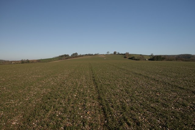
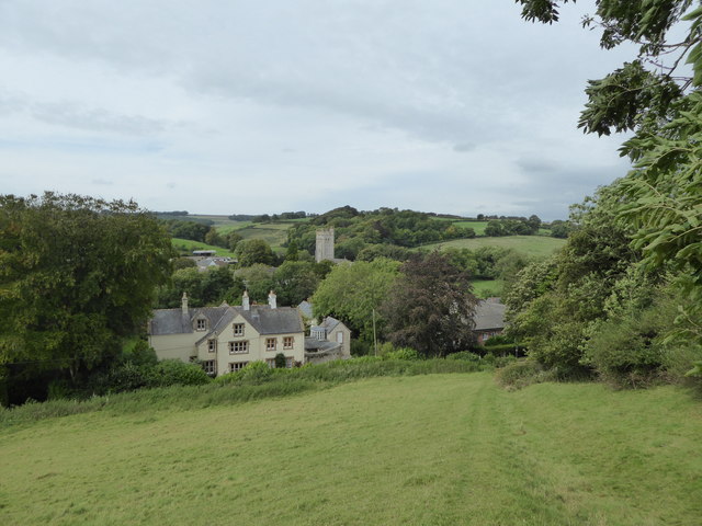
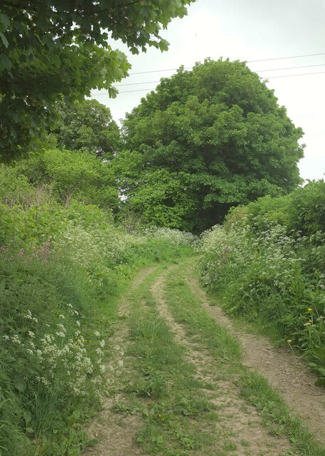
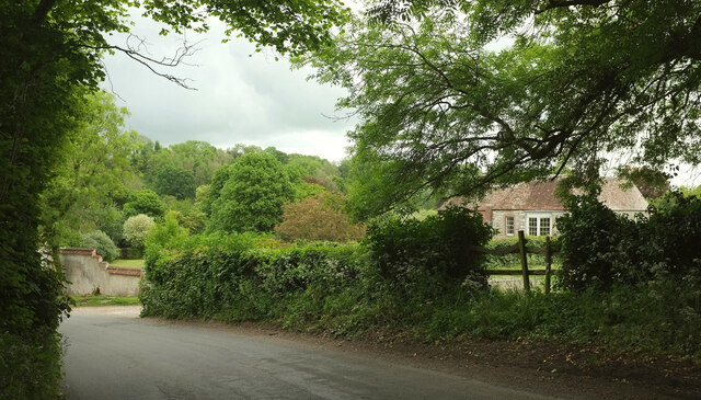
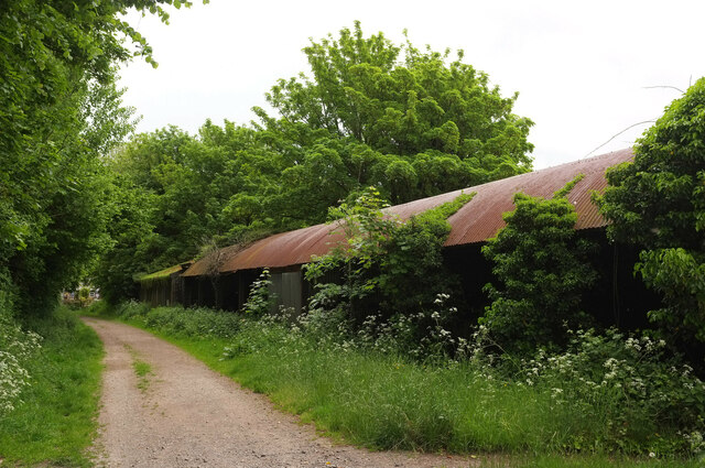
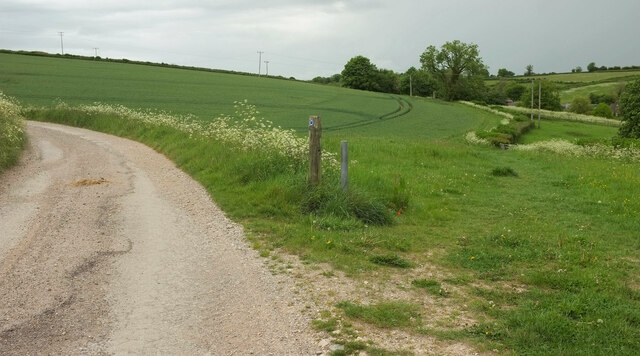
Ash Bed Coppice is a woodland located in Dorset, England. Spanning an area of approximately 200 acres, it is characterized by its dense growth of ash trees, giving it its name. The woodland is part of a larger forested area known as Dorset Forest.

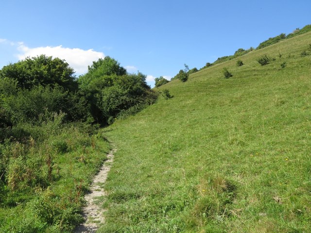
Ash Bed Coppice is a diverse ecosystem, with a rich variety of flora and fauna. The dominant tree species, ash (Fraxinus excelsior), provides a canopy that allows limited sunlight to reach the forest floor. This creates a unique microclimate, supporting a wide range of understory plants such as bluebells, wood anemones, and wild garlic. The woodland is also home to a variety of ferns, mosses, and lichens.

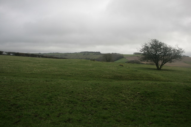
The forested area provides habitat for a diverse range of wildlife. Numerous bird species can be found here, including great spotted woodpeckers, tawny owls, and blackbirds. Small mammals such as squirrels, foxes, and hedgehogs are also present in the area. Additionally, the woodland is known to be a breeding ground for several species of butterflies, making it a popular spot for nature enthusiasts and photographers.

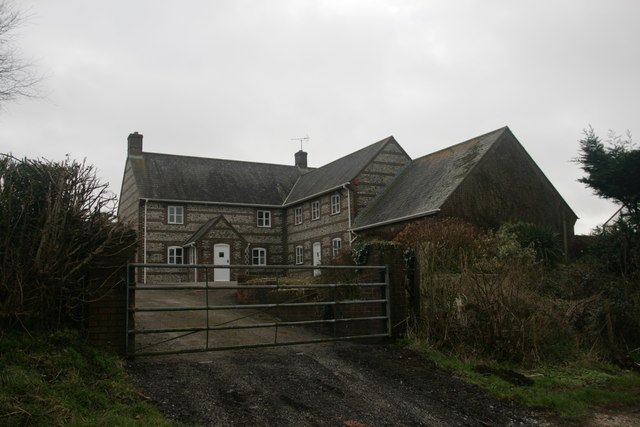
Ash Bed Coppice is managed by the local authorities, who actively work to maintain the health and biodiversity of the woodland. This includes regular thinning of the trees to promote new growth, as well as the removal of invasive plants. The forest is also a popular destination for hikers and nature lovers, with designated walking trails and picnic areas available for visitors to enjoy the serene beauty of this natural habitat.

If you have any feedback on the listing, please let us know in the comments section below.

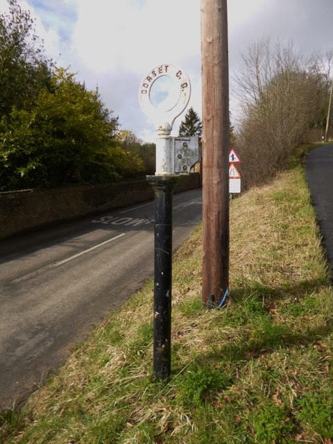
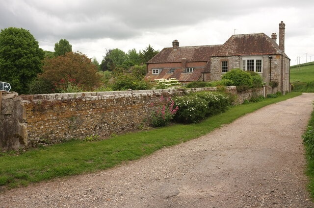
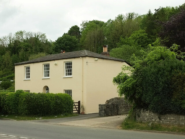
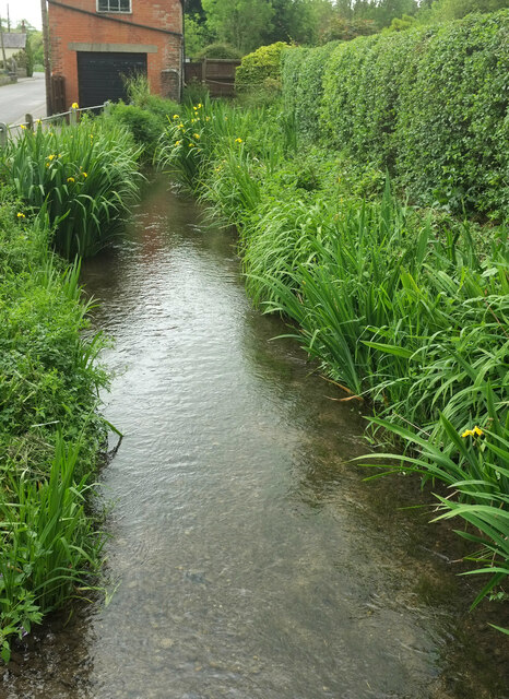
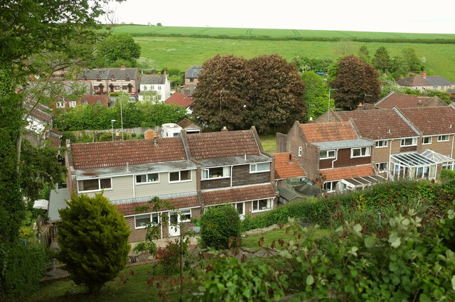
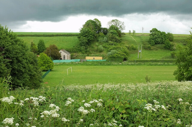
Ash Bed Coppice Images

Images are sourced within 2km of 50.805345/-2.4313414 or Grid Reference ST6900. Thanks to Geograph Open Source API. All images are credited.

Church Lane, Piddletrenthide
Near summit of East Hill, Piddletrenthide Not that you'd really know you were on a hill. It's all arable crops!
Near summit of East Hill, Piddletrenthide
Not that you'd really know you were on a hill. It's all arable crops!
New Barn Farm, near Piddletrenthide
Settlement on West Hill, near Plush
Benchmark on cottage, Alton Pancras Ordnance Survey benchmark on cottage in Alton Pancras, described on database at <span class="nowrap"><a title="http://www.bench-marks.org.uk/bm69121" rel="nofollow ugc noopener" href="http://www.bench-marks.org.uk/bm69121">Link</a><img style="margin-left:2px;" alt="External link" title="External link - shift click to open in new window" src="https://s1.geograph.org.uk/img/external.png" width="10" height="10"/></span>.
Benchmark on cottage, Alton Pancras
Ordnance Survey benchmark on cottage in Alton Pancras, described on database at LinkExternal link.
Piddletrenthide Taken from the footpath above the village.
Piddletrenthide
Taken from the footpath above the village.
Direction Sign - Signpost by the B3143 Annulus finial - no arm; Dorset halo without NGR by the B3143, in parish of Piddletrenthide (West Dorset District), Piddletrenthide, at junction with UC road to Mappowder, on verge.

Surveyed

Milestone Society National ID: DO_ST7000
Direction Sign - Signpost by the B3143
Annulus finial - no arm; Dorset halo without NGR by the B3143, in parish of Piddletrenthide (West Dorset District), Piddletrenthide, at junction with UC road to Mappowder, on verge. Surveyed Milestone Society National ID: DO_ST7000
Bridleway past West House, Piddletrenthide West House, also shown at <a href="https://www.geograph.org.uk/photo/887114">SY7099 : West House - Piddletrenthide</a>, is described at <span class="nowrap"><a title="https://historicengland.org.uk/listing/the-list/list-entry/1324130?section=official-list-entry" rel="nofollow ugc noopener" href="https://historicengland.org.uk/listing/the-list/list-entry/1324130?section=official-list-entry">Link</a><img style="margin-left:2px;" alt="External link" title="External link - shift click to open in new window" src="https://s1.geograph.org.uk/img/external.png" width="10" height="10"/></span> . Taken from where bridleway S36 41 leaves Back Lane.
Bridleway past West House, Piddletrenthide
West House, also shown at SY7099 : West House - Piddletrenthide, is described at LinkExternal link . Taken from where bridleway S36 41 leaves Back Lane.
Bridleway, Piddletrenthide Bridleway S36 25 runs parallel to the River Piddle, here about 70 metres to the left.
Bridleway, Piddletrenthide
Bridleway S36 25 runs parallel to the River Piddle, here about 70 metres to the left.
Cerne Abbas Lane, Piddletrenthide The stretch of lane between its junction with bridleway S36 25 (behind camera) and S36 41, which runs beside West House (on the right, see <a href="https://www.geograph.org.uk/photo/7182136">SY7099 : Bridleway past West House, Piddletrenthide</a>)
Cerne Abbas Lane, Piddletrenthide
The stretch of lane between its junction with bridleway S36 25 (behind camera) and S36 41, which runs beside West House (on the right, see SY7099 : Bridleway past West House, Piddletrenthide)
Barns, Piddletrenthide Beside bridleway S36 24.
Barns, Piddletrenthide
Beside bridleway S36 24.
River Piddle, Piddletrenthide From a footbridge carrying non-horses along bridleway S36 24; in the foreground is the ford for the horses. The bridleway continues along the left side of the river. On the left is the rear of the Piddle Inn. The further pair of houses is Baker's Row <span class="nowrap"><a title="https://historicengland.org.uk/listing/the-list/list-entry/1153408?section=official-list-entry" rel="nofollow ugc noopener" href="https://historicengland.org.uk/listing/the-list/list-entry/1153408?section=official-list-entry">Link</a><img style="margin-left:2px;" alt="External link" title="External link - shift click to open in new window" src="https://s1.geograph.org.uk/img/external.png" width="10" height="10"/></span> . This is an identical view to <a href="https://www.geograph.org.uk/photo/1343387">SY7099 : Piddletrenthide: River Piddle alongside the Piddle Inn</a>, about thirteen years later.
River Piddle, Piddletrenthide
From a footbridge carrying non-horses along bridleway S36 24; in the foreground is the ford for the horses. The bridleway continues along the left side of the river. On the left is the rear of the Piddle Inn. The further pair of houses is Baker's Row LinkExternal link . This is an identical view to SY7099 : Piddletrenthide: River Piddle alongside the Piddle Inn, about thirteen years later.
Listed houses, Piddletrenthide Two attached houses with banded flint and either brick or rubble. 

The more recently thatched house is listed as "House adjoining Pear Tree House to the North" <span class="nowrap"><a title="https://historicengland.org.uk/listing/the-list/list-entry/1118799?section=official-list-entry" rel="nofollow ugc noopener" href="https://historicengland.org.uk/listing/the-list/list-entry/1118799?section=official-list-entry">Link</a><img style="margin-left:2px;" alt="External link" title="External link - shift click to open in new window" src="https://s1.geograph.org.uk/img/external.png" width="10" height="10"/></span> . The map shows "Middle Thatch" but also implies there is another property at this end, and the name "Corner Cottage" appears on the wall. Moreover, the listing, dating from 1984, begins "House and shop".

The further house, Pear Tree Cottage, is listed as Pear Tree House ) (first listing 1956) <span class="nowrap"><a title="https://historicengland.org.uk/listing/the-list/list-entry/1304341?section=official-list-entry" rel="nofollow ugc noopener" href="https://historicengland.org.uk/listing/the-list/list-entry/1304341?section=official-list-entry">Link</a><img style="margin-left:2px;" alt="External link" title="External link - shift click to open in new window" src="https://s1.geograph.org.uk/img/external.png" width="10" height="10"/></span> .
Listed houses, Piddletrenthide
Two attached houses with banded flint and either brick or rubble. The more recently thatched house is listed as "House adjoining Pear Tree House to the North" LinkExternal link . The map shows "Middle Thatch" but also implies there is another property at this end, and the name "Corner Cottage" appears on the wall. Moreover, the listing, dating from 1984, begins "House and shop". The further house, Pear Tree Cottage, is listed as Pear Tree House ) (first listing 1956) LinkExternal link .
East House, Piddletrenthide An early C19 house, described at <span class="nowrap"><a title="https://historicengland.org.uk/listing/the-list/list-entry/1118800?section=official-list-entry" rel="nofollow ugc noopener" href="https://historicengland.org.uk/listing/the-list/list-entry/1118800?section=official-list-entry">Link</a><img style="margin-left:2px;" alt="External link" title="External link - shift click to open in new window" src="https://s1.geograph.org.uk/img/external.png" width="10" height="10"/></span> . Woodland has developed behind the village here, but remains unnamed on maps.
East House, Piddletrenthide
An early C19 house, described at LinkExternal link . Woodland has developed behind the village here, but remains unnamed on maps.
River Piddle, Piddletrenthide Running beside the B3143 here, and seen from a footbridge at the start of footpath S36 30.
River Piddle, Piddletrenthide
Running beside the B3143 here, and seen from a footbridge at the start of footpath S36 30.
Northover Close, Piddletrenthide Seen from bridleway S36 23, looking across the Piddle valley.
Northover Close, Piddletrenthide
Seen from bridleway S36 23, looking across the Piddle valley.
Playing field, Piddletrenthide Looking across the Piddle valley from  bridleway S36 23.  On the left is a disused chapel built of flint, named "Wesley House" on the map. <span class="nowrap"><a title="http://www.piddlevalley.info/church.php" rel="nofollow ugc noopener" href="http://www.piddlevalley.info/church.php">Link</a><img style="margin-left:2px;" alt="External link" title="External link - shift click to open in new window" src="https://s1.geograph.org.uk/img/external.png" width="10" height="10"/></span> has the following: "The former Methodist chapel in Piddletrenthide is being converted to a private dwelling". <span class="nowrap"><a title="https://www.opcdorset.org/PiddleFiles/Piddletrenthide/Piddletrenthide.htm" rel="nofollow ugc noopener" href="https://www.opcdorset.org/PiddleFiles/Piddletrenthide/Piddletrenthide.htm">Link</a><img style="margin-left:2px;" alt="External link" title="External link - shift click to open in new window" src="https://s1.geograph.org.uk/img/external.png" width="10" height="10"/></span> gives a date of 1894 for the "Wesleyan Chapel".
Playing field, Piddletrenthide
Looking across the Piddle valley from bridleway S36 23. On the left is a disused chapel built of flint, named "Wesley House" on the map. LinkExternal link has the following: "The former Methodist chapel in Piddletrenthide is being converted to a private dwelling". LinkExternal link gives a date of 1894 for the "Wesleyan Chapel".
Bridleway junction by South Farm Cottage Bridleway S36 21 veers left here, while S36 23 branches off to the right, up the valley.
Bridleway junction by South Farm Cottage
Bridleway S36 21 veers left here, while S36 23 branches off to the right, up the valley.
Show me another place!

Ash Bed Coppice is located at Grid Ref: ST6900 (Lat: 50.805345, Lng: -2.4313414)

Unitary Authority: Dorset

Police Authority: Dorset

What 3 Words

///crackles.glue.wonderfully. Near Charminster, Dorset

Related Wikis

Piddletrenthide Hoard

The Piddletrenthide Hoard is a Roman coin hoard dating from the 3rd century AD, found near Piddletrenthide, Dorset. It consisted of 2,114 base silver radiates...

Piddletrenthide

Piddletrenthide ( ) is a village and civil parish in the English county of Dorset. It is sited by the small River Piddle in a valley on the dip slope of...

Piddletrenthide (liberty)

Piddletrenthide Liberty was a liberty in the county of Dorset, England, containing the following parishes: Gorewood (from 1858) Minterne Magna (part)...

Alton Pancras

Alton Pancras is a small village and civil parish in Dorset, England. In the 2011 census the civil parish had a population of 175. The village church is...

Plush, Dorset

Plush is a small village in the English county of Dorset. It lies within the civil parish of Piddletrenthide in the west of the county, and is approximately...

Doles Ash

Doles Ash is a farm in Dorset, England, a few kilometers east of Piddletrenthide and south of Plush. The farm features in Thomas Hardy's Tess of the D...

Black Hill Down

Black Hill Down (grid reference ST668005) is a 71.84 hectare biological Site of Special Scientific Interest in Dorset, notified in 1989. == Sources... ==

Cerne Abbey

Cerne Abbey was a Benedictine monastery founded in 987 in the town now called Cerne Abbas, Dorset, by Æthelmær the Stout. == History == The abbey was founded...

Nearby Amenities

Located within 500m of 50.805345,-2.4313414
Ford: yes
Lat/Long: 50.8060966/-2.4259463
Material: wood
Power: pole
Source: bing
Lat/Long: 50.8024938/-2.4264144
Material: wood
Power: pole
Source: bing
Lat/Long: 50.8032118/-2.4266381
Material: wood
Power: pole
Source: bing
Lat/Long: 50.805426/-2.4259015
Material: wood
Power: pole
Source: bing
Lat/Long: 50.8060967/-2.4257728
Material: wood
Power: pole
Source: bing
Lat/Long: 50.8067834/-2.4257918
Material: wood
Power: pole
Source: bing
Lat/Long: 50.8076008/-2.4256968
Material: wood
Power: pole
Source: bing
Lat/Long: 50.807853/-2.4266147
Material: wood
Power: pole
Source: bing
Transformer: distribution
Lat/Long: 50.8080447/-2.4287784
Material: wood
Power: pole
Source: bing
Lat/Long: 50.8081905/-2.4277606
Power: pole
Source: bing
Lat/Long: 50.8043719/-2.4260889
Power: pole
Source: bing
Lat/Long: 50.8050584/-2.4259669
The data included in this document is from www.openstreetmap.org. The data is made available under ODbL.

Have you been to Ash Bed Coppice?

Leave your review of Ash Bed Coppice below (or comments, questions and feedback).