Kiddle's Bottom

Valley in Dorset

England

Kiddle's Bottom

Church Lane, Piddletrenthide
Church Lane, Piddletrenthide Credit: Becky Williamson

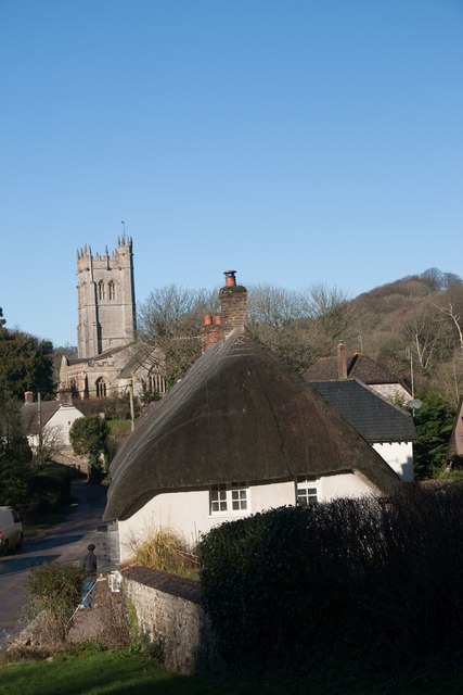
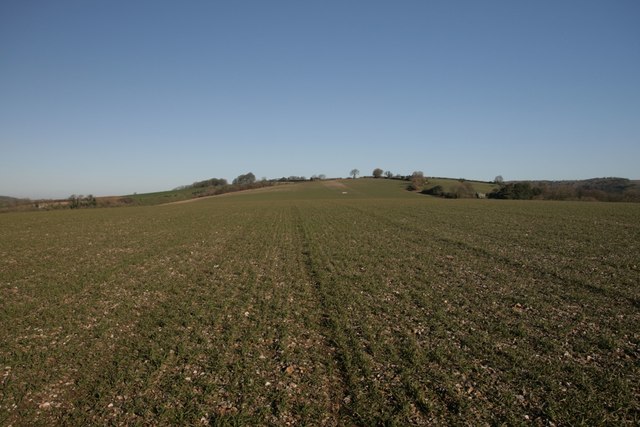
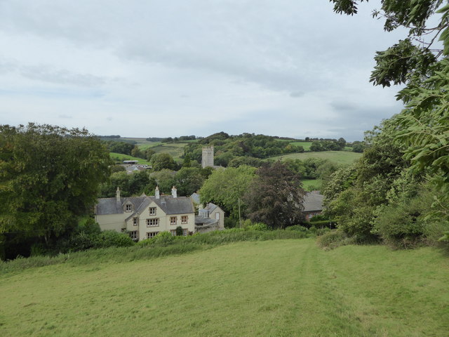
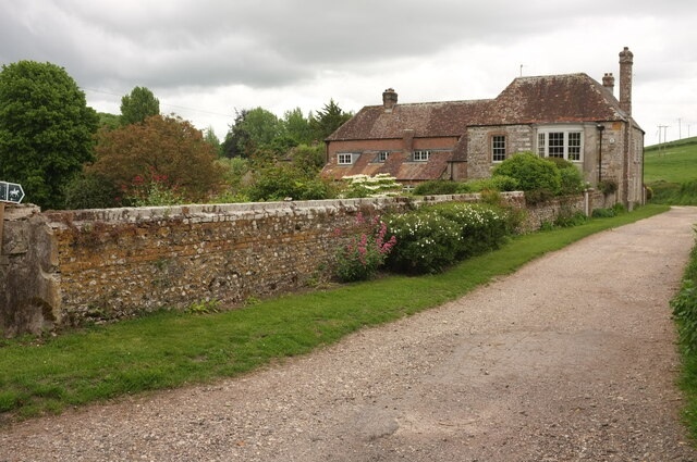
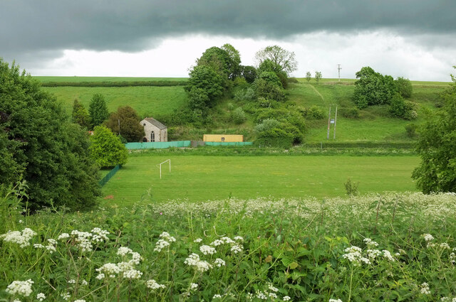
Kiddle's Bottom is a picturesque valley located in the county of Dorset, England. Nestled in the heart of the countryside, the valley is surrounded by rolling hills and lush greenery, making it a popular destination for nature lovers and outdoor enthusiasts.

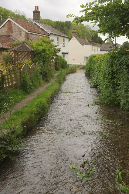
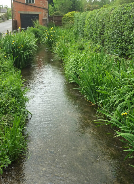
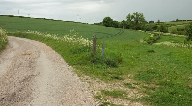
The valley gets its name from the small stream that runs through it, known as Kiddle's Brook, which adds to the charm and tranquility of the area. The brook is lined with beautiful wildflowers and bordered by ancient woodland, creating a serene and idyllic atmosphere.

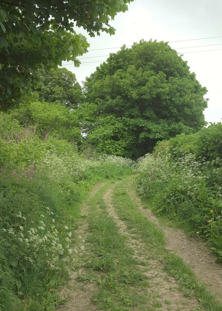
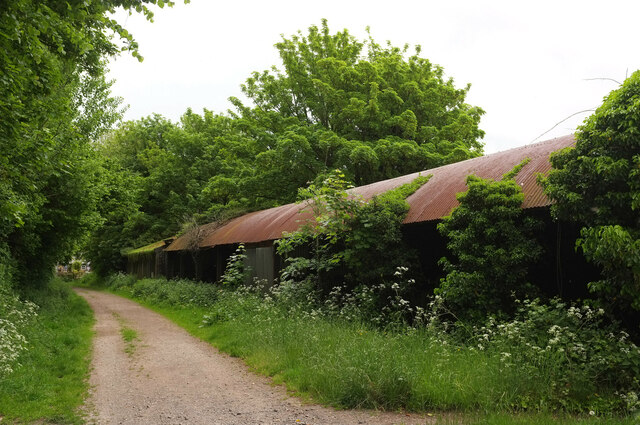
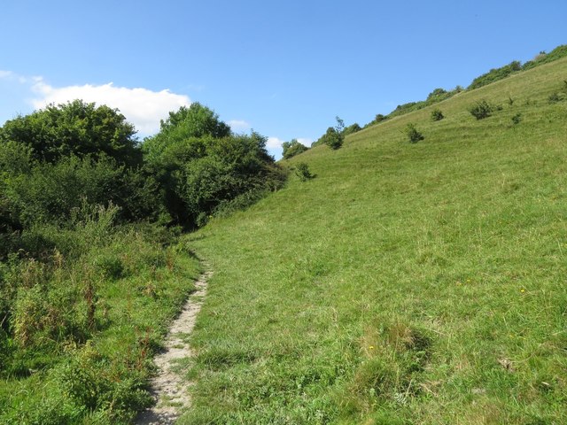
Kiddle's Bottom is known for its diverse wildlife, with an abundance of bird species, butterflies, and small mammals inhabiting the area. It offers excellent opportunities for birdwatching, as well as peaceful walks and hikes along the many footpaths that wind through the valley.

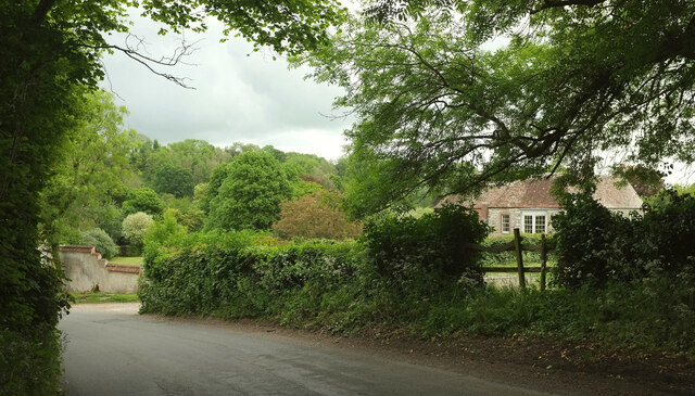
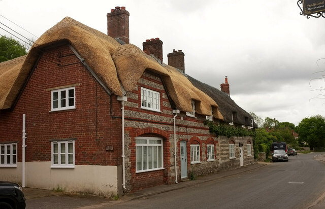
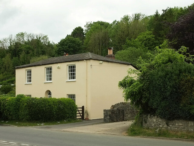
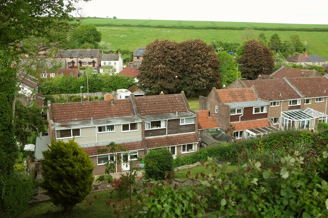
The surrounding hills provide stunning panoramic views of the valley, making it a popular spot for photographers and artists seeking inspiration. Additionally, the valley is dotted with quaint cottages and farmhouses, adding to its rustic charm.

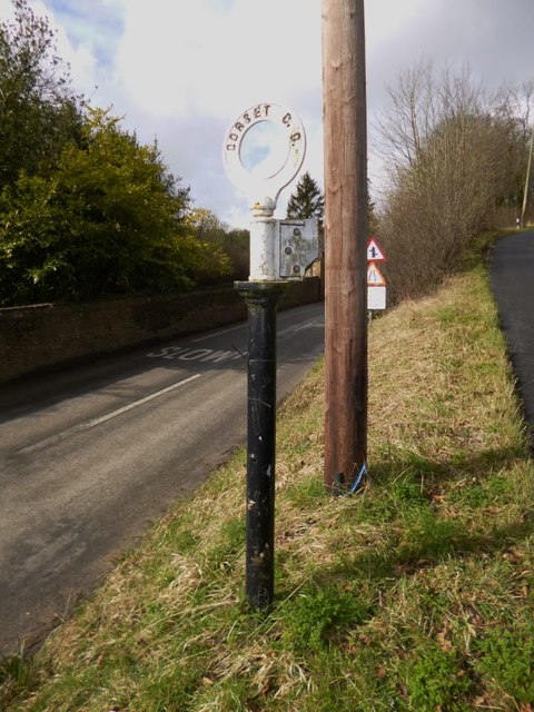
Despite its rural setting, Kiddle's Bottom is easily accessible, with several nearby villages providing amenities such as shops, pubs, and accommodations. The valley is also within close proximity to popular attractions in Dorset, including the Jurassic Coast and the historic town of Dorchester.

In summary, Kiddle's Bottom is a picturesque and tranquil valley in Dorset, offering visitors a chance to experience the beauty of the English countryside and enjoy a range of outdoor activities in a serene and unspoiled setting.

If you have any feedback on the listing, please let us know in the comments section below.

Kiddle's Bottom Images

Images are sourced within 2km of 50.802003/-2.4377389 or Grid Reference ST6900. Thanks to Geograph Open Source API. All images are credited.

Church Lane, Piddletrenthide
Near summit of East Hill, Piddletrenthide Not that you'd really know you were on a hill. It's all arable crops!
Near summit of East Hill, Piddletrenthide
Not that you'd really know you were on a hill. It's all arable crops!
Piddletrenthide Taken from the footpath above the village.
Piddletrenthide
Taken from the footpath above the village.
Direction Sign - Signpost by the B3143 Annulus finial - no arm; Dorset halo without NGR by the B3143, in parish of Piddletrenthide (West Dorset District), Piddletrenthide, at junction with UC road to Mappowder, on verge.

Surveyed

Milestone Society National ID: DO_ST7000
Direction Sign - Signpost by the B3143
Annulus finial - no arm; Dorset halo without NGR by the B3143, in parish of Piddletrenthide (West Dorset District), Piddletrenthide, at junction with UC road to Mappowder, on verge. Surveyed Milestone Society National ID: DO_ST7000
Bridleway past West House, Piddletrenthide West House, also shown at <a href="https://www.geograph.org.uk/photo/887114">SY7099 : West House - Piddletrenthide</a>, is described at <span class="nowrap"><a title="https://historicengland.org.uk/listing/the-list/list-entry/1324130?section=official-list-entry" rel="nofollow ugc noopener" href="https://historicengland.org.uk/listing/the-list/list-entry/1324130?section=official-list-entry">Link</a><img style="margin-left:2px;" alt="External link" title="External link - shift click to open in new window" src="https://s1.geograph.org.uk/img/external.png" width="10" height="10"/></span> . Taken from where bridleway S36 41 leaves Back Lane.
Bridleway past West House, Piddletrenthide
West House, also shown at SY7099 : West House - Piddletrenthide, is described at LinkExternal link . Taken from where bridleway S36 41 leaves Back Lane.
Bridleway, Piddletrenthide Bridleway S36 25 runs parallel to the River Piddle, here about 70 metres to the left.
Bridleway, Piddletrenthide
Bridleway S36 25 runs parallel to the River Piddle, here about 70 metres to the left.
Cerne Abbas Lane, Piddletrenthide The stretch of lane between its junction with bridleway S36 25 (behind camera) and S36 41, which runs beside West House (on the right, see <a href="https://www.geograph.org.uk/photo/7182136">SY7099 : Bridleway past West House, Piddletrenthide</a>)
Cerne Abbas Lane, Piddletrenthide
The stretch of lane between its junction with bridleway S36 25 (behind camera) and S36 41, which runs beside West House (on the right, see SY7099 : Bridleway past West House, Piddletrenthide)
Barns, Piddletrenthide Beside bridleway S36 24.
Barns, Piddletrenthide
Beside bridleway S36 24.
River Piddle, Piddletrenthide From a footbridge carrying non-horses along bridleway S36 24; in the foreground is the ford for the horses. The bridleway continues along the left side of the river. On the left is the rear of the Piddle Inn. The further pair of houses is Baker's Row <span class="nowrap"><a title="https://historicengland.org.uk/listing/the-list/list-entry/1153408?section=official-list-entry" rel="nofollow ugc noopener" href="https://historicengland.org.uk/listing/the-list/list-entry/1153408?section=official-list-entry">Link</a><img style="margin-left:2px;" alt="External link" title="External link - shift click to open in new window" src="https://s1.geograph.org.uk/img/external.png" width="10" height="10"/></span> . This is an identical view to <a href="https://www.geograph.org.uk/photo/1343387">SY7099 : Piddletrenthide: River Piddle alongside the Piddle Inn</a>, about thirteen years later.
River Piddle, Piddletrenthide
From a footbridge carrying non-horses along bridleway S36 24; in the foreground is the ford for the horses. The bridleway continues along the left side of the river. On the left is the rear of the Piddle Inn. The further pair of houses is Baker's Row LinkExternal link . This is an identical view to SY7099 : Piddletrenthide: River Piddle alongside the Piddle Inn, about thirteen years later.
Listed houses, Piddletrenthide Two attached houses with banded flint and either brick or rubble. 

The more recently thatched house is listed as "House adjoining Pear Tree House to the North" <span class="nowrap"><a title="https://historicengland.org.uk/listing/the-list/list-entry/1118799?section=official-list-entry" rel="nofollow ugc noopener" href="https://historicengland.org.uk/listing/the-list/list-entry/1118799?section=official-list-entry">Link</a><img style="margin-left:2px;" alt="External link" title="External link - shift click to open in new window" src="https://s1.geograph.org.uk/img/external.png" width="10" height="10"/></span> . The map shows "Middle Thatch" but also implies there is another property at this end, and the name "Corner Cottage" appears on the wall. Moreover, the listing, dating from 1984, begins "House and shop".

The further house, Pear Tree Cottage, is listed as Pear Tree House ) (first listing 1956) <span class="nowrap"><a title="https://historicengland.org.uk/listing/the-list/list-entry/1304341?section=official-list-entry" rel="nofollow ugc noopener" href="https://historicengland.org.uk/listing/the-list/list-entry/1304341?section=official-list-entry">Link</a><img style="margin-left:2px;" alt="External link" title="External link - shift click to open in new window" src="https://s1.geograph.org.uk/img/external.png" width="10" height="10"/></span> .
Listed houses, Piddletrenthide
Two attached houses with banded flint and either brick or rubble. The more recently thatched house is listed as "House adjoining Pear Tree House to the North" LinkExternal link . The map shows "Middle Thatch" but also implies there is another property at this end, and the name "Corner Cottage" appears on the wall. Moreover, the listing, dating from 1984, begins "House and shop". The further house, Pear Tree Cottage, is listed as Pear Tree House ) (first listing 1956) LinkExternal link .
East House, Piddletrenthide An early C19 house, described at <span class="nowrap"><a title="https://historicengland.org.uk/listing/the-list/list-entry/1118800?section=official-list-entry" rel="nofollow ugc noopener" href="https://historicengland.org.uk/listing/the-list/list-entry/1118800?section=official-list-entry">Link</a><img style="margin-left:2px;" alt="External link" title="External link - shift click to open in new window" src="https://s1.geograph.org.uk/img/external.png" width="10" height="10"/></span> . Woodland has developed behind the village here, but remains unnamed on maps.
East House, Piddletrenthide
An early C19 house, described at LinkExternal link . Woodland has developed behind the village here, but remains unnamed on maps.
River Piddle, Piddletrenthide Running beside the B3143 here, and seen from a footbridge at the start of footpath S36 30.
River Piddle, Piddletrenthide
Running beside the B3143 here, and seen from a footbridge at the start of footpath S36 30.
Northover Close, Piddletrenthide Seen from bridleway S36 23, looking across the Piddle valley.
Northover Close, Piddletrenthide
Seen from bridleway S36 23, looking across the Piddle valley.
Playing field, Piddletrenthide Looking across the Piddle valley from  bridleway S36 23.  On the left is a disused chapel built of flint, named "Wesley House" on the map. <span class="nowrap"><a title="http://www.piddlevalley.info/church.php" rel="nofollow ugc noopener" href="http://www.piddlevalley.info/church.php">Link</a><img style="margin-left:2px;" alt="External link" title="External link - shift click to open in new window" src="https://s1.geograph.org.uk/img/external.png" width="10" height="10"/></span> has the following: "The former Methodist chapel in Piddletrenthide is being converted to a private dwelling". <span class="nowrap"><a title="https://www.opcdorset.org/PiddleFiles/Piddletrenthide/Piddletrenthide.htm" rel="nofollow ugc noopener" href="https://www.opcdorset.org/PiddleFiles/Piddletrenthide/Piddletrenthide.htm">Link</a><img style="margin-left:2px;" alt="External link" title="External link - shift click to open in new window" src="https://s1.geograph.org.uk/img/external.png" width="10" height="10"/></span> gives a date of 1894 for the "Wesleyan Chapel".
Playing field, Piddletrenthide
Looking across the Piddle valley from bridleway S36 23. On the left is a disused chapel built of flint, named "Wesley House" on the map. LinkExternal link has the following: "The former Methodist chapel in Piddletrenthide is being converted to a private dwelling". LinkExternal link gives a date of 1894 for the "Wesleyan Chapel".
Bridleway junction by South Farm Cottage Bridleway S36 21 veers left here, while S36 23 branches off to the right, up the valley.
Bridleway junction by South Farm Cottage
Bridleway S36 21 veers left here, while S36 23 branches off to the right, up the valley.
The Piddle Inn The pub first opened in the 19th century as the Green Dragon.  As the Piddle Inn, it closed in March 2020 at the start of the Covid pandemic.  It has since been used as holiday accommodation, but villagers have been campaigning to get it reopened as a pub.
The Piddle Inn
The pub first opened in the 19th century as the Green Dragon. As the Piddle Inn, it closed in March 2020 at the start of the Covid pandemic. It has since been used as holiday accommodation, but villagers have been campaigning to get it reopened as a pub.
Approaching Piddletrenthide Footpath S36 4 descends diagonally towards the Piddle valley, with All Saints' church 
<a title="https://www.geograph.org.uk/search.php?i=157787599" href="https://www.geograph.org.uk/search.php?i=157787599">Link</a> visible ahead.
Approaching Piddletrenthide
Footpath S36 4 descends diagonally towards the Piddle valley, with All Saints' church Link visible ahead.
Bridleway, Piddletrenthide Bridleway S36 25 runs along the Piddle valley on the west side of the village.
Bridleway, Piddletrenthide
Bridleway S36 25 runs along the Piddle valley on the west side of the village.
Show me another place!

Kiddle's Bottom is located at Grid Ref: ST6900 (Lat: 50.802003, Lng: -2.4377389)

Unitary Authority: Dorset

Police Authority: Dorset

What 3 Words

///political.ozone.infinite. Near Charminster, Dorset

Related Wikis

Piddletrenthide Hoard

The Piddletrenthide Hoard is a Roman coin hoard dating from the 3rd century AD, found near Piddletrenthide, Dorset. It consisted of 2,114 base silver radiates...

Piddletrenthide

Piddletrenthide ( ) is a village and civil parish in the English county of Dorset. It is sited by the small River Piddle in a valley on the dip slope of...

Piddletrenthide (liberty)

Piddletrenthide Liberty was a liberty in the county of Dorset, England, containing the following parishes: Gorewood (from 1858) Minterne Magna (part)...

Alton Pancras

Alton Pancras is a small village and civil parish in Dorset, England. In the 2011 census the civil parish had a population of 175. The village church is...

Black Hill Down

Black Hill Down (grid reference ST668005) is a 71.84 hectare biological Site of Special Scientific Interest in Dorset, notified in 1989. == Sources... ==

Cerne Abbey

Cerne Abbey was a Benedictine monastery founded in 987 in the town now called Cerne Abbas, Dorset, by Æthelmær the Stout. == History == The abbey was founded...

Plush, Dorset

Plush is a small village in the English county of Dorset. It lies within the civil parish of Piddletrenthide in the west of the county, and is approximately...

Cerne Abbas Giant

The Cerne Abbas Giant is a hill figure near the village of Cerne Abbas in Dorset, England. 55 metres (180 ft) high, it depicts a standing nude male with...

Nearby Amenities

Located within 500m of 50.802003,-2.4377389
Material: wood
Power: pole
Source: bing
Lat/Long: 50.7979718/-2.4403221
The data included in this document is from www.openstreetmap.org. The data is made available under ODbL.

Have you been to Kiddle's Bottom?

Leave your review of Kiddle's Bottom below (or comments, questions and feedback).