Rogers' Bottom

Valley in Dorset

England

Rogers' Bottom

Church Lane, Piddletrenthide
Church Lane, Piddletrenthide Credit: Becky Williamson

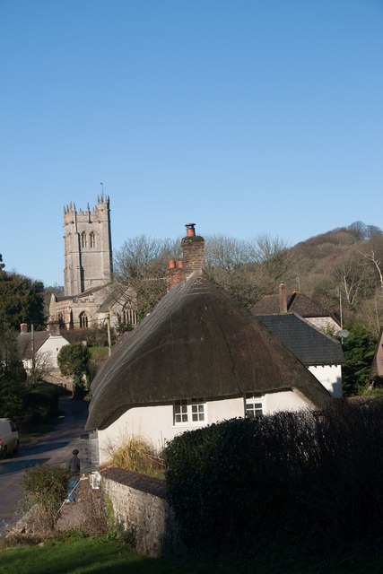
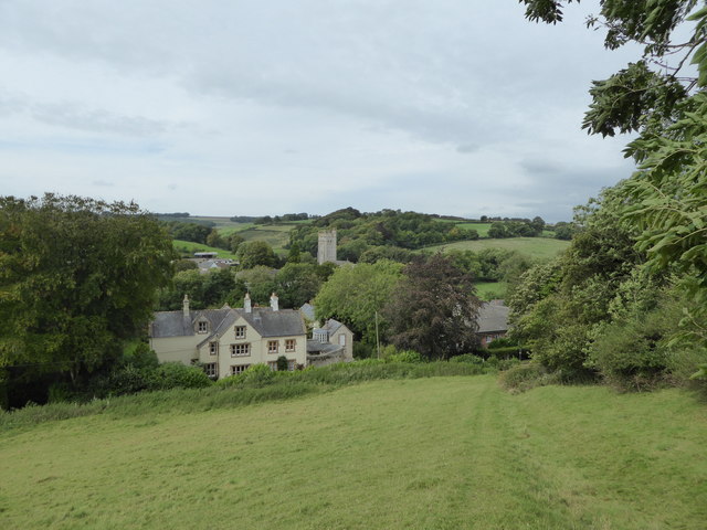
Rogers' Bottom, also known as Rogers' Valley, is a picturesque rural area located in the county of Dorset, England. Situated in the heart of the stunning Dorset countryside, this small valley is known for its scenic beauty and tranquil atmosphere.

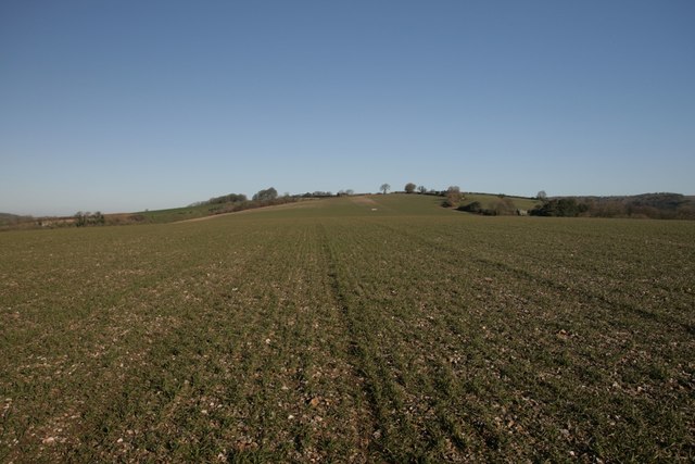
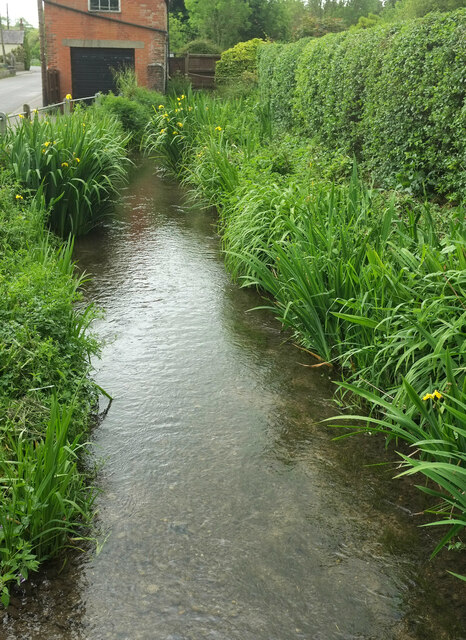
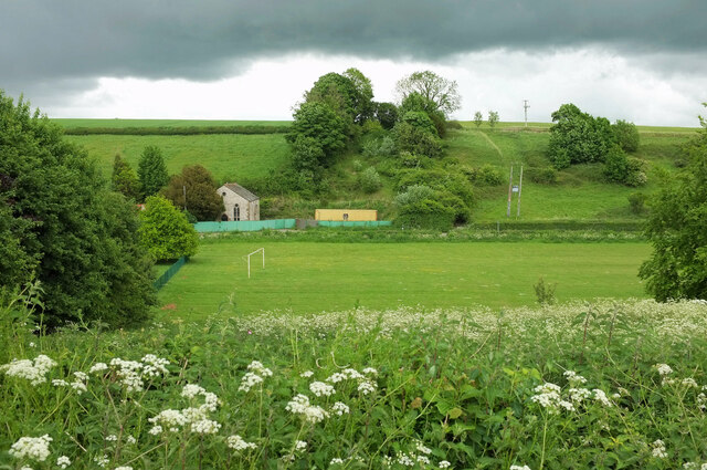
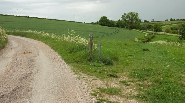
The valley is named after the Rogers family, who were early settlers in the area. It is surrounded by rolling hills and meandering streams, creating a picturesque landscape that is popular among nature enthusiasts and hikers. The lush greenery and diverse wildlife make it an ideal spot for outdoor activities such as walking, birdwatching, and picnicking.

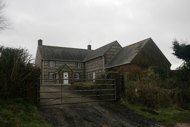
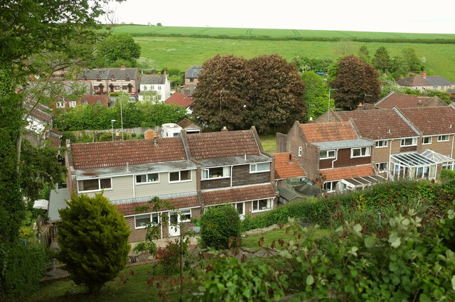
Rogers' Bottom is also home to a few scattered cottages and farmhouses, adding to the charm and character of the area. The locals are friendly and welcoming, and the community has a strong sense of pride in their rural heritage.

The valley is renowned for its agricultural practices, with many farms producing local produce such as cheese, milk, and organic vegetables. The fertile soil and favourable climate make it a thriving farming community.

Rogers' Bottom is well connected to the nearby towns and villages, with good road and public transport links. It is a peaceful retreat away from the hustle and bustle of city life, offering a serene and idyllic countryside experience.

In summary, Rogers' Bottom is a beautiful valley in Dorset, known for its scenic beauty, rural charm, and agricultural practices. It is a haven for nature lovers and a place where visitors can immerse themselves in the tranquility of the countryside.

If you have any feedback on the listing, please let us know in the comments section below.

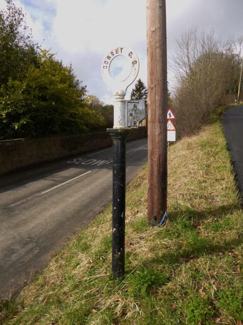
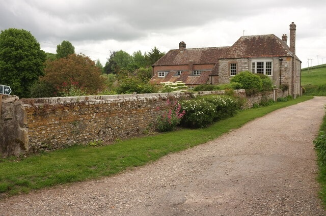
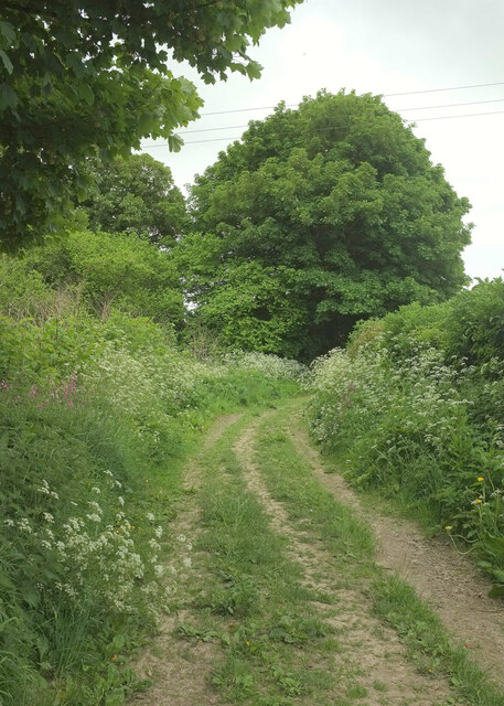
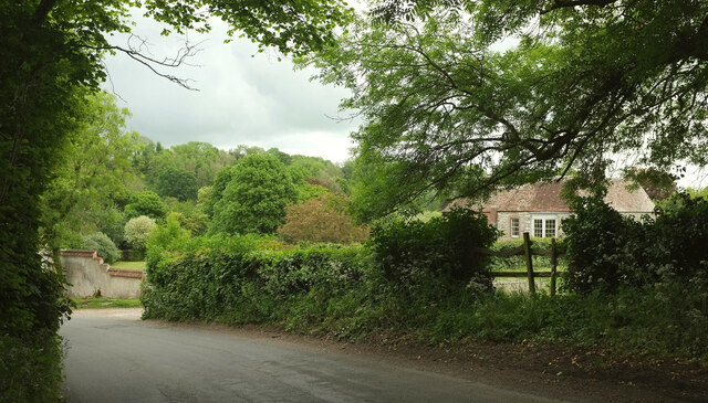
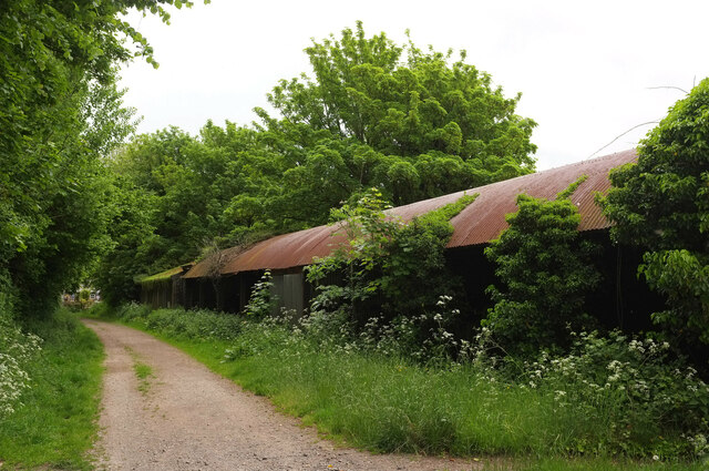
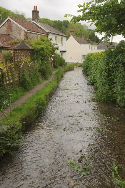
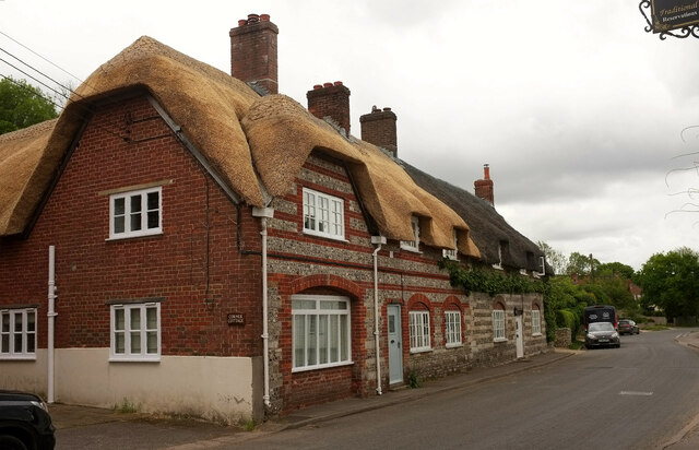
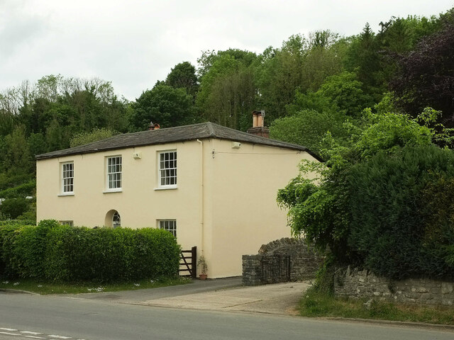
Rogers' Bottom Images

Images are sourced within 2km of 50.79898/-2.4284023 or Grid Reference ST6900. Thanks to Geograph Open Source API. All images are credited.

Church Lane, Piddletrenthide
Near summit of East Hill, Piddletrenthide Not that you'd really know you were on a hill. It's all arable crops!
Near summit of East Hill, Piddletrenthide
Not that you'd really know you were on a hill. It's all arable crops!
New Barn Farm, near Piddletrenthide
Piddletrenthide Taken from the footpath above the village.
Piddletrenthide
Taken from the footpath above the village.
Direction Sign - Signpost by the B3143 Annulus finial - no arm; Dorset halo without NGR by the B3143, in parish of Piddletrenthide (West Dorset District), Piddletrenthide, at junction with UC road to Mappowder, on verge.

Surveyed

Milestone Society National ID: DO_ST7000
Direction Sign - Signpost by the B3143
Annulus finial - no arm; Dorset halo without NGR by the B3143, in parish of Piddletrenthide (West Dorset District), Piddletrenthide, at junction with UC road to Mappowder, on verge. Surveyed Milestone Society National ID: DO_ST7000
Bridleway past West House, Piddletrenthide West House, also shown at <a href="https://www.geograph.org.uk/photo/887114">SY7099 : West House - Piddletrenthide</a>, is described at <span class="nowrap"><a title="https://historicengland.org.uk/listing/the-list/list-entry/1324130?section=official-list-entry" rel="nofollow ugc noopener" href="https://historicengland.org.uk/listing/the-list/list-entry/1324130?section=official-list-entry">Link</a><img style="margin-left:2px;" alt="External link" title="External link - shift click to open in new window" src="https://s1.geograph.org.uk/img/external.png" width="10" height="10"/></span> . Taken from where bridleway S36 41 leaves Back Lane.
Bridleway past West House, Piddletrenthide
West House, also shown at SY7099 : West House - Piddletrenthide, is described at LinkExternal link . Taken from where bridleway S36 41 leaves Back Lane.
Bridleway, Piddletrenthide Bridleway S36 25 runs parallel to the River Piddle, here about 70 metres to the left.
Bridleway, Piddletrenthide
Bridleway S36 25 runs parallel to the River Piddle, here about 70 metres to the left.
Cerne Abbas Lane, Piddletrenthide The stretch of lane between its junction with bridleway S36 25 (behind camera) and S36 41, which runs beside West House (on the right, see <a href="https://www.geograph.org.uk/photo/7182136">SY7099 : Bridleway past West House, Piddletrenthide</a>)
Cerne Abbas Lane, Piddletrenthide
The stretch of lane between its junction with bridleway S36 25 (behind camera) and S36 41, which runs beside West House (on the right, see SY7099 : Bridleway past West House, Piddletrenthide)
Barns, Piddletrenthide Beside bridleway S36 24.
Barns, Piddletrenthide
Beside bridleway S36 24.
River Piddle, Piddletrenthide From a footbridge carrying non-horses along bridleway S36 24; in the foreground is the ford for the horses. The bridleway continues along the left side of the river. On the left is the rear of the Piddle Inn. The further pair of houses is Baker's Row <span class="nowrap"><a title="https://historicengland.org.uk/listing/the-list/list-entry/1153408?section=official-list-entry" rel="nofollow ugc noopener" href="https://historicengland.org.uk/listing/the-list/list-entry/1153408?section=official-list-entry">Link</a><img style="margin-left:2px;" alt="External link" title="External link - shift click to open in new window" src="https://s1.geograph.org.uk/img/external.png" width="10" height="10"/></span> . This is an identical view to <a href="https://www.geograph.org.uk/photo/1343387">SY7099 : Piddletrenthide: River Piddle alongside the Piddle Inn</a>, about thirteen years later.
River Piddle, Piddletrenthide
From a footbridge carrying non-horses along bridleway S36 24; in the foreground is the ford for the horses. The bridleway continues along the left side of the river. On the left is the rear of the Piddle Inn. The further pair of houses is Baker's Row LinkExternal link . This is an identical view to SY7099 : Piddletrenthide: River Piddle alongside the Piddle Inn, about thirteen years later.
Listed houses, Piddletrenthide Two attached houses with banded flint and either brick or rubble. 

The more recently thatched house is listed as "House adjoining Pear Tree House to the North" <span class="nowrap"><a title="https://historicengland.org.uk/listing/the-list/list-entry/1118799?section=official-list-entry" rel="nofollow ugc noopener" href="https://historicengland.org.uk/listing/the-list/list-entry/1118799?section=official-list-entry">Link</a><img style="margin-left:2px;" alt="External link" title="External link - shift click to open in new window" src="https://s1.geograph.org.uk/img/external.png" width="10" height="10"/></span> . The map shows "Middle Thatch" but also implies there is another property at this end, and the name "Corner Cottage" appears on the wall. Moreover, the listing, dating from 1984, begins "House and shop".

The further house, Pear Tree Cottage, is listed as Pear Tree House ) (first listing 1956) <span class="nowrap"><a title="https://historicengland.org.uk/listing/the-list/list-entry/1304341?section=official-list-entry" rel="nofollow ugc noopener" href="https://historicengland.org.uk/listing/the-list/list-entry/1304341?section=official-list-entry">Link</a><img style="margin-left:2px;" alt="External link" title="External link - shift click to open in new window" src="https://s1.geograph.org.uk/img/external.png" width="10" height="10"/></span> .
Listed houses, Piddletrenthide
Two attached houses with banded flint and either brick or rubble. The more recently thatched house is listed as "House adjoining Pear Tree House to the North" LinkExternal link . The map shows "Middle Thatch" but also implies there is another property at this end, and the name "Corner Cottage" appears on the wall. Moreover, the listing, dating from 1984, begins "House and shop". The further house, Pear Tree Cottage, is listed as Pear Tree House ) (first listing 1956) LinkExternal link .
East House, Piddletrenthide An early C19 house, described at <span class="nowrap"><a title="https://historicengland.org.uk/listing/the-list/list-entry/1118800?section=official-list-entry" rel="nofollow ugc noopener" href="https://historicengland.org.uk/listing/the-list/list-entry/1118800?section=official-list-entry">Link</a><img style="margin-left:2px;" alt="External link" title="External link - shift click to open in new window" src="https://s1.geograph.org.uk/img/external.png" width="10" height="10"/></span> . Woodland has developed behind the village here, but remains unnamed on maps.
East House, Piddletrenthide
An early C19 house, described at LinkExternal link . Woodland has developed behind the village here, but remains unnamed on maps.
River Piddle, Piddletrenthide Running beside the B3143 here, and seen from a footbridge at the start of footpath S36 30.
River Piddle, Piddletrenthide
Running beside the B3143 here, and seen from a footbridge at the start of footpath S36 30.
Northover Close, Piddletrenthide Seen from bridleway S36 23, looking across the Piddle valley.
Northover Close, Piddletrenthide
Seen from bridleway S36 23, looking across the Piddle valley.
Playing field, Piddletrenthide Looking across the Piddle valley from  bridleway S36 23.  On the left is a disused chapel built of flint, named "Wesley House" on the map. <span class="nowrap"><a title="http://www.piddlevalley.info/church.php" rel="nofollow ugc noopener" href="http://www.piddlevalley.info/church.php">Link</a><img style="margin-left:2px;" alt="External link" title="External link - shift click to open in new window" src="https://s1.geograph.org.uk/img/external.png" width="10" height="10"/></span> has the following: "The former Methodist chapel in Piddletrenthide is being converted to a private dwelling". <span class="nowrap"><a title="https://www.opcdorset.org/PiddleFiles/Piddletrenthide/Piddletrenthide.htm" rel="nofollow ugc noopener" href="https://www.opcdorset.org/PiddleFiles/Piddletrenthide/Piddletrenthide.htm">Link</a><img style="margin-left:2px;" alt="External link" title="External link - shift click to open in new window" src="https://s1.geograph.org.uk/img/external.png" width="10" height="10"/></span> gives a date of 1894 for the "Wesleyan Chapel".
Playing field, Piddletrenthide
Looking across the Piddle valley from bridleway S36 23. On the left is a disused chapel built of flint, named "Wesley House" on the map. LinkExternal link has the following: "The former Methodist chapel in Piddletrenthide is being converted to a private dwelling". LinkExternal link gives a date of 1894 for the "Wesleyan Chapel".
Bridleway junction by South Farm Cottage Bridleway S36 21 veers left here, while S36 23 branches off to the right, up the valley.
Bridleway junction by South Farm Cottage
Bridleway S36 21 veers left here, while S36 23 branches off to the right, up the valley.
Field near South House Pasture in the Piddle valley, with a glimpse of the listed South House <span class="nowrap"><a title="https://historicengland.org.uk/listing/the-list/list-entry/1118804?section=official-list-entry" rel="nofollow ugc noopener" href="https://historicengland.org.uk/listing/the-list/list-entry/1118804?section=official-list-entry">Link</a><img style="margin-left:2px;" alt="External link" title="External link - shift click to open in new window" src="https://s1.geograph.org.uk/img/external.png" width="10" height="10"/></span> . Large trees line the river.
Field near South House
Pasture in the Piddle valley, with a glimpse of the listed South House LinkExternal link . Large trees line the river.
Bridleway to White Lackington This is bridleway S36 21. Ahead is Myrtle Cottage.
Bridleway to White Lackington
This is bridleway S36 21. Ahead is Myrtle Cottage.
Show me another place!

Rogers' Bottom is located at Grid Ref: ST6900 (Lat: 50.79898, Lng: -2.4284023)

Unitary Authority: Dorset

Police Authority: Dorset

What 3 Words

///stews.paddocks.headers. Near Charminster, Dorset

Related Wikis

Piddletrenthide Hoard

The Piddletrenthide Hoard is a Roman coin hoard dating from the 3rd century AD, found near Piddletrenthide, Dorset. It consisted of 2,114 base silver radiates...

Piddletrenthide

Piddletrenthide ( ) is a village and civil parish in the English county of Dorset. It is sited by the small River Piddle in a valley on the dip slope of...

Piddletrenthide (liberty)

Piddletrenthide Liberty was a liberty in the county of Dorset, England, containing the following parishes: Gorewood (from 1858) Minterne Magna (part)...

Doles Ash

Doles Ash is a farm in Dorset, England, a few kilometers east of Piddletrenthide and south of Plush. The farm features in Thomas Hardy's Tess of the D...

Nearby Amenities

Located within 500m of 50.79898,-2.4284023
Material: wood
Power: pole
Source: bing
Lat/Long: 50.7952697/-2.4267179
Material: wood
Power: pole
Source: bing
Lat/Long: 50.795764/-2.4251016
Material: wood
Power: pole
Source: bing
Lat/Long: 50.7963495/-2.4230749
Material: wood
Power: pole
Source: bing
Lat/Long: 50.7964966/-2.4259939
Material: wood
Poles: bipole
Power: pole
Source: bing
Lat/Long: 50.7965135/-2.4254551
Material: wood
Power: pole
Source: bing
Lat/Long: 50.7969471/-2.4239449
Material: wood
Power: pole
Source: bing
Lat/Long: 50.7972198/-2.4241524
Material: wood
Power: pole
Source: bing
Lat/Long: 50.7978279/-2.4244314
Material: wood
Power: pole
Source: bing
Lat/Long: 50.8015638/-2.4251205
Material: wood
Power: pole
Source: bing
Lat/Long: 50.8024938/-2.4264144
Material: wood
Power: pole
Source: bing
Lat/Long: 50.8032118/-2.4266381
Rogers' Bottom
Place: locality
Source: OS_OpenData_StreetView
Lat/Long: 50.7990185/-2.426455
Poles: bipole
Power: pole
Source: bing
Lat/Long: 50.7968744/-2.4244099
Poles: bipole
Power: pole
Source: bing
Lat/Long: 50.7970748/-2.4245514
Direction: 85
Generator Method: photovoltaic
Generator Output Electricity: yes
Generator Solar Modules: 10
Generator Source: solar
Generator Type: solar_photovoltaic_panel
Location: roof
Power: generator
Lat/Long: 50.8024706/-2.4246288
Direction: 265
Generator Method: photovoltaic
Generator Output Electricity: yes
Generator Solar Modules: 6
Generator Source: solar
Generator Type: solar_photovoltaic_panel
Location: roof
Power: generator
Lat/Long: 50.8024592/-2.4246885
Direction: 190
Generator Method: photovoltaic
Generator Output Electricity: yes
Generator Solar Modules: 12
Generator Source: solar
Generator Type: solar_photovoltaic_panel
Location: roof
Power: generator
Lat/Long: 50.8014027/-2.4227197
Power: pole
Source: bing
Transformer: distribution
Lat/Long: 50.8021038/-2.424269
Power: pole
Source: bing
Lat/Long: 50.7999492/-2.4245225
Power: pole
Source: bing
Lat/Long: 50.801012/-2.4244251
Power: pole
Source: bing
Lat/Long: 50.798386/-2.4247271
Power: pole
Source: bing
Lat/Long: 50.8019903/-2.4257536
The data included in this document is from www.openstreetmap.org. The data is made available under ODbL.

Have you been to Rogers' Bottom?

Leave your review of Rogers' Bottom below (or comments, questions and feedback).