Sebastopol Covert

Wood, Forest in Cheshire

England

Sebastopol Covert

Junction 20 sign on the M6 Heading north on the M6.
Junction 20 sign on the M6 Credit: Steve Daniels

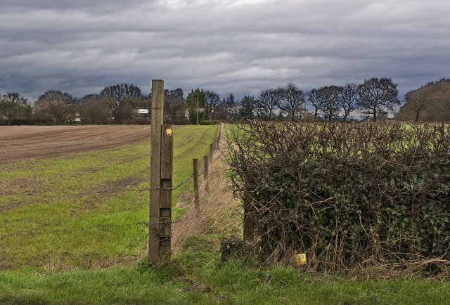
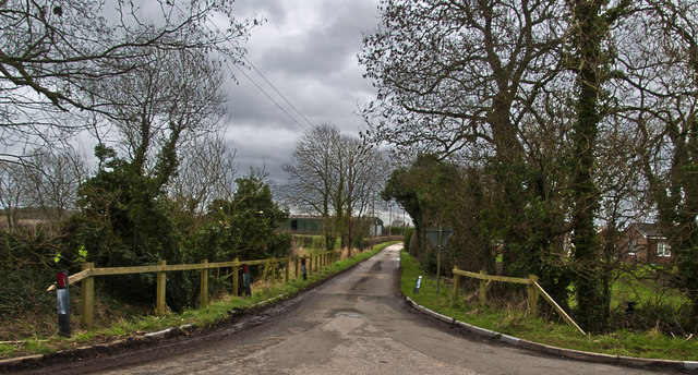
Sebastopol Covert is a picturesque woodland located in the county of Cheshire, England. Nestled within the heart of the region, this enchanting forest offers visitors a serene and captivating experience. Stretching across an area of approximately 15 acres, Sebastopol Covert is a peaceful haven for nature enthusiasts and outdoor adventurers.

The woodland is characterized by its dense canopy of trees, which primarily consists of oak, beech, and birch. These towering giants create a cool and shady environment, providing a welcome respite from the heat during the summer months. The forest floor is covered in a lush carpet of ferns, mosses, and wildflowers, further enhancing the area's natural beauty.

Sebastopol Covert is home to a diverse range of wildlife, making it a haven for nature lovers. Visitors may catch a glimpse of deer, foxes, badgers, and a variety of bird species. The tranquil atmosphere of the forest also makes it an ideal spot for birdwatching and photography.

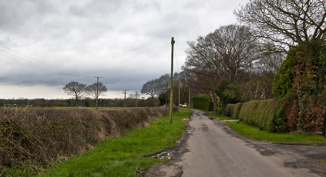
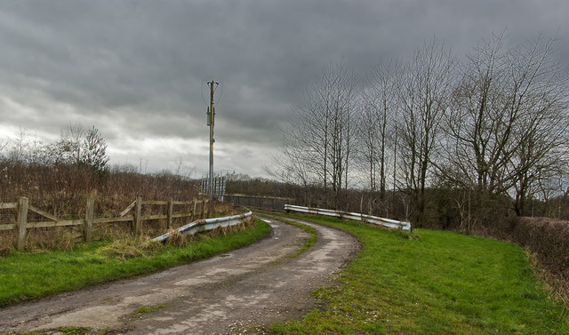
The woodland is crisscrossed by a network of well-maintained trails, allowing visitors to explore its hidden corners and discover its hidden treasures. These paths wind through the forest, meandering around ancient trees and babbling brooks. There are also designated picnic areas and benches, where visitors can unwind and enjoy a leisurely lunch amidst nature's splendor.

Sebastopol Covert is open to the public year-round, free of charge. It offers a peaceful retreat for those seeking solace in nature, and its idyllic setting makes it a popular destination for families, hikers, and photographers alike.

If you have any feedback on the listing, please let us know in the comments section below.

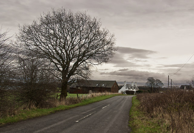
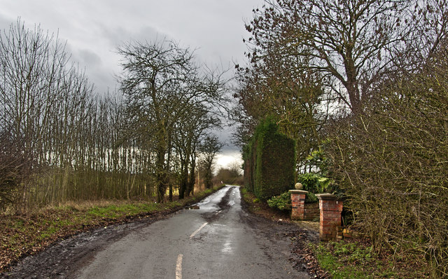
Sebastopol Covert Images

Images are sourced within 2km of 53.344137/-2.4926813 or Grid Reference SJ6783. Thanks to Geograph Open Source API. All images are credited.

Junction 20 sign on the M6 Heading north on the M6.
Junction 20 sign on the M6
Heading north on the M6.
A farm track crosses the M6 Heading north on the M6.
A farm track crosses the M6
Heading north on the M6.
Junction 20 on the M6 Heading north on the M6.
Junction 20 on the M6
Heading north on the M6.
Trucks at Lymm Services Lymm Services was originally just a small truck stop was later developed into a full blown service area and officially named "Poplar 2000".
Trucks at Lymm Services
Lymm Services was originally just a small truck stop was later developed into a full blown service area and officially named "Poplar 2000".
Lorries at Lymm Lymm Services was originally just a small truck stop was later developed into a full blown service area and officially named "Poplar 2000". It is close to the intersection of the M6 and M56 and so accessible from both motorways.
Lorries at Lymm
Lymm Services was originally just a small truck stop was later developed into a full blown service area and officially named "Poplar 2000". It is close to the intersection of the M6 and M56 and so accessible from both motorways.
Coach and Lorry park at Lymm Services Lymm Services was originally just a small truck stop was later developed into a full blown service area and officially named "Poplar 2000". It is close to the intersection of the M6 and M56 and so accessible from both motorways.
Coach and Lorry park at Lymm Services
Lymm Services was originally just a small truck stop was later developed into a full blown service area and officially named "Poplar 2000". It is close to the intersection of the M6 and M56 and so accessible from both motorways.
McDonald's at Lymm Services Lymm Services was originally just a small truck stop was later developed into a full blown service area and officially named "Poplar 2000". It is close to the intersection of the M6 and M56 and so accessible from both motorways.
McDonald's at Lymm Services
Lymm Services was originally just a small truck stop was later developed into a full blown service area and officially named "Poplar 2000". It is close to the intersection of the M6 and M56 and so accessible from both motorways.
Postbox and Electric charging points at Lymm Services Since Chris Downer photographed EIIR postbox WA13 119 in 2012 <a href="https://www.geograph.org.uk/photo/3287238">SJ6684 : Lymm: postbox № WA13 119, M6 services</a> two charging points for electric cars have been added to the car park. 

Lymm Services was originally just a small truck stop. It was later developed into a full blown service area and officially named "Poplar 2000". It is close to the intersection of the M6 and M56 and so accessible from both motorways.
Postbox and Electric charging points at Lymm Services
Since Chris Downer photographed EIIR postbox WA13 119 in 2012 SJ6684 : Lymm: postbox № WA13 119, M6 services two charging points for electric cars have been added to the car park. Lymm Services was originally just a small truck stop. It was later developed into a full blown service area and officially named "Poplar 2000". It is close to the intersection of the M6 and M56 and so accessible from both motorways.
Ibis Budget Hotel Motel at Lymm Services.
Ibis Budget Hotel
Motel at Lymm Services.
Lymm Services Lymm Services was originally just a small truck stop. It was later developed into a full blown service area and officially named "Poplar 2000". It is close to the intersection of the M6 and M56 and so accessible from both motorways.
Lymm Services
Lymm Services was originally just a small truck stop. It was later developed into a full blown service area and officially named "Poplar 2000". It is close to the intersection of the M6 and M56 and so accessible from both motorways.
Vehicles at Lymm Services Lymm Services was originally just a small truck stop. It was later developed into a full blown service area and officially named "Poplar 2000". It is close to the intersection of the M6 and M56 and so accessible from both motorways.
Vehicles at Lymm Services
Lymm Services was originally just a small truck stop. It was later developed into a full blown service area and officially named "Poplar 2000". It is close to the intersection of the M6 and M56 and so accessible from both motorways.
Barleycastle Farm
Barleycastle Farm
Crowley Lane Mud and puddles
Crowley Lane
Mud and puddles
Footpath to Rowlinson's Green off Swineyard Lane
Fanners Lane
Fanners Lane
A private bridge over the motorway slip road
The Bears Paw Inn Michelin may have a bit of a start, but on the strength of one lunch here I’m tempted to start my own Good Food Guide.
The Bears Paw Inn
Michelin may have a bit of a start, but on the strength of one lunch here I’m tempted to start my own Good Food Guide.
Golbourne Lane
Golbourne Lane
Show me another place!

Sebastopol Covert is located at Grid Ref: SJ6783 (Lat: 53.344137, Lng: -2.4926813)

Unitary Authority: Cheshire East

Police Authority: Cheshire

What 3 Words

///kept.willing.ghost. Near High Legh, Cheshire

Related Wikis

Swineyard Hall

Swineyard Hall is a moated country house in the parish of High Legh, Cheshire, England. It was built in the 16th century, with additions made in the 19th...

RNAS Stretton (HMS Blackcap)

Royal Naval Air Station Stretton (RNAS Stretton, also known as HMS Blackcap), was an airfield situated in the village of Appleton Thorn, though named for...

St Mary's Chapel, Arley

St Mary's Chapel is the private chapel to Arley Hall, near the village of Arley, Cheshire, England. It is recorded in the National Heritage List for England...

Arley Hall

Arley Hall is a country house in the village of Arley, Cheshire, England, about 4 miles (6 km) south of Lymm and 5 miles (8 km) north of Northwich. It...

Arley, Cheshire

Arley is a small village in the civil parish of Aston by Budworth, Cheshire, England, adjacent to Arley Hall. 0.7 miles (1.1 km) to the east is a small...

Bucklow Hundred

The hundred of Bucklow was an ancient division of the historic county of Cheshire, in northern England. It was known to have been in existence at least...

St Mary's Chapel, High Legh

St Mary's Chapel is a former Anglican parish church in the village of High Legh, Cheshire, England. It is recorded in the National Heritage List for England...

St John's Church, High Legh

St John's Church is an active Anglican parish church in the village of High Legh, Cheshire, England. It is in the deanery of Knutsford, the archdeaconry...

Nearby Amenities

Located within 500m of 53.344137,-2.4926813
Motorway Junction
Lymm Interchange
Ref: 20
Lat/Long: 53.3472758/-2.4975535
Sink Moss
Place: locality
Lat/Long: 53.3448529/-2.4859304
The data included in this document is from www.openstreetmap.org. The data is made available under ODbL.

Have you been to Sebastopol Covert?

Leave your review of Sebastopol Covert below (or comments, questions and feedback).