Common Wood

Wood, Forest in Somerset

England

Common Wood

Ordnance Survey Rivet This damaged  OS rivet can be found on the south parapet of the bridge. It marks a point 27.655m above mean sea level.
Ordnance Survey Rivet Credit: Adrian Dust

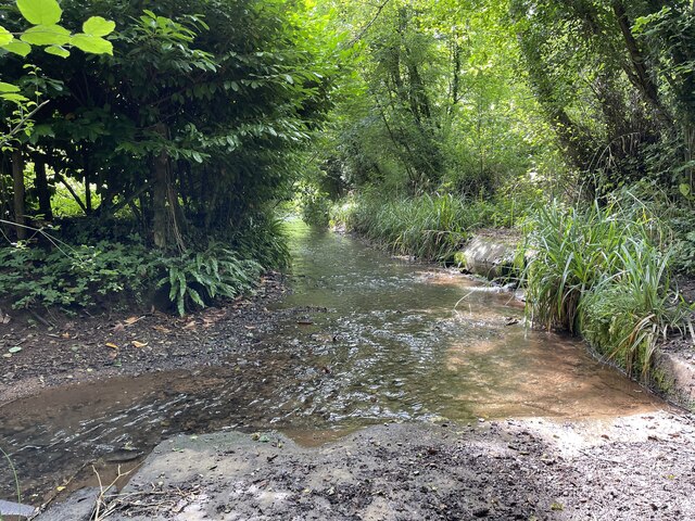
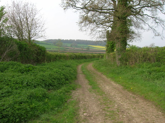
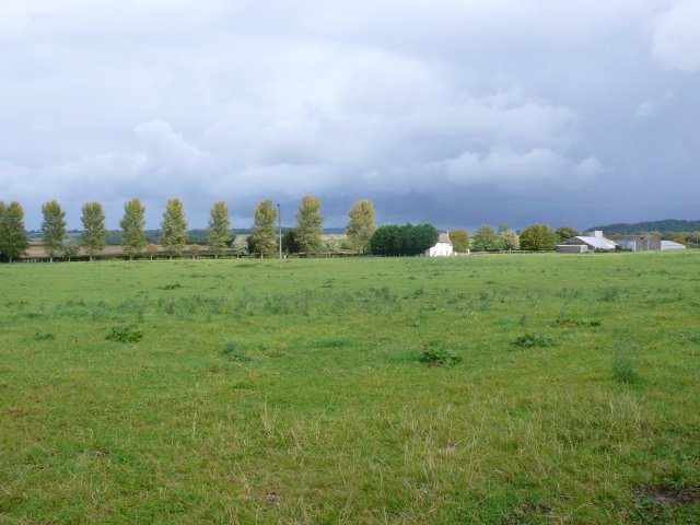
Common Wood is a picturesque forest located in Somerset, England. Covering an area of approximately 100 acres, this wood is an oasis of tranquility and natural beauty. It is nestled amidst the rolling hills and lush green landscapes that characterize the region.

The wood is predominantly composed of deciduous trees, such as oak, beech, and birch, which provide a vibrant and ever-changing display of colors throughout the year. In spring, the wood comes alive with a burst of fresh green leaves, while autumn transforms it into a mesmerizing tapestry of red, orange, and gold.

Common Wood offers a haven for various species of wildlife. Visitors may spot roe deer gracefully roaming through the undergrowth or catch a glimpse of squirrels busily collecting acorns. The forest is also home to a diverse range of bird species, including woodpeckers, owls, and songbirds, which fill the air with their melodic tunes.

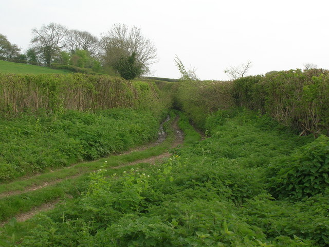
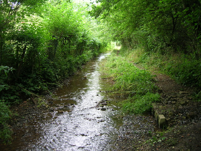
There are several well-maintained walking trails that meander through the wood, allowing visitors to explore its enchanting beauty at their own pace. These trails offer breathtaking views of the surrounding countryside and provide opportunities for peaceful picnics or idyllic nature photography.

Common Wood is a popular destination for nature lovers, hikers, and families seeking a peaceful retreat from the hustle and bustle of everyday life. It is a place where one can reconnect with nature and enjoy the simple pleasures of the great outdoors.

If you have any feedback on the listing, please let us know in the comments section below.
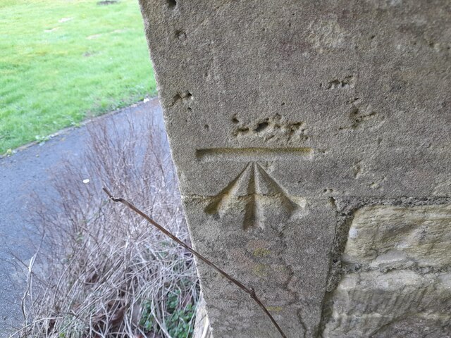
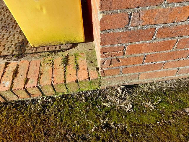
Common Wood Images

Images are sourced within 2km of 51.35926/-2.4976803 or Grid Reference ST6562. Thanks to Geograph Open Source API. All images are credited.

Ordnance Survey Rivet This damaged  OS rivet can be found on the south parapet of the bridge. It marks a point 27.655m above mean sea level.
Ordnance Survey Rivet
This damaged OS rivet can be found on the south parapet of the bridge. It marks a point 27.655m above mean sea level.
Ordnance Survey Cut Mark This OS cut mark can be found on the wall north side of the road. It marks a point 120.250m above mean sea level.
Ordnance Survey Cut Mark
This OS cut mark can be found on the wall north side of the road. It marks a point 120.250m above mean sea level.
Ordnance Survey Cut Mark This OS cut mark can be found on the NW angle of St Peter's Church. It marks a point 123.834m above mean sea level.
Ordnance Survey Cut Mark
This OS cut mark can be found on the NW angle of St Peter's Church. It marks a point 123.834m above mean sea level.
Ordnance Survey Cut Mark This OS cut mark can be found on the Hall SE side of the road. It marks a point 122.624m above mean sea level.
Ordnance Survey Cut Mark
This OS cut mark can be found on the Hall SE side of the road. It marks a point 122.624m above mean sea level.
Ordnance Survey Cut Mark This OS cut mark can be found on the old chapel NW side of the road. It marks a point 120.277m above mean sea level.
Ordnance Survey Cut Mark
This OS cut mark can be found on the old chapel NW side of the road. It marks a point 120.277m above mean sea level.
Ordnance Survey Cut Mark This OS cut mark can be found on Sun Galore, SE side of the road. It marks a point 126.355m above mean sea level.
Ordnance Survey Cut Mark
This OS cut mark can be found on Sun Galore, SE side of the road. It marks a point 126.355m above mean sea level.
Ordnance Survey Cut Mark This OS cut mark can be found on the wall south side of the road. It marks a point 130.692m above mean sea level.
Ordnance Survey Cut Mark
This OS cut mark can be found on the wall south side of the road. It marks a point 130.692m above mean sea level.
Ordnance Survey Cut Mark This OS cut mark can be found on the wall south side of the road. It marks a point 111.883m above mean sea level.
Ordnance Survey Cut Mark
This OS cut mark can be found on the wall south side of the road. It marks a point 111.883m above mean sea level.
Ordnance Survey Cut Mark This OS cut mark can be found on the NW angle of All Saints Church. It marks a point 119.661m above mean sea level.
Ordnance Survey Cut Mark
This OS cut mark can be found on the NW angle of All Saints Church. It marks a point 119.661m above mean sea level.
Ordnance Survey Cut Mark This OS cut mark can be found on a building at the Sewage Works. It marks a point 90.613m above mean sea level.
Ordnance Survey Cut Mark
This OS cut mark can be found on a building at the Sewage Works. It marks a point 90.613m above mean sea level.
Ford on Bathford Brook This ford on the Bathford Brook is found at Tuckingmill near Compton Dando. A video of the ford can be viewed at:

<span class="nowrap"><a title="https://youtu.be/Q56WbYovyYI" rel="nofollow ugc noopener" href="https://youtu.be/Q56WbYovyYI">Link</a><img style="margin-left:2px;" alt="External link" title="External link - shift click to open in new window" src="https://s1.geograph.org.uk/img/external.png" width="10" height="10"/></span>

I shall probably never forget our visit here, not for the delightful ford but because I parked the Landcruiser on the grass verge at the top of the track and on leaving managed to ‘pop’ the bottom arm of the drive shaft and spent the next 15 hours waiting to be recovered by the RAC. Many thanks to all the helpful villagers and the tenant farmer who kept checking up on us as well as the local community police officers. We were fortunate it didn’t happen on one of the tracks and that there was the Compton Inn close by to provide us with a hearty meal.
Ford on Bathford Brook
This ford on the Bathford Brook is found at Tuckingmill near Compton Dando. A video of the ford can be viewed at: LinkExternal link I shall probably never forget our visit here, not for the delightful ford but because I parked the Landcruiser on the grass verge at the top of the track and on leaving managed to ‘pop’ the bottom arm of the drive shaft and spent the next 15 hours waiting to be recovered by the RAC. Many thanks to all the helpful villagers and the tenant farmer who kept checking up on us as well as the local community police officers. We were fortunate it didn’t happen on one of the tracks and that there was the Compton Inn close by to provide us with a hearty meal.
Byway near Stanton Prior
Old Byway track Looking south away from the village of Stanton Prior
Old Byway track
Looking south away from the village of Stanton Prior
Bathford Brook flows down the Byway to Tucking Mill The last 100 metres or so of this dead-end Byway is the bed of the stream.  After the mill the access is for pedestrians (and residents) only.
Bathford Brook flows down the Byway to Tucking Mill
The last 100 metres or so of this dead-end Byway is the bed of the stream. After the mill the access is for pedestrians (and residents) only.
Maize Field This gate leads into a ripening maize field close to where the Compton Dando road leaves the minor road between Hunstrete and Woollard
Maize Field
This gate leads into a ripening maize field close to where the Compton Dando road leaves the minor road between Hunstrete and Woollard
Fields near Hunstrete These fields had been harvested a few weeks ago and the new grass growth was already starting to show through.
Fields near Hunstrete
These fields had been harvested a few weeks ago and the new grass growth was already starting to show through.
Wick farm A large farm approached along an avenue of polars from the road between Wollard and Hunstrete.
Wick farm
A large farm approached along an avenue of polars from the road between Wollard and Hunstrete.
Common Wood, Hunstrete near Bath Things you do not expect to see in a common wood.
Common Wood, Hunstrete near Bath
Things you do not expect to see in a common wood.
Show me another place!

Common Wood is located at Grid Ref: ST6562 (Lat: 51.35926, Lng: -2.4976803)

Unitary Authority: Bath and North East Somerset

Police Authority: Avon and Somerset

What 3 Words

///apple.huddling.feasts. Near Compton Dando, Somerset

Related Wikis

Hunstrete

Hunstrete (grid reference ST625643) is a small village on the River Chew in the Chew Valley, Bath and North East Somerset, England. It falls within the...

Hunstrete Lake

Hunstrete Lake (grid reference ST646622) is a mature lake of 5 acres (20,000 m2). Two new lakes of 3.5 acres (14,000 m2) were constructed alongside in...

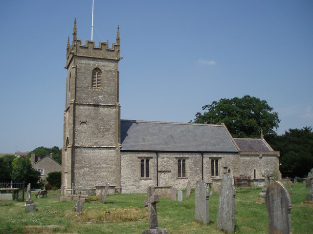
Church of St Peter, Marksbury

The Church of St Peter in Marksbury, Somerset, England dates from the 12th century, although most of the current fabric is from the 15th century and is...

Marksbury

Marksbury is a small village and civil parish on the eastern edge of the affluent Chew Valley in Somerset, about 4 miles (6.4 km) from Keynsham and 7 miles...

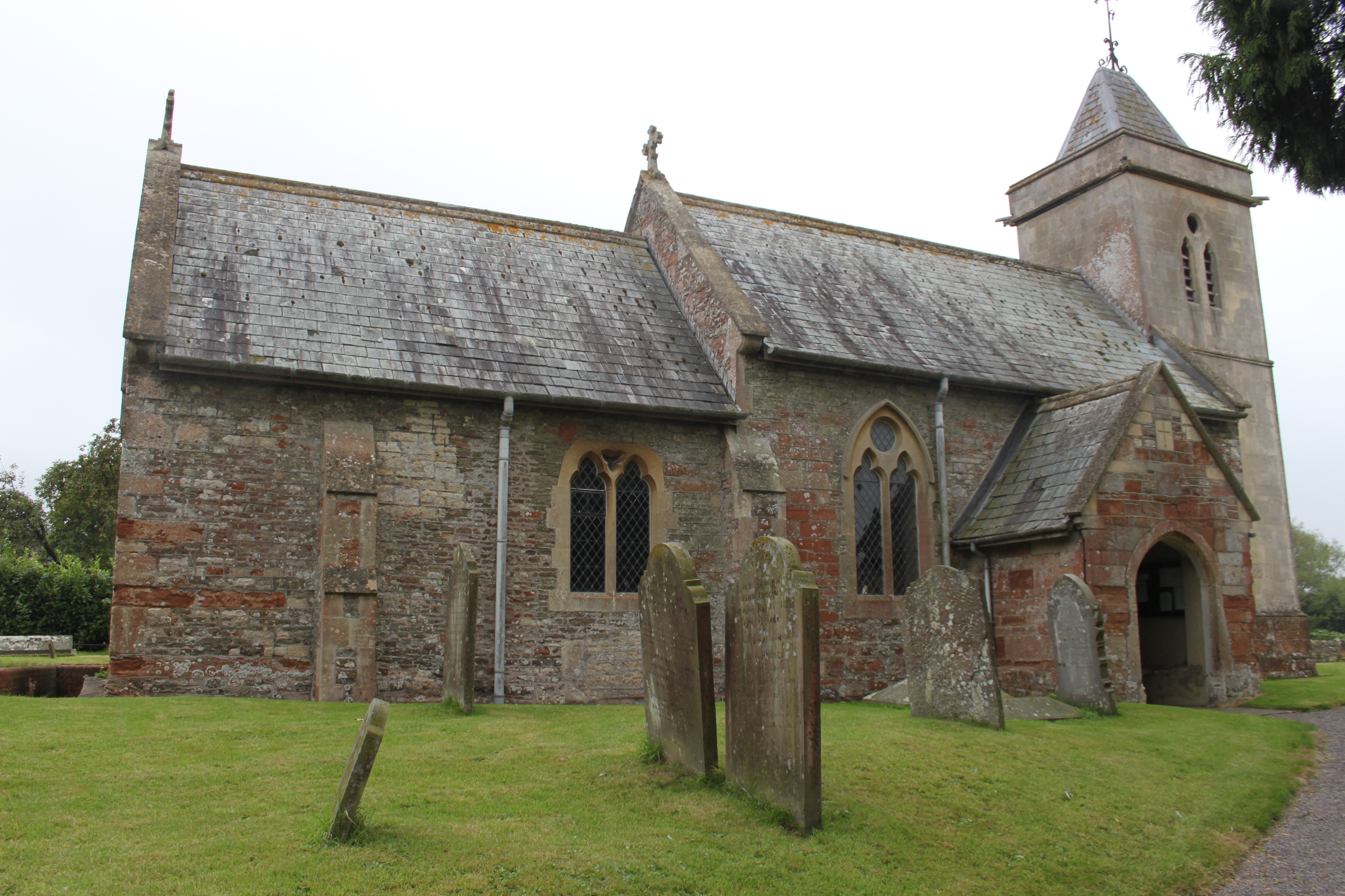
Church of All Saints, Farmborough

The Church of All Saints is an Anglican parish church in Farmborough, Somerset, England. It was principally built in the 15th century (with parts dating...

Chelwood

Chelwood is a small village and civil parish in Somerset, England, and is in the affluent Chew Valley in the Bath and North East Somerset council area...

Farmborough

Farmborough is a small village and civil parish, 6 miles (9.7 km) south west of Bath in Somerset, England. It straddles both the A39 and A368 roads. The...

Church of St Leonard, Chelwood

The Church of St Leonard is a redundant church in Chelwood, Somerset, England. It was built in the 14th century and has been designated as a Grade II...

Related Videos

Sneak preview of another epic helicopter adventure

Sneak preview of another epic helicopter adventure to a stunning private site in the heart of Somerset with some of the best locally ...

BVM VLOG #114 - Changing Bikes & Practice Session!

Craig & Laurence went for a practice at one of their local riding grounds along with two of the youngest bvm team riders for some ...

Nearby Amenities

Located within 500m of 51.35926,-2.4976803
Hamburger Hill
Addr City: Bristol
Addr Postcode: BS39 4NT
Fhrs Id: 205299
Operator: Bristol Outdoor Pursuits
Sport: paintball
Website: https://www.hamburgerhill.co.uk/index.php
Lat/Long: 51.3592727/-2.5008057
Power: pole
Lat/Long: 51.3558054/-2.5008139
Power: pole
Lat/Long: 51.3564017/-2.5013182
Power: pole
Lat/Long: 51.357142/-2.5018895
Power: pole
Lat/Long: 51.3578757/-2.5024688
Power: pole
Lat/Long: 51.359641/-2.5038448
Ford: yes
Lat/Long: 51.3597956/-2.5032092
Barrier: kissing_gate
Lat/Long: 51.3633058/-2.4979409
Barrier: kissing_gate
Lat/Long: 51.3629265/-2.4955976
Barrier: kissing_gate
Lat/Long: 51.3628438/-2.4953258
Power: pole
Lat/Long: 51.3591656/-2.5045618
Power: pole
Lat/Long: 51.3597951/-2.5040618
Power: pole
Lat/Long: 51.3603968/-2.5035678
Power: pole
Lat/Long: 51.3611228/-2.5029824
Power: pole
Lat/Long: 51.3618501/-2.5023807
Power: pole
Lat/Long: 51.3625215/-2.5018522
The data included in this document is from www.openstreetmap.org. The data is made available under ODbL.

Have you been to Common Wood?

Leave your review of Common Wood below (or comments, questions and feedback).