Roundhill Wood

Wood, Forest in Somerset

England

Roundhill Wood

Ordnance Survey Rivet This damaged  OS rivet can be found on the south parapet of the bridge. It marks a point 27.655m above mean sea level.
Ordnance Survey Rivet Credit: Adrian Dust

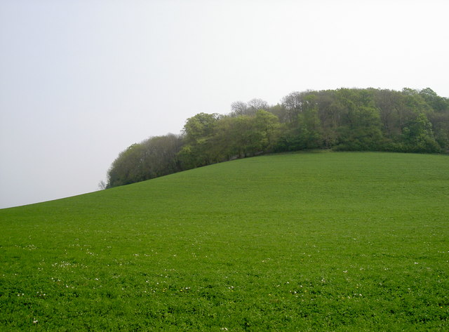
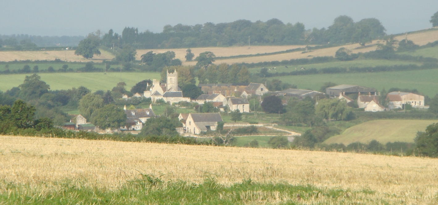
Roundhill Wood is a charming woodland area located in the county of Somerset, England. Covering an expansive area of approximately 50 hectares, this captivating forest is an absolute haven for nature enthusiasts and outdoor lovers. The wood is situated near the small village of Stoke St. Michael, providing a picturesque escape from the hustle and bustle of everyday life.

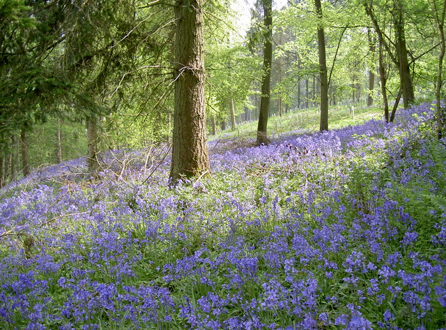
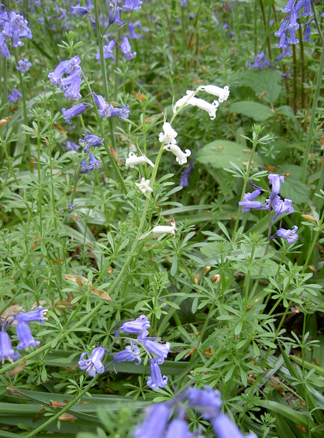
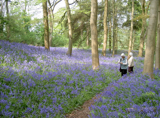
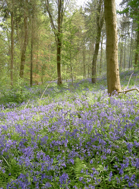
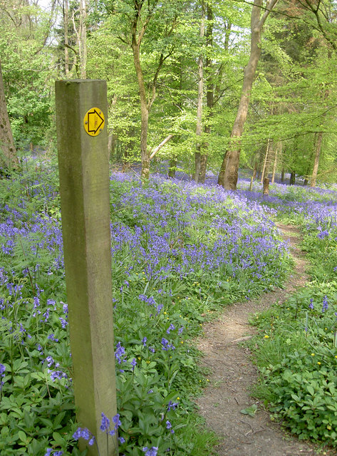
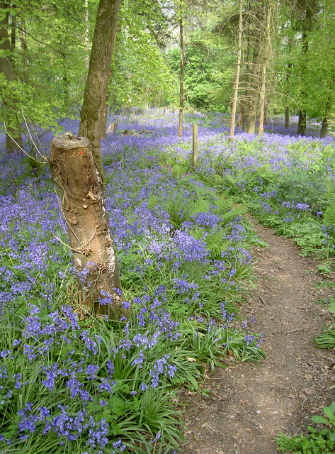
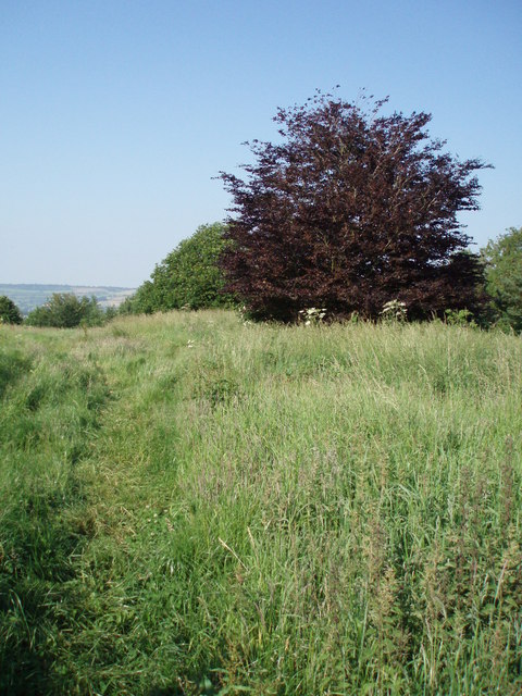
Roundhill Wood boasts a diverse range of tree species, including oak, ash, beech, and birch, creating a rich and vibrant ecosystem. The forest floor is adorned with a lush carpet of bluebells during the spring, making it a popular destination for visitors seeking to witness the beauty of nature in full bloom.

The woodland is home to a variety of wildlife, offering a sanctuary for numerous bird species, such as woodpeckers, treecreepers, and tawny owls. Visitors may also catch glimpses of deer, foxes, and badgers, adding to the enchantment and tranquility of the area.

The wood is crisscrossed by a network of well-maintained footpaths, allowing visitors to explore and immerse themselves in the natural wonders that Roundhill Wood has to offer. Whether it's a leisurely stroll or a more challenging hike, there are routes to suit all abilities.

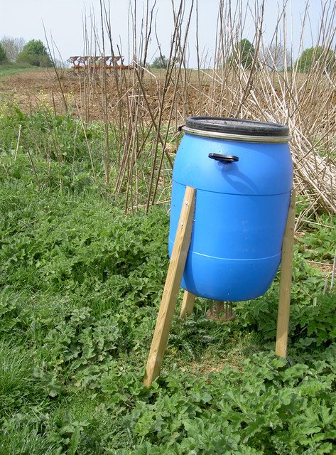
Roundhill Wood is managed by the local authorities, who strive to preserve its natural beauty and protect the delicate balance of its ecosystem. Visitors are encouraged to respect the environment and adhere to any guidelines or restrictions in place.

In conclusion, Roundhill Wood is a captivating forest in Somerset, offering a serene and enchanting escape into nature. With its diverse range of tree species, abundant wildlife, and well-maintained footpaths, this woodland paradise is a must-visit destination for anyone seeking solace and tranquility amidst the beauty of the natural world.

If you have any feedback on the listing, please let us know in the comments section below.

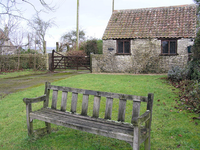
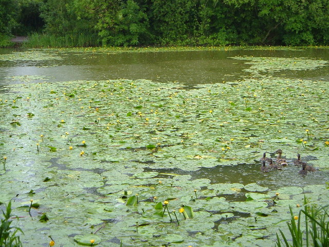
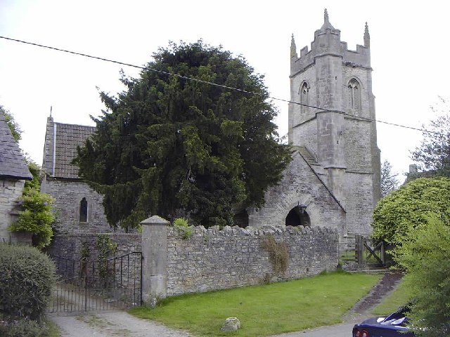
Roundhill Wood Images

Images are sourced within 2km of 51.364251/-2.4931668 or Grid Reference ST6562. Thanks to Geograph Open Source API. All images are credited.

Ordnance Survey Rivet This damaged  OS rivet can be found on the south parapet of the bridge. It marks a point 27.655m above mean sea level.
Ordnance Survey Rivet
This damaged OS rivet can be found on the south parapet of the bridge. It marks a point 27.655m above mean sea level.
Ordnance Survey Cut Mark This OS cut mark can be found on the wall north side of the road. It marks a point 120.250m above mean sea level.
Ordnance Survey Cut Mark
This OS cut mark can be found on the wall north side of the road. It marks a point 120.250m above mean sea level.
Ordnance Survey Cut Mark This OS cut mark can be found on the NW angle of St Peter's Church. It marks a point 123.834m above mean sea level.
Ordnance Survey Cut Mark
This OS cut mark can be found on the NW angle of St Peter's Church. It marks a point 123.834m above mean sea level.
Ford on Bathford Brook This ford on the Bathford Brook is found at Tuckingmill near Compton Dando. A video of the ford can be viewed at:

<span class="nowrap"><a title="https://youtu.be/Q56WbYovyYI" rel="nofollow ugc noopener" href="https://youtu.be/Q56WbYovyYI">Link</a><img style="margin-left:2px;" alt="External link" title="External link - shift click to open in new window" src="https://s1.geograph.org.uk/img/external.png" width="10" height="10"/></span>

I shall probably never forget our visit here, not for the delightful ford but because I parked the Landcruiser on the grass verge at the top of the track and on leaving managed to ‘pop’ the bottom arm of the drive shaft and spent the next 15 hours waiting to be recovered by the RAC. Many thanks to all the helpful villagers and the tenant farmer who kept checking up on us as well as the local community police officers. We were fortunate it didn’t happen on one of the tracks and that there was the Compton Inn close by to provide us with a hearty meal.
Ford on Bathford Brook
This ford on the Bathford Brook is found at Tuckingmill near Compton Dando. A video of the ford can be viewed at: LinkExternal link I shall probably never forget our visit here, not for the delightful ford but because I parked the Landcruiser on the grass verge at the top of the track and on leaving managed to ‘pop’ the bottom arm of the drive shaft and spent the next 15 hours waiting to be recovered by the RAC. Many thanks to all the helpful villagers and the tenant farmer who kept checking up on us as well as the local community police officers. We were fortunate it didn’t happen on one of the tracks and that there was the Compton Inn close by to provide us with a hearty meal.
Open for light refreshments The village hall offers some tasty home cooking and tea on the day of the fair. All proceeds to the parish.
Open for light refreshments
The village hall offers some tasty home cooking and tea on the day of the fair. All proceeds to the parish.
A drowned crown On the day of the village fair, a golden crown rests in the stream by the hall. Has some king befallen trouble of perhaps a child's toy?
A drowned crown
On the day of the village fair, a golden crown rests in the stream by the hall. Has some king befallen trouble of perhaps a child's toy?
Rounding up the ducks Barriers are in place in front of the grating: the village fair duck race will end here by the hall.
Rounding up the ducks
Barriers are in place in front of the grating: the village fair duck race will end here by the hall.
Decked out for the village's day Compton Dando village fair is on today and the bunting is out on available fixtures.
Decked out for the village's day
Compton Dando village fair is on today and the bunting is out on available fixtures.
A seat for the patient? The converted telephone box has a defibrillator and also something to sit on.
A seat for the patient?
The converted telephone box has a defibrillator and also something to sit on.
Bluebells, Stantonbury Hill Perfect weather this Spring has brought out a large showing of woodland bluebells.
Bluebells, Stantonbury Hill
Perfect weather this Spring has brought out a large showing of woodland bluebells.
White bluebells Despite the obvious misnomer, there are white flowers among the traditional blue variety. Pink ones also occur. Some estimate that whites occur less than 1:10,000, and are a natural phenomenon. The introduction of the Spanish Bluebell variety has produced hybridisation, making identifying the exact species tricky.
White bluebells
Despite the obvious misnomer, there are white flowers among the traditional blue variety. Pink ones also occur. Some estimate that whites occur less than 1:10,000, and are a natural phenomenon. The introduction of the Spanish Bluebell variety has produced hybridisation, making identifying the exact species tricky.
Awash with Bluebells, Stantonbury Hill The footpath up to the top of Stantonbury Hill has been blessed this year with a fabulous showing of the traditional woodland bluebell.
Awash with Bluebells, Stantonbury Hill
The footpath up to the top of Stantonbury Hill has been blessed this year with a fabulous showing of the traditional woodland bluebell.
Bluebells, Stantonbury Hill Bluebells thriving on the slopes of the old hill-fort, along with a generous mixture of deciduous trees.
Bluebells, Stantonbury Hill
Bluebells thriving on the slopes of the old hill-fort, along with a generous mixture of deciduous trees.
Hilltop agriculture The top of Stantonbury Hill is a small plateau. After passing through the tree-lined and bluebell covered slopes (see <a href="https://www.geograph.org.uk/photo/2378780">ST6763 : Awash with Bluebells, Stantonbury Hill</a> for example), the open area is a bit of a surprise. Here there is clear evidence of cultivation, and <a href="https://www.geograph.org.uk/photo/2378822">ST6763 : Take-away for pheasants?</a> may indicate the area is kept for the benefit of pheasants.
Hilltop agriculture
The top of Stantonbury Hill is a small plateau. After passing through the tree-lined and bluebell covered slopes (see ST6763 : Awash with Bluebells, Stantonbury Hill for example), the open area is a bit of a surprise. Here there is clear evidence of cultivation, and ST6763 : Take-away for pheasants? may indicate the area is kept for the benefit of pheasants.
Take-away for pheasants? A feeder constructed from handy materials, presumably for the use by pheasants. A nearby sett may be home to a few more interested parties.

The thin hedgeline and the cultivated ground behind it may suggest the hilltop is being specifically prepared for birds, though. See <a href="https://www.geograph.org.uk/photo/2378797">ST6763 : Hilltop agriculture</a> for a better view of the machinery.
Take-away for pheasants?
A feeder constructed from handy materials, presumably for the use by pheasants. A nearby sett may be home to a few more interested parties. The thin hedgeline and the cultivated ground behind it may suggest the hilltop is being specifically prepared for birds, though. See ST6763 : Hilltop agriculture for a better view of the machinery.
Bluebells this way In fact, they are almost everywhere!
Bluebells this way
In fact, they are almost everywhere!
Footpath through the bluebells Stantonbury Hill is the site of an old hill-fort, and the footpath goes right across it. The weather this Spring has certainly brought the best out of these traditional woodland flowers.
Footpath through the bluebells
Stantonbury Hill is the site of an old hill-fort, and the footpath goes right across it. The weather this Spring has certainly brought the best out of these traditional woodland flowers.
Profile of Stantonbury Hill A view of the old hill-fort showing the outline of the land and the trees on the higher slopes. The ancient earthworks known as the Wansdyke ran across it, although little evidence remains here now.
Profile of Stantonbury Hill
A view of the old hill-fort showing the outline of the land and the trees on the higher slopes. The ancient earthworks known as the Wansdyke ran across it, although little evidence remains here now.
Show me another place!

Roundhill Wood is located at Grid Ref: ST6562 (Lat: 51.364251, Lng: -2.4931668)

Unitary Authority: Bath and North East Somerset

Police Authority: Avon and Somerset

What 3 Words

///starter.ideals.cucumber. Near Compton Dando, Somerset

Related Wikis

Church of St Peter, Marksbury

The Church of St Peter in Marksbury, Somerset, England dates from the 12th century, although most of the current fabric is from the 15th century and is...

Hunstrete

Hunstrete (grid reference ST625643) is a small village on the River Chew in the Chew Valley, Bath and North East Somerset, England. It falls within the...

Marksbury

Marksbury is a small village and civil parish on the eastern edge of the affluent Chew Valley in Somerset, about 4 miles (6.4 km) from Keynsham and 7 miles...

Hunstrete Lake

Hunstrete Lake (grid reference ST646622) is a mature lake of 5 acres (20,000 m2). Two new lakes of 3.5 acres (14,000 m2) were constructed alongside in...

Stantonbury Camp

Stantonbury Camp is the site of an Iron Age hill fort near Stanton Prior within the parish of Marksbury in Somerset, England. It is a Scheduled Ancient...

Compton Dando

Compton Dando is a small village and civil parish on the River Chew in the affluent Chew Valley in England. It is in the Bath and North East Somerset council...

Church of St Lawrence, Stanton Prior

The Anglican Church of St Lawrence in Stanton Prior, Somerset, England, has its origins in the 12th century but is mainly 15th century. The church has...

Stanton Prior

Stanton Prior is a small village within the civil parish of Marksbury, in the Bath and North East Somerset district, in the ceremonial county of Somerset...

Related Videos

Sneak preview of another epic helicopter adventure

Sneak preview of another epic helicopter adventure to a stunning private site in the heart of Somerset with some of the best locally ...

BVM VLOG #114 - Changing Bikes & Practice Session!

Craig & Laurence went for a practice at one of their local riding grounds along with two of the youngest bvm team riders for some ...

Nearby Amenities

Located within 500m of 51.364251,-2.4931668
Barrier: kissing_gate
Lat/Long: 51.3633058/-2.4979409
Barrier: kissing_gate
Lat/Long: 51.3629265/-2.4955976
Barrier: kissing_gate
Lat/Long: 51.3628438/-2.4953258
Power: pole
Lat/Long: 51.364702/-2.5000065
Power: pole
Lat/Long: 51.3655536/-2.4992544
Power: pole
Lat/Long: 51.3663658/-2.4985409
Power: pole
Lat/Long: 51.3670105/-2.4979615
Power: pole
Lat/Long: 51.3676311/-2.4974025
The data included in this document is from www.openstreetmap.org. The data is made available under ODbL.

Have you been to Roundhill Wood?

Leave your review of Roundhill Wood below (or comments, questions and feedback).