Fir Copse

Wood, Forest in Somerset

England

Fir Copse

Ordnance Survey Cut Mark This OS cut mark can be found on the wall north side of the road. It marks a point 120.250m above mean sea level.
Ordnance Survey Cut Mark Credit: Adrian Dust

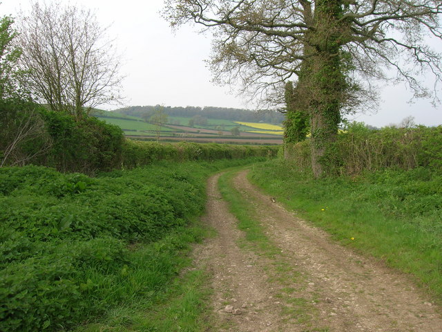
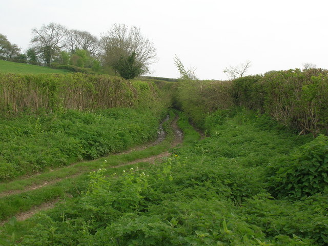
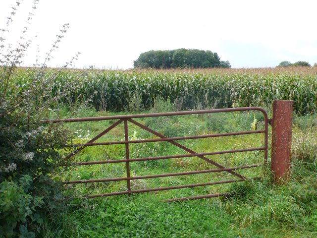
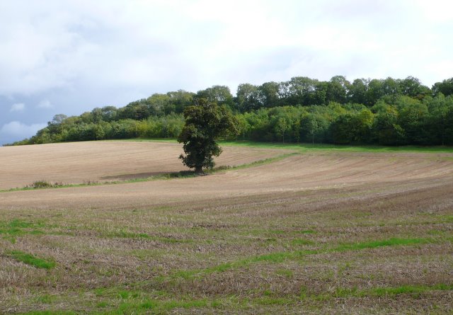
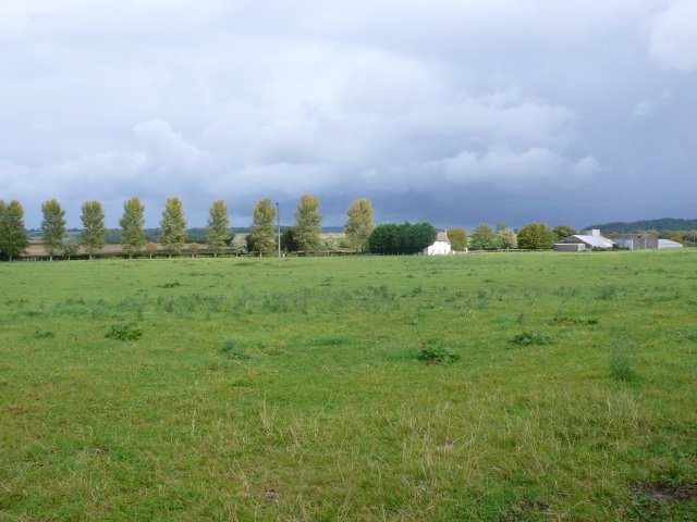
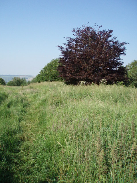
Fir Copse is a picturesque woodland located in Somerset, England. It covers an area of approximately 50 acres and is known for its dense growth of fir trees, which give the copse its name. The woodland is situated in a rural area, surrounded by rolling countryside and farmland.

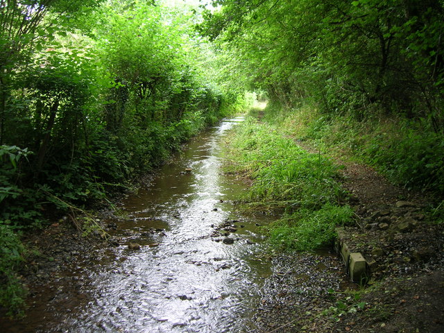
The copse is primarily composed of various species of fir trees, including Douglas fir, Norway spruce, and Scots pine. These towering evergreen trees create a dense canopy, providing a habitat for a diverse range of wildlife. The forest floor is covered in a thick layer of fallen needles, creating a soft and springy carpet underfoot.

Fir Copse is a popular destination for nature enthusiasts and hikers, offering a tranquil and serene environment for outdoor activities. There are several well-maintained trails that wind through the copse, allowing visitors to explore its natural beauty and observe the flora and fauna. The copse is also home to a variety of bird species, making it a haven for birdwatchers.

In addition to its natural appeal, Fir Copse has historical significance. It is believed to have been part of an ancient woodland that has existed for centuries. The copse has been carefully managed over the years to preserve its natural charm and ecological balance.

Overall, Fir Copse in Somerset is a captivating woodland that offers a peaceful retreat from the hustle and bustle of everyday life. With its majestic fir trees, diverse wildlife, and scenic trails, it is a true gem for nature lovers and outdoor enthusiasts.

If you have any feedback on the listing, please let us know in the comments section below.
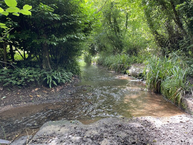
Fir Copse Images

Images are sourced within 2km of 51.357741/-2.4931256 or Grid Reference ST6562. Thanks to Geograph Open Source API. All images are credited.

Ordnance Survey Cut Mark This OS cut mark can be found on the wall north side of the road. It marks a point 120.250m above mean sea level.
Ordnance Survey Cut Mark
This OS cut mark can be found on the wall north side of the road. It marks a point 120.250m above mean sea level.
Ordnance Survey Cut Mark This OS cut mark can be found on the NW angle of St Peter's Church. It marks a point 123.834m above mean sea level.
Ordnance Survey Cut Mark
This OS cut mark can be found on the NW angle of St Peter's Church. It marks a point 123.834m above mean sea level.
Ordnance Survey Cut Mark This OS cut mark can be found on the Hall SE side of the road. It marks a point 122.624m above mean sea level.
Ordnance Survey Cut Mark
This OS cut mark can be found on the Hall SE side of the road. It marks a point 122.624m above mean sea level.
Ordnance Survey Cut Mark This OS cut mark can be found on the old chapel NW side of the road. It marks a point 120.277m above mean sea level.
Ordnance Survey Cut Mark
This OS cut mark can be found on the old chapel NW side of the road. It marks a point 120.277m above mean sea level.
Ordnance Survey Cut Mark This OS cut mark can be found on Sun Galore, SE side of the road. It marks a point 126.355m above mean sea level.
Ordnance Survey Cut Mark
This OS cut mark can be found on Sun Galore, SE side of the road. It marks a point 126.355m above mean sea level.
Ordnance Survey Cut Mark This OS cut mark can be found on the wall south side of the road. It marks a point 130.692m above mean sea level.
Ordnance Survey Cut Mark
This OS cut mark can be found on the wall south side of the road. It marks a point 130.692m above mean sea level.
Ordnance Survey Cut Mark This OS cut mark can be found on the wall south side of the road. It marks a point 111.883m above mean sea level.
Ordnance Survey Cut Mark
This OS cut mark can be found on the wall south side of the road. It marks a point 111.883m above mean sea level.
Ordnance Survey Cut Mark This OS cut mark can be found on the NW angle of All Saints Church. It marks a point 119.661m above mean sea level.
Ordnance Survey Cut Mark
This OS cut mark can be found on the NW angle of All Saints Church. It marks a point 119.661m above mean sea level.
Ordnance Survey Cut Mark This OS cut mark can be found on a building at the Sewage Works. It marks a point 90.613m above mean sea level.
Ordnance Survey Cut Mark
This OS cut mark can be found on a building at the Sewage Works. It marks a point 90.613m above mean sea level.
Ford on Bathford Brook This ford on the Bathford Brook is found at Tuckingmill near Compton Dando. A video of the ford can be viewed at:

<span class="nowrap"><a title="https://youtu.be/Q56WbYovyYI" rel="nofollow ugc noopener" href="https://youtu.be/Q56WbYovyYI">Link</a><img style="margin-left:2px;" alt="External link" title="External link - shift click to open in new window" src="https://s1.geograph.org.uk/img/external.png" width="10" height="10"/></span>

I shall probably never forget our visit here, not for the delightful ford but because I parked the Landcruiser on the grass verge at the top of the track and on leaving managed to ‘pop’ the bottom arm of the drive shaft and spent the next 15 hours waiting to be recovered by the RAC. Many thanks to all the helpful villagers and the tenant farmer who kept checking up on us as well as the local community police officers. We were fortunate it didn’t happen on one of the tracks and that there was the Compton Inn close by to provide us with a hearty meal.
Ford on Bathford Brook
This ford on the Bathford Brook is found at Tuckingmill near Compton Dando. A video of the ford can be viewed at: LinkExternal link I shall probably never forget our visit here, not for the delightful ford but because I parked the Landcruiser on the grass verge at the top of the track and on leaving managed to ‘pop’ the bottom arm of the drive shaft and spent the next 15 hours waiting to be recovered by the RAC. Many thanks to all the helpful villagers and the tenant farmer who kept checking up on us as well as the local community police officers. We were fortunate it didn’t happen on one of the tracks and that there was the Compton Inn close by to provide us with a hearty meal.
Byway near Stanton Prior
Old Byway track Looking south away from the village of Stanton Prior
Old Byway track
Looking south away from the village of Stanton Prior
Bathford Brook flows down the Byway to Tucking Mill The last 100 metres or so of this dead-end Byway is the bed of the stream.  After the mill the access is for pedestrians (and residents) only.
Bathford Brook flows down the Byway to Tucking Mill
The last 100 metres or so of this dead-end Byway is the bed of the stream. After the mill the access is for pedestrians (and residents) only.
Maize Field This gate leads into a ripening maize field close to where the Compton Dando road leaves the minor road between Hunstrete and Woollard
Maize Field
This gate leads into a ripening maize field close to where the Compton Dando road leaves the minor road between Hunstrete and Woollard
Fields near Hunstrete These fields had been harvested a few weeks ago and the new grass growth was already starting to show through.
Fields near Hunstrete
These fields had been harvested a few weeks ago and the new grass growth was already starting to show through.
Wick farm A large farm approached along an avenue of polars from the road between Wollard and Hunstrete.
Wick farm
A large farm approached along an avenue of polars from the road between Wollard and Hunstrete.
Common Wood, Hunstrete near Bath Things you do not expect to see in a common wood.
Common Wood, Hunstrete near Bath
Things you do not expect to see in a common wood.
Entrance to Valley Farm, near Marksbury
Show me another place!

Fir Copse is located at Grid Ref: ST6562 (Lat: 51.357741, Lng: -2.4931256)

Unitary Authority: Bath and North East Somerset

Police Authority: Avon and Somerset

What 3 Words

///race.swanky.imprinted. Near Compton Dando, Somerset

Related Wikis

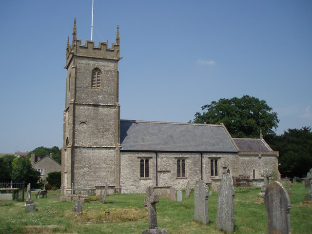
Church of St Peter, Marksbury

The Church of St Peter in Marksbury, Somerset, England dates from the 12th century, although most of the current fabric is from the 15th century and is...

Marksbury

Marksbury is a small village and civil parish on the eastern edge of the affluent Chew Valley in Somerset, about 4 miles (6.4 km) from Keynsham and 7 miles...

Hunstrete

Hunstrete (grid reference ST625643) is a small village on the River Chew in the Chew Valley, Bath and North East Somerset, England. It falls within the...
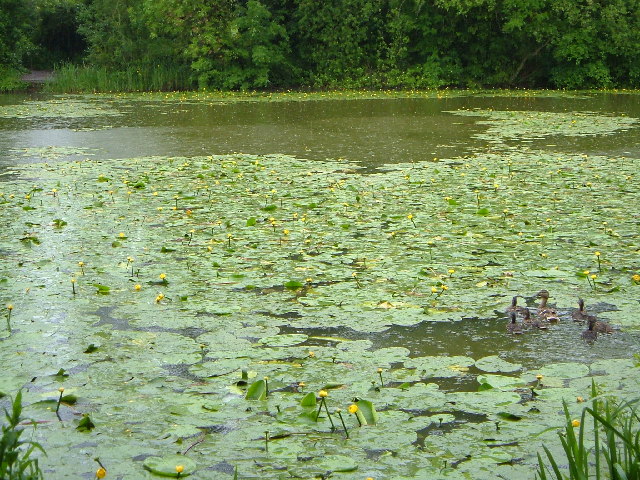
Hunstrete Lake

Hunstrete Lake (grid reference ST646622) is a mature lake of 5 acres (20,000 m2). Two new lakes of 3.5 acres (14,000 m2) were constructed alongside in...

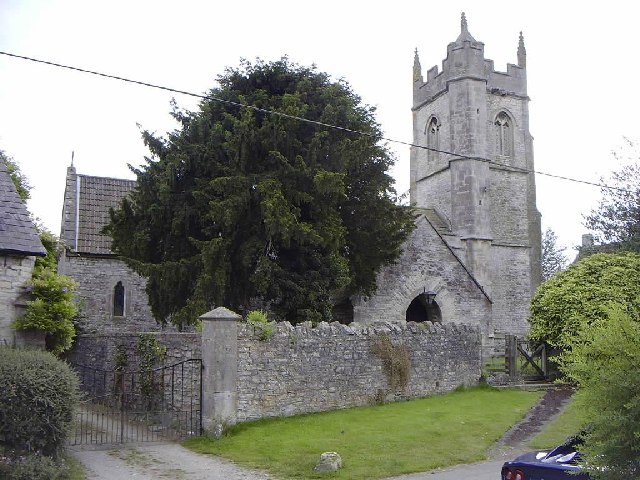
Church of All Saints, Farmborough

The Church of All Saints is an Anglican parish church in Farmborough, Somerset, England. It was principally built in the 15th century (with parts dating...

Farmborough

Farmborough is a small village and civil parish, 6 miles (9.7 km) south west of Bath in Somerset, England. It straddles both the A39 and A368 roads. The...

Stantonbury Camp

Stantonbury Camp is the site of an Iron Age hill fort near Stanton Prior within the parish of Marksbury in Somerset, England. It is a Scheduled Ancient...

Church of St Lawrence, Stanton Prior

The Anglican Church of St Lawrence in Stanton Prior, Somerset, England, has its origins in the 12th century but is mainly 15th century. The church has...

Nearby Amenities

Located within 500m of 51.357741,-2.4931256
Power: pole
Lat/Long: 51.3580728/-2.4859578
Power: pole
Lat/Long: 51.3584782/-2.4863506
The data included in this document is from www.openstreetmap.org. The data is made available under ODbL.

Have you been to Fir Copse?

Leave your review of Fir Copse below (or comments, questions and feedback).