Castle Wood

Wood, Forest in Northumberland

England

Castle Wood

Forest Pool near Kielder Viaduct
Forest Pool near Kielder Viaduct Credit: Philip Cornwall

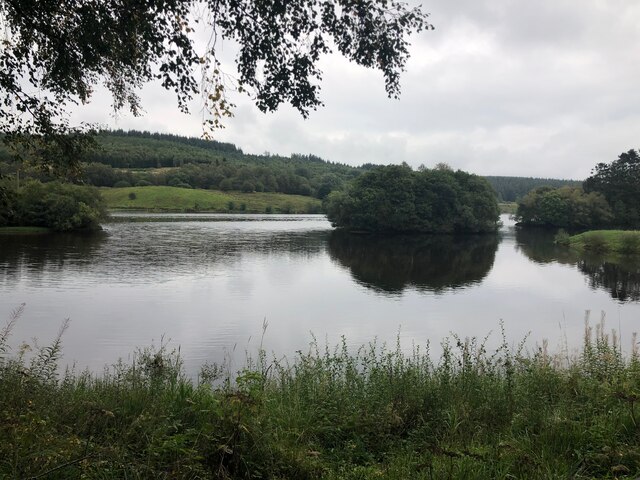
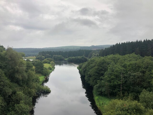
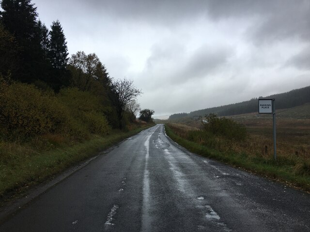
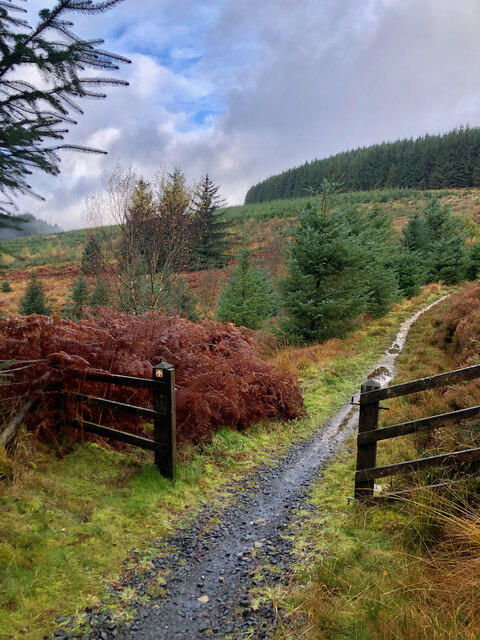
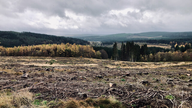
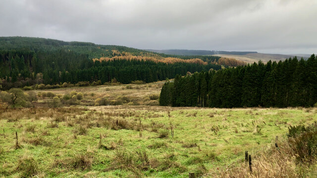
Castle Wood is a picturesque forest located in the county of Northumberland, England. Situated near the scenic countryside, this woodland is known for its natural beauty and historical significance. Covering an extensive area of approximately 400 acres, Castle Wood offers visitors a tranquil escape from the bustling city life.

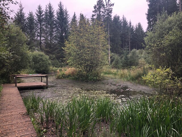
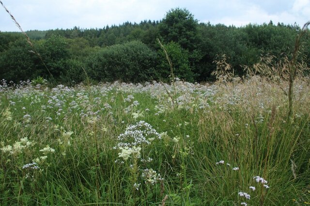
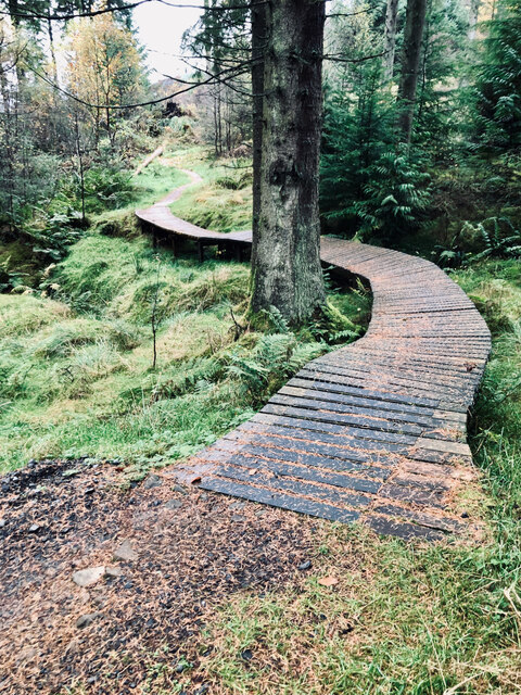
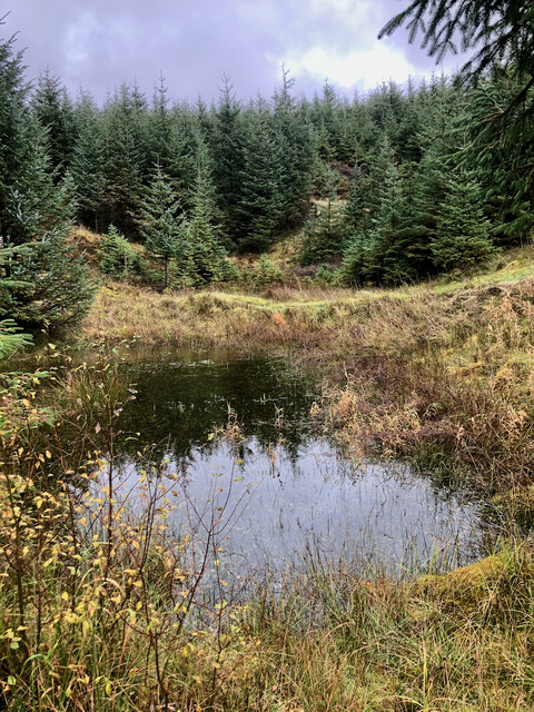
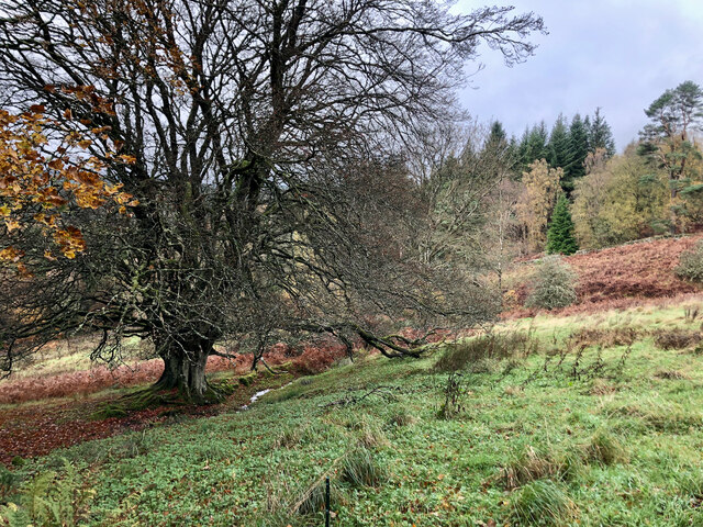
The forest is characterized by its dense canopy of oak, beech, and pine trees, creating a serene and peaceful atmosphere. Walking through the forest, one can witness a rich diversity of flora and fauna, including various wildflowers, mosses, and ferns. The forest floor is also home to a wide range of wildlife, such as deer, foxes, squirrels, and numerous bird species that can be spotted throughout the year.

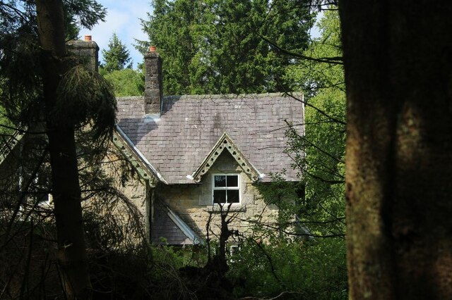
The name "Castle Wood" derives from the presence of a medieval castle ruins within its boundaries. The remnants of the castle, believed to date back to the 12th century, provide a fascinating glimpse into the region's past. The castle ruins are a popular attraction among history enthusiasts and hikers, who can explore the site and learn about its historical significance.

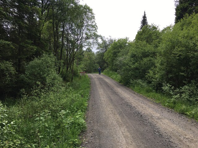
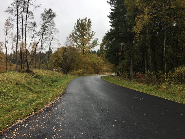
Castle Wood is not only a haven for nature lovers and history buffs but also offers various recreational activities. The forest features well-marked trails, allowing visitors to enjoy scenic walks, jogging, and cycling. It also provides picnic areas for families and friends to relax and soak in the natural surroundings.

With its idyllic setting, diverse wildlife, and historical ruins, Castle Wood in Northumberland offers a delightful experience for anyone seeking to immerse themselves in the beauty of nature and uncover the region's rich heritage.

If you have any feedback on the listing, please let us know in the comments section below.
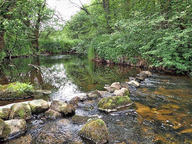
Castle Wood Images

Images are sourced within 2km of 55.237103/-2.5800101 or Grid Reference NY6393. Thanks to Geograph Open Source API. All images are credited.

Forest Pool near Kielder Viaduct
View from Hide on Bakethin Nature Reserve Link to Northumberland Wildlife Trust page on Bakethin Reserve <span class="nowrap"><a title="https://www.nwt.org.uk/nature-reserves/bakethin" rel="nofollow ugc noopener" href="https://www.nwt.org.uk/nature-reserves/bakethin">Link</a><img style="margin-left:2px;" alt="External link" title="External link - shift click to open in new window" src="https://s1.geograph.org.uk/img/external.png" width="10" height="10"/></span>
View from Hide on Bakethin Nature Reserve
Link to Northumberland Wildlife Trust page on Bakethin Reserve LinkExternal link
View of river North Tyne as it enters Bakethin Reservoir Taken from the disused railway viaduct that crosses the river.
View of river North Tyne as it enters Bakethin Reservoir
Taken from the disused railway viaduct that crosses the river.
Forestry road near Kielder village
Building adjacent Kielder United Reformed Church
Wild flowers in meadow opposite Kielder United Reformed Church
Minor road near Kielder Castle
Minor road near Kielder village
Elevated bike track
Elevated bike track
Path/fence crossing
Path/fence crossing
Clear felling; view towards Kielder Castle
North Tyne Valley
North Tyne Valley
Clearing, Sandy Sike
Ordnance Survey Cut Mark This OS cut mark can be found on the stone containing the name of Butteryhaugh Bridge. It marks a point 189.360m above mean sea level.
Ordnance Survey Cut Mark
This OS cut mark can be found on the stone containing the name of Butteryhaugh Bridge. It marks a point 189.360m above mean sea level.
Ordnance Survey Cut Mark This OS cut mark can be found on the east face of Station Cottage. It marks a point 208.578m above mean sea level.
Ordnance Survey Cut Mark
This OS cut mark can be found on the east face of Station Cottage. It marks a point 208.578m above mean sea level.
Ordnance Survey Rivet This OS rivet can be found on the west parapet of Cleugh Bridge. It marks a point 209.184m above mean sea level.
Ordnance Survey Rivet
This OS rivet can be found on the west parapet of Cleugh Bridge. It marks a point 209.184m above mean sea level.
River North Tyne
River North Tyne
Show me another place!

Castle Wood is located at Grid Ref: NY6393 (Lat: 55.237103, Lng: -2.5800101)

Unitary Authority: Northumberland

Police Authority: Northumbria

What 3 Words

///rooftop.blaring.pedicure. Near Rochester, Northumberland

Nearby Locations

Castle Wood Butteryhaugh

Related Wikis

Kielder

Kielder is a small, remote village in western Northumberland, England. Located at the head of Kielder Water and in the north west of Kielder Forest, the...

Butteryhaugh

Butteryhaugh is a village in Northumberland, in England. It is situated a short distance to the south-east of Kielder. Although a separate "village" from...

Kielder railway station

Kielder railway station is a closed railway station that served the village hamlet of Kielder, Northumberland. == History == Kielder railway station was...

Kielder Forest Star Camp

The Kielder Forest Star Camp is an annual star party held each autumn and spring in Kielder Forest. The five night event is based on the Kielder Campsite...

Nearby Amenities

Located within 500m of 55.237103,-2.5800101
Barrier: toll_booth
Lat/Long: 55.2347443/-2.5802067
Cafe
Cafe at the Castle
Addr City: Kileder
Addr Postcode: NE48 1ER
Cuisine: regional
Internet Access: yes
Note: Well behaved dogs allowed on leads
Phone: +44 1434 250100
Smoking: no
Lat/Long: 55.2338306/-2.5801659
Kielder Visitor Centre
Addr City: Kileder
Addr Postcode: NE48 1ER
Information: office
Phone: +44 1434 250209
Tourism: information
Website: http://www.visitkielder.com/visit/kielder-castle-visitor-centre
Lat/Long: 55.2339093/-2.5804878
Post Office
Kielder Post Office
Addr City: Hexham
Addr Country: GB
Addr Housenumber: 32
Addr Postcode: NE48 1EQ
Addr Street: Castle Drive
Addr Village: Kielder
Brand: Post Office
Brand Wikidata: Q1783168
Contact Website: https://www.postoffice.co.uk/branch-finder/4593294/kielder
Opening Hours: Mo,We-Sa 09:30-13:00,14:00-16:00; Tu 09:30-12:00
Ref Pol Id: 15292
Lat/Long: 55.2345774/-2.5853449
Kielder
Place: village
Lat/Long: 55.2343585/-2.585124
Minotaur Maze
Artist Name: Nick Coombe and Shona Kitchen
Tourism: artwork
Website: http://kielderartandarchitecture.com/art-architecture/minotaur.html
Lat/Long: 55.2333678/-2.5809673
Twenty Seven B&B
Tourism: guest_house
Lat/Long: 55.2344387/-2.5859602
Post Box
Ref: NE48 89
Lat/Long: 55.2345315/-2.5854496
Toilets
Access: yes
Changing Table: yes
Changing Table Count: 1
Changing Table Location: unisex_toilet
Drinking Water: no
Fee: no
Female: yes
Male: yes
Toilets Disposal: flush
Unisex: yes
Wheelchair: yes
Lat/Long: 55.234973/-2.5806075
Leisure: playground
Lat/Long: 55.2367868/-2.5865947
The grass seemed darker than ever
Artist Name: Fiona Curran
Tourism: artwork
Website: http://kielderartandarchitecture.com/art-architecture/the-grass-seemed-darker-than-ever.html
Lat/Long: 55.2364638/-2.5731551
Bicycle Parking
Bicycle Parking: stands
Capacity: 18
Check Date Capacity: 2021-11-13
Covered: no
Lat/Long: 55.2351106/-2.5803595
Bicycle Parking
Bicycle Parking: stands
Capacity: 10
Covered: no
Lit: no
Lat/Long: 55.2339666/-2.5807303
Toilets
Changing Table: yes
Changing Table Count: 1
Changing Table Location: unisex_toilet
Drinking Water: no
Female: yes
Male: yes
Unisex: yes
Wheelchair: yes
Lat/Long: 55.2339815/-2.5802502
Direction: SE
Generator Method: photovoltaic
Generator Output Electricity: yes
Generator Solar Modules: 64
Generator Source: solar
Generator Type: solar_photovoltaic_panel
Location: roof
Power: generator
Lat/Long: 55.233574/-2.5778895
Direction: 145
Fixme: possible solar hot water
Generator Method: photovoltaic
Generator Output Electricity: yes
Generator Solar Modules: 2
Generator Source: solar
Generator Type: solar_photovoltaic_panel
Location: roof
Power: generator
Lat/Long: 55.232709/-2.5790583
Direction: 145
Fixme: possible solar hot water
Generator Method: photovoltaic
Generator Output Electricity: yes
Generator Solar Modules: 2
Generator Source: solar
Generator Type: solar_photovoltaic_panel
Location: roof
Power: generator
Lat/Long: 55.2326874/-2.579133
Direction: 145
Fixme: possible solar hot water
Generator Method: photovoltaic
Generator Output Electricity: yes
Generator Solar Modules: 2
Generator Source: solar
Generator Type: solar_photovoltaic_panel
Location: roof
Power: generator
Lat/Long: 55.23266/-2.5792003
Direction: 145
Fixme: possible solar hot water
Generator Method: photovoltaic
Generator Output Electricity: yes
Generator Solar Modules: 2
Generator Source: solar
Generator Type: solar_photovoltaic_panel
Location: roof
Power: generator
Lat/Long: 55.2326269/-2.5792603
Noexit: yes
Lat/Long: 55.2333811/-2.5809789
Noexit: yes
Lat/Long: 55.2333363/-2.5809639
Noexit: yes
Lat/Long: 55.2333393/-2.5810411
Noexit: yes
Lat/Long: 55.2333256/-2.5810337
Noexit: yes
Lat/Long: 55.2333005/-2.5810106
Noexit: yes
Lat/Long: 55.2333057/-2.5809747
Noexit: yes
Lat/Long: 55.233308/-2.5809566
Noexit: yes
Lat/Long: 55.2333936/-2.5808778
Noexit: yes
Lat/Long: 55.2333648/-2.5809298
Noexit: yes
Lat/Long: 55.2333863/-2.580939
Noexit: yes
Lat/Long: 55.2334116/-2.5809338
Noexit: yes
Lat/Long: 55.2333906/-2.5809003
Noexit: yes
Lat/Long: 55.233381/-2.5810594
Noexit: yes
Lat/Long: 55.233395/-2.5810653
Noexit: yes
Lat/Long: 55.2334074/-2.5810688
Noexit: yes
Lat/Long: 55.2333431/-2.5809097
Noexit: yes
Lat/Long: 55.2333319/-2.580907
Historic: milestone
Noexit: yes
Lat/Long: 55.2333716/-2.5808014
Noexit: yes
Lat/Long: 55.233341/-2.5808738
Noexit: yes
Lat/Long: 55.2333386/-2.5808232
Noexit: yes
Lat/Long: 55.2333403/-2.5807655
Entrance: exit
Lat/Long: 55.2334473/-2.580796
Entrance: main
Lat/Long: 55.2334501/-2.5807843
Telephone
Fee: yes
Payment Coins: yes
Lat/Long: 55.2368745/-2.5867141
Defibrillator
Defibrillator Location: On the front of the reception building in a green and yellow box
Emergency: defibrillator
Indoor: no
Lat/Long: 55.237112/-2.5866418
Entrance: exit
Maxheight: 0.5
Source Maxheight: estimated
Lat/Long: 55.2332898/-2.5810172
Entrance: main
Lat/Long: 55.2351783/-2.5803463
Information: map
Map Size: site
Mtb: yes
Tourism: information
Lat/Long: 55.2360573/-2.5798962
Information: board
Tourism: information
Lat/Long: 55.2359778/-2.5802194
Vending Machine
Vending: parking_tickets
Lat/Long: 55.2359617/-2.5802234
The data included in this document is from www.openstreetmap.org. The data is made available under ODbL.

Have you been to Castle Wood?

Leave your review of Castle Wood below (or comments, questions and feedback).