Butteryhaugh

Settlement in Northumberland

England

Butteryhaugh

Forestry road near Kielder village
Forestry road near Kielder village Credit: Steven Brown

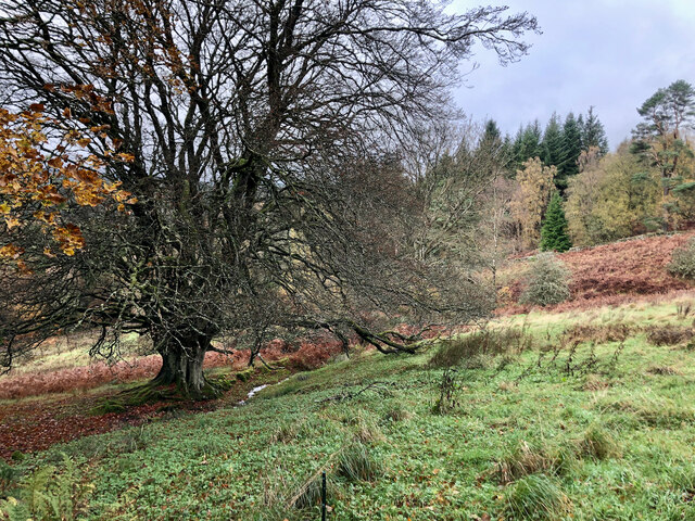
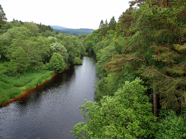
Butteryhaugh is a small village located in the county of Northumberland, in the northeast of England. Situated on the southern bank of the River Tyne, it lies approximately 4 miles west of the town of Hexham.

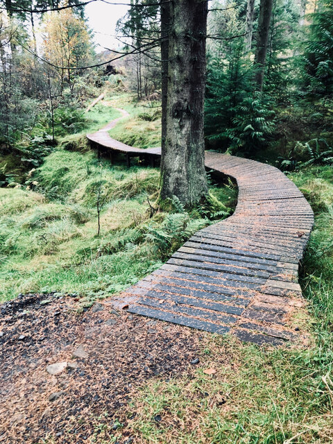
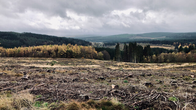
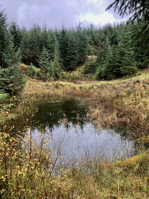
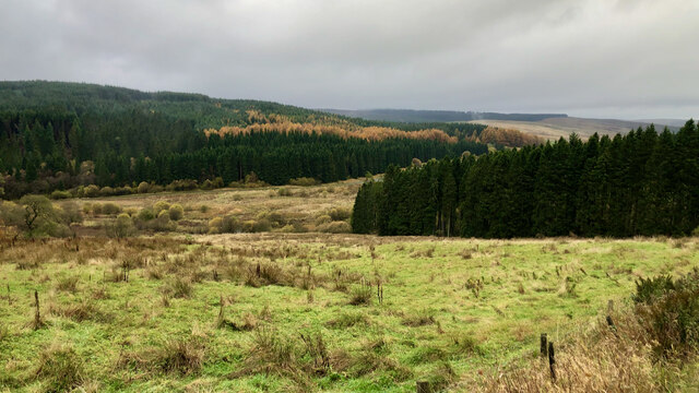
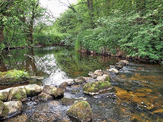
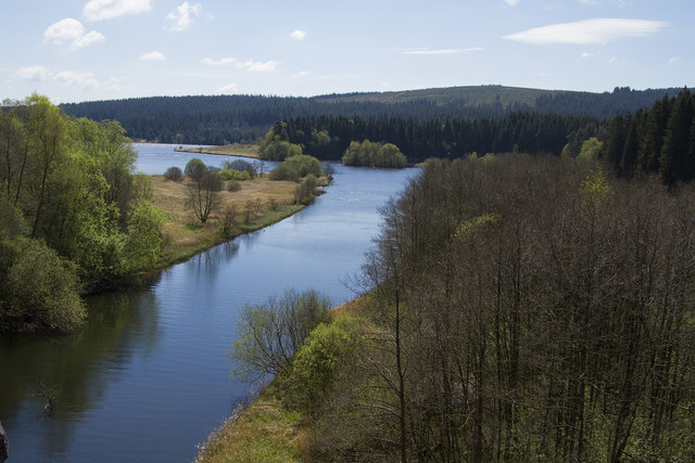
The village is known for its picturesque setting, surrounded by rolling hills and lush greenery, making it a popular destination for nature lovers and outdoor enthusiasts. The River Tyne, flowing nearby, offers opportunities for fishing and boating.

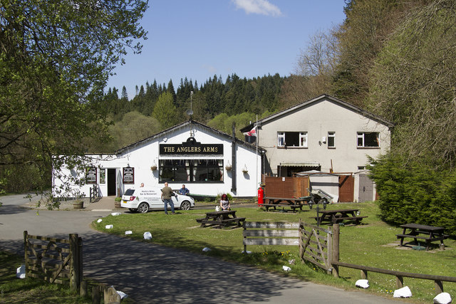
Butteryhaugh is a tight-knit community with a population of around 200 residents. It mainly consists of residential properties, including traditional stone cottages and more modern houses. The village retains its rural charm and tranquility, offering a peaceful escape from the hustle and bustle of city life.

Despite its small size, Butteryhaugh benefits from its proximity to Hexham, which provides essential services and amenities such as schools, shops, and healthcare facilities. The village is also well-connected, with good road links to nearby towns and cities, including Newcastle upon Tyne, providing further access to a range of amenities and attractions.

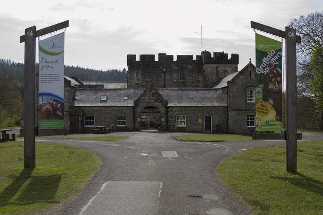
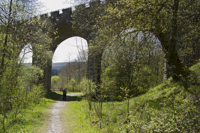
The area surrounding Butteryhaugh is rich in history and offers various opportunities for exploration. Nearby attractions include Hexham Abbey, Hadrian's Wall, and the Northumberland National Park, which boasts stunning landscapes and excellent hiking trails.

Overall, Butteryhaugh offers a peaceful and idyllic rural lifestyle, while still providing easy access to essential services and the wider region's attractions.

If you have any feedback on the listing, please let us know in the comments section below.
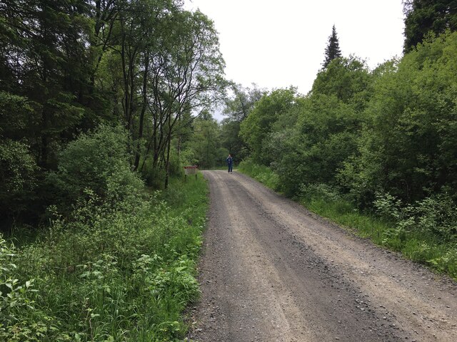
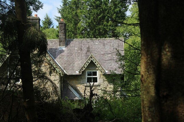
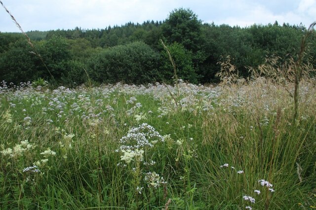
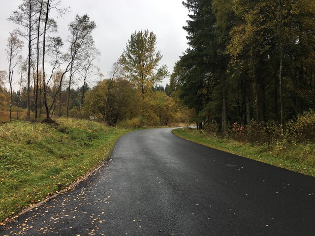
Butteryhaugh Images

Images are sourced within 2km of 55.230201/-2.580592 or Grid Reference NY6393. Thanks to Geograph Open Source API. All images are credited.

Forestry road near Kielder village
Building adjacent Kielder United Reformed Church
Wild flowers in meadow opposite Kielder United Reformed Church
Minor road near Kielder Castle
Elevated bike track
Elevated bike track
Clear felling; view towards Kielder Castle
North Tyne Valley
North Tyne Valley
Clearing, Sandy Sike
Ordnance Survey Cut Mark This OS cut mark can be found on the stone containing the name of Butteryhaugh Bridge. It marks a point 189.360m above mean sea level.
Ordnance Survey Cut Mark
This OS cut mark can be found on the stone containing the name of Butteryhaugh Bridge. It marks a point 189.360m above mean sea level.
Ordnance Survey Cut Mark This OS cut mark can be found on the east face of Station Cottage. It marks a point 208.578m above mean sea level.
Ordnance Survey Cut Mark
This OS cut mark can be found on the east face of Station Cottage. It marks a point 208.578m above mean sea level.
Ordnance Survey Rivet This OS rivet can be found on the west parapet of Cleugh Bridge. It marks a point 209.184m above mean sea level.
Ordnance Survey Rivet
This OS rivet can be found on the west parapet of Cleugh Bridge. It marks a point 209.184m above mean sea level.
River North Tyne
River North Tyne
River North Tyne
River North Tyne
Kielder Castle This is not really a true castle but a hunting lodge built by the Duke of Northumberland in the late 1780's. Originally it was in very open land but is now hemmed in by the Kielder Forest and very close to Kielder Water. There are several interesting walks from here, of varying lengths from less than a mile to more than eight miles as well as lots of cycle tracks / trails. One walk inparticular will interest very young children - the Gruffalo Trail.
Kielder Castle
This is not really a true castle but a hunting lodge built by the Duke of Northumberland in the late 1780's. Originally it was in very open land but is now hemmed in by the Kielder Forest and very close to Kielder Water. There are several interesting walks from here, of varying lengths from less than a mile to more than eight miles as well as lots of cycle tracks / trails. One walk inparticular will interest very young children - the Gruffalo Trail.
The Kielder Viaduct The Kielder Viaduct was built to match the Kielder Castle with its false arrow slits and the "crenellations" i.e. the battlements.  When built it was in open ground but since then the Kielder Forest has been planted and grown up as well as the Kielder Reservoir has been built and filled which have both impinged on the viaduct. The viaduct itself is special as it is a skewed viaduct with the lines of stones set at an angle to the arches which made building it rather difficult.
The Kielder Viaduct
The Kielder Viaduct was built to match the Kielder Castle with its false arrow slits and the "crenellations" i.e. the battlements. When built it was in open ground but since then the Kielder Forest has been planted and grown up as well as the Kielder Reservoir has been built and filled which have both impinged on the viaduct. The viaduct itself is special as it is a skewed viaduct with the lines of stones set at an angle to the arches which made building it rather difficult.
The top of the Kielder Reservoir The river flowing into Kielder water at this point is the Kielder Burn. This is the most northerly of the various inflows.
The top of the Kielder Reservoir
The river flowing into Kielder water at this point is the Kielder Burn. This is the most northerly of the various inflows.
The Angler's Arms public house The pub is at the very head of the Kielder Reservoir, It serves the small Kielder Village but presumably gets most of its trade from the tourists visiting the castle and the paths and cycle trails of the Kielder area.
The Angler's Arms public house
The pub is at the very head of the Kielder Reservoir, It serves the small Kielder Village but presumably gets most of its trade from the tourists visiting the castle and the paths and cycle trails of the Kielder area.
Show me another place!

Butteryhaugh is located at Grid Ref: NY6393 (Lat: 55.230201, Lng: -2.580592)

Unitary Authority: Northumberland

Police Authority: Northumbria

What 3 Words

///dreamer.birthdays.depravity. Near Rochester, Northumberland

Nearby Locations

Castle Wood Butteryhaugh

Related Wikis

Kielder

Kielder is a small, remote village in western Northumberland, England. Located at the head of Kielder Water and in the north west of Kielder Forest, the...

Butteryhaugh

Butteryhaugh is a village in Northumberland, in England. It is situated a short distance to the south-east of Kielder. Although a separate "village" from...

Kielder railway station

Kielder railway station is a closed railway station that served the village hamlet of Kielder, Northumberland. == History == Kielder railway station was...
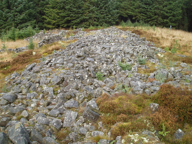
Devil's Lapful

Devil's Lapful is an archaeological site in Northumberland, England, in Kielder Forest about 0.8 miles (1.3 km) south-east of Kielder. The site, a Neolithic...

Nearby Amenities

Located within 500m of 55.230201,-2.580592
Cafe
Cafe at the Castle
Addr City: Kileder
Addr Postcode: NE48 1ER
Cuisine: regional
Internet Access: yes
Note: Well behaved dogs allowed on leads
Phone: +44 1434 250100
Smoking: no
Lat/Long: 55.2338306/-2.5801659
Kielder Visitor Centre
Addr City: Kileder
Addr Postcode: NE48 1ER
Information: office
Phone: +44 1434 250209
Tourism: information
Website: http://www.visitkielder.com/visit/kielder-castle-visitor-centre
Lat/Long: 55.2339093/-2.5804878
Turn off for Kielder Observatory.
Lat/Long: 55.2298511/-2.5857049
Library
Kielder Library
Source: survey
Wikidata: Q54810887
Lat/Long: 55.2318658/-2.5796014
Minotaur Maze
Artist Name: Nick Coombe and Shona Kitchen
Tourism: artwork
Website: http://kielderartandarchitecture.com/art-architecture/minotaur.html
Lat/Long: 55.2333678/-2.5809673
Crossing
Crossing: unmarked
Crossing Island: no
Kerb: lowered
Tactile Paving: no
Lat/Long: 55.2303698/-2.5799158
Childcare
Little Squirrels Nursery
Lat/Long: 55.2319387/-2.5793035
Telephone
Booth: KX100
Check Date: 2021-11-13
Covered: booth
Lat/Long: 55.2302811/-2.5808085
Post Box
Check Date: 2021-11-13
Post Box Type: lamp
Ref: NE48 12
Lat/Long: 55.2302558/-2.5807711
Bicycle Parking
Bicycle Parking: stands
Capacity: 10
Covered: no
Lit: no
Lat/Long: 55.2339666/-2.5807303
Toilets
Changing Table: yes
Changing Table Count: 1
Changing Table Location: unisex_toilet
Drinking Water: no
Female: yes
Male: yes
Unisex: yes
Wheelchair: yes
Lat/Long: 55.2339815/-2.5802502
Direction: SE
Generator Method: photovoltaic
Generator Output Electricity: yes
Generator Solar Modules: 64
Generator Source: solar
Generator Type: solar_photovoltaic_panel
Location: roof
Power: generator
Lat/Long: 55.233574/-2.5778895
Direction: 145
Fixme: possible solar hot water
Generator Method: photovoltaic
Generator Output Electricity: yes
Generator Solar Modules: 2
Generator Source: solar
Generator Type: solar_photovoltaic_panel
Location: roof
Power: generator
Lat/Long: 55.232709/-2.5790583
Direction: 145
Fixme: possible solar hot water
Generator Method: photovoltaic
Generator Output Electricity: yes
Generator Solar Modules: 2
Generator Source: solar
Generator Type: solar_photovoltaic_panel
Location: roof
Power: generator
Lat/Long: 55.2326874/-2.579133
Direction: 145
Fixme: possible solar hot water
Generator Method: photovoltaic
Generator Output Electricity: yes
Generator Solar Modules: 2
Generator Source: solar
Generator Type: solar_photovoltaic_panel
Location: roof
Power: generator
Lat/Long: 55.23266/-2.5792003
Direction: 145
Fixme: possible solar hot water
Generator Method: photovoltaic
Generator Output Electricity: yes
Generator Solar Modules: 2
Generator Source: solar
Generator Type: solar_photovoltaic_panel
Location: roof
Power: generator
Lat/Long: 55.2326269/-2.5792603
Direction: 145
Fixme: possible solar hot water
Generator Method: photovoltaic
Generator Output Electricity: yes
Generator Solar Modules: 2
Generator Source: solar
Generator Type: solar_photovoltaic_panel
Location: roof
Power: generator
Lat/Long: 55.2326053/-2.5793349
Direction: 145
Fixme: possible solar hot water
Generator Method: photovoltaic
Generator Output Electricity: yes
Generator Solar Modules: 2
Generator Source: solar
Generator Type: solar_photovoltaic_panel
Location: roof
Power: generator
Lat/Long: 55.2325721/-2.5793949
Direction: SSE
Generator Method: photovoltaic
Generator Output Electricity: yes
Generator Source: solar
Generator Type: solar_photovoltaic_panel
Location: roof
Power: generator
Lat/Long: 55.2301921/-2.5796591
Direction: SSE
Generator Method: photovoltaic
Generator Output Electricity: yes
Generator Source: solar
Generator Type: solar_photovoltaic_panel
Location: roof
Power: generator
Lat/Long: 55.2302334/-2.5795116
Direction: 165
Generator Method: photovoltaic
Generator Output Electricity: yes
Generator Solar Modules: 2
Generator Source: solar
Generator Type: solar_photovoltaic_panel
Location: roof
Note: possibly hot water
Power: generator
Lat/Long: 55.2324769/-2.5798103
Direction: 165
Generator Method: photovoltaic
Generator Output Electricity: yes
Generator Solar Modules: 2
Generator Source: solar
Generator Type: solar_photovoltaic_panel
Location: roof
Note: possibly hot water
Power: generator
Lat/Long: 55.2324625/-2.5799034
Direction: 165
Generator Method: photovoltaic
Generator Output Electricity: yes
Generator Solar Modules: 2
Generator Source: solar
Generator Type: solar_photovoltaic_panel
Location: roof
Note: possibly hot water
Power: generator
Lat/Long: 55.2324481/-2.5799965
Direction: 165
Generator Method: photovoltaic
Generator Output Electricity: yes
Generator Solar Modules: 2
Generator Source: solar
Generator Type: solar_photovoltaic_panel
Location: roof
Note: possibly hot water
Power: generator
Lat/Long: 55.2324337/-2.5800895
Direction: 165
Generator Method: photovoltaic
Generator Output Electricity: yes
Generator Solar Modules: 2
Generator Source: solar
Generator Type: solar_photovoltaic_panel
Location: roof
Note: possibly hot water
Power: generator
Lat/Long: 55.2324194/-2.5801826
Direction: 165
Generator Method: photovoltaic
Generator Output Electricity: yes
Generator Solar Modules: 2
Generator Source: solar
Generator Type: solar_photovoltaic_panel
Location: roof
Note: possibly hot water
Power: generator
Lat/Long: 55.232405/-2.5802757
Direction: SSE
Generator Method: photovoltaic
Generator Output Electricity: yes
Generator Solar Modules: 39
Generator Source: solar
Generator Type: solar_photovoltaic_panel
Location: roof
Power: generator
Lat/Long: 55.2318857/-2.5792913
Noexit: yes
Lat/Long: 55.2333811/-2.5809789
Noexit: yes
Lat/Long: 55.2333363/-2.5809639
Noexit: yes
Lat/Long: 55.2333393/-2.5810411
Noexit: yes
Lat/Long: 55.2333256/-2.5810337
Noexit: yes
Lat/Long: 55.2333005/-2.5810106
Noexit: yes
Lat/Long: 55.2333057/-2.5809747
Noexit: yes
Lat/Long: 55.233308/-2.5809566
Noexit: yes
Lat/Long: 55.2333936/-2.5808778
Noexit: yes
Lat/Long: 55.2333648/-2.5809298
Noexit: yes
Lat/Long: 55.2333863/-2.580939
Noexit: yes
Lat/Long: 55.2334116/-2.5809338
Noexit: yes
Lat/Long: 55.2333906/-2.5809003
Noexit: yes
Lat/Long: 55.233381/-2.5810594
Noexit: yes
Lat/Long: 55.233395/-2.5810653
Noexit: yes
Lat/Long: 55.2334074/-2.5810688
Noexit: yes
Lat/Long: 55.2333431/-2.5809097
Noexit: yes
Lat/Long: 55.2333319/-2.580907
Historic: milestone
Noexit: yes
Lat/Long: 55.2333716/-2.5808014
Noexit: yes
Lat/Long: 55.233341/-2.5808738
Noexit: yes
Lat/Long: 55.2333386/-2.5808232
Noexit: yes
Lat/Long: 55.2333403/-2.5807655
Entrance: exit
Lat/Long: 55.2334473/-2.580796
Entrance: main
Lat/Long: 55.2334501/-2.5807843
Entrance: exit
Maxheight: 0.5
Source Maxheight: estimated
Lat/Long: 55.2332898/-2.5810172
The data included in this document is from www.openstreetmap.org. The data is made available under ODbL.

Have you been to Butteryhaugh?

Leave your review of Butteryhaugh below (or comments, questions and feedback).