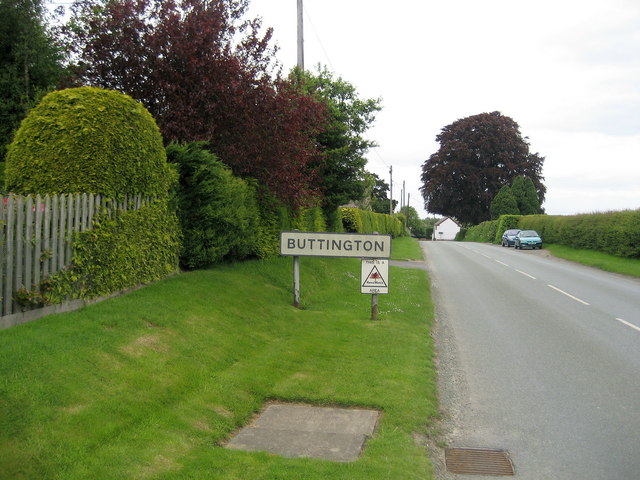
Buttington

Settlement in Montgomeryshire

Wales

Buttington

Shropshire Union Canal (Montgomery Branch), S of Pool Quay
Shropshire Union Canal (Montgomery Branch), S of Pool Quay Credit: Colin Park

Buttington is a small village located in the historical county of Montgomeryshire, in Wales. Situated in the heart of the Severn Valley, it lies approximately 3 miles east of Welshpool. With a population of around 500 people, Buttington is a close-knit community that boasts a rich history and picturesque surroundings.

The village is best known for its significant role in the Battle of Buttington, which took place in 893 AD. This battle, fought between the Welsh and the Anglo-Saxons, was a pivotal event in Welsh history. Today, visitors can explore the Buttington Cross, a monument commemorating the battle, and learn about the area's past at the nearby Welshpool & Llanfair Light Railway Museum.

The village itself is characterized by charming cottages, a village green, and a 13th-century church dedicated to St. Mary. The church, with its impressive stained glass windows and ancient architecture, is a popular attraction for history enthusiasts and lovers of heritage.

In terms of amenities, Buttington offers a range of services to its residents and visitors, including a primary school, a village hall, and a local pub. The village is also surrounded by beautiful countryside, making it an ideal base for outdoor activities such as walking, cycling, and fishing.

Overall, Buttington is a peaceful and historically significant village that offers a glimpse into Welsh heritage while providing a serene escape for those seeking a slower pace of life.

If you have any feedback on the listing, please let us know in the comments section below.
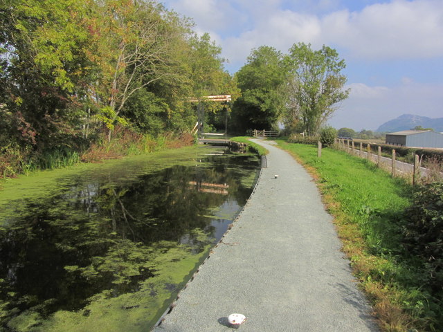
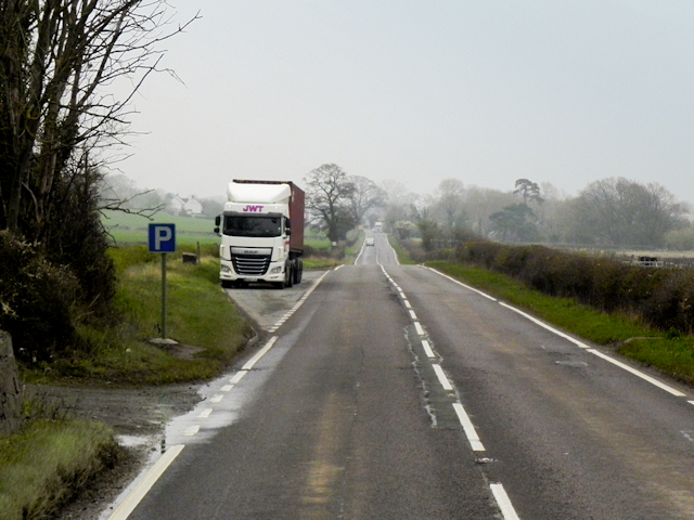
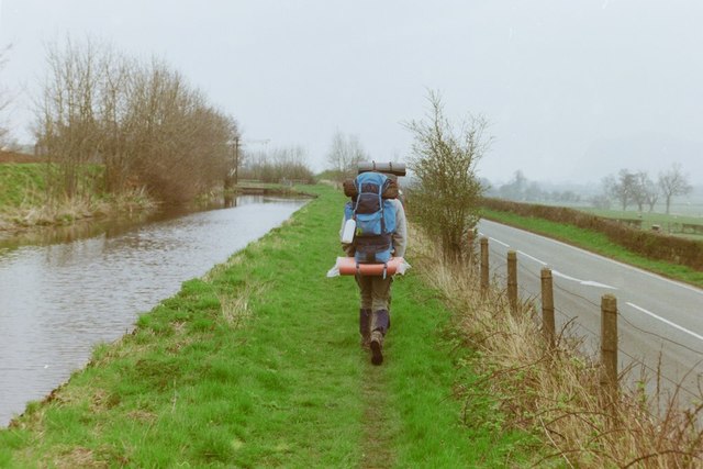
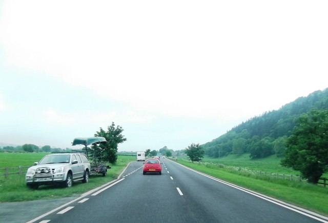
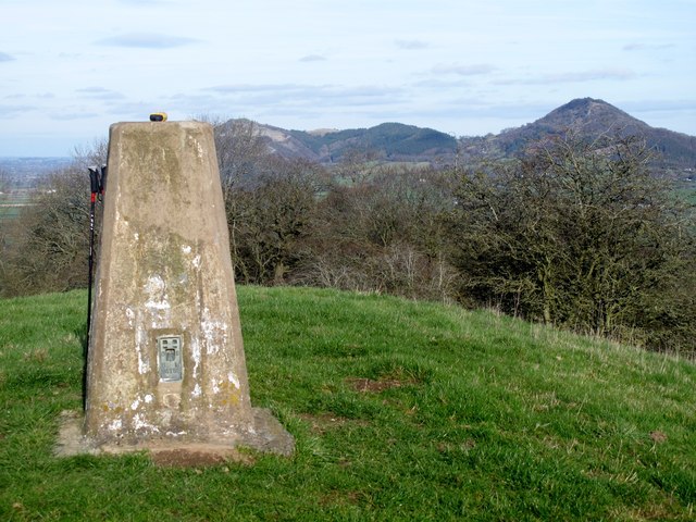
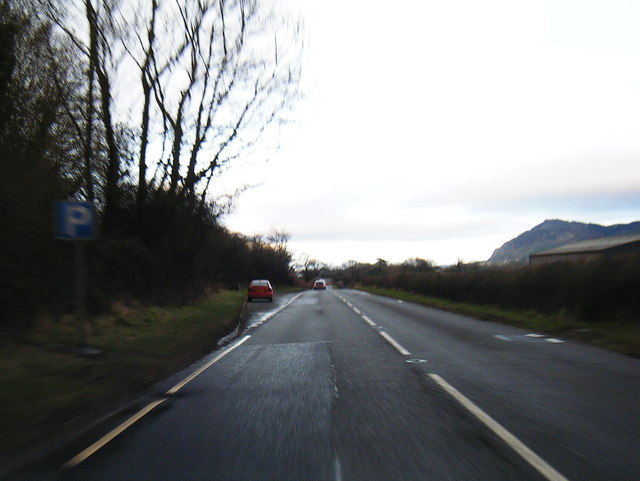
Buttington Images

Images are sourced within 2km of 52.671646/-3.113579 or Grid Reference SJ2408. Thanks to Geograph Open Source API. All images are credited.

Shropshire Union Canal (Montgomery Branch), S of Pool Quay
Layby on the A483 near to Pool Quay The A483 is a major north-south trunk road in Wales, running for 149 miles between Chester and Junction 42 of the M4 motorway just east of Swansea.
<span class="nowrap"><a title="http://www.sabre-roads.org.uk/wiki/index.php?title=A483" rel="nofollow ugc noopener" href="http://www.sabre-roads.org.uk/wiki/index.php?title=A483">Link</a><img style="margin-left:2px;" alt="External link" title="External link - shift click to open in new window" src="https://s1.geograph.org.uk/img/external.png" width="10" height="10"/></span>  SABRE
<span class="nowrap"><a title="https://en.wikipedia.org/wiki/A483_road" rel="nofollow ugc noopener" href="https://en.wikipedia.org/wiki/A483_road">Link</a><img style="margin-left:2px;" alt="External link" title="External link - shift click to open in new window" src="https://s1.geograph.org.uk/img/external.png" width="10" height="10"/></span>  Wikipedia
Layby on the A483 near to Pool Quay
The A483 is a major north-south trunk road in Wales, running for 149 miles between Chester and Junction 42 of the M4 motorway just east of Swansea. LinkExternal link SABRE LinkExternal link Wikipedia
Offa's Dyke path by the Montgomery Canal, 1988 Approaching a lift bridge.
Offa's Dyke path by the Montgomery Canal, 1988
Approaching a lift bridge.
The A483
The A483
Yr Allt Parked by the canal for a longer work for my seventh HuMP of the day. I agree with CW, but correction has been applied since I printed off my data.
Name: Yr Allt
Hill number: 5186
Height: 232m / 761ft
Area: 30E: Bala to Welshpool
Class: Hu
Grid ref: SJ 24240 10006
Summit feature: no feature 250m S of trig point
Drop: 106m
Col: 126m  SJ218088
Yr Allt
Parked by the canal for a longer work for my seventh HuMP of the day. I agree with CW, but correction has been applied since I printed off my data. Name: Yr Allt Hill number: 5186 Height: 232m / 761ft Area: 30E: Bala to Welshpool Class: Hu Grid ref: SJ 24240 10006 Summit feature: no feature 250m S of trig point Drop: 106m Col: 126m SJ218088
A483 near Weir End
A483 near Weir End
Pont gamlas / Canal bridge Cerddwr yn agosau at bont wrth ddilyn Llwybr Clawdd Offa.

Walker approaching a bridge while walking the Offa's Dyke Path.
Pont gamlas / Canal bridge
Cerddwr yn agosau at bont wrth ddilyn Llwybr Clawdd Offa. Walker approaching a bridge while walking the Offa's Dyke Path.
Wide section of Montgomery Canal
A483 and barns at Weir Head The Breidden Hills form the backcloth.
A483 and barns at Weir Head
The Breidden Hills form the backcloth.
Woodland on hill parallel to A483
Modern Mile Marker, Montgomery Canal, Pool Quay NE of Welshpool on the towpath (a.k.a. Severn Way &/or Offa's Dyke Path). 
A close-up view of the commemorative plate is <a href="https://www.geograph.org.uk/photo/7583215">SJ2510 : Commemorative Plate, Montgomery Canal, Pool Quay</a>.
An alternative view of the mile peg is <a href="https://www.geograph.org.uk/photo/582015">SJ2510 : Montgomery Canal 19 mile milepost</a>.

Inscription: Newtown / 16 / Miles // Welsh / Frankton / 19 Miles // Montgomery / Canal // MWRT / 1983

Milestone Society National ID: MGY-19R
Modern Mile Marker, Montgomery Canal, Pool Quay
NE of Welshpool on the towpath (a.k.a. Severn Way &/or Offa's Dyke Path). A close-up view of the commemorative plate is SJ2510 : Commemorative Plate, Montgomery Canal, Pool Quay. An alternative view of the mile peg is SJ2510 : Montgomery Canal 19 mile milepost. Inscription: Newtown / 16 / Miles // Welsh / Frankton / 19 Miles // Montgomery / Canal // MWRT / 1983 Milestone Society National ID: MGY-19R
Commemorative Plate, Montgomery Canal, Pool Quay NE of Welshpool, placed there 16ᵗʰ 1983. 
A close-up view of the Mile Marker it sits next to is <a href="https://www.geograph.org.uk/photo/7583213">SJ2510 : Modern Mile Marker, Montgomery Canal, Pool Quay</a>.
An alternative view of the mile peg is <a href="https://www.geograph.org.uk/photo/582015">SJ2510 : Montgomery Canal 19 mile milepost</a>.

Inscription (part):  Jack Richards /  MV Lawford / member of the / Inland Waterway Association
Commemorative Plate, Montgomery Canal, Pool Quay
NE of Welshpool, placed there 16ᵗʰ 1983. A close-up view of the Mile Marker it sits next to is SJ2510 : Modern Mile Marker, Montgomery Canal, Pool Quay. An alternative view of the mile peg is SJ2510 : Montgomery Canal 19 mile milepost. Inscription (part): Jack Richards / MV Lawford / member of the / Inland Waterway Association
On the canal towpath near Pool Quay With a distant view to the lovely Breidden Hills.
On the canal towpath near Pool Quay
With a distant view to the lovely Breidden Hills.
Looking southwards on the canal near Pool Quay The afternoon sun is bright and warm.
Looking southwards on the canal near Pool Quay
The afternoon sun is bright and warm.
Distant view to the Breidden Hills from a field near Pool Quay What stately edifices.
Distant view to the Breidden Hills from a field near Pool Quay
What stately edifices.
View to Breidden Hill View across the meadows beside to River Severn to the distinctively shaped Breidden Hill from near Buttington Cross.
View to Breidden Hill
View across the meadows beside to River Severn to the distinctively shaped Breidden Hill from near Buttington Cross.
View to Yr Allt View across the meadows beside the River Severn to Yr Allt from near Buttington Cross, both the River Severn and the Montgomery Canal pass through this landscape.
View to Yr Allt
View across the meadows beside the River Severn to Yr Allt from near Buttington Cross, both the River Severn and the Montgomery Canal pass through this landscape.
Green Dragon Inn, Buttington The Green Dragon Inn at Buttington stands on the junction of the B4388 with the A458.
Green Dragon Inn, Buttington
The Green Dragon Inn at Buttington stands on the junction of the B4388 with the A458.
Show me another place!

Buttington is located at Grid Ref: SJ2408 (Lat: 52.671646, Lng: -3.113579)

Unitary Authority: Powys

Police Authority: Dyfed Powys

What 3 Words

///frail.senses.youngest. Near Welshpool, Powys

Nearby Locations

Buttington

Related Wikis

Buttington Oak

The Buttington Oak was a tree near to Offa's Dyke at Buttington, Wales, said to have been planted to mark the site of the Battle of Buttington between...

Buttington

Buttington (Welsh: Tal-y-bont) is a village in Powys, Wales, less than 3 km from Welshpool and about 300 m from the River Severn, in the community of Trewern...

Battle of Buttington

The Battle of Buttington was fought in 893 between a Viking army and an alliance of Anglo-Saxons and Welsh. The annals for 893 reported that a large Viking...
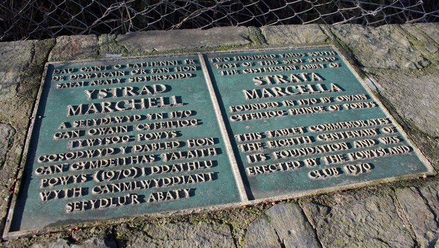
Strata Marcella

The Abbey of Strata Marcella (Welsh: Abaty Ystrad Marchell) was a medieval Cistercian monastery situated at Ystrad Marchell (Strata Marcella being the...

Nearby Amenities

Located within 500m of 52.671646,-3.113579
Post Box
Collection Times: Mo-Fr 17:15; Sa 11:45
Operator: Royal Mail
Post Box Type: wall
Ref: SY21 4
Royal Cypher: EVIIR
Royal Cypher Wikidata: Q33102324
Source: survey
Survey Date: 2019-07-06
Lat/Long: 52.6721515/-3.1104916
Buttington Crossing
Alt Name: Buttington Level Crossing
Crossing Barrier: half
Crossing Light: yes
Railway: level_crossing
Lat/Long: 52.6726289/-3.1124267
Railway: level_crossing
Lat/Long: 52.671839/-3.1156573
Mini Roundabout
Direction: clockwise
Lat/Long: 52.6693438/-3.109541
Barrier: block
Lat/Long: 52.6702374/-3.1085741
Railway: level_crossing
Lat/Long: 52.6721202/-3.114533
Mini Roundabout
Lat/Long: 52.6713788/-3.1076458
Entrance: main
Lat/Long: 52.6719769/-3.1107509
Power: pole;tower
Lat/Long: 52.6679659/-3.1094289
Power: tower
Lat/Long: 52.6693416/-3.1090075
Power: tower
Lat/Long: 52.6702096/-3.1084283
Power: tower
Lat/Long: 52.6712473/-3.1077727
Power: pole
Lat/Long: 52.6680183/-3.1152863
Power: pole
Lat/Long: 52.6688636/-3.114559
Power: pole
Lat/Long: 52.6698385/-3.1139187
Power: pole
Lat/Long: 52.6707981/-3.1138127
Power: pole
Lat/Long: 52.6717515/-3.1142775
Power: tower
Lat/Long: 52.6726183/-3.1147652
Power: pole
Lat/Long: 52.6736431/-3.113794
Power: pole
Lat/Long: 52.6748055/-3.1126825
Power: pole
Lat/Long: 52.6758131/-3.1117495
Power: pole
Lat/Long: 52.6700216/-3.1195149
Buttington
Place: hamlet
Population: 277
Source: OS_OpenData_StreetView
Source Population: 2011 census data from the ONS for ward W00002658
Wikidata: Q5003067
Wikipedia: en:Buttington
Lat/Long: 52.6718574/-3.1120558
Power: pole
Lat/Long: 52.672214/-3.1070049
Direction: ESE
Generator Method: photovoltaic
Generator Output Electricity: yes
Generator Solar Modules: 10
Generator Source: solar
Generator Type: solar_photovoltaic_panel
Location: roof
Power: generator
Lat/Long: 52.6699916/-3.1091228
Direction: 178
Generator Method: photovoltaic
Generator Output Electricity: yes
Generator Solar Modules: 14
Generator Source: solar
Generator Type: solar_photovoltaic_panel
Location: roof
Power: generator
Lat/Long: 52.6717502/-3.1084228
Direction: 178
Generator Method: photovoltaic
Generator Output Electricity: yes
Generator Solar Modules: 14
Generator Source: solar
Generator Type: solar_photovoltaic_panel
Location: roof
Power: generator
Lat/Long: 52.6717486/-3.1085113
The data included in this document is from www.openstreetmap.org. The data is made available under ODbL.

Have you been to Buttington?

Leave your review of Buttington below (or comments, questions and feedback).