Bridge Wood

Wood, Forest in Westmorland South Lakeland

England

Bridge Wood

Old oak in a field This is the further tree beyond the pair seen in the foreground of <a href="https://www.geograph.org.uk/photo/6816077">SD6083 : Minor road towards Rigmaden</a> taken in the spring of the same year.
Old oak in a field Credit: Stephen Craven

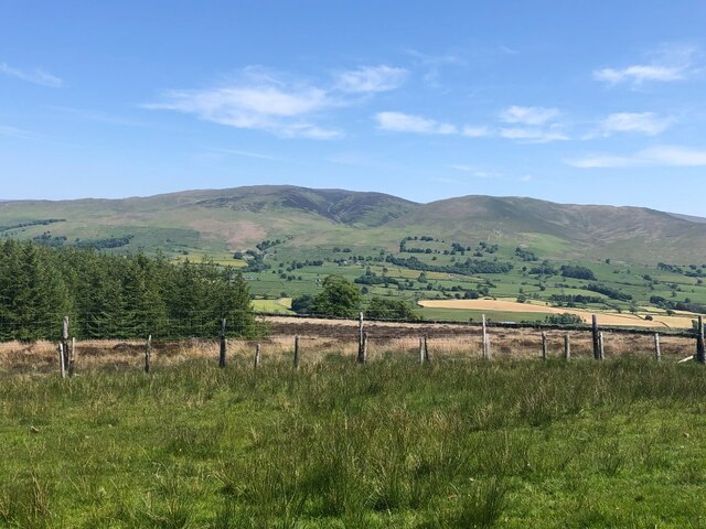
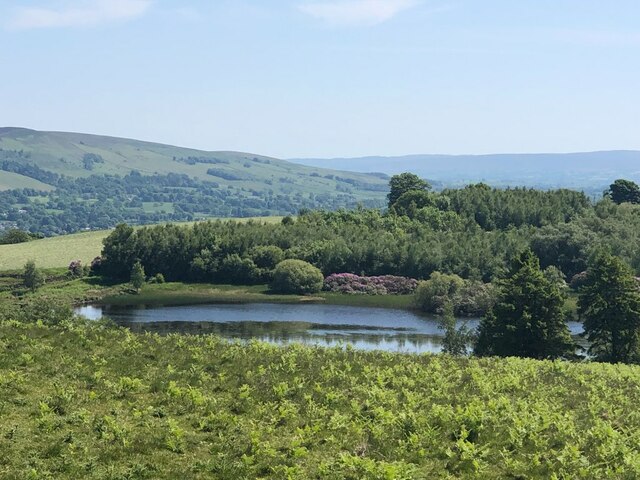
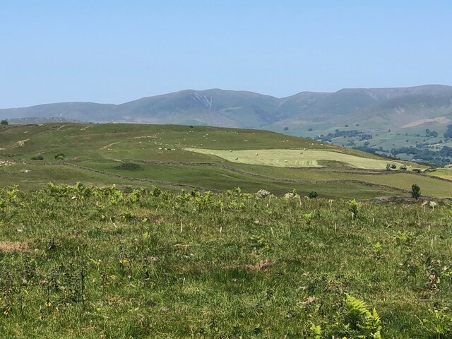
Bridge Wood is a small but picturesque woodland located in the district of Westmorland, in the northwest region of England. Nestled in the heart of the stunning Lake District National Park, it is known for its lush greenery, tranquil atmosphere, and diverse wildlife.

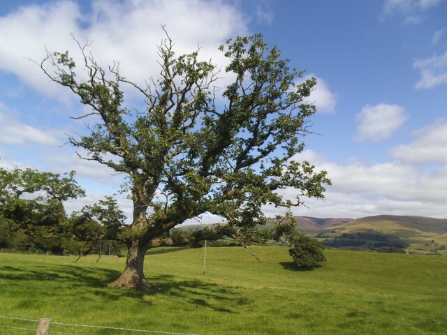
Stretching over an area of approximately 50 acres, Bridge Wood is predominantly comprised of native broadleaf trees such as oak, birch, and beech. These trees create a dense canopy, providing shade and shelter for a variety of flora and fauna. The forest floor is adorned with a vibrant carpet of wildflowers, including bluebells and primroses, adding a splash of color to the landscape.

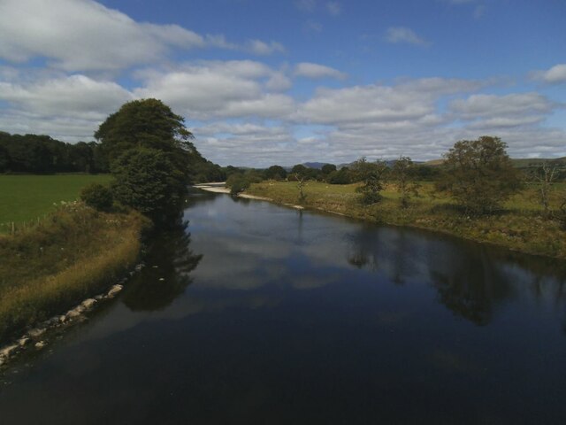
The wood is crisscrossed by a network of footpaths and trails, making it an ideal destination for nature lovers and hikers. Visitors can explore the wood at their own pace, immersing themselves in its natural beauty and listening to the soothing sounds of birdsong. The wood is also home to a small stream that meanders through its heart, adding to its charm and tranquility.

Wildlife enthusiasts will delight in the abundance of creatures that call Bridge Wood home. Roe deer can often be spotted grazing among the trees, while squirrels dart playfully from branch to branch. The wood is also frequented by a variety of bird species, including woodpeckers, thrushes, and owls.

Bridge Wood is a hidden gem within the Lake District, offering a peaceful retreat from the hustle and bustle of daily life. Whether for a leisurely stroll or a deeper exploration of nature, this woodland provides a serene and enchanting experience for all who visit.

If you have any feedback on the listing, please let us know in the comments section below.

Bridge Wood Images

Images are sourced within 2km of 54.258102/-2.5875628 or Grid Reference SD6184. Thanks to Geograph Open Source API. All images are credited.

Old oak in a field This is the further tree beyond the pair seen in the foreground of <a href="https://www.geograph.org.uk/photo/6816077">SD6083 : Minor road towards Rigmaden</a> taken in the spring of the same year.
Old oak in a field
This is the further tree beyond the pair seen in the foreground of SD6083 : Minor road towards Rigmaden taken in the spring of the same year.
Carrfoot Lodge The lodge was that of Rigmaden Park that stretches about 1.2km south from this junction. See <a href="https://www.geograph.org.uk/photo/6816094">SD6185 : Carrfoot Lodge</a> for a closer view taken earlier the same year.
Carrfoot Lodge
The lodge was that of Rigmaden Park that stretches about 1.2km south from this junction. See SD6185 : Carrfoot Lodge for a closer view taken earlier the same year.
Sheep at Rigmaden Farm Grazing on a level field part way up the west slope of Lonsdale.
Sheep at Rigmaden Farm
Grazing on a level field part way up the west slope of Lonsdale.
Rigmaden bridge The grade II listed bridge (list entry 1086894) has an unusual curved girder construction and dates from the 1880s. <a href="https://www.geograph.org.uk/photo/1213202">SD6184 : Rigmaden Bridge</a> shows a side view quite clearly.
Rigmaden bridge
The grade II listed bridge (list entry 1086894) has an unusual curved girder construction and dates from the 1880s. SD6184 : Rigmaden Bridge shows a side view quite clearly.
River Lune north from Rigmaden bridge Photographed towards the end of a fairly dry summer.  <a href="https://www.geograph.org.uk/photo/4395485">SD6184 : River Lune at Rigmaden</a> shows it in late winter with a greater depth of flow.
River Lune north from Rigmaden bridge
Photographed towards the end of a fairly dry summer. SD6184 : River Lune at Rigmaden shows it in late winter with a greater depth of flow.
Church of the Holy Ghost, Middleton
Minor Road in Rigmaden Park The road seen here rising towards the woodland of High Rigg Brown and Low Rigg Brown
Minor Road in Rigmaden Park
The road seen here rising towards the woodland of High Rigg Brown and Low Rigg Brown
View over Rigmaden and the Lune Valley View taking in a sweep of landscape over the Lune Valley towards Middleton Fell
View over Rigmaden and the Lune Valley
View taking in a sweep of landscape over the Lune Valley towards Middleton Fell
View towards the Howgill Fells
Track below Talebrigg Hill Bridleway crossing a patch of moorland towards the Old Scotch Road from Rigmaden
Track below Talebrigg Hill
Bridleway crossing a patch of moorland towards the Old Scotch Road from Rigmaden
Egholme Farm
Egholme Farm
Minor Road descending into Lunedale
Pastures below Green Park Hill
View across Lunedale From Shawrigg towards Calf.
View across Lunedale
From Shawrigg towards Calf.
Young shelterbelt, Talebrigg Hill Further on, by the tarn, the Rhododendron ponticum is in bloom.
Young shelterbelt, Talebrigg Hill
Further on, by the tarn, the Rhododendron ponticum is in bloom.
Kittmere View from Talebrigg Hill
Kittmere
View from Talebrigg Hill
Flowering Rhododendron ponticum, Kitmere The notorious pest is good to look at for a short while.
Flowering Rhododendron ponticum, Kitmere
The notorious pest is good to look at for a short while.
Silage making, Lunedale View from Talebrigg Hill towards the Howgill Fells.
Silage making, Lunedale
View from Talebrigg Hill towards the Howgill Fells.
Show me another place!

Bridge Wood is located at Grid Ref: SD6184 (Lat: 54.258102, Lng: -2.5875628)

Administrative County: Cumbria

District: South Lakeland

Police Authority: Cumbria

What 3 Words

///arrived.adopters.goodnight. Near Kirkby Lonsdale, Cumbria

Related Wikis

Middleton, Cumbria

Middleton is a village and a civil parish on the A683 road, in the South Lakeland district, in the county of Cumbria, England. Middleton has a church called...

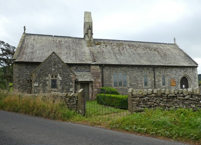
St Peter's Church, Mansergh

St Peter's Church is in the village of Mansergh, Cumbria, England. It is an active Anglican parish church in the deanery of Kendal, the archdeaconry of...

Barbon railway station

Barbon railway station was located in Westmorland (now part of Cumbria), England, serving the town and locale of Barbon on the Ingleton Branch Line....

St Bartholomew's Church, Barbon

St Bartholomew's Church is in the village of Barbon, Cumbria, England. It is an active Anglican parish church in the deanery of Kendal, the archdeaconry...

Mansergh, Cumbria

Mansergh is a village and civil parish in the South Lakeland district of the English county of Cumbria. It includes the village of Mansergh and the hamlet...

Beckside

Beckside is a village in Cumbria, England.

Barbon Beck

Barbon Beck is a small river in Barbondale, Cumbria. It is a tributary of the River Lune. Rising at Weather Ling Hill, where it is known as Barkin Beck...

Middleton-on-Lune railway station

Middleton-on-Lune railway station was located in Westmorland, England, (now in Cumbria), serving the hamlet and rural locale of Middleton on the Ingleton...

Nearby Amenities

Located within 500m of 54.258102,-2.5875628
Lune Access/Egress
Sport: canoe
Lat/Long: 54.257817/-2.5905633
Parking
Rigmaden Parking area
Access: private
Capacity: 5
Lat/Long: 54.2581053/-2.5887823
Give Way
Direction: forward
Lat/Long: 54.2591521/-2.5831523
The data included in this document is from www.openstreetmap.org. The data is made available under ODbL.

Have you been to Bridge Wood?

Leave your review of Bridge Wood below (or comments, questions and feedback).